
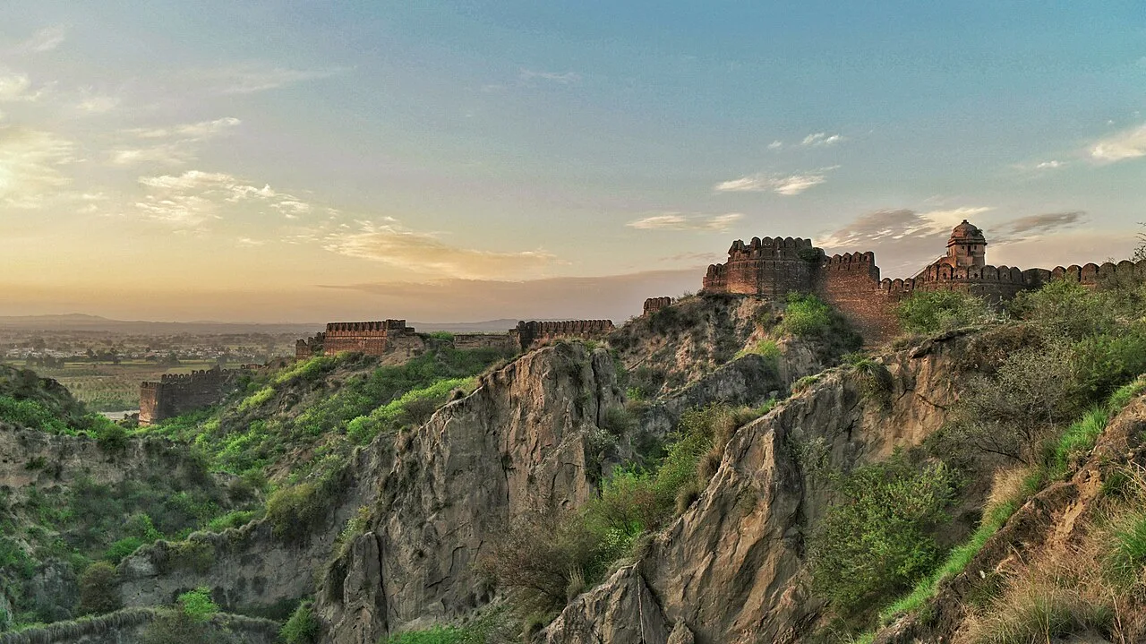
Rohtas Fort
Rohtas Fort, also known as Rohtasgarh, stands in Rohtas town, within Bihar’s Rohtas district. Visitors come to see the fort in its setting in the Son River valley.
Key facts · verified by Ghumoopedia editors
- Type of place
- Heritage monument
- Best time to visit
- October to March
- Nearest railway station
- Sasaram Junction · about 40 km (straight line)
- Nearest airport
- Gaya Airport · about 105 km (straight line)
- Verified
- 21 Nov 2026
Plan a trip from Rohtas Fort — a day-by-day route through places nearby.
Rohtasgarh is another name for Rohtas Fort, which stands in the town of Rohtas. The town is in Rohtas district, Bihar, India, and lies in the Son River valley. The fort’s location can be described through both the nearby town and the broader valley. Rohtas town is within Bihar’s Rohtas district, while the Son River valley forms the surrounding geographical setting. Visitors to Rohtas can see the fort, known by either name. Its location links it with the town of Rohtas and the valley of the Son River. Bihar is the heart of ancient Magadha — the land of the Buddha's enlightenment, the Mahavihara of Nalanda, the Mauryan capital Pataliputra, Jain tirthankara Mahavira and the Maithili and Bhojpuri cultures. Bihar has very hot summers from April to June, a monsoon from June to September that can flood low-lying areas, and cool, pleasant winters from November to February with foggy mornings in December and January. The usual best time to visit is October to March. Timings, fees and access arrangements must be confirmed locally. For official information, see Bihar Tourism at https://tourism.bihar.gov.in.
Why it matters
Rohtasgarh Fort, also known as Rohtas Fort, is a major historic landmark in Rohtas district, Bihar. Set above the Son River valley on the Kaimur plateau, it illustrates the strategic importance of the region’s upland routes and strongholds. The fort is associated with Sher Shah Suri and later Mughal-era administration, and its extensive remains help visitors understand the changing political landscape of eastern India. The Archaeological Survey of India identifies the site as a protected monument; it is not a UNESCO World Heritage Site. For nearby communities, the fort is also a prominent part of local history and identity, though its remote setting means access and visitor facilities can be limited.
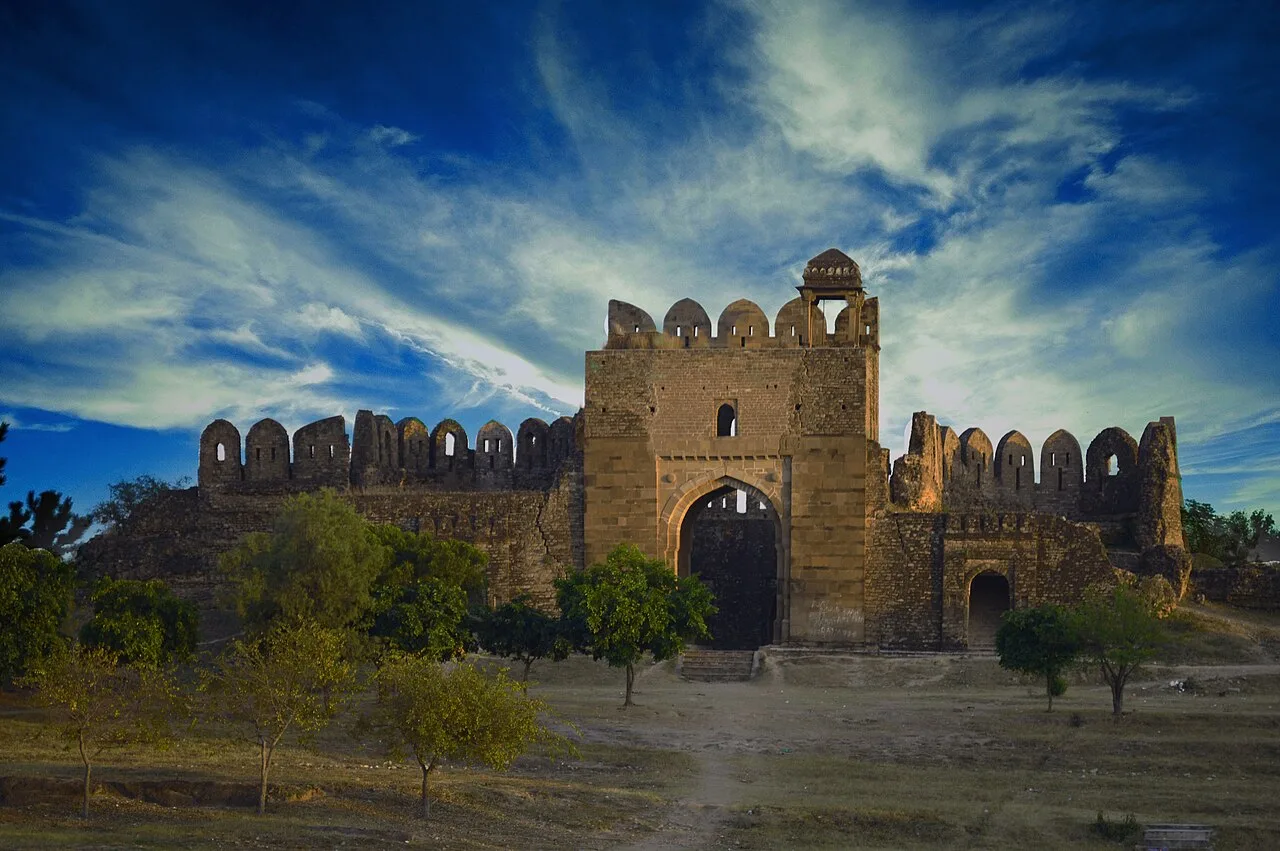
The early history of Rohtasgarh is uncertain, and accounts of its foundation are mixed with local tradition. The hilltop stronghold is associated in historical accounts with Sher Shah Suri, who took control of it in the sixteenth century during his struggle with the Mughal emperor Humayun. Its elevated position, defensible approaches and command of routes through the region made it strategically valuable. In the Mughal period, Raja Man Singh, a leading general of Emperor Akbar and governor in the region, is associated with substantial building and use of the fort. Surviving remains from different periods suggest that the complex served not only as a military refuge but also as a seat of administration and residence. Its structures include gateways, religious buildings and palace remains. Over time, changes in political and military priorities reduced the fort’s importance, and many buildings fell into ruin. The site is now protected as a historic monument, but its scale and exposed location present ongoing conservation challenges. Visitors may encounter weathered masonry and incomplete structures rather than a fully restored complex; conservation work and access arrangements can change, so check current local guidance before travelling.
Origin stories & folklore
According to local tradition, Rohtasgarh takes its name from Rohitaswa, a son of the legendary king Harishchandra. Stories connect the prince with the founding or early occupation of the hill stronghold, but these accounts are part of regional folklore rather than a securely established archaeological history. Other retellings associate the fort with ancient rulers and a past far older than its well-documented medieval use. Such traditions remain important to how the place is remembered locally and add a cultural layer to a visit. They should be distinguished from the historical record linking the fort to Sher Shah Suri and later Mughal-era figures.
Architecture & design
Rohtasgarh is a hill fort spread across a broad plateau on the Kaimur range, with steep terrain helping defend its approaches. Its extensive stone walls and gateways follow the contours of the upland site rather than forming a compact, level enclosure. Visitors can see ruined defensive works alongside remains of residences and religious buildings, reflecting the fort’s military and administrative roles. Notable structures associated with the complex include the Hathiya Pol gateway, the palace attributed to Raja Man Singh, and the Jama Masjid. The buildings use local stone and show varied construction and decorative details from different periods. The scale of the site means that walking between remains involves uneven paths and changes in level. Much of the masonry is weathered or partly collapsed, so the architecture is best understood as a layered landscape of surviving fragments rather than a single intact building.
Important objects & sculptures
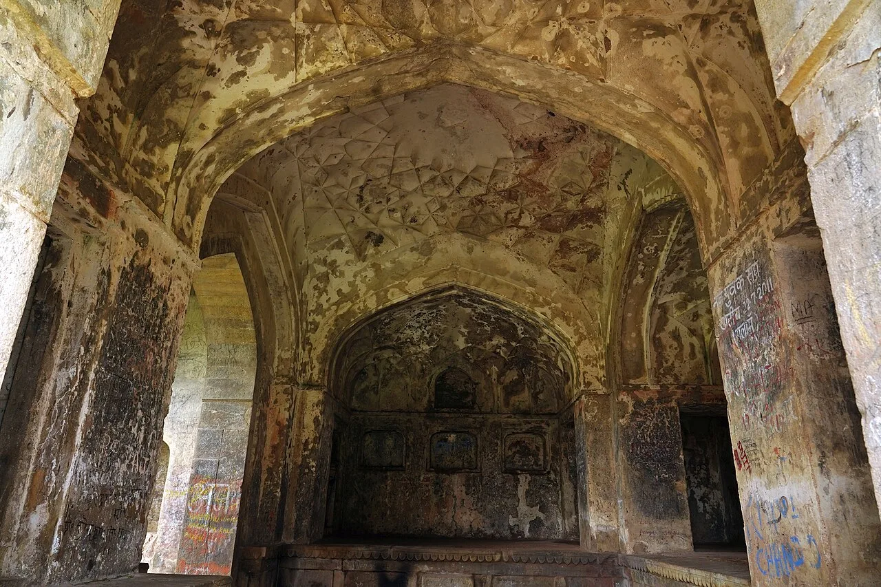
Rohtasgarh is chiefly an architectural and archaeological landscape rather than a museum with a curated collection. Look for surviving gateways, fragments of carved stonework, architectural mouldings and details on the remains of religious and residential buildings. The Jama Masjid and structures associated with the Man Singh palace are among the named landmarks visitors may encounter. Inscriptions or decorative elements may be weathered, difficult to read or inaccessible, and their interpretation can require a knowledgeable guide. Do not touch, remove or climb on masonry fragments; these are part of the protected site. Displays and interpretation boards may be limited, so confirm locally whether a guide or audio interpretation is available.
Explore Rohtas Fort slowly and read the interpretation boards, use the official audio guide where available or hire an authorised guide to understand its history. Check opening days, ticket counters and camera rules in advance; many monuments and museums close on one weekday and on some public holidays. Early morning gives softer light, cooler air and smaller crowds. A comfortable itinerary is one main visit in the morning, a local meal at midday and a short nearby stop before an afternoon return. Use the district list on this site to find other places in Rohtas, but check the route and its condition before combining stops. If a festival or fair is on — such as Chhath or the Sonepur fair — roads and stays can be busy, and the experience can be unforgettable. Leave no litter: many sites are protected by the communities around them.
Suggested itineraries
Half day: Allow about 3–4 hours for the approach, a measured walk to the main accessible gateways and ruins, time to read available interpretation, and a return break in a nearby settlement. Full day: Set aside most of the day for travel, a guided or self-paced exploration of the fort, a local meal, and—if roads and daylight allow—a short visit to another Rohtas district attraction. Gentler option: Arrange a vehicle drop-off as close as locally permitted, explore only the easiest accessible section with frequent rests, and avoid steep or rough paths.
Rohtasgarh lies in a district shaped by rural life and the cultural traditions of south-western Bihar. Bhojpuri and Hindi are commonly heard in the wider region, alongside other local speech varieties. Chhath, Holi, Diwali and Eid are observed in surrounding communities, with customs varying between villages and households. The fort is a place of heritage and local memory, but visitors should not assume that ceremonies take place there regularly. Everyday life around the site is more likely to be encountered in nearby settlements and markets than within the ruins. Ask before photographing residents, respect places of worship, and follow local guidance if a religious observance is taking place.
Festivals & events
Chhath, usually observed in the autumn and again in spring, is an important festival across Bihar; nearby riverbanks and settlements can become especially busy during observances. Holi in spring and Diwali in autumn are also widely celebrated in the district, while Eid brings community gatherings in local towns. These are regional celebrations rather than festivals known to be held specifically inside Rohtas Fort. Travel demand, road traffic and accommodation availability may increase around major observances. Check local conditions before setting out, and be considerate around worshippers and festival preparations.
Local food in Bihar includes litti chokha, sattu paratha, khaja (a layered sweet from Silao), tilkut and anarsa from Gaya, makhana (fox nuts) from the Mithila region, chana ghugni, malpua and thekua. Ask what is fresh that day; many small eateries cook a limited daily menu. Vegetarian travellers eat very well across this region, and most towns also have non-vegetarian options. Remote sites may have no restaurant at all. Carry water and snacks, eat a proper breakfast before long drives, and ask your accommodation for a packed lunch if you are heading out early. Try a home-cooked or dhaba meal when you can — it is often the best food on the route. Choose busy, clean places, drink sealed or filtered water, and carry your packaging back with you.
Shopping & local experiences
Shopping options immediately around the fort may be limited, so plan to buy essentials in a larger nearby town such as Sasaram. Local markets are practical places to look for snacks, seasonal produce and everyday goods rather than dedicated monument souvenirs. Visitors may find regional sweets and familiar Bhojpuri-area foods in town eateries, though menus and availability vary. Ask sellers about locally made products and buy directly from artisans when possible. Avoid purchasing antiquities, carved fragments or objects claimed to come from the protected site.
October to March
The nearest principal railway station by straight-line distance is Sasaram Junction, roughly 40 km away. The nearest operating airport by straight-line distance is Gaya Airport, roughly 105 km away. These figures are calculated from map coordinates — actual road distance is longer. Patna Junction, Rajendra Nagar Terminal and Gaya Junction are the main rail gateways, and Patna and Gaya have airports; Varanasi airport serves the west of the state. For the final leg, Bihar State Road Transport Corporation (BSRTC) buses, private coaches and shared jeeps and autos link district towns; shared jeeps usually leave early in the morning. A private taxi gives more flexibility for remote sites. When comparing train, bus and flight, count the complete door-to-door time: a flight saves the most time only if the onward road transfer is short, while an overnight train can save a hotel night. Book your return before you leave, because seats fill quickly on weekends, festivals and holidays. Current train numbers, timings, return services and fares are not listed here; check IRCTC and NTES for trains and the airline's own schedule for flights. No permit is needed to visit Bihar. Buddhist circuit sites such as Bodh Gaya, Rajgir, Nalanda and Vaishali welcome visitors of all backgrounds; dress modestly at temples, monasteries and dargahs. The Sonepur fair, Chhath Puja and the Rajgir Mahotsav draw very large crowds, so book transport and stays well ahead.
Confirm onward and return timings on IRCTC / NTES, the state bus operator or your airline before travel. A dash means current timings or fares have not been verified.
Getting around
The fort is in a rural, hilly setting, so the final approach may be less straightforward than travel to a district town. Sasaram is a principal rail gateway for the area; from there, visitors can arrange a private taxi or check for local buses and shared vehicles serving nearby settlements. Autos may be available around towns, but should not be assumed to operate all the way to the site. Walking is necessary within the fort, where paths can be uneven and distances between remains are substantial. Ask locally about road conditions, parking and the safest drop-off point, especially after rain.
Hours, tickets & permissions
Entry arrangements, opening days and access to different parts of the fort can change. A ticket or other entry procedure may apply, and some areas may be restricted for conservation or safety. Camera rules, permissions for commercial photography and requirements for organised groups should be checked before arrival. Carry identification if requested by the managing authority, and follow notices at the entrance. Confirm current visiting hours, entry conditions and any applicable fees with the Archaeological Survey of India or the local site authority before travelling.
Facilities
Facilities at the fort may be basic or limited. Toilets, drinking water, food stalls, shaded seating and reliable mobile coverage should not be assumed to be available on site; check locally and carry water and snacks. Parking may be possible near an access point, subject to local conditions. Guides may be found by prior arrangement or through local contacts, but availability is not guaranteed. Sasaram and other district towns are more likely to offer restaurants, accommodation, ATMs and everyday services. Carry essential supplies and confirm arrangements before making the journey.
Accessibility
The fort occupies a large, hilly site with uneven ground, stone remains and paths that may be steep or rough. Reaching individual structures can involve substantial walking and changes in level; shade may be limited in exposed sections. Wheelchair and stroller access is likely to be difficult, and accessible routes, toilets or step-free entry should not be assumed. Older visitors or anyone with limited mobility may prefer a short visit to the easiest area, accompanied by someone who can assist. Check the approach and current ground conditions locally, particularly after rain, and avoid climbing on walls or loose masonry.
No permit is needed to visit Bihar. Buddhist circuit sites such as Bodh Gaya, Rajgir, Nalanda and Vaishali welcome visitors of all backgrounds; dress modestly at temples, monasteries and dargahs. The Sonepur fair, Chhath Puja and the Rajgir Mahotsav draw very large crowds, so book transport and stays well ahead. Carry a photo ID at all times and save the emergency number 112 and your accommodation's contact offline. Heat in summer and fog in winter are the main weather risks; carry water and allow extra travel time on foggy December–January mornings. Respect community rules, private property and posted instructions. Follow local guidance if access changes.
Photography
Early morning often offers softer light and cooler conditions for photographing the fort’s walls and landscape. Views from accessible elevated points can show the scale of the plateau, but do not approach unstable edges or climb on ruins for a better angle. Personal photography may be allowed, but confirm camera restrictions and any permissions for professional or commercial work with the site authority. Drone use can be restricted by heritage, aviation or security rules; obtain permission before flying. Ask before photographing people, and avoid disrupting worship or local observances.
Choose a stay by the full journey to Rohtas Fort, not just the district name. Patna, Gaya and Bodh Gaya offer the widest choice, from pilgrim dharamshalas to international hotels; monastery guesthouses in Bodh Gaya are good value. In summer, check air-conditioning or coolers; in December and January, check hot water. Book in advance for weekends, festivals and the peak season (October to March). Confirm the exact location, meals included, check-in time and cancellation terms in writing. Avoid sending money to unverified contacts or touts at stations. Carry some cash, as card and digital payments can be unreliable in remote areas.
Sasaram is a useful nearby town and is known for the Tomb of Sher Shah Suri, a major example of Afghan-era funerary architecture. The Tomb of Hasan Khan Suri is also in the Sasaram area. Maa Tara Chandi Temple, near Sasaram, is an important local religious site; visitors should check current access and observance arrangements. Manjhar Kund and Dhua Kund are waterfalls in the wider district, whose flows and approach conditions vary seasonally. These places may require separate transport and should not be combined with the fort without checking road conditions, available daylight and travel time locally.
For couples, Rohtas Fort rewards a slow pace: arrive early for soft light and fewer crowds, share a local meal and keep the evening free. Sunset on the Ganga at a Patna ghat or an evening under the Bodhi tree's descendant at Bodh Gaya is quietly memorable. Public displays of affection can be frowned upon in conservative communities and at religious sites, so be discreet. Keep a buffer in your itinerary, because weather and road conditions can delay plans.
Q: How much time should I allow for Rohtas Fort? A: Allow at least half a day for the approach and a focused visit; exploring more of the spread-out site can take longer. Q: When is the best season to visit? A: October to March is generally the most comfortable period in Bihar. Check local weather and road conditions before travelling. Q: Is there an entry ticket, and when is the fort open? A: Entry rules, fees and visiting hours can change. Confirm current details with the managing authority before setting out. Q: Is the fort suitable for children and older visitors? A: Families can visit, but the uneven, hilly terrain requires care. Those with limited mobility may prefer a shorter visit to an accessible area. Q: Where can I stay nearby? A: Sasaram and other district towns are the more practical places to look for accommodation; check availability and transport arrangements in advance.
Be the first to share photos, stories, advice or a helpful contact for Rohtas Fort.
Loading…