
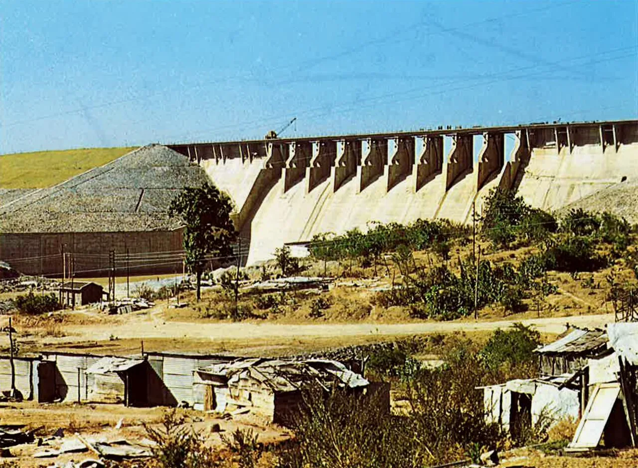
Konar Dam
Konar Dam is a multipurpose dam in Jharkhand’s Hazaribagh district, built on the Konar River as part of the Damodar Valley Corporation’s first-phase programme. Visitors come to the area for recreation.
Key facts · verified by Ghumoopedia editors
- Type of place
- Natural attraction
- Best time to visit
- October to February for sightseeing; July to September for waterfalls at full flow (expect slippery paths)
- Nearest railway station
- Gomoh Junction · about 40 km (straight line)
- Verified
- 21 Nov 2026
Plan a trip from Konar Dam — a day-by-day route through places nearby.
Situated in Hazaribagh district, Jharkhand, the dam spans the Konar River, a tributary of the Damodar. It opened in 1955 and was the second of four multipurpose dams planned for the first phase of the Damodar Valley Corporation. The site has also been developed for recreation, giving visitors a leisure destination alongside the dam. Its setting by the river and its place within the corporation’s initial programme are central to its identity. Jharkhand is the land of forests, waterfalls and Adivasi communities such as the Santhal, Ho and Munda, with major pilgrimages at Baidyanath Dham (Deoghar) and Shikharji (Parasnath). Jharkhand has hot summers from March to June, a monsoon from June to September when the waterfalls are at their fullest, and cool winters from November to February; the Netarhat plateau stays pleasant for much of the year. The usual best time to visit is October to February for sightseeing; July to September for waterfalls at full flow (expect slippery paths). Timings, fees and access arrangements must be confirmed locally. For official information, see Jharkhand Tourism at https://www.jharkhandtourism.gov.in.
Why it matters
Konar Dam is significant as the second of the four multipurpose dams included in the first phase of the Damodar Valley Corporation (DVC), a major river-valley development programme in eastern India. Built across the Konar River, a tributary of the Damodar, it was opened in 1955. Its importance is both regional and local: it forms part of the DVC’s planned infrastructure for the Damodar basin, while the reservoir and dam surroundings have also become a recreational destination in Hazaribagh district. Published accounts describe it as a developed recreational spot. No UNESCO World Heritage or Archaeological Survey of India protected-site status is established for the dam; check official sources for current designations and access information.
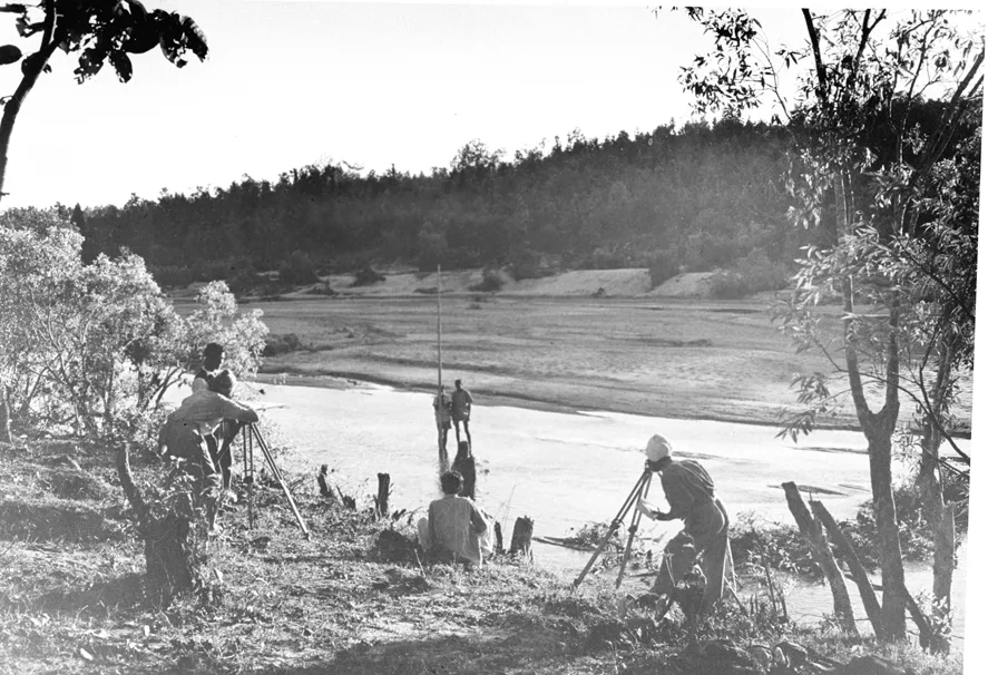
Konar Dam was constructed across the Konar River in what is now Hazaribagh district, Jharkhand, as part of the first phase of the Damodar Valley Corporation’s multipurpose dam programme. The DVC was established in 1948 to support coordinated development in the Damodar basin. Konar was the second of the four dams in that programme and opened in 1955. The other first-phase dams were Tilaiya, Maithon and Panchet, built at different points in the programme’s early years. The project made the river valley part of a larger system of planned water and infrastructure management; it should not be confused with a naturally formed lake or waterfall. Over time, the dam and its waterside setting also came to be visited for recreation. The available summary does not document a separate founding settlement, a named local builder, major reconstruction or a formal restoration campaign, so those details should not be assumed. For current information about dam operations, public access and any restrictions, consult the relevant DVC or local administration notices.
Origin stories & folklore
No specific, well-documented origin legend for Konar Dam is established in the available account. As elsewhere in Jharkhand, stories about rivers, hills and forested landscapes may be shared within families and communities, but traditions can vary from one locality to another. Visitors should treat any story they hear at the dam as local oral tradition rather than verified history, and should ask permission before recording or publishing personal accounts. The dam itself is a modern engineering work, opened in 1955; its history should be distinguished from folklore about the river or surrounding landscape. Do not enter restricted areas or disturb places that local people identify as culturally sensitive.
Spend unhurried time at Konar Dam: walk the marked paths, use official viewpoints and ask locally whether a guide, entry ticket or forest permission is needed. Enjoy the water from safe, marked points; rocks near falls are slippery and currents are dangerous, especially in the monsoon — never swim below a waterfall. Wildlife sightings are never guaranteed — patience and quiet improve your chances. A comfortable itinerary is one main visit in the morning, a local meal at midday and a short nearby stop before an afternoon return. Use the district list on this site to find other places in Hazaribagh, but check the route and its condition before combining stops. If a festival or fair is on — such as the Shravani Mela at Deoghar or Sarhul — roads and stays can be busy, and the experience can be unforgettable. Leave no litter: many sites are protected by the communities around them.
Suggested itineraries
Half day: Travel from your base to the dam; spend about 1–2 hours at permitted viewpoints and on safe paths; pause for a local meal or refreshments; return before late afternoon. Full day: Visit the dam in the morning; allow about 2–3 hours for viewing and a relaxed walk; have lunch in a nearby town; add one locally confirmed Hazaribagh-area stop; return with time for the road journey. Gentler option: Arrange a vehicle drop-off close to an authorised viewpoint, enjoy a short seated visit, and avoid uneven banks and longer walks.
Konar Dam is a recreational and infrastructure site rather than a documented centre for regular performances or ritual gatherings. Its cultural setting is the wider, diverse landscape of Hazaribagh and Jharkhand, where Hindi and regional languages are heard alongside languages spoken by Adivasi communities. Music, dance, clothing and customs vary between communities and occasions; visitors should not assume that one tradition represents everyone in the district. Festivals and family gatherings can bring local people onto roads and into public spaces, but events are not guaranteed at the dam itself. Ask before photographing people, and be considerate around any worship or community activity you encounter.
Local communities
People connected with the wider Hazaribagh region include Adivasi communities as well as other rural and town residents; the state is home to communities such as the Santhal, Munda and Ho, though their presence or activities should not be assumed at the dam itself. Livelihoods across the district can include farming, trade, service work and employment linked to towns and public infrastructure. The reservoir and dam may also support local recreation and travel-related work. Community identities and livelihoods are diverse and changing. Visitors should buy directly from local sellers where possible, follow access rules and avoid treating people or customary knowledge as tourist attractions.
Festivals & events
Sarhul, a spring festival observed by several Adivasi communities in Jharkhand, and Karma, generally associated with the monsoon season, are among the region’s important community festivals. Sohrai, a harvest and cattle-related festival, is observed in parts of the state around the post-monsoon season; practices differ by community and locality. They may affect travel and accommodation in nearby towns when celebrations or fairs are taking place. Check local notices before setting out, allow extra time on busy roads and visit community events only when they are open to visitors.
Local food in Jharkhand includes dhuska, rugra (bamboo shoot and mushroom dishes), handia (rice beer, offered by tribal communities), litti, arsa roti, pittha, chilka roti and mahua-based preparations. Ask what is fresh that day; many small eateries cook a limited daily menu. Vegetarian travellers eat very well across this region, and most towns also have non-vegetarian options. Remote sites may have no restaurant at all. Carry water and snacks, eat a proper breakfast before long drives, and ask your accommodation for a packed lunch if you are heading out early. Try a home-cooked or dhaba meal when you can — it is often the best food on the route. Choose busy, clean places, drink sealed or filtered water, and carry your packaging back with you.
Shopping & local experiences
The dam itself may have few or no reliable shopping options, so browse markets in Hazaribagh town or other nearby settlements. Look for locally made goods and, where available, Hazaribagh’s distinctive Sohrai and Khovar painting traditions; ask sellers about the maker and materials rather than assuming every item is locally produced. Seasonal produce and regional snacks can be a useful way to support small vendors. Availability varies, and visitors should agree on purchases directly with sellers. Avoid buying wildlife products or items made from protected plants.
The dam spans the Konar River and creates a broad reservoir setting among the landforms of Hazaribagh district. Water levels and the appearance of the banks change with rainfall and reservoir operations; the monsoon can make the surrounding landscape greener while also creating slippery surfaces and stronger, less predictable water conditions. Vegetation in the wider region includes woodland and cultivated land, but the exact mix around the dam varies by location and season. Birds and other wildlife may be present in the surrounding landscape, though sightings are never assured. Observe from safe public areas, do not approach wildlife or enter the water, and take all litter away. Follow any local restrictions around the dam infrastructure.
October to February for sightseeing; July to September for waterfalls at full flow (expect slippery paths)
The nearest principal railway station by straight-line distance is Gomoh Junction, roughly 40 km away. The nearest operating airport by straight-line distance is Birsa Munda Airport, Ranchi, roughly 85 km away. These figures are calculated from map coordinates — actual road distance is longer. Ranchi, Dhanbad, Tatanagar (Jamshedpur), Bokaro and Gomoh are the main rail gateways, and Ranchi, Deoghar and Durgapur have airports. For the final leg, Jharkhand State Transport buses, private buses and shared Sumo and Bolero jeeps link district towns; shared jeeps usually leave early in the morning. A private taxi gives more flexibility for remote sites. When comparing train, bus and flight, count the complete door-to-door time: a flight saves the most time only if the onward road transfer is short, while an overnight train can save a hotel night. Book your return before you leave, because seats fill quickly on weekends, festivals and holidays. Current train numbers, timings, return services and fares are not listed here; check IRCTC and NTES for trains and the airline's own schedule for flights. No permit is needed to visit Jharkhand. Some forest and mining areas have check posts, and a few interior pockets are affected by Left-wing extremism — check current advisories with your host or the district administration before travelling to remote areas, and avoid travelling on isolated roads after dark.
Confirm onward and return timings on IRCTC / NTES, the state bus operator or your airline before travel. A dash means current timings or fares have not been verified.
Getting around
Konar Dam is outside the main urban centre, so visitors commonly plan the final approach from a district town using a private taxi or other locally arranged vehicle. Jharkhand State Transport or private buses and shared jeeps may connect district towns, but service availability and departure points should be checked locally. Autos may be available in towns, though they should not be assumed to serve the dam entrance. Walking is suitable only for short distances on safe, permitted ground; avoid walking along active roads or dam structures. Confirm parking arrangements on arrival, and do not leave a vehicle where it blocks access or emergency routes.
Hours, tickets & permissions
Public access arrangements can depend on dam operations, safety conditions and local rules. A visit may involve designated access areas, security checks or restrictions on entering operational sections; ask locally whether a ticket, permit or other permission is required. Camera or drone rules may also apply, especially near infrastructure. Carry identification if requested by the managing authority, and follow signs and staff instructions. No current opening hours or fees are stated here. Confirm access, permitted areas, current hours and any charges with the relevant DVC office or local administration before travelling.
Facilities
Facilities at the dam may be limited or change with access conditions. Toilets, drinking water, food stalls, seating and rubbish bins should not be assumed to be available on site; check locally and carry water and essential supplies. Food, shops and cash services are more likely to be found in nearby settlements or Hazaribagh town. Parking and local guides may be available in some circumstances, but neither is guaranteed. Bring any medicines you need, take your waste with you and ask before hiring a guide or entering areas beyond public viewpoints.
Accessibility
The visitor experience may involve uneven ground, exposed banks, slopes or unpaved paths, and conditions can become muddy or slippery during and after rain. There is no confirmed information here about step-free routes, ramps, accessible toilets or wheelchair-accessible viewpoints. A wheelchair or stroller may therefore be difficult to use beyond a vehicle-accessible area. Older visitors and anyone with limited mobility may prefer a short visit from a safe, authorised viewpoint and should avoid steep edges and long walks. Shade and seating can be limited; check conditions locally and bring sun protection and water.
No permit is needed to visit Jharkhand. Some forest and mining areas have check posts, and a few interior pockets are affected by Left-wing extremism — check current advisories with your host or the district administration before travelling to remote areas, and avoid travelling on isolated roads after dark. Carry a photo ID at all times and save the emergency number 112 and your accommodation's contact offline. Heat in summer and fog in winter are the main weather risks; carry water and allow extra travel time on foggy December–January mornings. Waterfalls are dangerous in the monsoon: keep behind barriers, never enter the water near a fall, and leave the area if the water level rises suddenly. Follow local guidance if access changes.
Photography
Early or late daylight can bring softer light to the water and surrounding landscape; conditions and viewpoints vary with season and reservoir levels. Photograph only from authorised public areas, and do not climb barriers or approach operational structures for a better angle. Ask permission before taking close portraits. Drone use may be restricted around dam infrastructure or by local rules, so confirm permission with the relevant authority before flying. Avoid photographing security-sensitive areas and respect any community activity, worship or privacy you encounter.
Choose a stay by the full journey to Konar Dam, not just the district name. Ranchi, Jamshedpur and Deoghar offer the widest choice; forest rest houses near the sanctuaries must be booked through the forest department. In summer, check air-conditioning or coolers; in December and January, check hot water. Book in advance for weekends, festivals and the peak season (October to February for sightseeing; July to September for waterfalls at full flow (expect slippery paths)). Confirm the exact location, meals included, check-in time and cancellation terms in writing. Avoid sending money to unverified contacts or touts at stations. Carry some cash, as card and digital payments can be unreliable in remote areas.
Hazaribagh town is a practical base for food, supplies and other local visits. In and around the town, visitors may consider Canary Hill and Hazaribagh Lake, while Hazaribagh Wildlife Sanctuary offers a separate nature-focused outing; check current access and conditions before travelling. Rajrappa, in neighbouring Ramgarh district, is known for the Chhinnamasta Temple and can be a longer regional excursion rather than a quick stop. These places are not necessarily close to one another by road. Check route conditions and allow enough travel time before combining them with Konar Dam.
For couples, Konar Dam rewards a slow pace: arrive early for soft light and fewer crowds, share a local meal and keep the evening free. A waterfall viewpoint after the monsoon or a sunset from a hill temple makes the trip memorable. Public displays of affection can be frowned upon in conservative communities and at religious sites, so be discreet. Keep a buffer in your itinerary, because weather and road conditions can delay plans.
Q: How much time should I allow for Konar Dam? A: A half day is usually a comfortable plan, including the road journey and time at permitted viewpoints; allow longer if combining it with another district attraction. Q: When is the best season to visit? A: October to February is generally comfortable for sightseeing. The monsoon brings greener scenery but can make paths slippery and water conditions hazardous. Q: Is there an entry fee or fixed opening time? A: Current access rules, hours and any fees can change. Confirm them with the relevant DVC office or local administration before travelling. Q: Is the dam suitable for children and elderly visitors? A: It can suit a brief visit from a safe viewpoint, but uneven ground, water edges and limited facilities require close supervision and careful planning. Q: Can I stay near the dam? A: Check accommodation availability in Hazaribagh town or other nearby settlements; do not assume there are places to stay at the dam itself.
Be the first to share photos, stories, advice or a helpful contact for Konar Dam.
Loading…