
Gurez
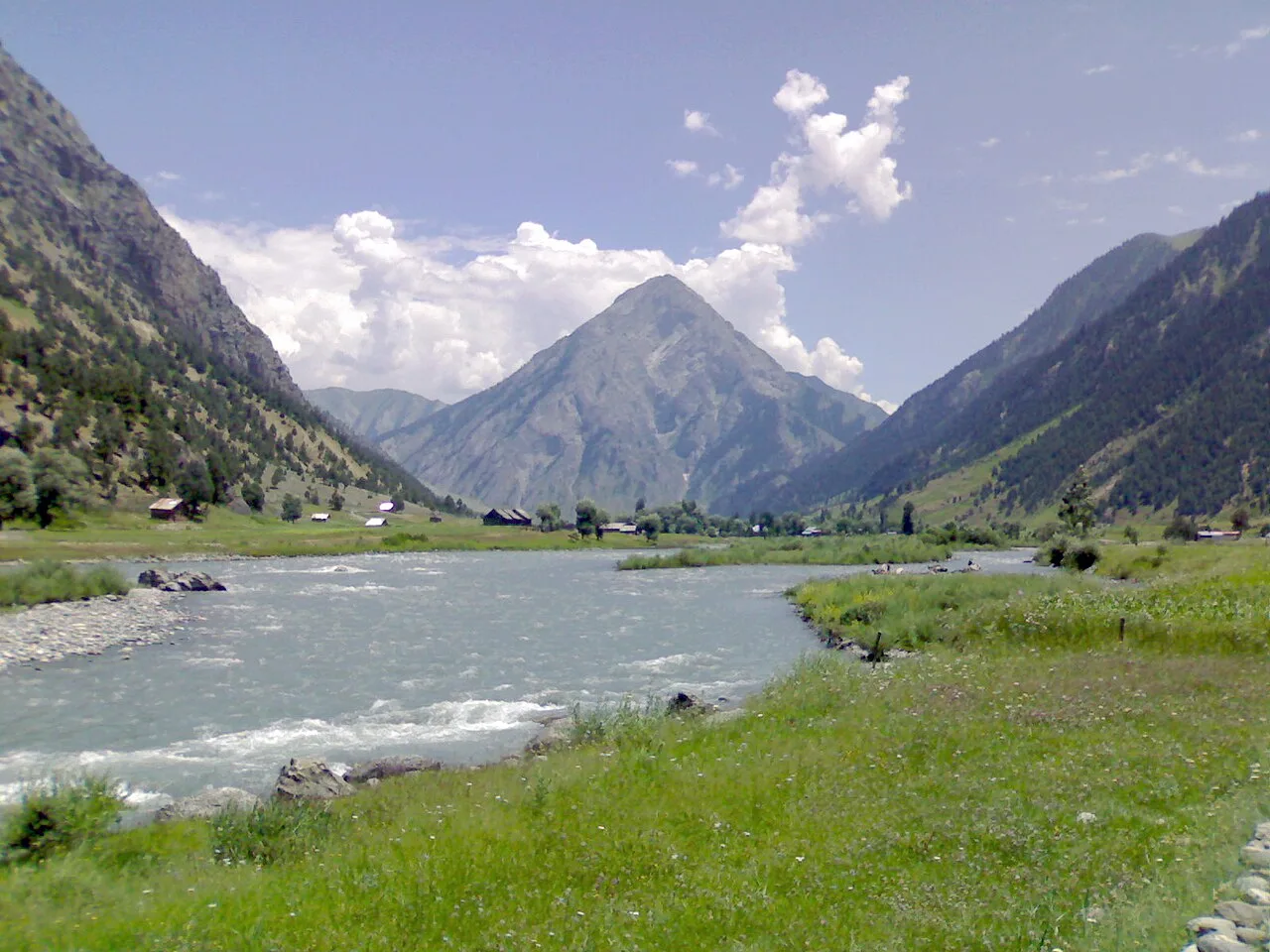
Gurez is a tehsil in Jammu and Kashmir, centred on a high-Himalayan valley. Visitors come for its mountain scenery, the Neelum River and the Shina culture of its communities.
Key facts · verified by Ghumoopedia editors
- Type of place
- Destination
- Best time to visit
- April to October for the Kashmir Valley and meadows; December to February for snow at Gulmarg; October to March for Jammu and the plains
- Nearest railway station
- Baramulla · about 65 km (straight line)
- Verified
- 21 Nov 2026
Plan a trip from Gurez — a day-by-day route through places nearby.
Also known as Gurais, or Guráai in Shina, Gurez is a tehsil in Bandipore district, Jammu and Kashmir. It covers most of Gurez Valley, a high-altitude part of the Himalayas north of Kashmir Valley, with the Great Himalayan range between the two. Bandipore, the district headquarters, is about 86 kilometres away, and Srinagar is roughly 123 kilometres distant. Dawar is the area's main township. Gurez lies close to the Line of Control; Astore and Neelum lie across it. Beyond Kamri, a sub-valley that includes Minimarg came under Pakistani control after 1947; it is now within Astore District in Gilgit-Baltistan. Burzil Pass, in Astore, provides a route from Gurez to Astore Valley. The valley is around 2,400 metres (8,000 ft) above sea level, surrounded by snow-capped mountains. The Neelum River runs through it. The area's wildlife includes Himalayan brown bears and snow leopards. Heavy winter snowfall closes Razdan Pass, cutting Gurez off from other parts of Jammu and Kashmir under Indian administration for six months of the year. An estimated 40,000 people live in its 15 villages. Most are ethnic Shins who speak Shina and share clothing styles and cultural traditions with their kin across the Line of Control in Gilgit-Baltistan. Kashmir is known for its Sufi shrines, Mughal gardens, houseboats and crafts such as pashmina, papier-mâché and carpets, while the Jammu region is the land of Dogra heritage and major Hindu pilgrimages. The Kashmir Valley has mild summers, colourful autumns and snowy winters, with Chillai Kalan (late December to January) the coldest spell; meadows such as Gulmarg and Sonamarg get heavy snow. Jammu and the plains are hot from April to June. Snow and landslides can close the Jammu–Srinagar highway and mountain roads. The usual best time to visit is April to October for the Kashmir Valley and meadows; December to February for snow at Gulmarg; October to March for Jammu and the plains. Timings, fees and access arrangements must be confirmed locally. For official information, see Jammu and Kashmir Tourism at https://jktourism.jk.gov.in.
Why it matters
Gurez is a high Himalayan tehsil in Bandipora district, centred on a valley north of the Kashmir Valley. The reference encyclopaedia account places it near the Line of Control and describes the Neelum, also known as the Kishanganga, River flowing through it. Its regional importance comes from its distinctive Shina-speaking communities, mountain landscape and seasonal connection with the rest of Jammu and Kashmir across Razdan Pass. Dawar is the valley’s main township and service centre. Gurez is also a gateway to the wider valley and nearby Tulail area, though access depends on road conditions and local restrictions. No UNESCO or Archaeological Survey of India designation is established for Gurez as a whole.
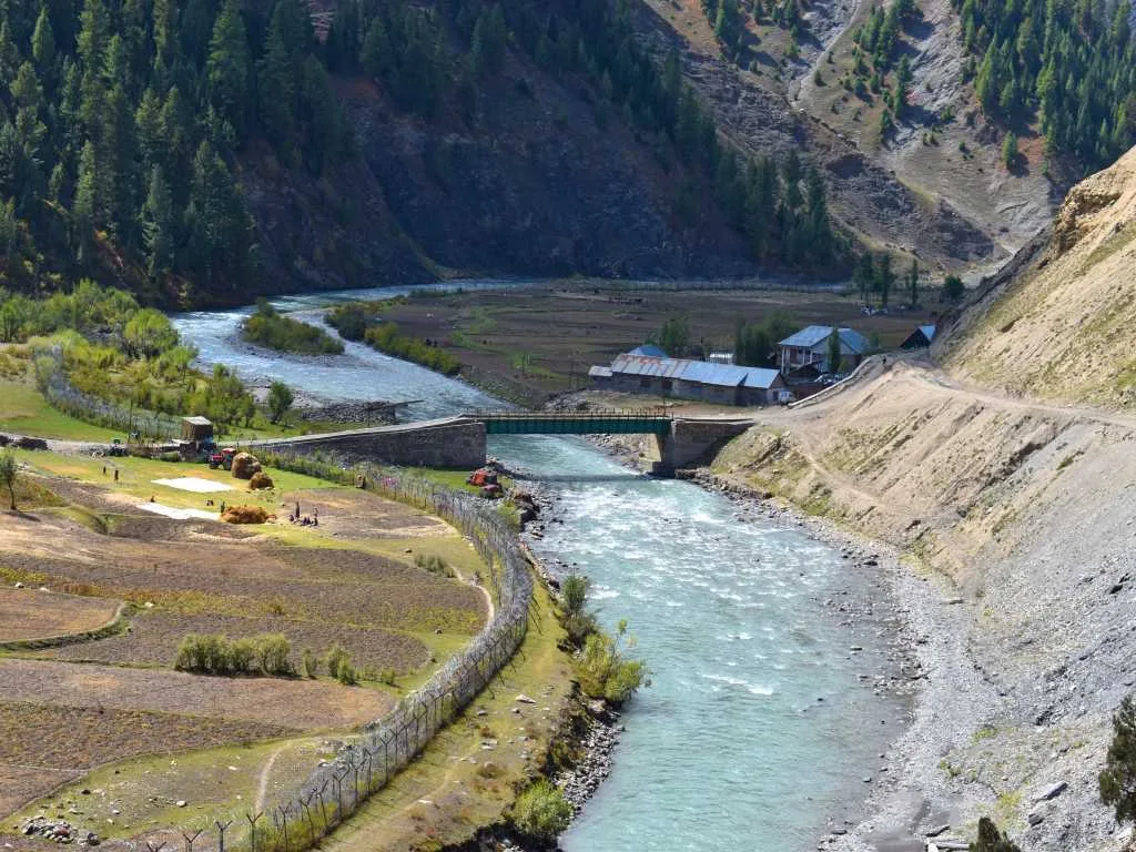
Gurez’s history is closely connected with the Shina-speaking communities who have long lived in the valley and neighbouring mountain regions. Its position among routes linking Kashmir with areas to the north made the valley a passage through difficult Himalayan terrain; details of early settlement and route use are not consistently documented, so precise dates should be treated cautiously. Dawar developed as the main township and gathering point for the scattered villages. The 1947 partition divided the wider Gurez region: the area beyond Kamri, including Minimarg, came under Pakistani control and is now in Astore District, Gilgit-Baltistan, according to the reference account. The present valley lies close to the Line of Control, a fact that shapes access and travel rules. Gurez is now administered as a tehsil of Bandipora district in Jammu and Kashmir. Its road connection over Razdan Pass is vulnerable to heavy snowfall, and seasonal closures have historically isolated the valley from the Kashmir Valley for extended periods. Gurez is a region rather than a single heritage monument, and no valley-wide restoration project is known.
Spend unhurried time at Gurez: walk the marked paths, use official viewpoints and ask locally whether a guide, entry ticket or permit is needed. Weather changes fast, so carry a warm or rain layer even on a clear morning. Wildlife sightings are never guaranteed — patience and quiet improve your chances. A comfortable itinerary is one main visit in the morning, a local meal at midday and a short nearby stop before an afternoon return. Use the district list on this site to find other places in Bandipora, but check the route and its condition before combining stops. If a festival or fair is on, roads and stays can be busy — and the experience can be unforgettable. Leave no litter: many sites are protected by the communities around them.
Suggested itineraries
Half day: Dawar town walk (about 1–2 hours), pause by the Kishanganga River at a locally accessible spot (about 30–60 minutes), then take a short drive or walk to an approved viewpoint (about 1–2 hours). Full day: Start in Dawar (about 1–2 hours), arrange a road outing to a nearby village or viewpoint after checking access (about 2–3 hours), stop for a local meal (about 1 hour), then return with time for a short riverside walk (about 1 hour). Gentler option: Keep to Dawar, choose a level, short walk near your accommodation, and arrange vehicle drop-offs rather than attempting longer or uneven trails.
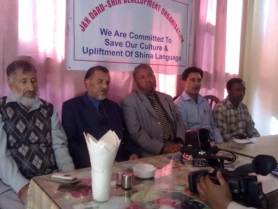
The reference account identifies the majority of Gurez’s inhabitants as ethnic Shins, with Shina as a principal language. Urdu and Kashmiri may also be heard, particularly in public-facing settings, but language use varies. The account notes cultural and dress similarities with Shina communities in Gilgit-Baltistan; everyday clothing today also reflects contemporary styles and the cold mountain climate. Family and village ties remain important, and hospitality is often part of visits, though travellers should ask before photographing people or entering private spaces. Religious observances and community gatherings shape local life. Visitors can learn more by listening to residents and engaging respectfully rather than treating local customs as performances.
Festivals & events
Eid-ul-Fitr and Eid-ul-Adha are observed by Muslim communities in Gurez, with dates varying each year according to the Islamic calendar. Weddings and family gatherings can also bring villages together, but they are private occasions rather than scheduled visitor events. Seasonal fairs or community celebrations may take place locally; their timing and public access are not reliably fixed, so ask in Dawar or with your accommodation. During major observances, some businesses may change their usual routines and local transport can be less predictable. Be respectful around prayers and celebrations, and seek permission before taking photographs.
Local food in Jammu and Kashmir includes Kashmiri Wazwan dishes such as rogan josh, yakhni, gushtaba and rista, nadru (lotus stem), haak saag, dum aloo, kahwa and salty noon chai; in the Jammu region, rajma-chawal, kalari cheese and Dogra dishes such as ambal and auria. Ask what is fresh that day; many small eateries cook a limited daily menu. Vegetarian travellers eat very well across this region, and most towns also have non-vegetarian options. Remote sites may have no restaurant at all. Carry water and snacks, eat a proper breakfast before long drives, and ask your accommodation for a packed lunch if you are heading out early. Try a home-cooked or dhaba meal when you can — it is often the best food on the route. Choose busy, clean places and carry your packaging back with you.
Shopping & local experiences
Shopping options are modest, especially outside Dawar. Where available, look for locally made woollens or handicrafts, and ask sellers about the maker and materials rather than assuming an item is locally produced. Small shops may stock everyday necessities and snacks, but visitors should not expect a large craft market. Local meals and seasonal foods are often a more direct way to experience the area; ask hosts what is available and whether advance notice is needed. Carry essential supplies from a larger town if you depend on particular products, and avoid buying wildlife products or items whose origin is unclear.
April to October for the Kashmir Valley and meadows; December to February for snow at Gulmarg; October to March for Jammu and the plains
The nearest principal railway station by straight-line distance is Baramulla, roughly 65 km away. The nearest operating airport by straight-line distance is Sheikh ul-Alam International Airport, Srinagar, roughly 70 km away. These figures are calculated from map coordinates — mountain roads wind a lot, so actual road distance and travel time are usually much longer. Jammu Tawi and Shri Mata Vaishno Devi Katra are the main long-distance rail gateways, and the line through the Chenab bridge now continues into the Kashmir Valley — check current services to Srinagar. Srinagar and Jammu airports have the most flights. For the final leg, J&K Road Transport Corporation (JKRTC) buses, private minibuses and shared Sumo taxis link district towns; shared taxis usually leave early in the morning. A private taxi gives more flexibility for remote sites. When comparing train, bus and flight, count the complete door-to-door time: a flight saves the most time only if the onward road transfer is short, while an overnight train can save a hotel night. Book your return before you leave, because seats fill quickly on weekends, festivals and holidays. Current train numbers, timings, return services and fares are not listed here; check IRCTC and NTES for trains and the airline's own schedule for flights. Indian visitors do not need a permit for the main destinations in Jammu and Kashmir. Areas close to the Line of Control, such as Gurez, Bangus, Keran and Machil, may require registration at police or army check posts, and foreign nationals face extra restrictions in some areas. Prepaid mobile SIM cards issued outside Jammu and Kashmir do not work here, so carry a postpaid connection. The Amarnath Yatra needs advance registration and a compulsory health certificate, and Vaishno Devi pilgrims need a yatra registration (RFID) card. Read your government's travel advisory and current local advisories before you go.
Confirm onward and return timings on IRCTC / NTES, the state bus operator or your airline before travel. A dash means current timings or fares have not been verified.
Getting around
Dawar is the main township and a practical base for arranging local travel. Taxis and shared vehicles may be available for trips between settlements, but services can be limited and should be checked locally; do not assume a regular bus connection to every village. Walking works for short outings in and around town, while valley journeys involve longer distances and mountain roads. Ask drivers about road conditions and whether a local guide or permission is needed before heading farther afield. Parking may be available near accommodation or central areas, but space and facilities vary. There is no regular visitor boat service to rely on.
Hours, tickets & permissions
Gurez is a populated valley, not a single ticketed attraction with one set of entry hours. Access to particular viewpoints, routes or sensitive areas may be subject to local security rules, permits, identity checks or temporary closures. Do not assume that a general visit permits travel close to the Line of Control. There is no confirmed general camera fee or dress code for the valley, but individual sites may have rules. Confirm current access, any required documents, opening arrangements and fees with local authorities or tourism staff before setting out.
Facilities
Dawar has the valley’s main cluster of basic visitor services, including accommodation and places to eat, though choice can be limited and seasonal. Toilets and drinking water are usually available at lodging or food stops; facilities may be sparse away from town, so carry water and plan ahead. Fuel, medical help, ATMs and reliable mobile connectivity should not be assumed to be readily available throughout the valley; check locally and bring essential supplies. Guides or drivers may be arranged through hosts, but availability varies. Parking is informal at many stops, and public facilities on trails are limited.
Accessibility
Gurez is a mountain valley with uneven ground, rural paths and roads that can be rough or affected by weather. Dawar offers some comparatively manageable, short outings, but viewpoints and village walks may involve slopes, loose surfaces or unpaved approaches. There is no reliable information that wheelchair ramps, lifts or accessible toilets are widely available. Wheelchair users and visitors with strollers should confirm the exact route and facilities with their accommodation before travelling. Older visitors or anyone with limited mobility may find a vehicle-based visit with brief stops more comfortable than a walking itinerary. Cold, rain and altitude can make even short outings tiring.
Indian visitors do not need a permit for the main destinations in Jammu and Kashmir. Areas close to the Line of Control, such as Gurez, Bangus, Keran and Machil, may require registration at police or army check posts, and foreign nationals face extra restrictions in some areas. Prepaid mobile SIM cards issued outside Jammu and Kashmir do not work here, so carry a postpaid connection. The Amarnath Yatra needs advance registration and a compulsory health certificate, and Vaishno Devi pilgrims need a yatra registration (RFID) card. Read your government's travel advisory and current local advisories before you go. Carry a photo ID at all times and save the emergency number 112 and your accommodation's contact offline. Altitude sickness is possible above about 2,500 m: ascend gradually, rest on arrival, drink water and turn back if you develop a severe headache, breathlessness or confusion. Snow and landslides can close roads at short notice — avoid night driving and keep a spare day. Stay on marked paths, keep away from cliff edges and fast water, and never approach wild animals. Follow local guidance if access changes.
Photography
Soft morning or late-afternoon light can bring out the mountain forms and river landscape; conditions change quickly, so allow flexibility rather than relying on a particular viewpoint. Photograph only from places where visitors are permitted, and follow any local security restrictions, especially near sensitive border areas. General photography is often possible in public outdoor spaces, but rules can differ at facilities or controlled locations. Drone use may be restricted or require permission; confirm current rules before bringing or launching one. Ask people before taking portraits, and avoid disrupting prayer, family gatherings or daily work.
Choose a stay by the full journey to Gurez, not just the district name. Srinagar houseboats, Jammu and Katra hotels and resort towns such as Gulmarg and Pahalgam offer the widest choice; book houseboats only through registered owners. At altitude, check heating, hot water and power backup, and expect cold nights for much of the year. Book in advance for weekends, festivals and the peak season (April to October for the Kashmir Valley and meadows; December to February for snow at Gulmarg; October to March for Jammu and the plains). Confirm the exact location, meals included, check-in time and cancellation terms in writing. Avoid sending money to unverified contacts or touts at stations. Carry some cash, as card and digital payments can be unreliable in remote areas.
Within Gurez, Dawar is the main township, while the Kishanganga River and views towards Habba Khatoon Peak are prominent features of the valley. Tulail Valley, farther along the Gurez region, is a possible separate outing when the road is open and local access is permitted; check conditions before planning it as a day trip. Bandipora town and Wular Lake are other places in the district that visitors may combine with a broader journey, but they are not quick stops from Gurez. Mountain road conditions and seasonal closures can change what is practical, so confirm routes locally and avoid overloading an itinerary.
For couples, Gurez rewards a slow pace: arrive early for soft light and fewer crowds, share a local meal and keep the evening free. A shikara ride or a houseboat night in Srinagar is a classic addition. Public displays of affection can be frowned upon in conservative communities and at religious sites, so be discreet. Keep a buffer in your itinerary, because weather and traffic can delay plans.
Q: How much time should I allow for Gurez? A: Allow at least a full day for Dawar and a nearby outing; a longer stay gives more flexibility for weather and road conditions. Q: When is the best season to visit? A: The warmer months, after the road over Razdan Pass becomes accessible, are generally the practical season. Confirm current conditions before travelling. Q: Is a permit or entry ticket required? A: There is no single valley-wide ticket confirmed here, but some routes or sensitive areas may require permission or be restricted. Check locally before departure. Q: Is Gurez suitable for children and elderly visitors? A: It can suit visitors who are comfortable with a long mountain journey, but uneven paths, cold weather and limited facilities may make vehicle-based, short outings preferable. Q: Can I stay overnight nearby? A: Accommodation is available in the area, especially around Dawar, but choice and availability vary by season. Confirm lodging before setting out.
Be the first to share photos, stories, advice or a helpful contact for Gurez.
Loading…