
Pir Panjal Pass
A high mountain crossing in Jammu and Kashmir’s Pir Panjal Range, Pir Panjal Pass is visited as a tourist destination and forms part of the Mughal Road linking Kashmir Valley with Poonch.
Key facts · verified by Ghumoopedia editors
- Type of place
- Natural attraction
- Best time to visit
- April to October for the Kashmir Valley and meadows; December to February for snow at Gulmarg; October to March for Jammu and the plains
- Nearest railway station
- Budgam · about 45 km (straight line)
- Verified
- 21 Nov 2026
Plan a trip from Pir Panjal Pass — a day-by-day route through places nearby.
Situated in Shopian district, Jammu and Kashmir, Pir Panjal Pass is also known as Peer Ki Gali or Peer Gali. It lies in the Pir Panjal Range, southwest of the Kashmir Valley. The pass is both a mountain crossing and a destination for visitors. The Mughal Road runs across this high point, connecting the Kashmir Valley with Poonch district in Jammu and Kashmir. At 3,490 metres (11,450 feet), it is the road’s highest point. The route passes through the mountain crossing between the valley and Poonch. Kashmir is known for its Sufi shrines, Mughal gardens, houseboats and crafts such as pashmina, papier-mâché and carpets, while the Jammu region is the land of Dogra heritage and major Hindu pilgrimages. The Kashmir Valley has mild summers, colourful autumns and snowy winters, with Chillai Kalan (late December to January) the coldest spell; meadows such as Gulmarg and Sonamarg get heavy snow. Jammu and the plains are hot from April to June. Snow and landslides can close the Jammu–Srinagar highway and mountain roads. The usual best time to visit is April to October for the Kashmir Valley and meadows; December to February for snow at Gulmarg; October to March for Jammu and the plains. Timings, fees and access arrangements must be confirmed locally. For official information, see Jammu and Kashmir Tourism at https://jktourism.jk.gov.in.
Why it matters
Pir Panjal Pass, also known as Peer Ki Gali or Peer Gali, is a high mountain pass in the Pir Panjal Range, in Shopian district. It is the highest point on the Mughal Road, at about 3,490 metres, and the road links the Kashmir Valley with Poonch district. Its regional importance comes from this route’s role as a connection across the mountains as well as its use by travellers enjoying the landscape. The pass is associated with a local Sufi shrine and is visited by people from nearby areas.
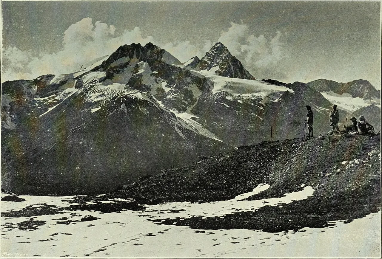
The pass lies on the route now known as the Mughal Road, which crosses the Pir Panjal Range between the Kashmir Valley and Poonch. Mountain routes across this range have long served as links between communities on either side, although their use depended on weather and passable conditions. The name Mughal Road reflects the route’s association with travel during the Mughal period; it is not a claim that the modern road was built by a particular Mughal ruler. The route is also connected with local religious tradition through a shrine at Peer Ki Gali. Details about the shrine’s founding and the pass’s earliest use are not consistently documented, so precise dates and builders should be treated cautiously. In more recent times, road development has made the crossing a recognised route for road travellers and visitors. Snowfall, landslides and other mountain conditions continue to affect access, and the route may close seasonally. The pass’s history is therefore tied both to movement across the mountains and to the practical limits imposed by its high-altitude setting.
Origin stories & folklore
According to local tradition, the name Peer Ki Gali refers to a pir, or revered Muslim holy person, associated with a shrine at the pass. Travellers and visitors may hear different accounts of the figure’s identity and the origins of the shrine; these stories belong to local belief and are not a substitute for a verified historical record. The shrine gives the mountain crossing a spiritual association for some visitors, alongside its importance as a road route. Visitors should approach the site respectfully, follow any local guidance and avoid treating religious customs or practices as tourist performances.
Spend unhurried time at Pir Panjal Pass: walk the marked paths, use official viewpoints and ask locally whether a guide, entry ticket or permit is needed. Weather changes fast, so carry a warm or rain layer even on a clear morning. Wildlife sightings are never guaranteed — patience and quiet improve your chances. A comfortable itinerary is one main visit in the morning, a local meal at midday and a short nearby stop before an afternoon return. Use the district list on this site to find other places in Shopian, but check the route and its condition before combining stops. If a festival or fair is on, roads and stays can be busy — and the experience can be unforgettable. Leave no litter: many sites are protected by the communities around them.
Suggested itineraries
Half day: Check road conditions in Shopian; travel to the pass; spend about an hour at permitted viewpoints and the shrine area; return before weather or light deteriorates. Full day: Set out early from Shopian; pause at safe viewpoints on the Mughal Road; spend time at Peer Ki Gali; have a meal in a nearby town; return with a buffer for road delays. Gentler option: Enjoy the pass from a vehicle or the closest safe, level stopping point, with minimal walking and frequent rests.
The pass sits between communities of the Kashmir Valley and the Poonch side of the Pir Panjal, so customs and everyday speech vary across the wider region. Kashmiri is widely spoken in the valley, while Pahari and other local languages are used in parts of the surrounding mountain districts; Urdu is also commonly used. Muslim religious traditions, including visits to shrines, form part of local life. In towns and villages, family gatherings and seasonal work shape the year as much as formal celebrations do. There is no single performance or dress tradition specific to the pass. Visitors may encounter regional foods, hospitality and craftwork in nearby settlements, but should ask before photographing people or religious activity.
Local communities
People connected with the pass include residents of Shopian district and communities on the Poonch side, as well as travellers using the Mughal Road. Livelihoods in the surrounding region include farming, horticulture, trade, transport and work linked to public services and tourism. Shopian is known for apple growing, though the pass itself is a high mountain crossing rather than a market or settled town. Shrine visitors and local custodians also have a connection to the site. Seasonal road conditions affect movement and business, so visitors should follow local advice and avoid assuming that services or transport will be available at the pass.
Festivals & events
Eid celebrations take place in communities across the region, with dates that vary according to the lunar calendar. Religious gatherings or an urs associated with a local shrine may also take place, but schedules and arrangements should be confirmed locally rather than assumed. These occasions can bring additional visitors to nearby settlements and may affect road movement or accommodation availability. Shopian’s seasonal life is also shaped by the apple harvest, though this is not a festival at the pass. If travelling during a local event, ask residents or district tourism sources about access, respectful conduct and any temporary restrictions.
Local food in Jammu and Kashmir includes Kashmiri Wazwan dishes such as rogan josh, yakhni, gushtaba and rista, nadru (lotus stem), haak saag, dum aloo, kahwa and salty noon chai; in the Jammu region, rajma-chawal, kalari cheese and Dogra dishes such as ambal and auria. Ask what is fresh that day; many small eateries cook a limited daily menu. Vegetarian travellers eat very well across this region, and most towns also have non-vegetarian options. Remote sites may have no restaurant at all. Carry water and snacks, eat a proper breakfast before long drives, and ask your accommodation for a packed lunch if you are heading out early. Try a home-cooked or dhaba meal when you can — it is often the best food on the route. Choose busy, clean places and carry your packaging back with you.
Shopping & local experiences
Shopian town is a practical place to look for everyday supplies and locally available foods. The wider Kashmir region is known for crafts such as pashmina, papier-mâché and carpets, though these are not specific to the pass and selection depends on the shop. Ask sellers about material and origin, especially for higher-value purchases. Visitors may also find seasonal fruit and regional dishes in nearby towns. There may be few or no shops at the pass itself, so do not plan on buying essentials there. Choose reusable packaging and carry any rubbish away.
The pass is a high-altitude crossing in the Pir Panjal Range, with broad mountain views and terrain that can change quickly with weather. The surrounding landscape includes steep slopes and mountain vegetation; lower sections of the route pass through forested areas, while higher ground can be sparsely vegetated or snow-covered depending on season. Snowmelt and seasonal streams contribute to the mountain water system, but conditions vary and water should not be assumed safe to drink. The wider region supports varied wildlife and birdlife, including species adapted to forest and mountain habitats. Sightings are never guaranteed, and visitors should watch quietly from permitted areas, keep a safe distance from animals and avoid leaving food or litter.
April to October for the Kashmir Valley and meadows; December to February for snow at Gulmarg; October to March for Jammu and the plains
The nearest principal railway station by straight-line distance is Budgam, roughly 45 km away. The nearest operating airport by straight-line distance is Sheikh ul-Alam International Airport, Srinagar, roughly 45 km away. These figures are calculated from map coordinates — mountain roads wind a lot, so actual road distance and travel time are usually much longer. Jammu Tawi and Shri Mata Vaishno Devi Katra are the main long-distance rail gateways, and the line through the Chenab bridge now continues into the Kashmir Valley — check current services to Srinagar. Srinagar and Jammu airports have the most flights. For the final leg, J&K Road Transport Corporation (JKRTC) buses, private minibuses and shared Sumo taxis link district towns; shared taxis usually leave early in the morning. A private taxi gives more flexibility for remote sites. When comparing train, bus and flight, count the complete door-to-door time: a flight saves the most time only if the onward road transfer is short, while an overnight train can save a hotel night. Book your return before you leave, because seats fill quickly on weekends, festivals and holidays. Current train numbers, timings, return services and fares are not listed here; check IRCTC and NTES for trains and the airline's own schedule for flights. Indian visitors do not need a permit for the main destinations in Jammu and Kashmir. Areas close to the Line of Control, such as Gurez, Bangus, Keran and Machil, may require registration at police or army check posts, and foreign nationals face extra restrictions in some areas. Prepaid mobile SIM cards issued outside Jammu and Kashmir do not work here, so carry a postpaid connection. The Amarnath Yatra needs advance registration and a compulsory health certificate, and Vaishno Devi pilgrims need a yatra registration (RFID) card. Read your government's travel advisory and current local advisories before you go.
Confirm onward and return timings on IRCTC / NTES, the state bus operator or your airline before travel. A dash means current timings or fares have not been verified.
Getting around
Most visitors arrange a private taxi or shared vehicle from Shopian or another nearby town; availability at the pass itself may be limited. Local buses and shared taxis serve some towns and routes, but do not assume a direct service to the pass or a return vehicle later in the day. Ask locally about road conditions, vehicle suitability and where stopping or parking is permitted. The road is winding and mountain weather can disrupt travel. Walking is useful for short explorations near a safe stopping point, but stay clear of traffic and do not walk onto unstable slopes.
Hours, tickets & permissions
There is no reliable visitor schedule stated here for the pass or its associated shrine, and road access can change with weather or official restrictions. Do not assume that a ticket, permit or camera fee is required—or that none is required. Check current access rules, any identity-document requirements and the status of the Mughal Road with the relevant district or tourism authority before travelling. Confirm current opening arrangements and any fees with the managing authority or local officials. Respect notices and guidance at the site.
Facilities
Facilities directly at the pass may be limited or unavailable, and visitors should not rely on finding toilets, drinking water, food, an ATM or a guide there. Check locally for any seasonal stalls or services before setting out. Carry water, food, warm clothing and essential medicines from a larger town. Parking or safe stopping places depend on road conditions and local directions. Shopian and other towns on the route are more likely to have basic shops and services, but availability varies. Take all rubbish back with you.
Accessibility
This is a high mountain road destination, not a level, purpose-built visitor complex. The approach involves winding roads, and the ground near viewpoints or the shrine may be uneven, sloped or affected by snow and mud. Walking distances depend on where a vehicle can safely stop. Wheelchair and stroller access cannot be assumed; there is no confirmed information here about ramps or accessible toilets. Older visitors and anyone with limited mobility may prefer to remain near a vehicle at a safe viewpoint, travel with a companion and avoid walking on slippery or steep ground. High altitude and cold weather may also be tiring.
Indian visitors do not need a permit for the main destinations in Jammu and Kashmir. Areas close to the Line of Control, such as Gurez, Bangus, Keran and Machil, may require registration at police or army check posts, and foreign nationals face extra restrictions in some areas. Prepaid mobile SIM cards issued outside Jammu and Kashmir do not work here, so carry a postpaid connection. The Amarnath Yatra needs advance registration and a compulsory health certificate, and Vaishno Devi pilgrims need a yatra registration (RFID) card. Read your government's travel advisory and current local advisories before you go. Carry a photo ID at all times and save the emergency number 112 and your accommodation's contact offline. Heat in summer and fog in winter are the main weather risks; carry water and allow extra travel time on foggy December–January mornings. Stay on marked paths, keep away from cliff edges and fast water, and never approach wild animals. Follow local guidance if access changes.
Photography
Clear mornings may offer good visibility, but cloud, mist and changing mountain weather can quickly alter the view. Use safe, permitted stopping points and avoid blocking the road while taking photographs. General landscape photography is usually suitable, but ask permission before photographing residents, shrine visitors or religious activity. Follow any notices about photography at the shrine or other restricted areas. Do not fly a drone without checking current aviation rules and local restrictions; mountain terrain, security considerations and changing conditions make casual drone use inappropriate.
Choose a stay by the full journey to Pir Panjal Pass, not just the district name. Srinagar houseboats, Jammu and Katra hotels and resort towns such as Gulmarg and Pahalgam offer the widest choice; book houseboats only through registered owners. In summer, check air-conditioning or coolers; in December and January, check heating and hot water. Book in advance for weekends, festivals and the peak season (April to October for the Kashmir Valley and meadows; December to February for snow at Gulmarg; October to March for Jammu and the plains). Confirm the exact location, meals included, check-in time and cancellation terms in writing. Avoid sending money to unverified contacts or touts at stations. Carry some cash, as card and digital payments can be unreliable in remote areas.
Shopian town is a useful place to arrange supplies and transport before or after visiting the pass. Aharbal Waterfall, in Shopian district, is another natural attraction that visitors may consider, subject to road conditions and available time. Hirpora Wildlife Sanctuary lies in the wider Shopian area; check current rules and access arrangements before planning a visit, and do not expect wildlife sightings. The Mughal Road itself offers mountain scenery along its route, but stopping is appropriate only where it is safe and permitted. Check local conditions before combining destinations, since road distances and travel times can be longer than map estimates.
For couples, Pir Panjal Pass rewards a slow pace: arrive early for soft light and fewer crowds, share a local meal and keep the evening free. A shikara ride or a houseboat night in Srinagar is a classic addition. Public displays of affection can be frowned upon in conservative communities and at religious sites, so be discreet. Keep a buffer in your itinerary, because weather and traffic can delay plans.
Q: How much time should I allow for a visit? A: Allow at least a half day from a nearby town, with extra time for road conditions, weather and stops. Q: When is the best season to visit? A: The warmer months are generally more suitable for access, but snow and road closures can affect the pass. Check conditions before departure. Q: Is entry to the pass or shrine ticketed? A: Check with local or district authorities before travelling. Q: Is the visit suitable for children and elderly visitors? A: It can be, with careful planning, warm clothing and minimal walking. The road is mountainous and the ground may be uneven or slippery. Q: Can I stay near the pass? A: Do not assume accommodation is available at the pass. Check lodging in Shopian or other towns along your planned route in advance.
Be the first to share photos, stories, advice or a helpful contact for Pir Panjal Pass.
Loading…