
Gorson Bugyal
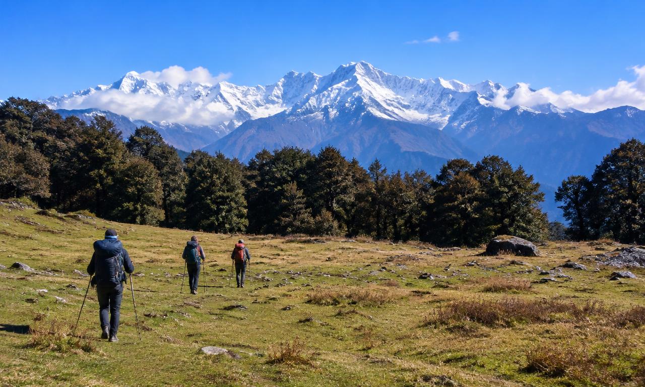
Gorson Bugyal, also called Gurson Bugyal, is an alpine meadow above Auli in Chamoli district. Visitors trek there for its grassy slopes and Himalayan scenery, including views of Nanda Devi in clear weather.
Key facts · verified by Ghumoopedia editors
- Type of place
- Natural attraction
- Best time to visit
- April–June, September–November; snow December–March
- Altitude
- 3,050 m
- Verified
- 21 Nov 2026
Plan a trip from Gorson Bugyal — a day-by-day route through places nearby.
At about 3,050 metres, Gorson Bugyal lies above Auli in Uttarakhand’s Chamoli district. The meadow is around 3 km from the upper end of the Auli ropeway. The route passes through oak and conifer woodland before reaching the open grassland. When the sky is clear, the Himalayan outlook includes Nanda Devi. Visitors generally make the journey as a day trek rather than staying overnight. The open meadow, mountain views and wooded approach are features of the walk. From commonly used starting points around upper Auli, allow approximately 3–4 kilometres each way and 4–6 hours overall, including rests and photography. Your actual distance depends on where your vehicle drops you, whether any lift is operating, and how far you explore the meadow. Ask your accommodation or guide to identify the precise starting point before leaving. The route is often described as easy to moderate, but altitude, uphill sections, mud, and snow can make it tiring. It suits reasonably fit beginners in favourable conditions, not every first-time walker regardless of fitness. Late spring and autumn generally offer appealing walking conditions; monsoon brings slippery trails and road disruption, while winter can require specialist footwear and local guidance. Start early for clearer views and a comfortable daylight return. There are no dependable services in the meadow itself.
Why it matters
Gorson Bugyal, also spelled Gurson Bugyal, is a high-altitude meadow above Auli in Chamoli district, valued for its open slopes, forest approach and views of the Himalayan range. At roughly 3,050 metres, it offers a natural contrast to the nearby developed hill destination and is commonly visited on a day walk from upper Auli. Nanda Devi may be visible when conditions are clear, though cloud and haze often limit views. The meadow is locally important for nature-based recreation and as part of the landscape around Auli and Joshimath. It is not known as a UNESCO World Heritage Site or an ASI-protected monument; check with local authorities for any current conservation or access rules.
Gorson Bugyal is a natural alpine meadow, not a monument with a documented builder or construction period. Bugyal is a regional term for a high-altitude grassland, and such meadows form part of the seasonal landscape of Uttarakhand’s mountains. The meadow’s exact formation history and the beginnings of local use are not set out in a widely established written record, so precise dates or origin claims should be treated cautiously. Traditionally, high meadows in the region have been associated with seasonal grazing and movement through mountain pastures; visitors should not assume that all such use applies to Gorson today. In more recent times, Gorson has become known as a walking destination reached from Auli. Auli’s development as a hill and winter-sports destination, along with improved visitor access in the surrounding area, has brought more day-trippers to the trail. The meadow itself has no known historic restoration project or built heritage site. Its continued appeal depends on the condition of its grassland, forest approaches and walking route, so visitors are encouraged to remain on established paths and carry out their rubbish.
Origin stories & folklore
There is no single, well-documented origin legend specific to Gorson Bugyal that can be confidently presented as fact. In the wider Garhwal Himalaya, local traditions often treat mountains, forests and high meadows with respect, and stories may connect particular landscapes with deities or ancestral journeys. Such accounts vary between communities and are best understood as living belief rather than a verified explanation of how this meadow formed. Visitors may hear local interpretations of the surrounding peaks from residents or guides, but should ask respectfully and avoid presenting a guide’s personal account as a tradition shared by everyone. The landscape’s name and natural features do not, by themselves, establish a particular legend.
- Walk through the forest above Auli at an unhurried pace, noticing the transition from sheltered woodland to open alpine grassland. Stay on the established path rather than cutting across fragile vegetation. - Spend time at the meadow edge enjoying the mountain panorama. A local guide can help identify visible peaks; clouds and haze may obscure even the most famous summits. - Photograph the contrast between forest, rolling slopes, and snowy mountains. Morning often offers better visibility, but avoid stepping onto cornices or steep snow-covered edges for a picture. - Carry a packed picnic and choose a durable resting spot. Bring every wrapper and food scrap back; do not feed wildlife or leave offerings containing plastic. - Watch birds quietly along the woodland section and enjoy seasonal flowers without picking them. - Combine the walk with relaxed sightseeing in Auli after returning. Treat any extension towards Chattrakund or more distant meadows as a separate route requiring a condition check, sufficient daylight, and preferably a guide.
Suggested itineraries
Half day: From an agreed upper-Auli trail access, walk through the forest to Gorson Bugyal, allow time for the meadow and views, then return by the same route; plan roughly 4–6 hours overall, including rests. Full day: Spend the morning on the Gorson walk and return to Auli; take a relaxed break, then explore Auli’s viewpoints or nearby sights if conditions and daylight allow. Keep any extension toward Chattrakund separate and check the route first. Gentler option: Skip the meadow trek and enjoy a short, level-as-possible outing around accessible parts of Auli with vehicle support arranged locally.
The living culture around Gorson is connected principally with Auli, Joshimath and the wider Garhwal region, rather than with a settlement in the meadow. Garhwali is widely spoken locally, alongside Hindi and other languages used by visitors and tourism workers. Regional music, dance, food and seasonal customs are part of community life in nearby towns and villages, though performances are not a regular feature of the trail. Visitors may encounter local hospitality through accommodation, guiding and transport services. Dress practically for mountain weather and ask before photographing residents, religious spaces or any ceremony. Treat the grassland as a natural landscape, not a venue for loud music or disposable picnic gatherings.
Local communities
Residents of Joshimath, Auli and nearby Garhwali settlements are connected to the area through tourism, transport, accommodation, guiding, food services and other local work. Agriculture and animal husbandry also form part of livelihoods in the wider mountain region, though practices and their connection to this particular meadow vary. Local guides can provide route and weather context that may not be apparent from a map. The meadow is not a visitor facility or an invitation to approach grazing animals, private land or work areas. Ask permission before photographing people, and follow local advice about paths and access.
Festivals & events
Gorson Bugyal is not known as a regular festival venue. Festivals and religious observances in nearby Joshimath and the wider Chamoli region are better places to experience local celebrations; events associated with temples and the Hindu calendar may bring increased activity at particular times of year. The Nanda Devi Raj Jat is a major regional pilgrimage traditionally held at intervals of about twelve years, with its route and observances extending beyond Auli. It is not an annual event at Gorson. Dates and arrangements vary, so check locally before planning around a festival. Busy periods can affect accommodation, roads and local services, even when the meadow itself is not hosting an event.
Eat breakfast in Auli before setting out, and carry a packed lunch or substantial snacks such as sandwiches, parathas, fruit, nuts, and energy bars. Do not rely on finding a stall along the trail or at Gorson. Carry around 1.5–2 litres of drinking water per person, adjusting for weather and your needs; do not assume streams are potable. Auli and Joshimath offer simple meals such as dal, rice, roti, and seasonal vegetables. Confirm early breakfast and packed-meal arrangements with your host the previous evening.
Shopping & local experiences
Auli has limited shopping compared with Joshimath, where visitors can look for everyday supplies, locally sold woollens and regional food products. Handwoven items and other crafts may be available through local shops, but selection and provenance vary; ask sellers about the maker and material rather than assuming an item is locally produced. Small food experiences in nearby towns may include regional Garhwali dishes, depending on the season and what local eateries are serving. There are no dependable shops at Gorson Bugyal. Buy provisions before the walk and carry packaging back to a bin or disposal point in town.
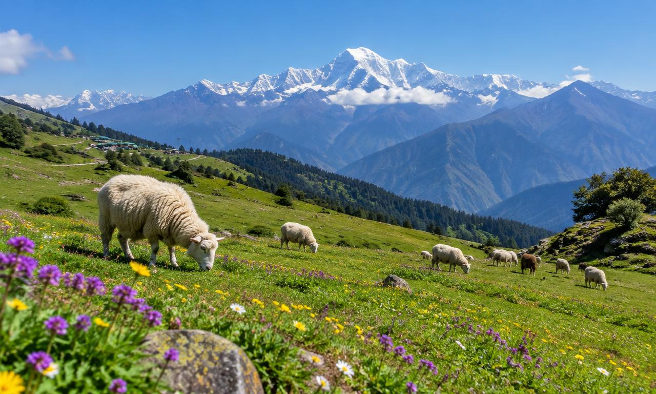
Gorson Bugyal is an open, rolling alpine grassland above Auli, approached through woodland that includes oak and conifer forest. The transition from sheltered trees to exposed meadow gives the walk much of its scenic character. Himalayan peaks, including Nanda Devi, may be visible in clear weather, but cloud, haze and changing conditions can obscure them. Seasonal grasses and wildflowers add colour at some times of year; leave plants undisturbed and stay on established paths to limit damage to fragile vegetation. Birds may be heard or seen along the woodland edge, but sightings are never assured. The meadow has no dependable visitor services, and weather can change quickly at altitude. Do not feed wildlife or leave food scraps.
April–June, September–November; snow December–March
Reach Joshimath, also called Jyotirmath, by road, then continue approximately 12–16 kilometres uphill to Auli, depending on your destination. Dehradun’s Jolly Grant Airport and rail connections at Haridwar or Rishikesh are common gateways. The onward mountain-road journey takes much of a day; allow extra time for traffic, weather, and roadworks rather than planning a tight connection. Buses and shared vehicles serve Joshimath from regional transport hubs, but departures and availability vary. Arrange the final Auli transfer locally, ideally before arriving late. Do not assume the Joshimath–Auli ropeway or Auli chairlift is operating: verify current status, hours, fares, and boarding points. Ask your driver which trail access they can reach and agree on the return pickup.
Getting around
Joshimath is the main nearby town for onward travel to Auli. From Auli, visitors generally reach the trail access on foot or by arranging a local vehicle, depending on where they are staying and the day’s road conditions. Agree with a driver on the precise drop-off and return pickup point before beginning the walk. The Joshimath–Auli ropeway and Auli chairlift should not be assumed to be operating; check their current status and boarding arrangements locally. Walking is the main way to explore the meadow. Parking and local vehicle access can vary, and public transport within Auli is limited, so plan the final connection in advance.
Hours, tickets & permissions
There is no dependable on-site service desk or published visitor schedule that should be assumed to apply in every season. Access may be affected by weather, trail conditions or local restrictions, and any forest or local-authority rules in force should be followed. Do not assume that a ticket, permit or camera fee is either required or unnecessary without checking current arrangements. Confirm visiting hours, access conditions and any fees with the relevant local or managing authority before setting out. Ask locally whether the route is suitable on the day.
Facilities
There are no dependable food, toilet or water services in the meadow itself. Carry drinking water, snacks and any personal essentials from Auli, and take all rubbish back with you. In Auli and Joshimath, accommodation, eateries and basic supplies are usually easier to find, but availability varies by season. Parking and vehicle access depend on the chosen trail starting point. Guides may be arranged locally and can advise on route conditions. ATMs and other services are more likely in Joshimath than at the meadow; check locally and do not rely on finding cash or supplies at the trail.
Accessibility
The walk involves several kilometres each way from commonly used upper-Auli starting points, with uphill sections and uneven ground. Mud, snow, altitude and changing weather can make it more demanding than the distance suggests. The forest path and meadow terrain are not reliably wheelchair- or stroller-accessible, and there is no confirmed step-free route or visitor infrastructure at the meadow. Shade is available in parts of the woodland approach, while the open grassland is exposed. Older visitors and people with limited mobility should assess fitness and altitude tolerance carefully, consider staying in Auli instead of attempting the full walk, and seek local advice before setting out.
Check the forecast, trail conditions, and any forest-entry requirements before departure. Hire a local guide if snow, poor visibility, or unfamiliar route junctions are expected. Wear grippy trekking shoes and carry layers, rain protection, sunscreen, a charged phone, offline navigation, and a basic first-aid kit. Mobile coverage can be unreliable. Set a turnaround time and avoid late-afternoon starts. Headache with nausea, unusual breathlessness, or dizziness warrants stopping; descend if symptoms persist or worsen. Do not continue uphill to prove fitness. In winter, obtain suitable traction and avoid icy slopes beyond your skills.
Photography
Morning often brings clearer mountain views, though visibility depends on weather and haze. The forest-to-meadow transition and open slopes provide natural viewpoints; photograph from stable ground and do not approach steep snow edges or cornices. General personal photography is usually possible, but check locally for any restrictions. Drone use may be subject to aviation rules, local permissions or protected-area restrictions, so do not fly without confirming requirements. Ask permission before photographing residents, guides or workers, and be especially considerate around religious places and ceremonies. Avoid trampling flowers or leaving the path for a better composition.
Auli is convenient for an early trail start and mountain views, with hotels, lodges, and resort-style accommodation across different budgets. Joshimath generally offers more transport connections and everyday services, but requires an uphill transfer before your walk. Check heating, hot-water availability, vehicle access, meal arrangements, and cancellation terms, especially in winter. Rates rise during holidays and snow season, so verify current prices directly. Do not assume camping is permitted in the meadow: confirm forest rules and any designated camping arrangements locally before booking.
Auli is the closest place to combine with a Gorson visit, with mountain viewpoints and seasonal hill activities depending on conditions. Joshimath, also called Jyotirmath, is the main nearby town and has religious sites including the Narsingh Temple. Chattrakund is another natural attraction in the wider Auli area, but reaching it should be treated as a separate route; check conditions, daylight and local guidance rather than assuming it is a simple extension. These places are in the surrounding Chamoli region, where weather and road conditions can affect plans. Confirm current access before travelling to any site.
Plan a relaxed morning walk rather than racing to a viewpoint. Book accommodation with reliable heating and arrange a packed breakfast or lunch for a scenic stop. Agree on a pace that suits the less experienced partner, and keep photography breaks away from exposed edges. A private guide can reduce navigation stress and help select a quieter resting place. For celebrations, leave decorations, candles, and picnic waste behind at your hotel, not in the meadow.
Q: How much time should I allow for Gorson Bugyal? A: From commonly used upper-Auli starting points, allow roughly 4–6 hours overall for the walk, rests and time in the meadow; the actual route varies. Q: When is a good season to visit? A: Late spring and autumn often offer appealing walking conditions. Monsoon can bring slippery trails and road disruption, while winter may require specialist footwear and local guidance. Q: Is there an entry ticket or permit? A: Requirements can vary, and no single arrangement should be assumed. Check current access rules and any fees with the relevant local authority before leaving. Q: Is the walk suitable for children or older visitors? A: It may suit reasonably fit walkers in favourable conditions, but altitude, uphill sections and weather add difficulty. Assess individual ability and ask locally about trail conditions. Q: Where can I stay nearby? A: Auli and Joshimath are the practical nearby bases, with more services generally available in Joshimath. Confirm accommodation availability for your travel season.
Be the first to share photos, stories, advice or a helpful contact for Gorson Bugyal.
Loading…