
Triund
Above McLeodganj, Triund is a high meadow in Himachal Pradesh’s Kangra district. Visitors come for the mountain scenery, the popular trek that ends there, and its role on Dhauladhar climbs.
Key facts · verified by Ghumoopedia editors
- Type of place
- Natural attraction
- Best time to visit
- March to June and October to November for most hill towns; May to October for Lahaul-Spiti and high passes
- Nearest railway station
- Kangra (narrow gauge) · about 20 km (straight line)
- Verified
- 21 Nov 2026
Plan a trip from Triund — a day-by-day route through places nearby.
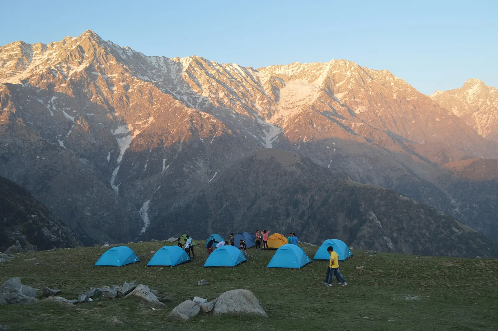
Triund is a meadow on a projecting ridge above McLeodganj, in Kangra district of Himachal Pradesh. It occupies the south-facing side of the Dhauladhar range and stands at approximately 2,800–2,900 metres. The setting makes it a scenic mountain destination. Many walkers make Triund the endpoint of a popular trek. For those heading towards the Dhauladhar peaks or passes, the meadow is also a stage along the way. Its role connects a walk that finishes at Triund with climbs that continue into the range. Himachal's hill towns blend Hindu temple traditions, Tibetan Buddhist monasteries and village devta (local deity) customs, with fairs and festivals tied to the farming calendar. Altitude decides the weather: the Shivalik foothills are mild, Shimla and Manali are cool with winter snow, and Lahaul-Spiti is a cold desert closed by snow for months. The July–September monsoon brings landslides and road closures in the hills. The usual best time to visit is March to June and October to November for most hill towns; May to October for Lahaul-Spiti and high passes. Timings, fees and access arrangements must be confirmed locally. For official information, see Himachal Pradesh Tourism at https://himachaltourism.gov.in.
Why it matters
Triund is a high mountain meadow in Kangra district, above McLeodganj, on a spur along the southern side of the Dhauladhar range. At about 2,800–2,900 metres, it is valued as a scenic destination and the endpoint of a popular trek. It also serves as a staging point for some journeys towards Dhauladhar peaks and passes; such routes require appropriate preparation and local advice. Its appeal comes from the open meadow and views towards the mountains, rather than from built monuments. No UNESCO World Heritage listing or Archaeological Survey of India protected-monument status is established for Triund. Visitors should check current access arrangements with local authorities or tourism offices before setting out.
Triund is a natural meadow, not a settlement or monument with a documented construction history. Its landscape developed through mountain processes in the Dhauladhar range, while its place in travel has grown through walking routes from the McLeodganj and Dharamkot area. There is no well-established record identifying a builder, a founding date, or a single community that created the present trekking route. The surrounding Kangra region has long been shaped by village agriculture, pastoral movement and religious traditions, but specific historical claims about Triund itself should be treated cautiously. In recent decades, Triund has become widely known as a day-hike destination and as a stopping point for trekkers continuing towards higher ground. Its popularity has brought seasonal visitor services and greater pressure to manage waste, trail conditions and overnight use. Facilities and rules can change with weather, safety concerns and local decisions. Unlike a historic building, the meadow has no known restoration phase; responsible care depends on protecting the landscape and respecting current access guidance.
Origin stories & folklore
No single, well-documented origin legend specific to Triund is widely established. In the broader Kangra region, mountains and natural places may be associated with local deities and spiritual traditions, but stories differ between villages and families. Visitors may hear accounts from guides or residents about the Dhauladhar landscape; these are best understood as local tradition or personal belief rather than verified history. Do not assume that every summit, rock or meadow has the same meaning to all communities. Ask respectfully before photographing people, shrines or any practice that appears private, and follow local guidance about places considered sacred.
Spend unhurried time at Triund: walk the marked paths, use official viewpoints and ask locally whether a guide, entry ticket or permit is needed. Weather changes fast, so carry a warm or rain layer even on a clear morning. Wildlife sightings are never guaranteed — patience and quiet improve your chances. A comfortable itinerary is one main visit in the morning, a local meal at midday and a short nearby stop before an afternoon return. Use the district list on this site to find other places in Kangra, but check the actual road route and its condition before combining stops. If a festival or fair is on, local roads and stays can be busy — and the experience can be unforgettable. Leave no litter: many sites are protected by the communities around them.
Suggested itineraries
Half day: Walk a comfortable section of the approach from the McLeodganj or Dharamkot side, pause at a suitable viewpoint, then return; allow about 3–4 hours depending on pace and conditions. Full day: Start early from the trailhead, walk to Triund, rest and enjoy the meadow without straying from established paths, then return before conditions or visibility worsen; allow about 6–9 hours overall, depending on pace and access. Gentler option: Skip the full ascent; explore McLeodganj or Dharamkot at an easy pace and choose a short, locally advised viewpoint walk with frequent rests.
Triund is reached from an area where Himachali and Tibetan cultural influences meet. In Kangra villages, customs can include worship of village deities, seasonal fairs and agricultural observances; McLeodganj and nearby Dharamshala also have a visible Tibetan Buddhist community and institutions. Kangri, Hindi and Gaddi are among the languages heard in the region, alongside Tibetan and English in visitor-facing settings. Music, dress and food vary by community and occasion, so there is no single cultural style that represents everyone around the meadow. Visitors can show respect by dressing practically and modestly, seeking permission before taking portraits, and following guidance at religious sites.
Local communities
People connected with the Triund trail include residents of McLeodganj, Dharamkot and nearby Kangra villages, as well as guides, drivers, food vendors and other seasonal tourism workers. In the wider district, agriculture and livestock keeping remain important livelihoods, while tourism provides work in transport, accommodation and guiding. Gaddi pastoral communities are part of the broader mountain region, though visitors should not assume that every local person or trail worker belongs to the same community. Services and employment can be seasonal, and weather affects access. Buying locally where appropriate and treating workers respectfully helps support the area without intruding on private or sacred practices.
Festivals & events
Triund itself is primarily a trekking destination, not a regular festival venue. In nearby McLeodganj and Dharamshala, Tibetan Losar celebrations usually fall in late winter or early spring, while local Hindu observances and village fairs take place at different times of year. Kangra district also has religious fairs and seasonal events, but dates and locations vary; confirm current details locally rather than planning around an assumed schedule. During major festivals, accommodation and roads in nearby towns can be busier, and some services may be limited. The trail is exposed mountain terrain, so a festival visit does not remove the need to check weather and access conditions.
Local food in Himachal Pradesh includes siddu (steamed stuffed bread), madra, dham (the traditional festive meal), chha gosht, trout from mountain streams, babru and fresh apples and apricots in season. Ask what is fresh that day; many small eateries cook a limited daily menu. Vegetarian travellers eat very well across this region, and most towns also have simple non-vegetarian dhabas. Remote sites may have no restaurant at all. Carry water and snacks, eat a proper breakfast before long drives, and ask your accommodation for a packed lunch if you are heading out early. Try a home-cooked or dhaba meal when you can — it is often the best food on the route. Choose busy, clean places and carry your packaging back to town.
Shopping & local experiences
McLeodganj and Dharamshala have shops selling Tibetan-style handicrafts, textiles, prayer items, books and locally made souvenirs. Products vary in origin and quality, so ask sellers about materials and provenance rather than assuming an item is locally made. Kangra tea and packaged regional foods can be options to look for in town. Small shops and food stalls may be seasonal or have changing stock, and the Triund meadow is not a dependable place for shopping. Buy only what you can carry back, avoid collecting plants or stones, and take all packaging and litter with you.
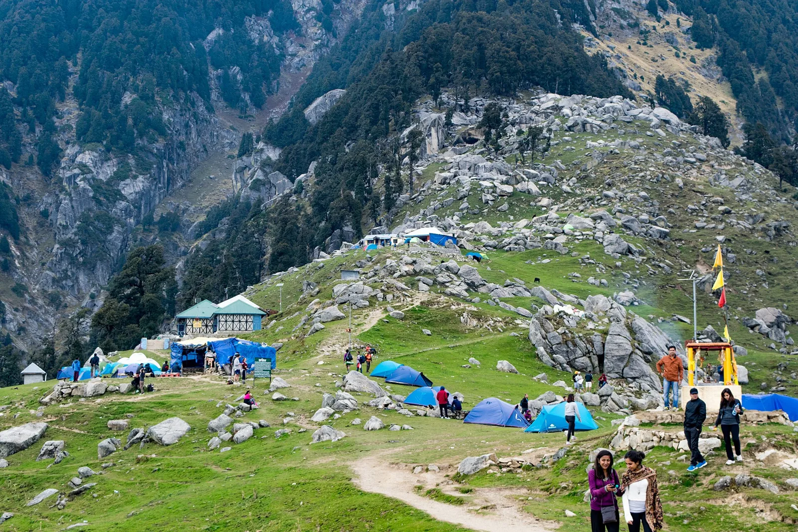
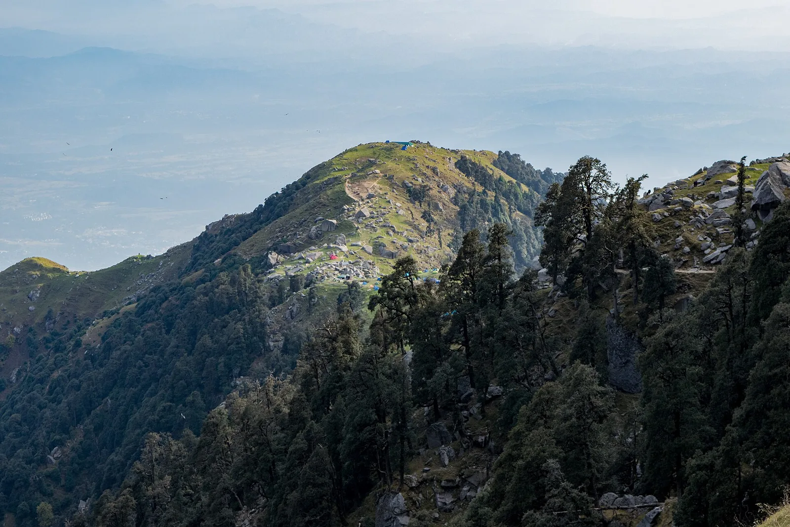
Triund is an open mountain meadow on a spur of the Dhauladhar range, at roughly 2,800–2,900 metres. The landscape changes along the approach: wooded sections below give way to more open slopes and grassland, with broad views of the surrounding mountains in clear weather. Oak and rhododendron occur in the wider forested approach, with other vegetation varying by elevation and season. Conditions can shift quickly, and the exposed meadow may feel cold or windy even when lower settlements are mild. Mountain birds and mammals may inhabit the region, but sightings are never assured. Carry out all rubbish, avoid disturbing wildlife and do not rely on streams or seasonal water sources for safe drinking water.
March to June and October to November for most hill towns; May to October for Lahaul-Spiti and high passes
The nearest principal railway station by straight-line distance is Kangra (narrow gauge), roughly 20 km away. The nearest operating airport by straight-line distance is Gaggal Airport, Kangra (Dharamshala), roughly 10 km away. These figures are calculated from map coordinates — hill roads wind a lot, so actual road distance and travel time are usually much longer. Chandigarh, Kalka and Pathankot are the main rail gateways for the hills, and the Kalka–Shimla toy train is itself a heritage journey. For the final leg, Himachal Road Transport Corporation (HRTC) buses and shared taxis link district towns; shared taxis usually leave early in the morning. A private taxi gives more flexibility for remote sites. When comparing train, bus and flight, count the complete door-to-door time: a flight saves the most time only if the onward road transfer is short, while an overnight train plus a road journey can save a hotel night. Book your return before you leave, because seats fill quickly on weekends and holidays. Current train numbers, timings, return services and fares are not listed here; check IRCTC and NTES for trains and the airline's own schedule for flights. No permit is needed for Indian visitors to most of Himachal Pradesh. Some stretches near the international border in Kinnaur and Lahaul-Spiti may have check posts, and foreign nationals should check current registration rules for border areas before travel.
Confirm onward and return timings on IRCTC / NTES, the state bus operator or your airline before travel. A dash means current timings or fares have not been verified.
Getting around
McLeodganj and Dharamkot are the usual starting areas for the Triund walk. Local buses, taxis and shared vehicles serve parts of the wider Dharamshala area; onward movement to trailheads may involve a short road transfer or walking, depending on the chosen route and current access. Parking is limited near popular trail access points, so check locally and avoid blocking village roads. There is no routine vehicle transport across the mountain trail to the meadow: visitors proceed on foot. Arrange a return plan before starting, especially if relying on a taxi or shared ride, and confirm road and trail conditions on arrival.
Hours, tickets & permissions
Triund is an outdoor mountain destination, and access can be affected by weather, trail conditions, safety advisories or local management decisions. There may be rules concerning trekking registration, guides, overnight stays, camping, fires or waste disposal; requirements can change, so confirm them locally before departure. Do not assume that a ticket, permit or camera fee is or is not required. Ask the relevant local authority, tourism office or established trail operator about current entry rules, hours and fees. Carry identification if advised, and follow any temporary closure notices.
Facilities
Facilities at Triund are limited and may vary by season. Food stalls or basic overnight arrangements may operate at times, but visitors should check locally and not depend on them being open. Toilets, safe drinking water, rubbish disposal and reliable phone coverage should not be assumed on the trail or at the meadow. Carry water, snacks, a warm layer and any personal medication. More services, including meals, accommodation, shops and cash access, are generally found in McLeodganj and Dharamshala. Ask locally about guides, current trail services and any restrictions on camping or fires.
Accessibility
Reaching Triund requires a substantial uphill walk on an uneven mountain trail, with rocky or steep sections and little shelter on exposed stretches. The route is not generally suitable for wheelchairs or strollers, and it can be demanding for visitors with limited mobility, balance concerns or heart or breathing conditions. There are no assured ramps or lifts on the trail. Shade is variable, and weather can make footing more difficult. Older visitors should assess their fitness honestly, consider a shorter walk with a local guide, and turn back if tired or conditions worsen. Allow extra time for rests and avoid walking alone.
No permit is needed for Indian visitors to most of Himachal Pradesh. Some stretches near the international border in Kinnaur and Lahaul-Spiti may have check posts, and foreign nationals should check current registration rules for border areas before travel. Carry a photo ID at all times and save the emergency number 112 and your accommodation's contact offline. Altitude sickness is possible above about 2,500 m: ascend gradually, rest on arrival, drink water and turn back if you develop a severe headache, breathlessness or confusion. Hill roads are prone to landslides in the monsoon — avoid night driving and heavy-rain travel. Stay on marked paths, keep away from cliff edges and fast water, and never approach wild animals. Check official advisories for the region before travel, and follow local guidance if access changes.
Photography
Clear mornings can offer good mountain visibility, while soft early or late light may bring out the contours of the meadow and Dhauladhar range; clouds and mist can obscure views at any time. Photography from established paths and viewpoints is generally the least disruptive approach. Confirm locally whether any site-specific restrictions apply. Drone use may be subject to aviation, safety, wildlife or local restrictions, so do not fly without checking current rules and obtaining any required permissions. Ask before photographing residents, workers or religious activity, and avoid disturbing other visitors or wildlife for a picture.
Choose a stay by the full journey to Triund, not just the district name. Main towns in Kangra usually offer hotels, state tourism lodges and guesthouses with better transport, meals and medical access, while village homestays offer a closer connection to local life. At altitude, check heating, hot water and power backup, and expect cold nights for much of the year. Book in advance for weekends, festival dates and the peak season (March to June and October to November for most hill towns; May to October for Lahaul-Spiti and high passes). Confirm the exact location, meals included, check-in time and cancellation terms in writing. Many homestays accept payment on arrival; avoid sending money to unverified contacts. Mobile network and digital payments can be unreliable in remote areas, so carry some cash.
McLeodganj and Dharamkot are the principal nearby bases for the Triund walk, with cafés, accommodation and access to local trails. Bhagsu Nag, including its temple area and waterfall route, is another popular stop near McLeodganj; conditions on the waterfall path can vary. Dharamshala offers additional town services and cultural sites, including the Norbulingka Institute. Naddi is known for views towards the Dhauladhar and can be visited from the McLeodganj area. These places are in the same local travel area, but road routes and conditions differ; check the actual journey before combining stops, especially during monsoon or after heavy rain.
For couples, Triund rewards a slow pace: arrive early for soft light and fewer crowds, share a local meal and keep the evening free. Public displays of affection can be frowned upon in conservative communities and at religious sites, so be discreet. A homestay or a small heritage hotel can make the trip memorable — confirm privacy, hot water and transport back. Keep a buffer in your itinerary, because weather and traffic can delay plans in Himachal Pradesh.
Q: How much time should I allow for Triund? A: A full-day outing is a sensible plan for walking to the meadow and returning. A shorter visit can focus on an easier section of the trail. Q: When is the best season to visit? A: Spring and autumn often offer suitable trekking conditions, but weather changes quickly. Check forecasts and local trail advice; monsoon rain can affect access. Q: Is entry paid or is a permit needed? A: Rules can change and may depend on current management arrangements. Confirm any ticket, registration, permit or guide requirement locally before starting. Q: Is Triund suitable for children or elderly visitors? A: The uphill, uneven trail can be strenuous. Suitability depends on fitness, age and conditions; consider a shorter walk and do not pressure anyone to continue. Q: Where can I stay nearby? A: McLeodganj, Dharamkot and Dharamshala have accommodation options. Check availability and current rules for any overnight stay at or near Triund.
Be the first to share photos, stories, advice or a helpful contact for Triund.
Loading…