
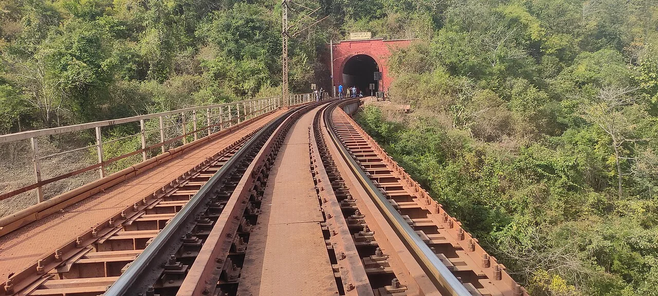
Kiriburu
Kiriburu is a Jharkhand census town near the Odisha border, visited for its Saranda forest setting, waterfalls, elephant-related name and iron-ore mines.
Key facts · verified by Ghumoopedia editors
- Type of place
- Destination
- Best time to visit
- October to February for sightseeing; July to September for waterfalls at full flow (expect slippery paths)
- Nearest railway station
- Rourkela Junction · about 45 km (straight line)
- Verified
- 21 Nov 2026
Plan a trip from Kiriburu — a day-by-day route through places nearby.
Kiriburu is a census town in Jharkhand’s West Singhbhum district, close to the Odisha boundary. It is a hill station set in Saranda forest; Saranda’s name refers to a region of seven hundred hills. The name Kiriburu comes from Mundari: kiri means elephant and buru means forest. The name reflects the many elephants in the woodland. Jhingara, Pundul, Ghagrita and Shadunala are among its waterfalls, and the forest has rich plant and animal life. Mining is another feature of the town. Kiriburu Iron-Ore Mine (KIOM) and Meghahatuburu Iron-Ore Mine (MIOM) are both large iron-ore mines administered by the Steel Authority of India Limited (SAIL). Jharkhand is the land of forests, waterfalls and Adivasi communities such as the Santhal, Ho and Munda, with major pilgrimages at Baidyanath Dham (Deoghar) and Shikharji (Parasnath). Jharkhand has hot summers from March to June, a monsoon from June to September when the waterfalls are at their fullest, and cool winters from November to February; the Netarhat plateau stays pleasant for much of the year. The usual best time to visit is October to February for sightseeing; July to September for waterfalls at full flow (expect slippery paths). Timings, fees and access arrangements must be confirmed locally. For official information, see Jharkhand Tourism at https://www.jharkhandtourism.gov.in.
Why it matters
Kiriburu is a census town in West Singhbhum district, near the Jharkhand–Odisha border, set within the Saranda forest region. Its name is commonly explained from Mundari words meaning “elephant” and “forest,” reflecting the area’s association with elephants. The town is also known regionally for the Kiriburu and Meghahatuburu iron-ore mines, operated by the Steel Authority of India Limited (SAIL), and locally as a base for experiencing the forested hills and waterfalls. These are important features of its identity and economy. No UNESCO World Heritage or ASI-protected status is established for Kiriburu itself; check with local authorities for current access and conservation rules.
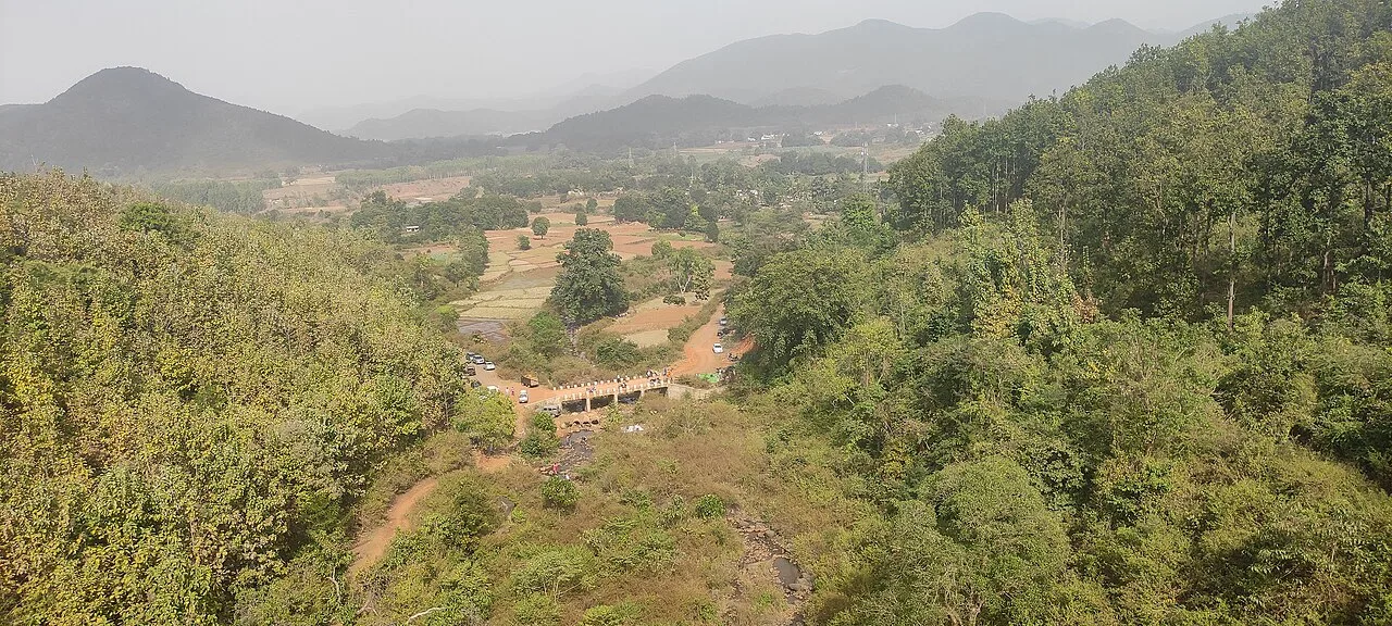
Kiriburu’s name is traditionally interpreted through Mundari as “forest of elephants,” connecting the settlement’s identity with the surrounding woodland and its wildlife. The Saranda region is home to Adivasi communities, including Ho and Munda people, whose presence and cultural life predate the town’s modern mining character. A detailed, independently verified chronology of Kiriburu’s settlement history is not readily established, so specific founding dates or early builders should not be assumed. The town’s contemporary growth is closely associated with the discovery and exploitation of iron ore in the area. Kiriburu Iron-Ore Mine (KIOM) and Meghahatuburu Iron-Ore Mine (MIOM) are operated by SAIL. Mining brought an industrial presence and supporting settlement into a landscape otherwise strongly identified with forest, hills and rural communities. The town therefore sits at the meeting point of extractive industry and a significant forest ecosystem. Visitors should respect mine boundaries and follow local instructions: operational areas are not automatically open to sightseeing.
Spend unhurried time at Kiriburu: walk the marked paths, use official viewpoints and ask locally whether a guide, entry ticket or forest permission is needed. Weather can change quickly, so carry a rain layer even on a clear morning. Wildlife sightings are never guaranteed — patience and quiet improve your chances. A comfortable itinerary is one main visit in the morning, a local meal at midday and a short nearby stop before an afternoon return. Use the district list on this site to find other places in West Singhbhum, but check the route and its condition before combining stops. If a festival or fair is on — such as the Shravani Mela at Deoghar or Sarhul — roads and stays can be busy, and the experience can be unforgettable. Leave no litter: many sites are protected by the communities around them.
Suggested itineraries
Half day: Check local access advice (about 20 minutes); visit an authorised viewpoint (45–60 minutes); take a short, permitted forest walk (about 1 hour); stop for a meal or tea locally (about 45 minutes). Full day: Start with a viewpoint in the morning (about 1 hour); take a guided or locally approved forest outing (2–3 hours); pause for lunch (about 1 hour); visit one accessible nearby waterfall or viewpoint if conditions and permissions allow (1–2 hours); return before late afternoon. Gentler option: Use a vehicle for the approach, spend time at one accessible viewpoint, and keep walking to a short, level stretch after checking the ground conditions.
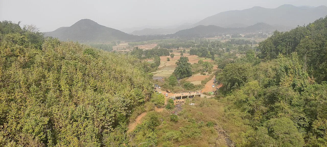
Kiriburu lies in a region where Ho and Munda communities have deep connections to the forest and local land. Ho and Mundari are among the languages associated with the wider area; Hindi is also useful for many visitors, though language use varies by household and setting. Community life includes seasonal observances, local music and dance, and customs linked to agriculture and the natural environment. Clothing and practices are diverse, so visitors should avoid treating any one style as representative of everyone. Ask before photographing people, homes or community events, and follow local guidance around forest areas and sacred or ceremonial spaces.
Festivals & events
In the wider Ho and Munda communities, seasonal festivals such as Mage Parab and Sarhul are observed, with customs and timing varying between villages. Sarhul is generally associated with spring, while Mage Parab is commonly held in winter. These are community occasions rather than guaranteed tourist events in Kiriburu; ask locally before making plans to attend. Larger observances can bring visitors to nearby settlements and make local transport or accommodation less predictable. Be a respectful guest: ceremonies are not performances, and photography should only be done with permission.
Local food in Jharkhand includes dhuska, rugra (bamboo shoot and mushroom dishes), handia (rice beer, offered by tribal communities), litti, arsa roti, pittha, chilka roti and mahua-based preparations. Ask what is fresh that day; many small eateries cook a limited daily menu. Vegetarian travellers eat very well across this region, and most towns also have non-vegetarian options. Remote sites may have no restaurant at all. Carry water and snacks, eat a proper breakfast before long drives, and ask your accommodation for a packed lunch if you are heading out early. Try a home-cooked or dhaba meal when you can — it is often the best food on the route. Choose busy, clean places, drink sealed or filtered water, and carry your packaging back with you.
Shopping & local experiences
Shopping in Kiriburu is likely to be practical rather than focused on dedicated souvenir stores. Look for everyday goods and locally prepared food in small shops, and ask residents whether community-made crafts are available nearby. The wider region has Adivasi craft traditions, but availability varies and visitors should buy directly from makers where possible, at a fair price. Try local meals or snacks where offered, and ask about ingredients if you have dietary needs. Do not collect plants, stones, wood or other natural items from forest areas.
October to February for sightseeing; July to September for waterfalls at full flow (expect slippery paths)
The nearest principal railway station by straight-line distance is Rourkela Junction, roughly 45 km away. The nearest operating airport by straight-line distance is Sonari Airport, Jamshedpur (limited flights), roughly 120 km away. These figures are calculated from map coordinates — actual road distance is longer. Ranchi, Dhanbad, Tatanagar (Jamshedpur), Bokaro and Gomoh are the main rail gateways, and Ranchi, Deoghar and Durgapur have airports. For the final leg, Jharkhand State Transport buses, private buses and shared Sumo and Bolero jeeps link district towns; shared jeeps usually leave early in the morning. A private taxi gives more flexibility for remote sites. When comparing train, bus and flight, count the complete door-to-door time: a flight saves the most time only if the onward road transfer is short, while an overnight train can save a hotel night. Book your return before you leave, because seats fill quickly on weekends, festivals and holidays. Current train numbers, timings, return services and fares are not listed here; check IRCTC and NTES for trains and the airline's own schedule for flights. No permit is needed to visit Jharkhand. Some forest and mining areas have check posts, and a few interior pockets are affected by Left-wing extremism — check current advisories with your host or the district administration before travelling to remote areas, and avoid travelling on isolated roads after dark.
Confirm onward and return timings on IRCTC / NTES, the state bus operator or your airline before travel. A dash means current timings or fares have not been verified.
Getting around
Kiriburu is a dispersed hill town, so the most practical way to reach separate viewpoints or nearby sites is often a locally hired taxi or jeep. Shared jeeps may connect settlements and district routes, but availability and departure arrangements can vary; ask locally before relying on them. Autos may be available for short journeys, though visitors should confirm on arrival. Walking can work for a short, approved route, but hills, weather and distances between sites matter. Check where parking is permitted and avoid leaving vehicles in mine or forest access areas.
Hours, tickets & permissions
Access may depend on the particular viewpoint, waterfall, forest track or mine area you plan to visit. Some places may have entry rules, restricted zones, local permissions or requirements to be accompanied by an authorised person; camera rules can also differ. Carry identification and follow instructions from the managing authority or local staff. Do not enter mine property or closed forest areas without permission. Confirm current opening arrangements, entry conditions and any fees with the relevant authority before setting out, as rules may change.
Facilities
Facilities can be limited and vary by location. Kiriburu may have basic food and daily-needs options, but choices can be limited outside the town centre. Toilets, drinking water, guides and visitor information are not assured at forest viewpoints or waterfalls, so check locally and carry water and essentials. Parking may be possible near some stopping points, but use only permitted areas. ATMs and broader services may not be convenient, so plan ahead. Confirm accommodation, food availability and access arrangements before travelling, especially for a remote-site visit.
Accessibility
Kiriburu’s hill and forest setting means uneven ground, slopes and potentially slippery paths, especially during and after rain. Reaching viewpoints or waterfalls may involve walking on rough tracks, and shade or seating cannot be assumed. Wheelchair and stroller access is likely to be limited beyond vehicle-accessible areas; check the exact route with local authorities before going. Older visitors or anyone with limited mobility may find a vehicle-based visit to one viewpoint more manageable than a forest walk. Allow extra time, wear secure footwear and avoid attempting steep or wet paths without local advice.
No permit is needed to visit Jharkhand. Some forest and mining areas have check posts, and a few interior pockets are affected by Left-wing extremism — check current advisories with your host or the district administration before travelling to remote areas, and avoid travelling on isolated roads after dark. Carry a photo ID at all times and save the emergency number 112 and your accommodation's contact offline. The plateau is cooler than the plains, but sun and wind can still be harsh; carry water and a warm layer in winter. Stay on marked paths, keep away from cliff edges and fast water, and never approach wild animals. Follow local guidance if access changes.
Photography
Morning or late-afternoon light can bring out the forested hills, but mist and changing weather may affect visibility. Use only authorised viewpoints and stay clear of mine property, wildlife and restricted areas. Photography rules can differ at managed sites, so ask before taking pictures, particularly near operational facilities. Drone use may be restricted by forest, mine or other local rules; obtain permission rather than assuming it is allowed. Photograph residents, workers, homes and ceremonies only with consent, and avoid disturbing wildlife for a picture.
Choose a stay by the full journey to Kiriburu, not just the district name. Ranchi, Jamshedpur and Deoghar offer the widest choice; forest rest houses near the sanctuaries must be booked through the forest department. On the plateau, check heating, hot water and power backup, and expect cold nights in winter. Book in advance for weekends, festivals and the peak season (October to February for sightseeing; July to September for waterfalls at full flow (expect slippery paths)). Confirm the exact location, meals included, check-in time and cancellation terms in writing. Avoid sending money to unverified contacts or touts at stations. Carry some cash, as card and digital payments can be unreliable in remote areas.
The most natural nearby visits are the Meghahatuburu area and the forested hills and viewpoints around Saranda, subject to local access rules. Waterfalls associated with the wider forest include Jhingara, Pundul, Ghagrita and Shadunala; their access and condition should be checked locally, particularly after rain. Noamundi is another mining town in West Singhbhum and may be of interest to visitors curious about the region’s iron-ore industry. These places are not necessarily straightforward to combine in one outing: check road conditions, permissions and transport before planning a route.
For couples, Kiriburu rewards a slow pace: arrive early for soft light and fewer crowds, share a local meal and keep the evening free. A waterfall viewpoint after the monsoon or a sunset from a hill temple makes the trip memorable. Public displays of affection can be frowned upon in conservative communities and at religious sites, so be discreet. Keep a buffer in your itinerary, because weather and road conditions can delay plans.
Q: How much time should I allow for Kiriburu? A: A half day can suit one viewpoint and a short walk; allow a full day if you are arranging an approved forest or waterfall visit. Q: When is a good season to visit? A: October to February is generally comfortable for sightseeing. Waterfalls are fuller in the monsoon, but paths can be slippery and access may be affected. Q: Is entry free, or do I need permission? A: Rules depend on the specific site. Confirm any entry requirements, permissions and fees with the relevant authority before travelling. Q: Is Kiriburu suitable for children and elderly visitors? A: A vehicle-based visit to an accessible viewpoint may work, but uneven, sloping or wet paths can be difficult. Check conditions and keep walks short. Q: Can I stay nearby? A: Confirm current accommodation availability in Kiriburu before setting out; if suitable lodging is unavailable, arrange a stay in a larger connected town.
Be the first to share photos, stories, advice or a helpful contact for Kiriburu.
Loading…