
District · Jharkhand
West Singhbhum
West Singhbhum offers a view of southern Jharkhand’s forested plateau country, where Adivasi village life, mining towns and long stretches of woodland share the landscape.
West Singhbhum lies in southern Jharkhand, within the forested plateau country of the Chota Nagpur region. Its landscape ranges from wooded hills and river valleys to the extensive Saranda forest, with iron-ore mining shaping parts of the district. Chaibasa is the district headquarters, while places such as Kiriburu and the waterfalls around the district draw visitors into more remote terrain. The area is closely associated with the Ho community and other Adivasi peoples, whose cultural life remains an important part of its character. Historically, the wider Singhbhum region included princely territories and saw resistance to British rule. Today, forest, village life, mining towns and transport corridors meet across a large and varied district.
West Singhbhum offers a view of southern Jharkhand’s forested plateau country, where Adivasi village life, mining towns and long stretches of woodland share the landscape. Chaibasa is the district headquarters and a practical base for exploring nearby sights, while Kiriburu gives access to the Saranda forest region and Hirni Falls draws visitors to a wooded river valley. The district is closely associated with the Ho community and its cultural traditions. Travellers come for the contrast between remote forest scenery and the everyday life of towns shaped by mining and regional transport links; it is best explored at an unhurried pace.
The wider Singhbhum region was home to Ho communities and other Adivasi peoples long before colonial rule. Ho social and political life traditionally included village institutions led by the Manki and Munda. The region also contained princely territories, including Porahat; Seraikela and Kharsawan were part of the wider historical Singhbhum area, though their later administrative histories differ from that of West Singhbhum. British expansion met sustained resistance. The Kol uprising of 1831–32 involved communities across parts of the Chota Nagpur region, and Ho resistance continued as colonial authority advanced into Kolhan during the nineteenth century. Under British rule, the area was administered within the Singhbhum region, with Chaibasa developing as an administrative centre. Iron-ore extraction and related infrastructure expanded during the modern period, bringing major changes to parts of the district while forest and village life remained central elsewhere. West Singhbhum was formed in 1990 when the former Singhbhum district was divided. It became part of Jharkhand when the state was created in 2000.
2 destination guides
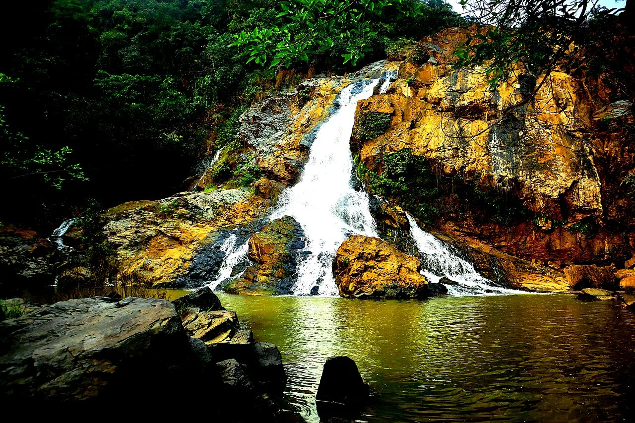
Hirni Falls
Hirni Falls is a waterfall in Jharkhand’s West Singhbhum district. Visitors go to see the waterfall, the defining feature of this place.
Kiriburu
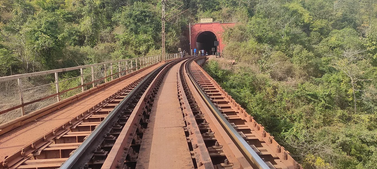
Kiriburu is a Jharkhand census town near the Odisha border, visited for its Saranda forest setting, waterfalls, elephant-related name and iron-ore mines.
Food traditions here reflect the wider cuisine of Jharkhand as well as local Adivasi practices. Dhuska, litti, arsa roti, pittha and chilka roti are familiar regional foods; seasonal meals may include rugra, a wild mushroom, and dishes made with bamboo shoots. Some tribal communities prepare handia, a fermented rice drink, and mahua-based foods or drinks also form part of regional traditions. Recipes and availability vary between villages and towns. Small eateries may cook a limited menu based on what is fresh, so ask what is available that day. Vegetarian options are common, with meat dishes served in many places too.
Craft traditions in West Singhbhum are varied and often rooted in household use and local materials. In villages and market towns, people make practical items such as baskets and other wares from bamboo, and plates from sal leaves. Woodwork and other forest-based skills are also part of the wider regional craft landscape. Ho and other Adivasi communities have distinctive cultural traditions, but there is no single craft that represents the whole district. Visitors hoping to buy handmade work can ask locally about artisans and community markets, as availability varies by place and season.
Mage Parab, an important Ho festival, is generally celebrated in winter and brings communities together through observances, music and social gatherings. Baha, associated with spring, is celebrated in Ho and other Adivasi communities in the wider region. Sarhul, Karma and Sohrai are also observed in parts of the district, with practices varying between communities and villages. Festival activity is often centred on local communities rather than large visitor events. Celebrations can make some towns and village areas busier, and accommodation may be more in demand around prominent gatherings; confirm local arrangements before travelling.
West Singhbhum lies across the forested plateau country of southern Jharkhand. Its terrain includes wooded hills, valleys and streams, with the extensive Saranda forest occupying a large part of the district. The Koel and other regional river systems drain the wider landscape, while waterfalls such as Hirni Falls are reached through hilly, forested surroundings. Iron-ore mining has altered some areas, particularly around mining settlements. Roads connect principal towns, but forest routes can be winding and travel slower than a map may suggest; reaching remote sights often requires planning and a suitable vehicle.
The district has hot summers, a monsoon season and cooler, generally drier winters. Summer conditions can make daytime walks and road journeys tiring, especially in exposed or remote areas. Monsoon rains bring greener forest scenery but can make rural roads slippery, slow journeys and affect access to waterfalls. The cooler months, broadly from late autumn through winter and into early spring, are usually the most comfortable time to visit. Pack light, breathable clothing, a warmer layer for evenings in winter, sturdy footwear and rain protection during the monsoon. Carry drinking water and sun protection, and check local road conditions before setting out.
Chaibasa and other parts of West Singhbhum are reached by road from Jamshedpur and Ranchi. Chakradharpur Junction and Tatanagar Junction are useful rail gateways; Birsa Munda Airport in Ranchi is a principal air gateway. From rail stations or the airport, continue by bus, taxi or hired vehicle. Buses and shared vehicles serve some towns, but services can be limited for remote forest areas, waterfalls and mining settlements; a locally arranged vehicle may be more practical for those trips. Check current services locally before setting out.
Road travel is the main way to move between Chaibasa, Chakradharpur, Kiriburu and smaller settlements. Buses and shared vehicles serve some towns, while autos are useful for shorter local journeys where available. Services to forest areas, waterfalls and mining settlements can be limited or irregular, so a taxi or locally arranged vehicle may be more practical for sightseeing. Roads through hilly and forested terrain can be slow, and conditions may change during the monsoon. There is no need to plan around boat transport for the listed sights; confirm current road access locally before departure.
2 days: Hirni Falls; sleep in Chaibasa on night 1. 3 days: Kiriburu; sleep in Kiriburu on nights 1 and 2, subject to locally available accommodation. 4 days: Hirni Falls → Kiriburu; sleep in Chaibasa on night 1 and Kiriburu on nights 2 and 3.
Chaibasa is the most practical base for Hirni Falls and for access to district transport links. Kiriburu can suit a visit focused on the mining-town and Saranda forest area, but accommodation choices and services may be limited, so check availability in advance. Stays in the district are generally centred on hotels and basic guest accommodation; homestays or community stays may be possible in some places but should be arranged locally. Government lodges and dharamshalas may be available in some towns, though facilities vary. For remote excursions, plan your overnight stops before leaving town.
Stay on established routes, follow local guidance around wildlife and do not enter mines or restricted work areas. Carry safe drinking water and basic medicines, and use caution near waterfall edges and fast-flowing streams. Mobile connectivity can be patchy in remote areas, so share your route and do not rely on a signal for navigation. Local restrictions or forest access rules may vary; confirm any required permissions with the relevant authorities before setting out. Keep valuables secure in crowded places.
- Khuntiabout 58 km
- Sundargarh · Odishaabout 59 km
- Seraikela Kharsawanabout 90 km
- Ranchiabout 97 km
- East Singhbhumabout 100 km
- Keonjhar · Odishaabout 106 km
- Mayurbhanj · Odishaabout 127 km
- Ramgarhabout 134 km
Straight-line distance between the centres of each district's destinations; road distance is longer.
Q: How many days should I spend in West Singhbhum? A: Two days can suit a visit to one main sight from Chaibasa. Allow three or four days if combining Hirni Falls and Kiriburu, since road journeys can be slow. Q: When is the best time to visit? A: The cooler months from late autumn to early spring are generally most comfortable. Monsoon brings greener scenery but can complicate road travel. Q: What is the best base for sightseeing? A: Chaibasa is the most practical base for transport and Hirni Falls. Kiriburu is useful for a Saranda-area visit, but has fewer services. Q: How do I get to West Singhbhum? A: Reach the district by road from Jamshedpur or Ranchi, or use Chakradharpur Junction or Tatanagar Junction as rail gateways. Birsa Munda Airport in Ranchi is a principal air gateway; continue by road. Q: Is West Singhbhum suitable for families or elderly travellers? A: Chaibasa and easier road-accessible stops can suit many visitors, but remote forest trips and uneven terrain may be tiring. Choose excursions to match mobility and check access conditions in advance.
This page draws on our 2 destination guides for West Singhbhum and is updated as our team checks it.
Be the first to share photos, stories, advice or a helpful contact for West Singhbhum.
Loading…