
District · Jharkhand
Ramgarh
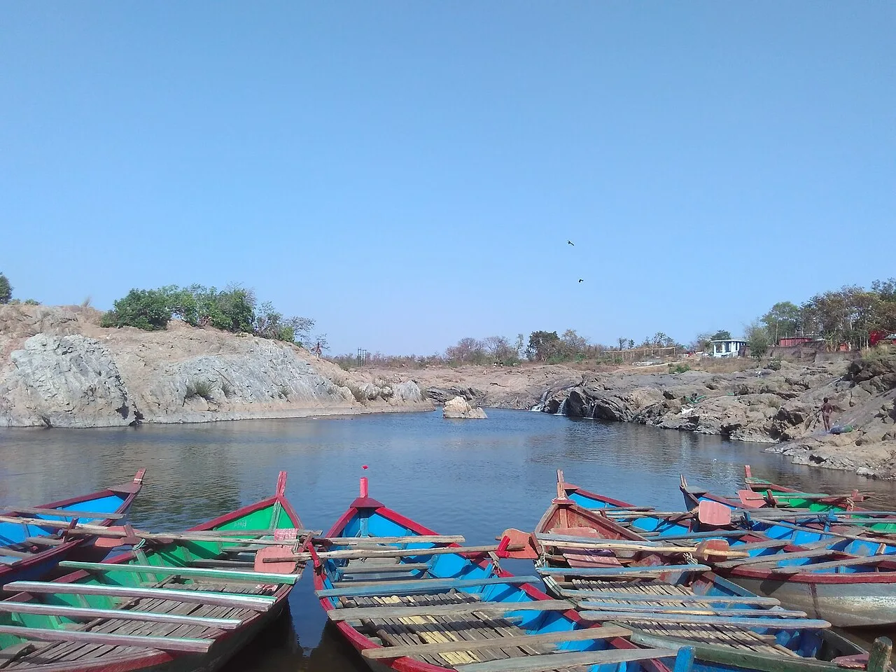
Ramgarh offers a close view of Jharkhand’s Damodar valley, where wooded uplands and riverside scenery meet active coalfields and industry.
Ramgarh district lies in north-central Jharkhand, where the Damodar valley cuts between wooded uplands and rocky hills. The river, reservoirs and patches of forest shape a landscape also strongly marked by coalfields, mines and industry. Ramgarh town is an important road and rail centre, while settlements range from busy mining communities to quieter rural areas. The district was formed in 2007 from part of the former Hazaribagh district. Its character brings together Adivasi and wider regional traditions, a long military presence around Ramgarh Cantonment, and the religious draw of Rajrappa, where the Chhinnamasta temple stands near the meeting of the Damodar and Bhairavi rivers. Nature, pilgrimage and working industrial landscapes sit close together here.
Ramgarh offers a close view of Jharkhand’s Damodar valley, where wooded uplands and riverside scenery meet active coalfields and industry. It lies in the north-central part of the state and is a useful road and rail centre for travel between Ranchi, Hazaribagh and Bokaro. The district is best known to many visitors for Rajrappa, a pilgrimage centre and waterfall where the Chhinnamasta temple stands near the meeting of the Damodar and Bhairavi rivers. Ramgarh also has a long military presence around its cantonment and a mix of Adivasi and wider regional traditions. It suits travellers interested in pilgrimage, landscape and the contrasts of a working industrial region.
The Ramgarh region has been part of the wider history of the Chota Nagpur plateau, where authority shifted among local chiefs and larger powers. The Nagvanshi rulers were influential across parts of the plateau, while the Ramgarh Raj estate became a significant local landholding; its boundaries and status changed over time. Under British rule, the estate was incorporated into colonial systems of administration and revenue collection. Rail links, coal extraction and related industry later altered settlement and work across the Damodar valley. Ramgarh Cantonment is associated with the military presence that developed in the twentieth century. In 1940, the Indian National Congress held its annual session at Ramgarh, presided over by Maulana Abul Kalam Azad. After independence, the area remained within Hazaribagh district until Ramgarh district was created in 2007 from part of Hazaribagh. Its history today is visible in the combination of cantonment, mining settlements, pilgrimage and rural communities.
Across Ramgarh and the wider Jharkhand region, everyday food often features rice, lentils and seasonal vegetables. Dhuska, a fried rice-and-lentil snack, and dishes made with forest produce such as rugra mushrooms are regional favourites. Other foods to look for include litti, arsa roti, pittha and chilka roti. Some Adivasi communities prepare handia, a fermented rice drink, and mahua-based foods or drinks; these are cultural traditions rather than universal offerings. Menus at small eateries can be limited, so ask what is freshly prepared that day. Vegetarian choices are common, with meat available in many towns.
Ramgarh is not especially known for one district-specific craft. Across Jharkhand, Adivasi communities sustain practices such as bamboo and woodwork, basketry and metal casting. Sohrai and Khovar murals are associated especially with the wider Hazaribagh region, while their presence and availability can vary from place to place. Ask locally about the maker and origin of an object rather than assuming a craft is specific to Ramgarh. Where possible, buying directly from artisans helps support local makers and keeps the connection between a craft and its community visible.
Rajrappa draws pilgrims throughout the year, with especially busy periods during Navratri and other Hindu festival seasons; crowds gather around the temple and riverside, and nearby rooms may be harder to find. Durga Puja and Chhath are observed in towns and communities, while Sarhul, Karma and Tusu reflect Adivasi and regional traditions, generally in spring, the monsoon season and winter respectively. Makar Sankranti is also marked in the region, and pilgrimage activity may increase around the season. Festival schedules and crowd levels vary, so reserve a stay ahead when travelling during major observances.
The Damodar valley runs through Ramgarh between wooded uplands, rocky hills and areas of forest. The Damodar and its tributaries, reservoirs and river crossings shape local scenery and routes; at Rajrappa, the Damodar meets the Bhairavi near the temple and waterfall. Coalfields, mines and industrial sites are also prominent parts of the landscape. Main roads connect larger settlements, but rural approaches can be slower and less direct, particularly in wet weather. Visitors should expect a mix of built-up corridors and quieter natural areas rather than uninterrupted wilderness.
Summer is generally hot, and outdoor visits are more comfortable early or late in the day. The monsoon brings rain, greener surroundings and potentially muddy or slippery approaches near rivers and falls; road journeys may take longer. Winter is usually milder and is often the most comfortable season for temple visits and exploring outdoors. October to February is a practical period for travel, though festival crowds can affect the experience. Pack light, breathable clothing for warm weather, a rain layer and footwear with good grip during the monsoon, and a light warm layer for winter mornings and evenings. Carry drinking water and sun protection in every season.
Ramgarh can be reached by road from Ranchi, Hazaribagh, Bokaro and other Jharkhand centres, using intercity buses or private vehicles. Ramgarh Cantonment is the nearest principal railway station, and Birsa Munda Airport in Ranchi is the nearest major airport. From Ramgarh town, buses and shared or hired vehicles serve nearby settlements, but onward connections to rural sites such as Rajrappa may vary. For remote places, arrange transport in advance and carry water and snacks. Check current services locally before travelling.
Ramgarh town and Ramgarh Cantonment are the main local transport hubs, with road connections to nearby towns and settlements. Buses and shared vehicles operate on some routes, while autos, hired cars and taxis can help with shorter journeys or more flexible plans. Rajrappa is reached by road, but onward services from Ramgarh may be limited or variable, so arrange a return journey in advance rather than relying on an immediate connection. Rural roads can be slower, especially in rain. There is no need to plan around boat transport for the district’s listed sight; check current local transport options before setting out.
2 days: Rajrappa; sleep night 1 and night 2 in Ramgarh town. 3 days: Rajrappa at an unhurried pace, with an extra day for rest or local travel; sleep nights 1 and 2 in Ramgarh town.
Ramgarh town is the most practical base for reaching Rajrappa and finding onward transport. Hotels and simpler guesthouses are generally the most useful options for independent travellers; availability and standards vary, so confirm arrangements before arrival. Chitarpur or the Rajrappa area may suit a shorter pilgrimage visit, but choices can be limited and should be checked locally. Dharamshalas may be available around pilgrimage facilities, subject to local rules and availability. Do not assume that homestays or government lodges are operating without confirming directly.
Use care on rocky, uneven or slippery ground near the waterfall and river, especially during and just after monsoon rain; keep away from unsafe edges and strong currents. Crowds can build around Rajrappa during festivals, so supervise children and agree on a meeting point. Carry drinking water and food for rural journeys, and use reliable sources rather than untreated river water. Roads can be rough or slow in wet weather, and mobile coverage may be inconsistent away from towns. Arrange return transport in advance. Check current local access rules or restrictions with official sources before visiting; do not assume that conditions or access remain unchanged.
- Bokaroabout 45 km
- Hazaribaghabout 48 km
- Ranchiabout 50 km
- Giridihabout 70 km
- Khuntiabout 76 km
- Kodermaabout 79 km
- Seraikela Kharsawanabout 80 km
- Chatraabout 93 km
Straight-line distance between the centres of each district's destinations; road distance is longer.
Q: How many days should I spend in Ramgarh district? A: Two days can cover a visit to Rajrappa at a comfortable pace. Allow an extra day if you want a slower schedule or more time for local travel. Q: What is the best time to visit? A: October to February is generally comfortable for outdoor visits. Monsoon brings lush scenery but can make approaches slippery, while summer can be hot. Q: Where is the best base for visiting Rajrappa? A: Ramgarh town is the practical base for transport and a wider choice of stays. Check accommodation near Rajrappa in advance if you prefer to stay closer. Q: How do I get to Ramgarh? A: Ramgarh Cantonment is the principal railway station, and the district is connected by road to Ranchi, Hazaribagh and Bokaro. The nearest major airport is in Ranchi. Q: Is Ramgarh suitable for families or elderly travellers? A: Yes, with planning. The temple area can be crowded, and uneven or slippery ground near the waterfall may be difficult for people with limited mobility.
This page draws on our 1 destination guides for Ramgarh and is updated as our team checks it.
Be the first to share photos, stories, advice or a helpful contact for Ramgarh.
Loading…