
District · Jharkhand
Koderma
Koderma lies in northern Jharkhand, on the Chota Nagpur Plateau near the Bihar border.
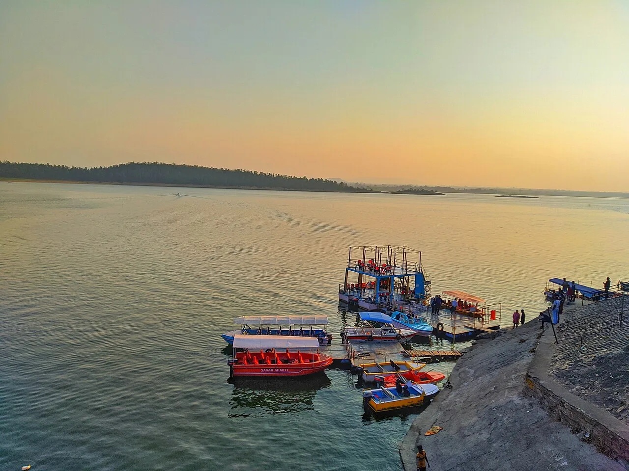
Koderma lies in northern Jharkhand, on the forested, rolling plateau of the Chota Nagpur region. Hills, woodland and rural settlements shape much of its landscape, while the Barakar River and Tilaiya reservoir are prominent features. The district was carved out of Hazaribagh in 1994 and is widely associated with mica mining, an industry that once earned the area a reputation as India’s mica capital. Koderma Wildlife Sanctuary protects a forested part of the district. The result is a place where mining history, small-town life and quieter natural landscapes meet. Tilaiya Dam, the first of the Damodar Valley Corporation’s four multi-purpose dams in its first phase, is among the district’s best-known landmarks.
Koderma lies in northern Jharkhand, on the Chota Nagpur Plateau near the Bihar border. It is best known for its history of mica mining and for Tilaiya Dam, the first of the four multipurpose dams included in the Damodar Valley Corporation’s first phase. The district offers a mix of reservoir scenery, wooded hills and small-town life rather than a dense circuit of documented tourist attractions. It can suit travellers interested in regional industry and infrastructure as well as those seeking a quiet outing by the water. Published destination information is limited, so visitors should plan around the places documented here and check local conditions before setting out.
Koderma’s history is part of the wider story of the Chota Nagpur Plateau, a region shaped by Indigenous communities, local chiefs and changing political boundaries. Nagvanshi rulers held power in parts of the plateau, but it would be misleading to assign the whole of today’s Koderma district to one kingdom throughout its history. Under British rule, the area was administered within the wider Chota Nagpur region and later formed part of Hazaribagh district. Mica deposits became an important feature of the local economy, with mining and trade developing during the colonial period and continuing after independence; their prominence gave Koderma a strong association with mica. Tilaiya Dam, built across the Barakar River as part of the Damodar Valley Corporation’s development programme, represents a later phase of planned water and power infrastructure. Koderma became a separate district on 10 April 1994, when it was carved out of Hazaribagh district in the then state of Bihar. It became part of Jharkhand when the state was formed in 2000.
Koderma’s food reflects the wider culinary traditions of Jharkhand. Look for dhuska, litti, arsa roti, pittha and chilka roti, alongside seasonal dishes made with local greens, mushrooms or bamboo shoots. Rugra, a mushroom delicacy, is associated with the region, though availability depends on the season. Handia, a fermented rice drink, is traditionally prepared and shared by some tribal communities; it is not served everywhere. Small eateries may offer a limited menu based on what is fresh that day. Vegetarian choices are common, and many towns also have non-vegetarian food.
Koderma is better known for its mica-mining history than for a widely documented signature craft or handloom tradition. Across Jharkhand, visitors may encounter bamboo and wood articles, dokra metalwork and tribal painting, though their presence and availability vary from place to place. Sohrai and Khovar wall-painting traditions are especially associated with the wider Hazaribagh region, rather than being exclusive to Koderma. Local markets may offer regional craftwork, but it is worth asking sellers where an item was made before treating it as a district-specific tradition.
Residents celebrate festivals including Sarhul and Karma, which reflect Adivasi traditions of the wider region, as well as Chhath, Durga Puja, Diwali and Holi. Sarhul and Karma are generally observed in spring or the monsoon season, while Chhath falls in autumn and Durga Puja usually takes place around the same broad festive period. Celebrations are local in scale, though popular festival periods can bring more visitors to town centres and increase demand for rooms. Travellers seeking a quieter visit may prefer to avoid the busiest days or arrange accommodation in advance.
Koderma is part of the Chota Nagpur Plateau, with undulating ground, rocky and wooded hills, and patches of forest. The Barakar River and its reservoir at Tilaiya Dam shape the district’s best-known waterside outing. Settlements and roads run through a mixed landscape rather than a level plain, so journeys can include winding stretches and changing road conditions. Forested areas and hills make scenery more varied, but do not assume that every natural area has marked trails, visitor facilities or easy access. Check local advice before walking away from established roads.
Koderma has hot summers, a rainy monsoon season and cooler, generally more comfortable winters. Summer days can make outdoor visits tiring, while monsoon rain may affect road conditions and limit views around the reservoir. The cooler months, broadly from late autumn through winter, are usually the most comfortable time to explore. The post-monsoon period can also be pleasant, though conditions vary from year to year. Pack light, breathable clothing for warm weather, a rain layer and footwear with good grip if travelling in the wet season, and a warm layer for winter mornings and evenings. Carry sun protection and drinking water in every season.
Koderma Junction is the district’s principal railway station, and Gaya Airport is the nearest operating airport by map location. Ranchi and other major Jharkhand rail and air gateways are alternatives, depending on your route. National Highway 20 and connecting roads link Koderma with towns in Jharkhand and neighbouring Bihar; actual road journeys can be longer than map distances suggest. From the station or town, local buses, private buses, shared vehicles and auto-rickshaws can help with onward travel, though remote sites may have limited services. Check current services locally before setting out.
Koderma town and Jhumri Tilaiya are useful road bases for reaching places around the district, including Tilaiya Dam. Local buses, shared jeeps and auto-rickshaws may serve routes between towns and larger villages, but service frequency and availability can vary, particularly for the final stretch to a less central stop. A hired taxi or locally arranged vehicle can be more practical for a reservoir visit or a flexible day out. Do not assume that boats operate at the dam; confirm any water-based activity locally. Allow extra time for rural roads and check return transport before leaving a town centre.
2 days: Koderma town → Tilaiya Dam → Koderma town; sleep in Koderma town. 3 days: Jhumri Tilaiya → Tilaiya Dam → Jhumri Tilaiya; sleep in Jhumri Tilaiya both nights. This slower plan allows flexibility, as the district’s published destination list is limited.
Koderma town and Jhumri Tilaiya are the most practical bases for visiting Tilaiya Dam and arranging local transport. They offer the best chance of finding ordinary hotels and guesthouses, while options in smaller settlements may be limited. Homestays, government lodges and dharamshalas should not be assumed to be available or open to all visitors; check directly and confirm facilities before relying on them. For a short visit, staying in town is generally more convenient than seeking accommodation near the reservoir.
Use care on hilly or rural roads, especially after dark or during monsoon rain, when surfaces may be slippery or visibility reduced. At the reservoir, keep away from steep banks, strong currents and unmarked edges, and supervise children closely; do not enter the water unless local conditions and facilities make it safe. Carry drinking water and basic medicines, and seek current local advice about forest access or wildlife rather than walking into wooded areas alone. Mobile coverage and roadside services may be weaker outside towns. No special permit is assumed for an ordinary visit to Tilaiya Dam; confirm any access restrictions or activity-specific permissions with local authorities before travel.
- Hazaribaghabout 31 km
- Chatraabout 36 km
- Nawada · Biharabout 43 km
- Gaya · Biharabout 67 km
- Ramgarhabout 79 km
- Giridihabout 80 km
- Jehanabad · Biharabout 89 km
- Nalanda · Biharabout 91 km
Straight-line distance between the centres of each district's destinations; road distance is longer.
Q: How many days should I spend in Koderma? A: Two days can cover a visit to Tilaiya Dam from a town base. Allow three days if you want a slower pace or more flexibility. Q: When is the best time to visit? A: The cooler months from late autumn through winter are generally the most comfortable. Monsoon scenery can be appealing, but rain may affect roads and outdoor plans. Q: What is the best base for visiting Tilaiya Dam? A: Koderma town and Jhumri Tilaiya are practical bases, with more services and accommodation options than smaller settlements. Q: How do I get to Koderma? A: Koderma is reachable by road and rail. From town, continue to local sights by bus, shared vehicle, auto-rickshaw or a locally arranged taxi; check current connections before travelling. Q: Is Koderma suitable for families or elderly travellers? A: Yes, with planning. Choose a town base, arrange reliable transport and take care around uneven ground and the reservoir; comfort may be lower during hot weather or heavy rain.
This page draws on our 1 destination guides for Koderma and is updated as our team checks it.
Be the first to share photos, stories, advice or a helpful contact for Koderma.
Loading…