
District · Jharkhand
Ranchi
Ranchi district brings together Jharkhand’s capital city and the plateau landscapes of the Chota Nagpur region.
Ranchi district lies on the Chota Nagpur Plateau, where undulating uplands, wooded stretches and rivers form a landscape marked by waterfalls. Ranchi city, Jharkhand’s capital, is the main urban centre and a practical base for exploring Hundru, Dassam and Jonha falls. Within the city, Tagore Hill, Pahari Mandir and Jagannath Temple offer different perspectives on its cultural and religious life. The district’s character reflects the longstanding presence of Adivasi communities, including Munda and Oraon peoples, alongside its growth as an administrative and educational centre. Its wider history is closely connected with movements over land and tribal rights. Patratu and Panchghagh Falls are nearby excursions, but belong to Ramgarh and Khunti districts respectively.
Ranchi district brings together Jharkhand’s capital city and the plateau landscapes of the Chota Nagpur region. It is best known to travellers for waterfalls such as Hundru, Dassam and Jonha, as well as city landmarks including Tagore Hill, Pahari Mandir and Jagannath Temple. Ranchi is a useful base for combining nature outings with cultural and religious sites, and serves as a major administrative and educational centre. The district’s identity is also shaped by Munda and Oraon communities and by a wider regional history of movements over land and Adivasi rights. Patratu and Panchghagh Falls are possible regional excursions, but lie in neighbouring districts.
The Ranchi region was part of the wider Chota Nagpur area, where the Nagvanshi rulers held authority over many centuries. Their seat shifted over time, and their influence existed alongside local communities and chiefs. The region’s history is closely tied to Adivasi landholding and customary rights. Under British rule, changes to revenue collection and control of land contributed to unrest, including the Kol uprising of 1831–32 and the Munda movement led by Birsa Munda around the turn of the twentieth century. British administration made Ranchi an important centre in Chota Nagpur. The district’s boundaries and administrative arrangements changed over time; Ranchi became the capital of the newly formed state of Jharkhand in 2000. The area’s development as an administrative and educational centre has continued alongside the presence and cultural life of its Adivasi communities.
8 destination guides
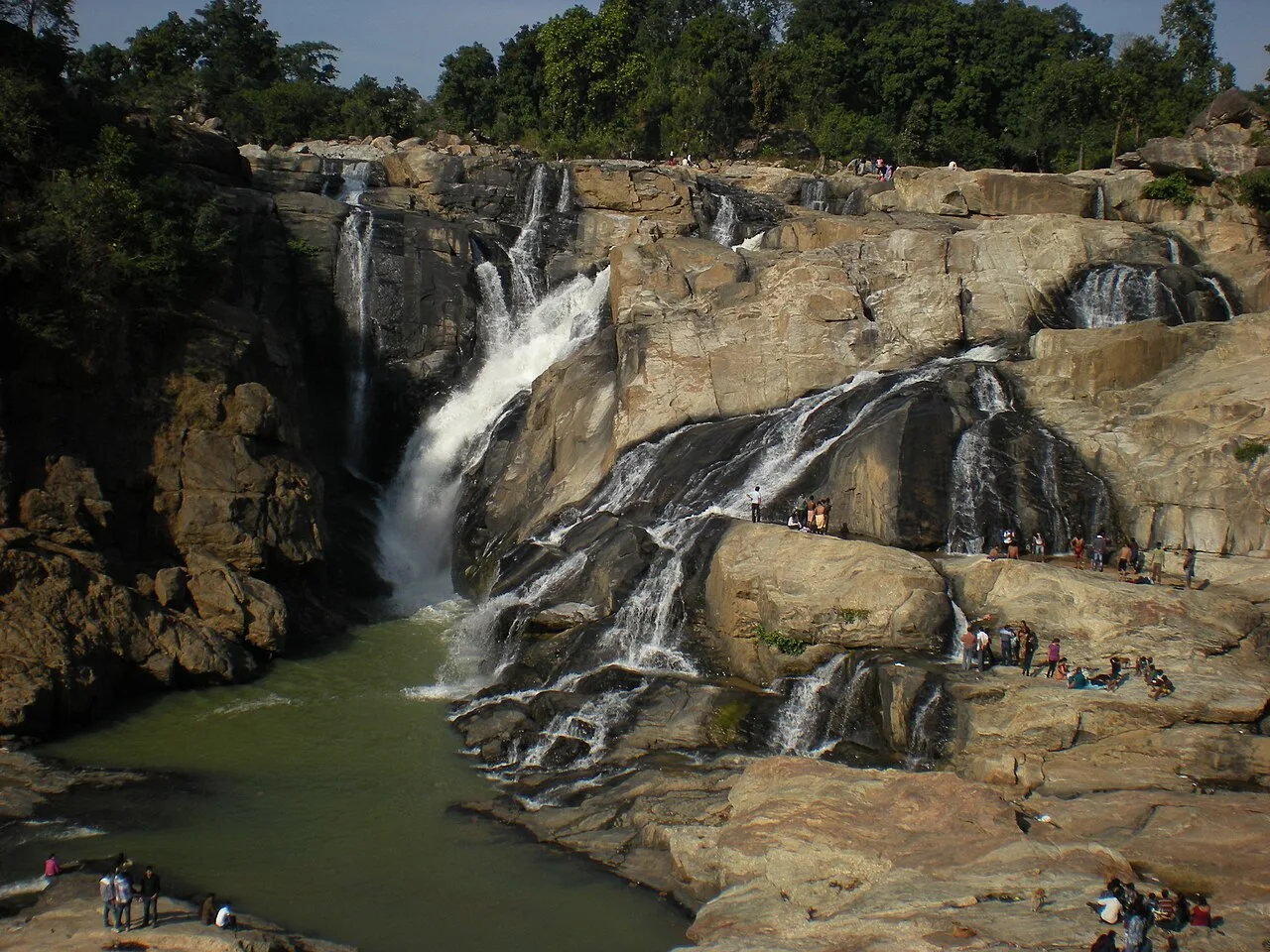
Dassam Falls
Dassam Falls, also known as Dassam Ghagh, is a 144-foot waterfall formed by the Kanchi River in Jharkhand. Visitors come to see the river’s descent.
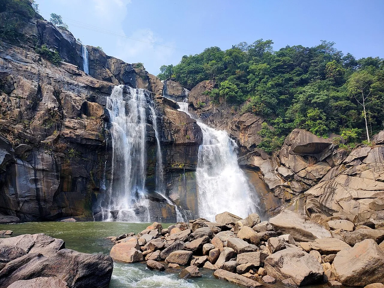
Hundru Falls
Hundru Falls is a waterfall in Ranchi district, Jharkhand, ranked 34th among India’s waterfalls and known as a prominent visitor attraction in its region.
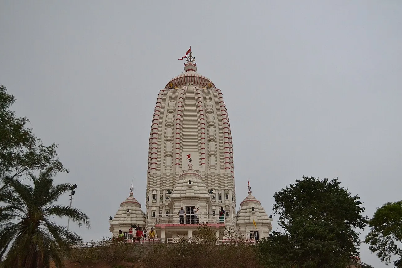
Jagannath Temple
Dedicated to Jagannath, this Hindu shrine in Ranchi, Jharkhand, draws worshippers for its hilltop setting and the annual Rath Yatra and fair held during Aashaadha.
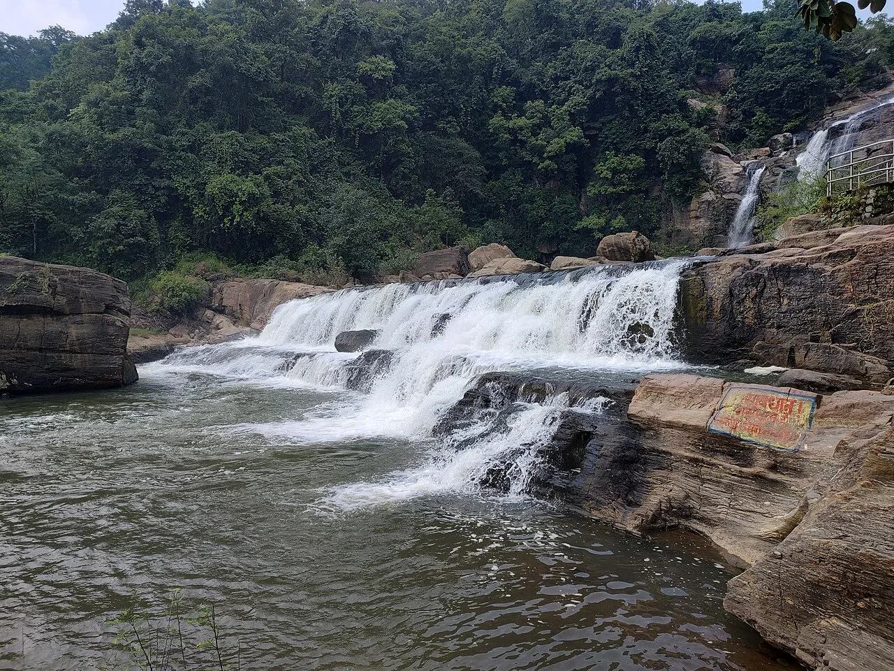
Jonha Falls
Jonha Falls, also known as Gautamdhara Falls, is a waterfall in Ranchi district, Jharkhand. Visitors can reach it by Jonha Fall Resort Road without taking the 722 steps.
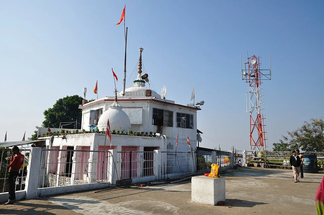
Pahari Mandir
Pahari Mandir is a Shiva shrine on a hill in Ranchi, known for worship during Sawan and Shivaratri, its colonial-era history and flag-raising ceremonies.
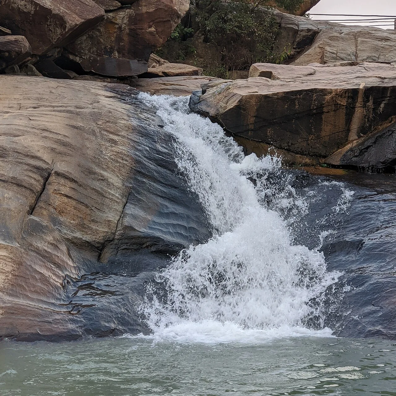
Panchghagh Falls
Panchghagh Falls is a waterfall in Jharkhand, associated with both Khunti and Ranchi districts. Visitors come to see the falls.
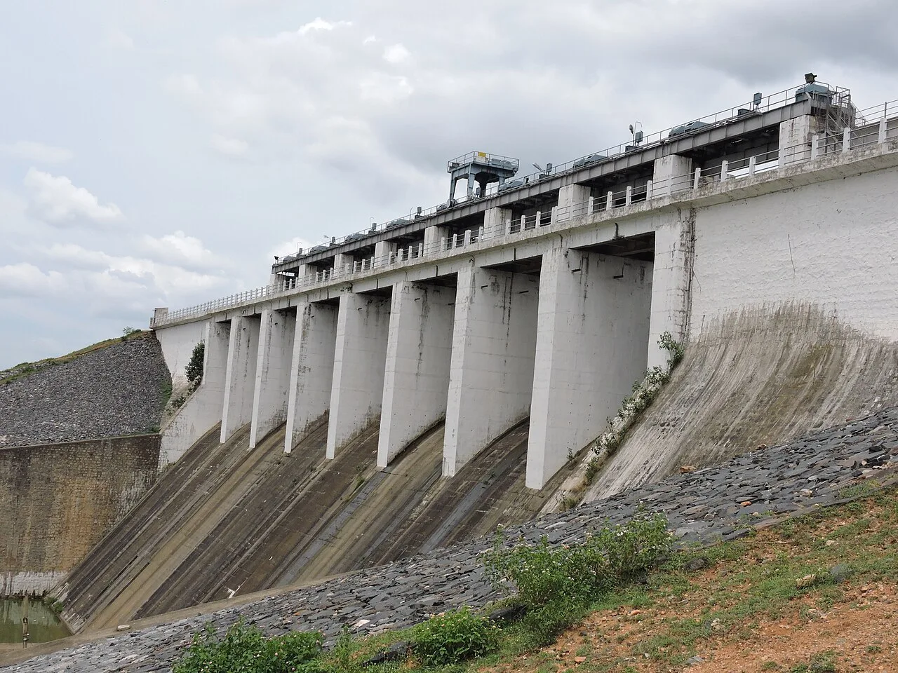
Patratu
Patratu is a census town in Jharkhand, linked administratively to Patratu block and Ramgarh subdivision. The details provided do not identify a specific visitor attraction.
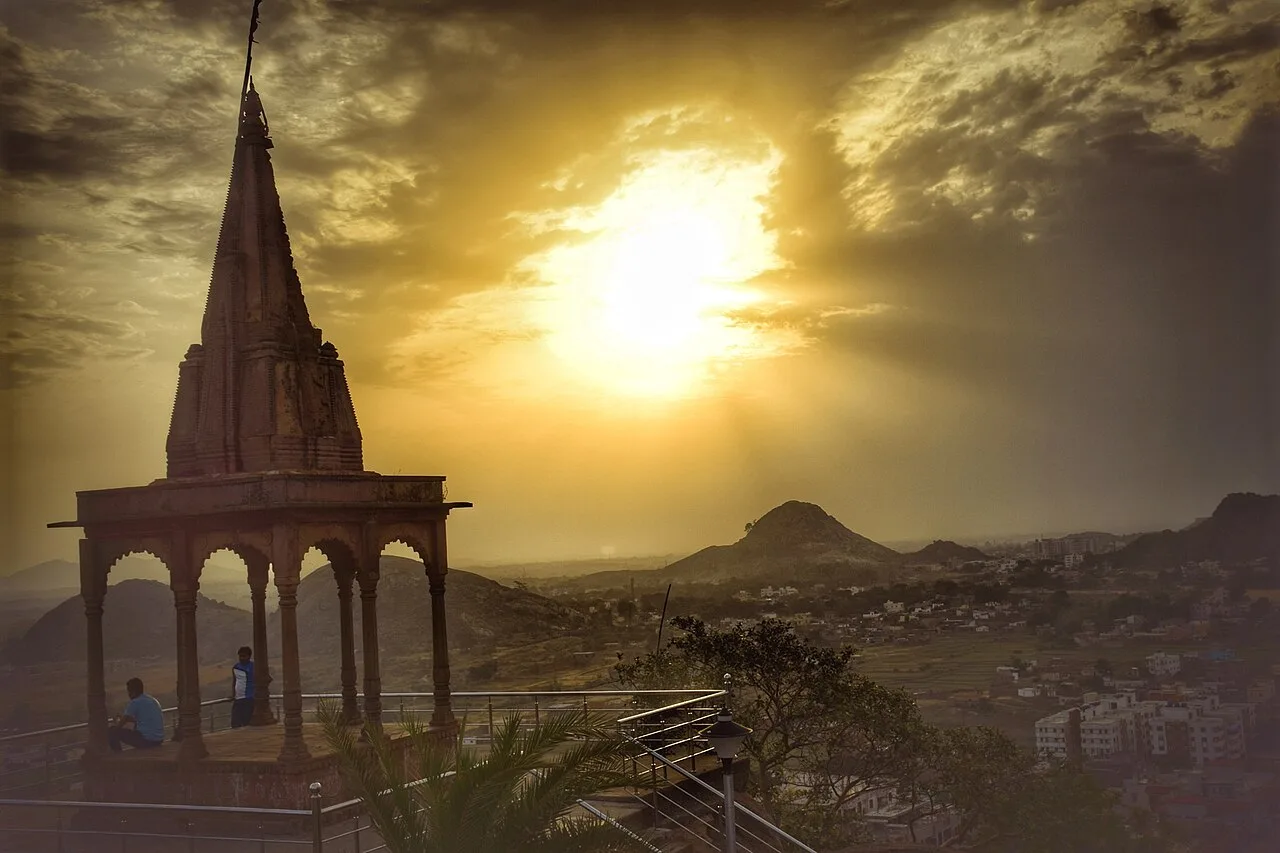
Tagore Hill
Tagore Hill, also called Morabadi Hill, is a Ranchi landmark linked to Jyotirindranath Tagore and his family. Visitors are drawn by this history and the buildings associated with his time there.
Ranchi’s food draws on the wider traditions of Jharkhand, with rice, pulses, seasonal greens and forest foods featuring in local meals. Look for dhuska, a fried rice-and-pulse preparation, along with chilka roti, pittha and sweet arsa roti. Litti is also familiar across the region. Rugra, a seasonal edible fungus, is a valued local ingredient rather than something available throughout the year. Handia, a fermented rice drink, and mahua-based preparations have cultural significance in some Adivasi communities; availability and customs vary. Ask small eateries what is freshly prepared, and carry drinking water and snacks when visiting waterfalls or other rural sites.
Ranchi is a useful place to look for crafts associated with wider Jharkhand, rather than a single district-exclusive tradition. Bamboo and cane basketry, woodwork and practical household objects reflect the region’s use of locally available materials. Tasar silk textiles and dokra metalwork are also associated with Jharkhand, though items sold in Ranchi may come from other districts. Sohrai and Khovar painting traditions are especially associated with the Hazaribagh region and should not be presented as uniquely Ranchi crafts. At shops or exhibitions, ask about the maker, place of production and materials, and favour purchases that directly support artisans.
Sarhul, celebrated in spring, is an important festival among Adivasi communities in the Ranchi region, while Karma is observed around the late monsoon and early autumn. Sohrai follows the harvest season, and Tusu is associated with winter harvest traditions. Chhath is widely observed, and the Rath Yatra at Jagannath Temple draws devotees. Festival processions and gatherings can make city roads and temple areas busier, while demand for rooms may rise around major celebrations. Dates vary by local calendars, so check locally when planning a visit.
Ranchi lies on the Chota Nagpur Plateau, with rolling uplands, rocky outcrops, wooded areas and river valleys. Streams and rivers descend over the plateau edge to form waterfalls, including Hundru, Dassam and Jonha. The city is surrounded by uneven terrain, and rural routes can include winding roads and steep or slippery approaches near falls. Forest and agricultural landscapes become especially green in the monsoon, but heavy rain can affect access. The plateau setting means that nearby sights may take longer to reach than their map distance suggests.
Summer, generally from March to May, can be hot, so plan outdoor visits for cooler parts of the day and carry water and sun protection. The monsoon, usually from June into September, brings lush scenery and stronger waterfalls, but rain can make paths slippery and rural roads less reliable. Winter, broadly from November to February, is usually the most comfortable season for sightseeing. October and the winter months are good choices for combining city visits and excursions. Pack light layers for cooler evenings, comfortable shoes with grip, rain protection during the monsoon, and sun protection in summer.
Birsa Munda Airport in Ranchi is the district’s main air gateway. Ranchi Junction and Hatia are useful railway arrival points, depending on your service and onward destination. Road connections link Ranchi with Jamshedpur, Ramgarh, Hazaribagh and other regional centres, with buses and hired vehicles providing onward travel. Within the city, auto-rickshaws and taxis are practical options. For waterfalls outside the urban area, a hired vehicle can simplify the final approach and return journey; public transport may not reach the entrance. Allow extra travel time during heavy rain and check road conditions before rural outings. Check current services locally.
Ranchi city is served by auto-rickshaws and taxis, while local buses and shared vehicles connect some neighbourhoods and nearby settlements. Road journeys from the city reach the waterfall areas and regional centres such as Bundu; services and onward access can be limited, so a hired vehicle is often convenient for a day of rural sightseeing. Ask locally about the final approach to each waterfall, as public transport may not reach the entrance. Patratu and Panchghagh Falls are excursions in Ramgarh and Khunti districts respectively, and require planning beyond Ranchi’s urban routes.
2 days: Tagore Hill → Pahari Mandir → Jagannath Temple; sleep in Ranchi both nights. 3 days: Hundru Falls → Jonha Falls → Dassam Falls; sleep in Ranchi each night. 4 days: Tagore Hill → Hundru Falls → Dassam Falls → Panchghagh Falls → Patratu; sleep in Ranchi, then arrange onward stays or return travel. Panchghagh Falls is in Khunti district and Patratu is in Ramgarh district.
Ranchi city is the most practical base for urban landmarks and day trips to the district’s waterfalls, with a range of hotels and guesthouses. It also offers the broadest choice of food and onward transport. For rural excursions, confirm locally whether accommodation is available near the intended route rather than assuming there will be rooms close to a falls site. Government lodges or homestays may be options in some areas, but availability varies. Dharamshalas may suit visitors near religious sites; check facilities and access before booking.
Waterfall rocks, steps and viewpoints can be slippery, especially during and after monsoon rain. Keep back from edges, heed local barriers and avoid entering fast-flowing water. Use reliable drinking water and carry essentials on rural outings, where shops and mobile connectivity may be limited. Check road conditions after heavy rain and avoid driving unfamiliar rural routes in poor visibility. Crowds can build at popular viewpoints and temples during weekends and festivals; supervise children closely. Wildlife may be present in wooded areas, so keep a respectful distance and do not feed animals. No general permit requirement is assumed for these listed sights; confirm any site-specific rules with local authorities before travel.
- Khuntiabout 45 km
- Ramgarhabout 50 km
- Hazaribaghabout 80 km
- Seraikela Kharsawanabout 83 km
- Bokaroabout 91 km
- West Singhbhumabout 97 km
- Chatraabout 106 km
- East Singhbhumabout 107 km
Straight-line distance between the centres of each district's destinations; road distance is longer.
Q: How many days should I spend in Ranchi district? A: Two or three days allow time for city landmarks and selected waterfalls; add time for slower travel or regional excursions. Q: When is the best time to visit? A: October to February is generally comfortable for sightseeing. Monsoon brings greener scenery and fuller falls, but can complicate access. Q: What is the best base for exploring? A: Ranchi city is the most practical base for transport, accommodation and day trips to the district’s main sights. Q: How do I get to Ranchi? A: Birsa Munda Airport, Ranchi Junction and Hatia are useful arrival points. Road links connect the city with regional centres; check current services locally. Q: Is Ranchi suitable for families or elderly travellers? A: The city’s temples and viewpoints can suit many visitors, but waterfall approaches may involve uneven paths and steps. Assess mobility needs and avoid slippery routes.
This page draws on our 8 destination guides for Ranchi and is updated as our team checks it.
Be the first to share photos, stories, advice or a helpful contact for Ranchi.
Loading…