
Mullayyanagiri
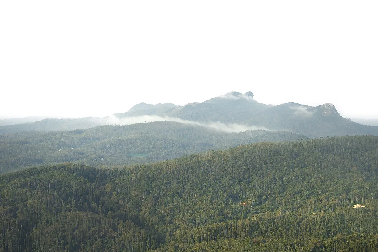
Mullayyanagiri is Karnataka’s highest mountain summit, set in the Western Ghats. People visit to reach its high point and see the small temple there.
Key facts · verified by Ghumoopedia editors
- Type of place
- Natural attraction
- Best time to visit
- October to February; June to September for monsoon greenery in the Western Ghats
- Nearest railway station
- Hassan Junction · about 59 km (straight line)
- Nearest airport
- Shivamogga (Kuvempu) Airport · about 53 km (straight line)
- Verified
- 21 Nov 2026
Plan a trip from Mullayyanagiri — a day-by-day route through places nearby.
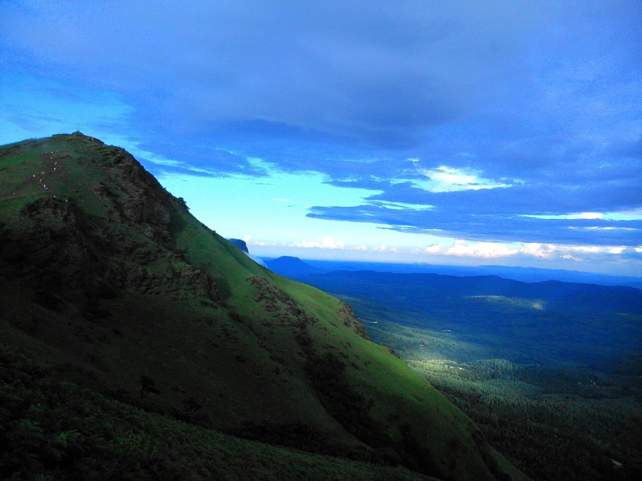
Mullayyanagiri stands in Chikkamagaluru district, Karnataka, among the Chandra Dhrona hill ranges of the Western Ghats. Its summit rises to 1,925 metres (6,316 ft), making it the state’s highest mountain and the 23rd-highest summit in the Western Ghats. The peak lies within Chikkamagaluru taluk. A small temple and a police radio relay station are located at the top. Seethalayyanagiri is a prominent neighbouring peak, situated beside Mullayyanagiri. These features mark the summit’s setting, elevation and nearby landscape. Karnataka holds the boulder-strewn ruins of Hampi, the Hoysala temple jewels of Belur and Halebidu, the Chalukyan monuments of Badami, Aihole and Pattadakal, the palaces of Mysuru, the coffee hills of Coorg and Chikkamagaluru, the temple-and-beach town of Gokarna and the tiger forests of Bandipur and Nagarhole. Bengaluru and the plateau are mild most of the year; the coast is hot and humid; the Malnad hills (Coorg, Chikkamagaluru, Agumbe) get very heavy monsoon rain from June to September. October to February is pleasant almost everywhere. The usual best time to visit is October to February; June to September for monsoon greenery in the Western Ghats. Timings, fees and access arrangements must be confirmed locally. For official information, see Karnataka Tourism at https://karnatakatourism.org.
Why it matters
Mullayyanagiri, also commonly spelled Mullayanagiri, is in Chikkamagaluru district in Karnataka’s Western Ghats. Its elevation and open hill-country setting make it a notable destination for visitors to the Chikkamagaluru region. A small temple and a police radio relay station stand near the summit, and Seethalayyanagiri is a prominent neighbouring peak. The wider Western Ghats are recognised for their natural significance, but that does not by itself establish a separate UNESCO or ASI designation for Mullayyanagiri. Check local authorities for current access arrangements.
Mullayyanagiri lies in the Chandra Dhrona hill ranges of the Western Ghats, above Chikkamagaluru. Its natural history is that of a high Western Ghats landscape; a detailed, reliably documented chronology of human settlement or construction on the summit is not readily established in general accounts. The small summit temple reflects the hill’s continuing religious significance, but published summaries do not securely identify its builder or date, so a precise origin should not be assumed. Local tradition connects the peak’s name with a holy man called Mullappa Swamy; that account is a belief rather than a verified construction history. A police radio relay station is also located at the summit, marking the site’s modern communications use. In recent decades, road access and interest in hill travel have made the peak a familiar excursion from Chikkamagaluru. The area remains subject to changing weather and access conditions, and visitors should follow any current instructions from local or forest authorities. There is no basis here for claiming a specific restoration campaign or formal heritage protection.
Origin stories & folklore
According to local tradition, the peak is associated with Mullappa Swamy, a holy man said to have meditated in the hills. The name Mullayyanagiri is commonly linked in local accounts to this figure, and the small temple near the summit is part of the site’s devotional character. Stories and explanations may vary between residents and visitors, and they should be understood as folklore rather than established historical evidence. Visitors can appreciate the place respectfully without entering restricted spaces or treating local beliefs as spectacle. For details about worship or temple customs, ask locally and follow the guidance of those responsible for the shrine.
Spend unhurried time at Mullayyanagiri: walk the marked paths, use official viewpoints and ask locally whether a guide, entry ticket or forest permission is needed. Weather can change quickly in the hills, so carry a rain layer even on a clear morning. A comfortable itinerary is one main visit in the morning, a local meal at midday and a short nearby stop before an afternoon return. Use the district list on this site to find other places in Chikkamagaluru, but check the route and its condition before combining stops. If a festival is on — such as Mysuru Dasara, the Hampi Utsav, the Kambala buffalo races on the coast or the Karaga in Bengaluru — roads and stays can be busy, and the experience can be unforgettable. Leave no litter: many sites are protected by the communities around them.
Suggested itineraries
Half day: Travel from Chikkamagaluru to the permitted access point; allow time for the uphill walk, summit and temple surroundings, and a return journey, adjusting for weather and access. Full day: Visit Mullayyanagiri in the morning; take a meal in or near Chikkamagaluru; add Seethalayyanagiri or another nearby stop only after checking road and access conditions. Gentler option: Enjoy the road-accessible viewpoints where permitted, keep the walk short, and return to town rather than attempting the summit approach.
The cultural life around Mullayyanagiri is shaped by the Malnad hills and nearby Chikkamagaluru town. Kannada is widely used, alongside other languages spoken by residents and visitors. Coffee cultivation is an important part of the district’s identity, and local meals often reflect Karnataka and Malnad food traditions. The summit temple remains a place of worship for some visitors, while others come for walking and views; modest, considerate behaviour is appropriate near the shrine. Local music, dance and dress are part of broader regional life rather than performances guaranteed at the peak. Ask permission before photographing worshippers, workers or residents, and avoid disturbing rituals or the quiet of the hills.
Local communities
People in Chikkamagaluru town and surrounding hill settlements are connected to Mullayyanagiri through worship, recreation and tourism. The wider district is known for coffee growing, alongside other farming and service livelihoods. Local drivers, guides, food sellers and accommodation providers may support visits, though services at the summit itself can be limited or change seasonally. The region includes diverse communities; visitors should not assume that one account or custom represents everyone. Treat residents and workers with courtesy, ask before taking portraits, and follow local advice about routes, weather and access.
Festivals & events
The peak is not known as a venue for a major recurring public festival, and visitors should not expect organised events there. Chikkamagaluru district has religious observances at nearby pilgrimage sites, including gatherings associated with Datta Jayanti and the Urs at Baba Budangiri; their schedules and arrangements vary. Such occasions can bring larger crowds and affect roads, parking and accommodation in the surrounding hills. Festival months can vary with the religious calendar, so confirm locally before planning. At Mullayyanagiri, keep clear of worship and follow any crowd-control or access directions.
Local food in Karnataka includes bisi bele bath, Mysore masala dosa, ragi mudde with sambar, Coorg's pandi (pork) curry, Mangalorean fish curry with neer dosa, Davangere benne dosa, Dharwad pedha and filter coffee everywhere. Ask what is fresh that day; many small eateries cook a limited daily menu. Vegetarian travellers eat very well across the state; the coast is the place for seafood, and Coorg has its own distinctive cuisine. Don't miss a tiffin breakfast of idli, vada and filter coffee. Remote sites may have no restaurant at all. Carry water and snacks, eat a proper breakfast before long drives, and ask your accommodation for a packed lunch if you are heading out early. Try a home-cooked or local thali meal when you can — it is often the best food on the route. Choose busy, clean places, drink sealed or filtered water, and carry your packaging back with you.
Shopping & local experiences
Chikkamagaluru is known for coffee, and visitors can look for locally grown beans or packaged coffee from town shops and producers. Local markets may also offer everyday regional foods and small souvenirs, but a particular craft or product should not be assumed to be available at the summit. Buying directly from reputable local businesses can support the area’s livelihoods. Ask about origin and packaging, carry purchases responsibly, and avoid collecting plants, rocks or other natural material from the hills. Food and shopping options are generally more dependable in town than on the peak.
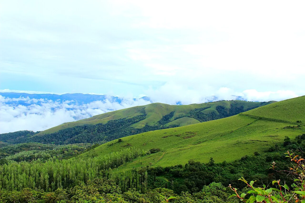
Mullayyanagiri rises within the Western Ghats, with exposed hill slopes, rocky ground and grassland interspersed with patches of montane forest. The surrounding highlands are part of a region known for varied habitats and substantial monsoon rainfall. Conditions can shift quickly: mist, wind and rain may reduce visibility, while exposed sections offer little shelter. The broader landscape supports native plants, insects, birds and other wildlife, but sightings are never guaranteed. Stay on established paths, do not pick plants or feed animals, and carry out all rubbish. Take particular care in wet weather, when rocks and tracks can be slippery.
October to February; June to September for monsoon greenery in the Western Ghats
The nearest principal railway station by straight-line distance is Hassan Junction, roughly 59 km away. The nearest operating airport by straight-line distance is Shivamogga (Kuvempu) Airport, roughly 53 km away. These figures are calculated from map coordinates — actual road distance is longer. Bengaluru is the hub for the south and centre; Hubballi and Belagavi serve the north; Mangaluru serves the coast; Mysuru is the gateway to Coorg, and Hosapete is the railhead for Hampi. KSRTC buses connect the district towns, and the coast is served by the Konkan Railway with frequent buses from Mangaluru and Udupi. For Hampi, take a train or bus to Hosapete and an autorickshaw for the last 13 km. When comparing train, bus and flight, count the complete door-to-door time: a flight saves the most time only if the onward road transfer is short, while an overnight train can save a hotel night. Book your return before you leave, because seats fill quickly on weekends, festivals and holidays. Current train numbers, timings, return services and fares are not listed here; check IRCTC and NTES for trains and the airline's own schedule for flights. No permit is needed to visit Karnataka. Tiger safaris in Bandipur, Nagarhole and the Kali Tiger Reserve must be booked in advance through the forest department or authorised lodges — weekend slots sell out. Treks in Kudremukh National Park and some Western Ghat peaks need forest entry permission. Hampi's monuments have ASI entry tickets; the core zone is best seen with a bicycle, moped or autorickshaw for the day.
Confirm onward and return timings on IRCTC / NTES, the state bus operator or your airline before travel. A dash means current timings or fares have not been verified.
Getting around
Most visitors arrange a taxi or other private vehicle from Chikkamagaluru, or travel with a local driver familiar with the hill roads. Local buses serve district towns, but they may not provide a convenient connection to the summit; verify the final leg before setting out. Road access and parking can be affected by weather, congestion or local controls, so follow signs and instructions rather than stopping on narrow stretches. From an authorised drop-off or parking area, visitors may need to continue on foot. Autos may be more useful in town than for the hill approach; confirm locally.
Hours, tickets & permissions
Access arrangements at Mullayyanagiri can change with weather, road conditions, crowd management or forest and safety requirements. Entry rules may include a designated access route, restrictions on vehicles or activities, and instructions around the summit temple or relay station. A ticket, permit or camera rule should not be assumed either way; confirm current requirements with the relevant local or forest authority before travelling. Check current visiting hours and any fees directly with the managing authority, and obey notices on site. Do not enter closed areas or disturb operational facilities.
Facilities
Facilities at the summit may be limited. Parking or vehicle drop-off arrangements can vary, and toilets, drinking water, food stalls and guides should not be relied on without checking locally. Chikkamagaluru town is a more dependable place to seek meals, accommodation, cash services and basic supplies, though availability varies by business. Carry water, snacks and any personal essentials from town, and take rubbish back with you. Mobile connectivity can be inconsistent in hill areas. Confirm current facilities and access arrangements before departure.
Accessibility
The hill approach includes sloping terrain, uneven surfaces and potentially steep or slippery walking sections. Reaching the summit may require more effort than a short viewpoint stop, and the amount of walking depends on current vehicle access. Shade and seating may be limited, particularly on exposed stretches. The route should not be assumed suitable for wheelchairs or strollers, and there may be no accessible toilets. Older visitors or anyone with limited mobility should check the current approach locally, take a companion if needed and choose a shorter stop if conditions are difficult. Mist, rain and altitude can add to the effort.
No permit is needed to visit Karnataka. Tiger safaris in Bandipur, Nagarhole and the Kali Tiger Reserve must be booked in advance through the forest department or authorised lodges — weekend slots sell out. Treks in Kudremukh National Park and some Western Ghat peaks need forest entry permission. Hampi's monuments have ASI entry tickets; the core zone is best seen with a bicycle, moped or autorickshaw for the day. Carry a photo ID at all times and save the emergency number 112 and your accommodation's contact offline. Heat in summer and heavy rain in the monsoon are the main weather risks; carry water, avoid midday sun and allow extra time when roads flood. Stay on marked paths, keep away from cliff edges and fast water, and never approach wild animals.
Photography
Clear mornings can offer the best chance of broad hill views, while mist and changing cloud create different conditions but may obscure the landscape. Use established viewpoints and keep a safe distance from edges. Photography for personal use is generally customary outdoors, but follow posted restrictions around the temple, relay station and any controlled areas. Ask permission before photographing people or worship. Do not fly a drone without confirming current aviation, forest and local permissions; restrictions may apply. Avoid blocking paths or disturbing other visitors.
Choose a stay by the full journey to Mullayyanagiri, not just the district name. Bengaluru, Mysuru and Mangaluru offer the widest choice; Hampi has guesthouses on both banks of the Tungabhadra, Coorg has plantation homestays and resorts, and the forest lodges at Bandipur and Nagarhole book out early. In summer, check air-conditioning; in the monsoon, check that the property is accessible if roads flood. Book in advance for weekends, festivals and the peak season (October to February; June to September for monsoon greenery in the Western Ghats). Confirm the exact location, meals included, check-in time and cancellation terms in writing. Avoid sending money to unverified contacts or touts at stations. Carry some cash, as card and digital payments can be unreliable in remote areas.
Seethalayyanagiri is a prominent neighbouring peak and can be considered with Mullayyanagiri if road and access conditions allow. Other recognised stops in Chikkamagaluru district include Baba Budangiri, Jhari Falls and Hirekolale Lake. Chikkamagaluru town is useful for meals and services, and its coffee-growing identity is part of the wider regional experience. These sites are not necessarily close by road or straightforward to combine in one outing; check current routes, conditions and permissions before planning multiple hill stops. Avoid attempting waterfalls or trails during unsafe weather.
For couples, Mullayyanagiri rewards a slow pace: arrive early for soft light and fewer crowds, share a local meal and keep the evening free. A sunset over Hampi's boulders, a coffee-estate walk in Coorg or a quiet evening on a Gokarna beach makes the trip memorable. Public displays of affection can be frowned upon in conservative communities and at religious sites, so be discreet. Keep a buffer in your itinerary, because weather and road conditions can delay plans.
Q: How much time should I allow for Mullayyanagiri? A: Allow at least a half-day for the journey, walking and time at the summit; road and weather conditions can extend the visit. Q: When is a good season to visit? A: October to February is generally pleasant. The June-to-September monsoon brings greenery but also heavy rain and potentially difficult conditions. Q: Is there an entry ticket or permit? A: Requirements can change. Check current access rules and any fees with local or forest authorities before travelling. Q: Is the summit suitable for children or older visitors? A: The walk can be steep, uneven and slippery. Consider mobility and weather, supervise children closely, and choose a shorter viewpoint visit if needed. Q: Where can I stay nearby? A: Chikkamagaluru town has accommodation options; confirm availability and travel arrangements locally, especially during busy periods.
Be the first to share photos, stories, advice or a helpful contact for Mullayyanagiri.
Loading…