
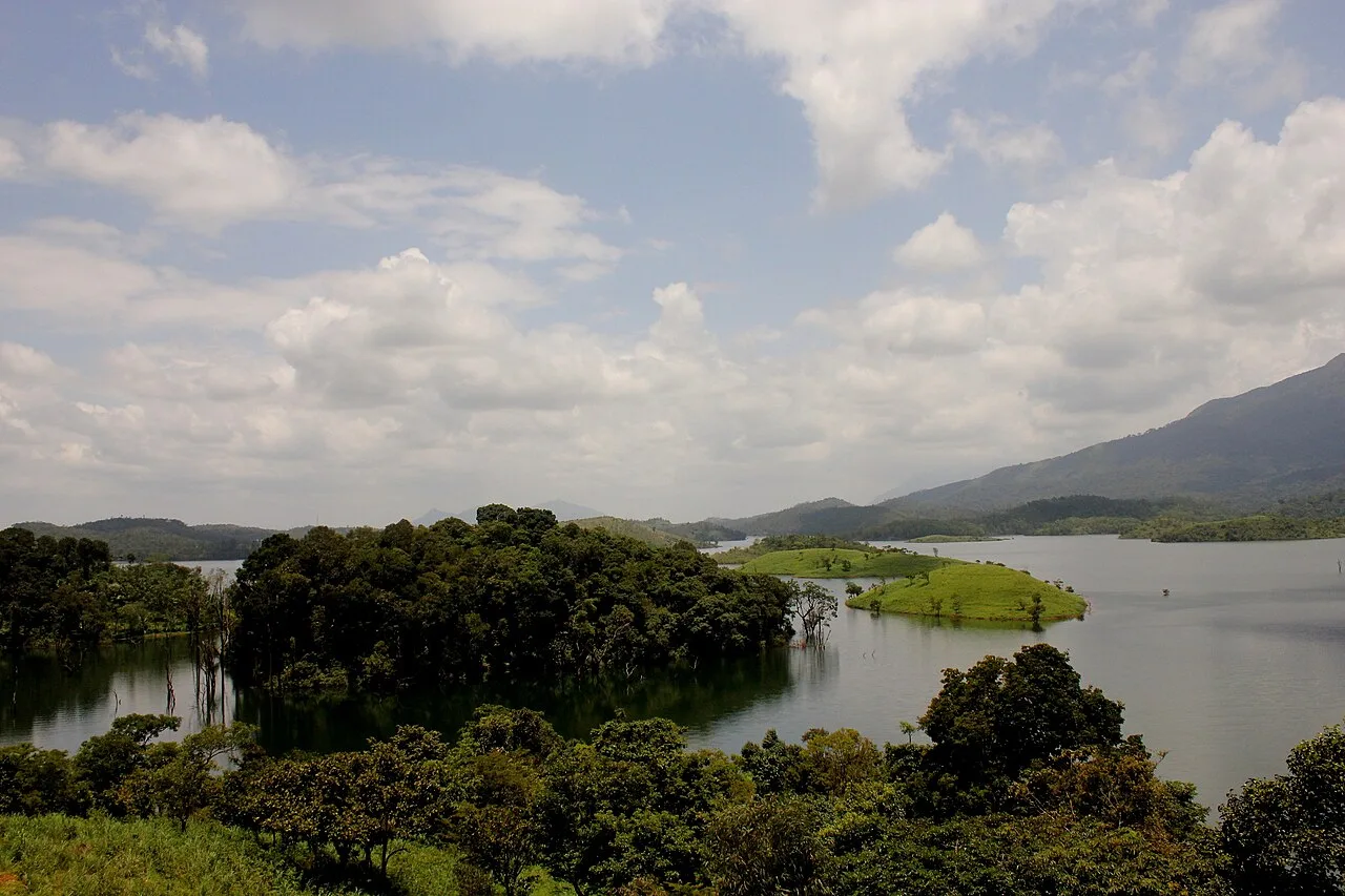
Banasura Sagar Dam
Banasura Sagar Dam is an earth dam and water-management project in Wayanad, Kerala. Visitors come to see its reservoir islands and the surrounding Banasura Hills.
Key facts · verified by Ghumoopedia editors
- Type of place
- Natural attraction
- Best time to visit
- September to March; June to August for monsoon Ayurveda and green landscapes
- Nearest railway station
- Kozhikode · about 51 km (straight line)
- Nearest airport
- Kannur International Airport · about 53 km (straight line)
- Verified
- 21 Nov 2026
Plan a trip from Banasura Sagar Dam — a day-by-day route through places nearby.
Banasura Sagar Dam lies at Padinjarathara in Wayanad district, Kerala, with Banasura Hills rising around it. It retains water from Karamanathodu, a tributary of the Kabini River. The facility is also called Kuttiyadi Augmentation Main Earthen Dam. By size, it is India’s largest earth dam and ranks second in Asia. Its construction uses large quantities of stones and boulders. The reservoir contains islands formed when water covered the surrounding land; these landforms and the hills shape the setting. The dam forms part of the Banasurasagar Project, a dam-and-canal scheme begun in 1979. The undertaking was planned to assist the Kakkayam hydroelectric power project and meet local needs for irrigation and drinking water. This is particularly important during seasonal dry spells, when the area faces water shortages. The Padinjarathara KSEB Station is responsible for the dam. A floating solar power installation described as India’s first operating plant of its kind was established at Banasura Dam. The main earthen structure is 38.5 metres high and 776 metres long. The Kuttiyadi Augmentation Scheme also includes a concrete gravity spillway and six saddle dams. Five are earth-fill structures: Kosani, 13.8 metres high; Near Kottagiri, 11 metres; Kottagiri, 14.5 metres; Nayanmoola, 3.5 metres; and Manjoora, 4 metres. The Kuttiyadi saddle dam is the exception: it is concrete and 16.5 metres high. The spillway stands beside the main dam, on the right bank of the river’s former course. Together, the principal earthen barrier, spillway and saddle dams make up the scheme’s dam works, alongside its canal project. The reservoir’s islands formed as nearby ground was inundated, leaving higher areas above the water. Kerala packs a lot into a narrow strip: the backwaters and houseboats of Alappuzha and Kumarakom, the tea hills of Munnar and the spice forests of Thekkady, the beaches of Kovalam, Varkala and Bekal, the colonial and Jewish heritage of Fort Kochi, and living art forms — Kathakali, Theyyam, Mohiniyattam and temple festivals with caparisoned elephants. Kerala is warm and humid at sea level all year. The southwest monsoon from June to September brings very heavy rain, and the northeast monsoon adds showers in October and November; the hill stations of Munnar, Wayanad and Vagamon are cool year-round and cold on winter nights. The usual best time to visit is September to March; June to August for monsoon Ayurveda and green landscapes. Timings, fees and access arrangements must be confirmed locally. For official information, see Kerala Tourism at https://www.keralatourism.org.
Why it matters
Banasura Sagar Dam is a major water and engineering landmark in Wayanad, Kerala. It impounds the Karamanathodu, a tributary of the Kabini River, as part of the Kuttiyadi Augmentation Scheme. The project supports the Kakkayam hydroelectric scheme and helps meet irrigation and drinking-water needs, particularly during seasonal dry periods. The dam is commonly described as India’s largest earth dam and Asia’s second largest of its kind; these rankings are widely cited but depend on how dams are classified. Its reservoir, islands and Banasura Hills backdrop have also made the area a popular nature and recreation destination. India’s first operating floating solar power plant was established at the dam, adding to its regional energy significance.
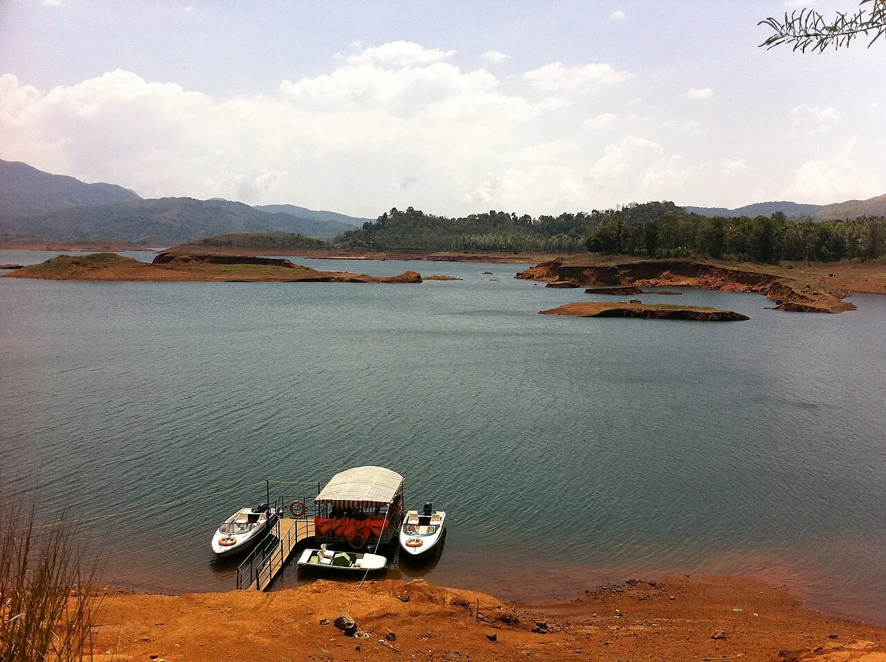
Banasura Sagar Dam was built as part of Kerala’s Kuttiyadi Augmentation Scheme, a state water and power project begun in 1979. The scheme was developed to help support the Kakkayam hydroelectric project and provide water for irrigation and drinking in areas affected by seasonal shortages. The dam is under the control of the Kerala State Electricity Board’s Padinjarathara station and is also known as the Kuttiyadi Augmentation Main Earthen Dam. The project is a group of structures rather than a single barrier: it includes the main earth dam, a concrete gravity spillway and six saddle dams. Most of the saddle dams are earth-fill structures; the Kuttiyadi saddle dam is concrete. The main dam is reported as 38.5 metres high and 776 metres long. Its reservoir submerged parts of the surrounding landscape, leaving hilltops as islands that are now a distinctive feature of the view. A floating solar power plant was later established on the reservoir and is described as India’s first operating plant of its kind. The dam continues to serve its water-management role while the reservoir area is also visited for its scenery and recreation. Visitors should follow current restrictions, since operational needs can affect access.
Origin stories & folklore
The name Banasura is linked in local storytelling to Banasura, a powerful asura king in Hindu tradition and a son of Mahabali. According to legend, Banasura performed austerities in the hills to please Lord Shiva and was granted a boon. Some retellings connect the surrounding hills with his name and describe the landscape as a setting for his penance. These stories are part of regional folklore, not historical accounts of the dam or its construction. The reservoir’s islands and the imposing mountain backdrop can lend themselves to imaginative tales, but visitors should distinguish such beliefs from the documented history of the modern water project.
Spend unhurried time at Banasura Sagar Dam: walk the marked paths, use official viewpoints and ask locally whether a guide, entry ticket or forest permission is needed. Enjoy the water from safe, marked points; rocks near falls and dams are slippery and currents are dangerous, especially in the monsoon. A comfortable itinerary is one main visit in the morning, a local meal at midday and a short nearby stop before an afternoon return. Use the district list on this site to find other places in Wayanad, but check the route and its condition before combining stops. If a festival is on — such as Onam, Thrissur Pooram, the Nehru Trophy snake-boat race on Punnamada Lake, the Theyyam season in Kannur and Kasaragod, or the Attukal Pongala — roads and stays can be busy, and the experience can be unforgettable. Leave no litter: many sites are protected by the communities around them.
Suggested itineraries
Half day: Spend about 2–3 hours at the dam area: check visitor rules, walk a permitted path, pause at official viewpoints and allow time for the reservoir and hill scenery. Full day: Allow about 6–8 hours: visit the dam in the morning, have a local meal, then choose one nearby stop such as Karlad Lake or Pookode Lake, allowing for hill-road travel. Gentler option: Keep to the closest accessible viewpoint, take seated breaks and skip boat activities or uneven paths if they are unsuitable.
The dam is part of the wider Wayanad landscape, where Malayalam is widely spoken alongside other languages used by residents and visitors. The district’s cultural life includes temple and church observances, seasonal harvest celebrations, folk performance traditions and community gatherings. Kathakali and other Kerala arts may be encountered at cultural venues or special events, though they are not regular performances at the dam itself. Local food commonly reflects Kerala’s rice-based cuisine, with regional vegetables and spices. Visitors can experience the area respectfully by following site rules, asking before photographing people and recognising that the reservoir is also working infrastructure, not only a scenic backdrop.
Local communities
Residents of Padinjarathara and nearby Wayanad communities are connected to the area through farming, trade, transport, tourism and work linked to public services. Wayanad is also home to Adivasi communities, including Paniya, Kurichiya, Adiya, Kuruma and Kattunaikka people; their histories and livelihoods are diverse, and should not be treated as a single culture. The dam project and reservoir have changed local land and water use, while tourism brings additional seasonal activity. Visitors should use local services respectfully and avoid entering private, forest or community areas without permission.
Festivals & events
Onam, usually celebrated around August or September, and Vishu in April are widely observed in Kerala, including Wayanad. Local temple festivals and church feasts take place at different times of year, with dates varying by community and calendar. Theyyam is especially associated with northern Kerala and may be seen at regional shrines during its season, generally in the cooler months, though it is not a regular event at the dam. Festival periods can bring busier roads, fuller accommodation and larger crowds at popular attractions. Check locally for events, access arrangements and respectful visitor guidance.
Local food in Kerala includes appam with stew, puttu with kadala curry, idiyappam, the vegetarian sadya served on a banana leaf, Kerala parotta with beef or chicken fry, Malabar biryani and pathiri in the north, karimeen pollichathu (pearl-spot fish in banana leaf), toddy-shop fish curry, banana chips and many kinds of payasam. Ask what is fresh that day; many small eateries cook a limited daily menu. Coconut oil and coconut are used in most dishes; ask for less spice if needed. Toddy shops serve some of the best fish curry in Kerala, and a full sadya is the highlight of Onam. Remote sites may have no restaurant at all. Carry water and snacks, eat a proper breakfast before long drives, and ask your accommodation for a packed lunch if you are heading out early. Try a home-cooked or local thali meal when you can — it is often the best food on the route. Choose clean places, drink sealed or filtered water, and carry your packaging back with you.
Shopping & local experiences
Look for Wayanad produce and everyday goods in nearby town markets, including coffee, spices, tea and locally grown foods when available. Small shops may sell snacks and simple souvenirs, but specialised craft choices can be limited at the dam itself. For a broader selection, browse established shops and markets in nearby towns and ask about the origin of products rather than assuming an item is locally made. Buying from local businesses can support livelihoods. Carry reusable bags and avoid purchasing products made from wildlife, forest materials or other restricted sources.
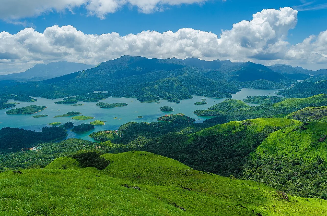
The reservoir lies among the Banasura Hills in the Western Ghats landscape of Wayanad. It holds water from the Karamanathodu, a tributary of the Kabini, and its spread created small islands where higher ground remained above the flooded valley. Hillsides, cultivated land and patches of natural vegetation shape the views around the water. The wider region supports varied plant life and wildlife, including birds associated with forest, farmland and wetland edges; sightings are never guaranteed. Water levels and the appearance of the islands change with rainfall and dam operations. Stay on permitted paths, keep away from unstable banks and do not enter the water except through any officially authorised activity.
September to March; June to August for monsoon Ayurveda and green landscapes
The nearest principal railway station by straight-line distance is Kozhikode, roughly 51 km away. The nearest operating airport by straight-line distance is Kannur International Airport, roughly 53 km away. These figures are calculated from map coordinates — actual road distance is longer. Thiruvananthapuram, Kollam, Kottayam, Ernakulam, Thrissur, Shoranur, Kozhikode and Kannur are the main rail stops along the coast line; Kochi, Thiruvananthapuram, Kozhikode and Kannur have international airports. For the final leg, KSRTC buses (from ordinary to air-conditioned Swift services), fast private buses, metered autos, app cabs and the Water Transport Department's public ferries in the backwaters link the towns. Distances look short on the map, but road and town traffic are slow, so allow extra time. When comparing train, bus and flight, count the complete door-to-door time: a flight saves the most time only if the onward road transfer is short, while an overnight train can save a hotel night. Kerala's coastal rail line is busy, so reserve trains early; KSRTC buses are frequent and often quicker to hill stations. Book your return before you leave, because seats fill quickly on weekends, festivals and holidays. Current train numbers, timings, return services and fares are not listed here; check IRCTC and NTES for trains and the airline's own schedule for flights. No permit is needed to visit Kerala. Several major temples, including Sree Padmanabhaswamy in Thiruvananthapuram and Guruvayur, admit only Hindus and enforce a strict dress code — men wear a mundu (dhoti) and remove shirts, women wear a saree or long skirt. Forest activities in Periyar, Eravikulam, Silent Valley, Parambikulam and Thattekad must be booked with the Kerala Forest Department, and Eravikulam National Park usually closes in February and March for the Nilgiri tahr calving season.
Confirm onward and return timings on IRCTC / NTES, the state bus operator or your airline before travel. A dash means current timings or fares have not been verified.
Getting around
Padinjarathara is the nearest local service centre for reaching the dam area. Local buses connect settlements in Wayanad, while autos and taxis can be useful for the final leg; availability may vary, so arrange a return ride in advance if needed. Visitors arriving by car or two-wheeler should use designated parking and follow site directions. Within the visitor area, expect to get around mainly on foot along permitted paths. Boating may be offered through authorised operators when conditions and rules allow, but it is an activity rather than a dependable transport link.
Hours, tickets & permissions
Access arrangements may differ between the dam infrastructure and visitor recreation areas. Entry tickets, activity charges, camera restrictions, permits or identification checks may apply, and operational or weather conditions can lead to temporary limits. Some areas may be closed to visitors for safety or security reasons. Do not assume that access to the reservoir means access to the dam structure. Confirm current opening arrangements, entry rules and fees with the managing authority or authorised local tourism operator before travelling. Follow signs and staff instructions, and do not cross barriers.
Facilities
Facilities can vary between the dam site and nearby recreation areas. Parking, toilets, small refreshment stalls or food options may usually be available around visitor zones, but provision and operating status can change. Carry drinking water and any essentials you need, and use only marked waste bins. Guided visits or boating may be available through authorised operators; check locally rather than assuming. ATMs, pharmacies and a wider choice of shops and restaurants are more likely in nearby towns than at the reservoir. Confirm current facilities before setting out, particularly during heavy rain or quieter travel periods.
Accessibility
The visitor area includes outdoor paths and viewpoints, and surfaces may be uneven, sloping or slippery after rain. Reaching some views can involve walking and steps; distances and access conditions vary with which areas are open. Shade may be limited in exposed sections, so plan rests and sun protection. Do not assume that every viewpoint is wheelchair- or stroller-accessible, or that ramps and accessible toilets are available. Older visitors and anyone with limited mobility may find a shorter visit focused on the nearest permitted viewpoint more comfortable. Check current conditions with the site authority before arrival.
No permit is needed to visit Kerala. Several major temples, including Sree Padmanabhaswamy in Thiruvananthapuram and Guruvayur, admit only Hindus and enforce a strict dress code — men wear a mundu (dhoti) and remove shirts, women wear a saree or long skirt. Forest activities in Periyar, Eravikulam, Silent Valley, Parambikulam and Thattekad must be booked with the Kerala Forest Department, and Eravikulam National Park usually closes in February and March for the Nilgiri tahr calving season. Carry a photo ID at all times and save the emergency number 112 and your accommodation's contact offline. Waterfalls, dams and rivers are dangerous in the monsoon: keep behind barriers and leave if the water rises suddenly.
Photography
The reservoir, islands and Banasura Hills make strong landscape subjects. Morning or late-afternoon light can bring out the contours, while cloud and mist may change views quickly. Use official viewpoints and check whether camera restrictions apply in operational areas. Drone use should not be assumed to be permitted; obtain the required approval and follow aviation and site rules before flying. Ask before photographing local people, workers or private property, and avoid interrupting rituals or entering restricted spaces for a picture. Keep equipment and tripods clear of paths and barriers.
Choose a stay by the full journey to Banasura Sagar Dam, not just the district name. Kerala Tourism's classified homestays are good value and a way to taste home cooking; beach towns have everything from hostels to Ayurveda resorts. In summer, check air-conditioning and backup power; in the monsoon, check that the property is accessible if roads flood. Book in advance for weekends, festivals and the peak season (September to March; June to August for monsoon Ayurveda and green landscapes). Confirm the exact location, meals included, check-in time and cancellation terms in writing. Avoid sending money to unverified contacts or touts at stations. Carry some cash, as card and digital payments can be unreliable in remote areas.
Karlad Lake is a nearby outdoor stop, while Pookode Lake and the Lakkidi viewpoint area are other well-known Wayanad outings. Kalpetta and Mananthavady offer town services and can serve as bases for exploring different parts of the district. Further afield, visitors may consider Edakkal Caves, Thirunelli Temple or Wayanad Wildlife Sanctuary, but these are separate trips and should not be combined without checking road conditions and travel time. Choose one or two stops rather than trying to cover the whole district in a day; monsoon weather and hill traffic can slow journeys.
For couples, Banasura Sagar Dam rewards a slow pace: arrive early for soft light and fewer crowds, share a local meal and keep the evening free. An overnight houseboat on Vembanad, a sunset on the Varkala cliffs or a misty morning walk through Munnar's tea estates makes the trip memorable. Public displays of affection can be frowned upon in conservative communities and at religious sites, so be discreet. Keep a buffer in your itinerary, because weather and road conditions can delay plans.
Q: How much time should I allow for a visit? A: A few hours is usually enough for viewpoints and a relaxed walk; add time if you plan an authorised activity or nearby stop. Q: When is a good season to visit? A: Drier months are generally easier for walking and road travel. Monsoon rain can be heavy, and conditions or access may change. Q: Is there an entry ticket or permit? A: Rules can vary by visitor area and activity. Check current entry, permit and camera requirements with the managing authority before travelling. Q: Is the visit suitable for children and older visitors? A: Families can enjoy the views, but supervise children closely near water and barriers. Uneven paths may be difficult for some older visitors or people with limited mobility. Q: Can I stay near the dam? A: Accommodation is available in the wider Wayanad area, including nearby towns. Check location, road access and current availability before booking.
Be the first to share photos, stories, advice or a helpful contact for Banasura Sagar Dam.
Loading…