
Illickal Kallu
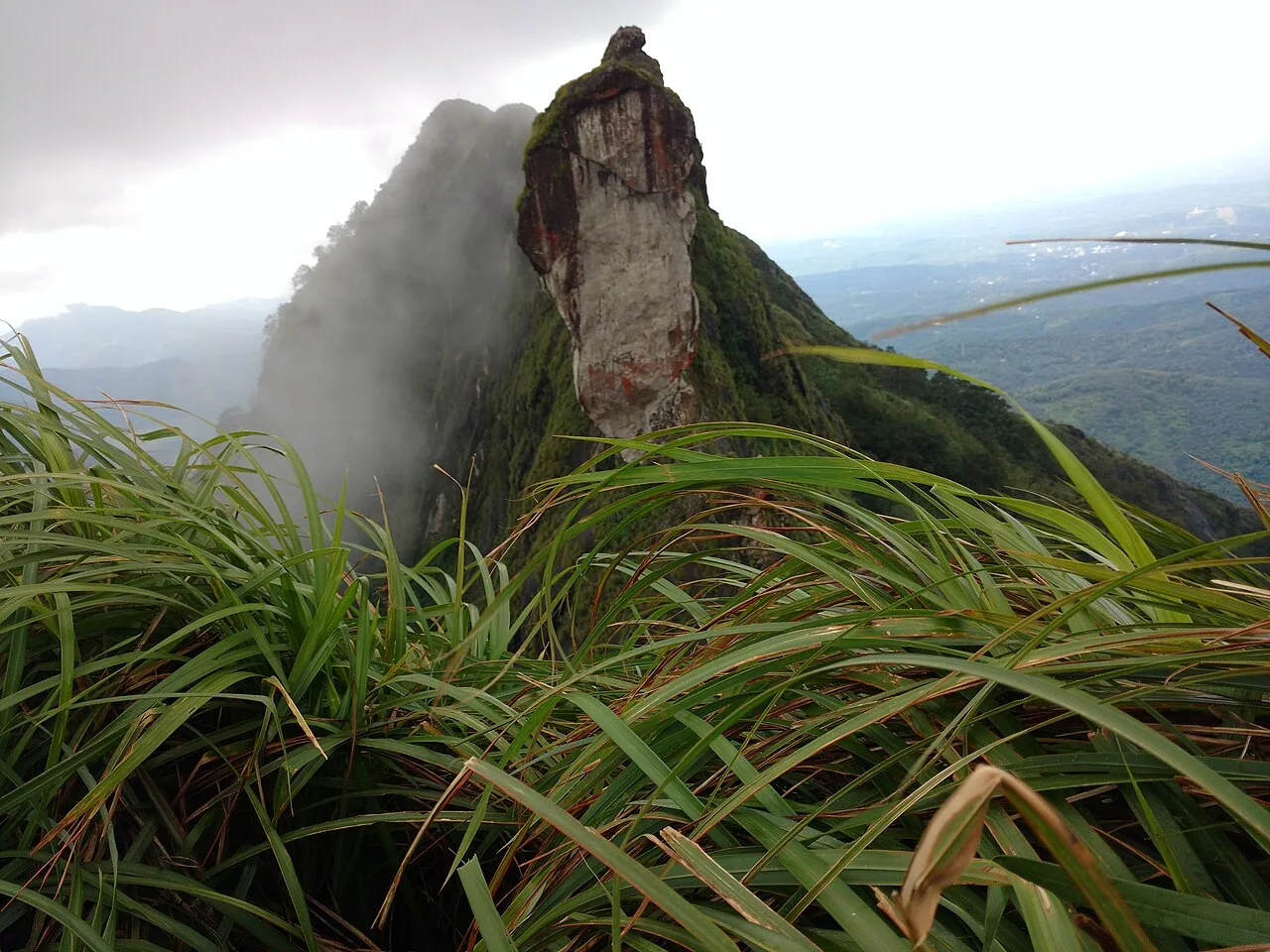
Illickal Kallu is a distinctive rock formation atop Illickal Mala in Kottayam district, Kerala. Visitors come to see its unusual hill shapes, walk to the summit and take in distant views.
Key facts · verified by Ghumoopedia editors
- Type of place
- Community & living culture
- Best time to visit
- September to March; June to August for monsoon Ayurveda and green landscapes
- Nearest railway station
- Kottayam · about 35 km (straight line)
- Nearest airport
- Cochin International Airport · about 64 km (straight line)
- Verified
- 21 Nov 2026
Plan a trip from Illickal Kallu — a day-by-day route through places nearby.
Illickal Kallu, also called Illikkankal, is a rock landmark on Illickal Mala in Kerala’s Kottayam district. It lies within Moonnilavu grama panchayat, in Thalanadu village of Meenachil taluk. The summit stands about 3,500 feet (1,067 m) above sea level and is roughly 57 km from Kottayam railway station; Teekoy is the nearest town. The formation once had two halves, but one has broken away and fallen. Reaching the top involves a walk of under 1 km. The site is a recognised attraction, with its unusual rocks and hilltop outlook among its points of interest. The wider Illikkal Mala comprises three hills, each rising to approximately 4,000 feet (1,220 m). Their outlines have inspired local names: Kuda Kallu, or umbrella rock, has a mushroom-like form, while Koonu Kallu, the hunchback rock, has a small outward bump. A slender natural link, only half a foot across, joins the two. It is called Narakapalam, meaning bridge to hell. The area’s rocky profile is sometimes likened to the pillar formations at Kodaikanal. Streams begin near the summit and descend to feed the Meenachil River. Local stories tell of Neela Koduveli, a fabled medicinal plant said to grow here. Its blue blossom is traditionally associated with special powers, prosperity and a plentiful harvest. On clear days, the Arabian Sea can be seen far along the horizon. The summit also offers a vantage point for watching the evening light fade and the moon rise, particularly around the full moon. Kerala packs a lot into a narrow strip: the backwaters and houseboats of Alappuzha and Kumarakom, the tea hills of Munnar and the spice forests of Thekkady, the beaches of Kovalam, Varkala and Bekal, the colonial and Jewish heritage of Fort Kochi, and living art forms — Kathakali, Theyyam, Mohiniyattam and temple festivals with caparisoned elephants. Kerala is warm and humid at sea level all year. The southwest monsoon from June to September brings very heavy rain, and the northeast monsoon adds showers in October and November; the hill stations of Munnar, Wayanad and Vagamon are cool year-round and cold on winter nights. The usual best time to visit is September to March; June to August for monsoon Ayurveda and green landscapes. Timings, fees and access arrangements must be confirmed locally. For official information, see Kerala Tourism at https://www.keralatourism.org.
Why it matters
Illickal Kallu, also called Illikkal Kallu or Illikkankal, is a distinctive natural landmark on Illickal Mala in Kottayam district. Located in the Moonnilavu grama panchayat area of Thalanadu, it is a locally important destination for visitors exploring the eastern hill country of Kerala. Its unusual rock forms, ridge views and links to local folklore give it both scenic and cultural interest. Streams beginning on the mountain flow downhill and contribute to the Meenachil River system. Visitors should check locally for current access arrangements and any conservation rules.
Illickal Kallu is a natural rock formation, not a structure known to have been built by a ruler, religious institution or community. No well-established written account dates its formation or records a founding event. The rock and surrounding hills have been shaped by natural processes over a long period; local descriptions note that only one half of the original formation remains, the other half having collapsed, though the timing is not established here. The names used for the landmark vary, including Illickal Kallu, Illikkal Kallu and Illikkankal. The broader mountain is called Illickal Mala and is described as a group of three hills, with individual formations known by names such as Kuda Kallu and Koonu Kallu. Local knowledge and oral tradition have helped preserve these names and stories. In more recent times the site has become a destination for visitors drawn to its landscape and viewpoints. Specific dates for tourism development, construction work or restoration are not reliably documented here; check with local authorities for information about current facilities and any work affecting access.
Origin stories & folklore
According to local tradition, the medicinal herb Neela Koduveli grows in the Illickal Mala area. Folklore describes it as a blue-flowered plant with special powers associated with prosperity and a good harvest. This is a cultural belief, not a verified claim about the plant’s medicinal effects or availability. The names Kuda Kallu, commonly understood as “umbrella rock,” and Koonu Kallu, or “hunchback rock,” reflect the distinctive shapes people recognise in the hills. A narrow natural rock connection between two formations is traditionally called Narakapalam, often translated as “bridge to hell.” These names and stories are part of local interpretation of the landscape; visitors should follow marked routes rather than approaching difficult or restricted rock features.
Spend unhurried time at Illickal Kallu: walk the marked paths, use official viewpoints and ask locally whether a guide, entry ticket or forest permission is needed. Weather can change quickly, so carry a rain layer even on a clear morning. A comfortable itinerary is one main visit in the morning, a local meal at midday and a short nearby stop before an afternoon return. Use the district list on this site to find other places in Kottayam, but check the route and its condition before combining stops. If a festival is on — such as Onam, Thrissur Pooram, the Nehru Trophy snake-boat race on Punnamada Lake, the Theyyam season in Kannur and Kasaragod, or the Attukal Pongala — roads and stays can be busy, and the experience can be unforgettable. Leave no litter: many sites are protected by the communities around them.
Suggested itineraries
Half day: Allow about 3–4 hours for the road approach, a relaxed walk to the permitted viewpoints, time for the scenery and a return; add a local meal if time allows. Full day: Set aside most of the day for the hill visit, a meal in the area and a nearby stop such as Marmala Waterfalls, checking road and access conditions before combining them. Gentler option: Spend time at an accessible roadside or lower viewpoint if available, skip the summit walk, and enjoy a relaxed meal in a nearby town.
The living culture around Illickal Kallu is rooted in the Malayalam-speaking communities of the Kottayam hill country. Malayalam is the main language visitors are likely to encounter, though English may be understood by some tourism workers. Everyday life in nearby settlements includes local markets, farming and community religious observances. Onam and Vishu are widely marked across Kerala, while temple and church festivals are important in many localities; customs vary from one community to another. Illickal Kallu is a natural viewpoint rather than a known performance venue, so visitors should not expect scheduled music or dance at the summit. Kathakali, Mohiniyattam and other Kerala art forms are part of the state’s wider cultural life, but are not specific to this hill.
Local communities
Residents of Thalanadu, Moonnilavu and nearby settlements are the communities most directly connected with everyday life around the hill. The wider eastern Kottayam region includes people whose livelihoods involve agriculture, small businesses, transport and services; individual occupations vary, and should not be assumed from a person’s community or location. Local workers may support visitors through food, transport or guidance when available. The landscape also forms part of the surroundings in which residents live and work, rather than being only a visitor attraction. Ask permission before photographing people, homes or private land, and follow local advice about paths, weather and access.
Festivals & events
Onam, generally celebrated during the Malayalam month of Chingam, and Vishu in the spring are widely observed across Kerala, including the Kottayam region. Festival periods can bring more visitors, processions or traffic to nearby settlements, so allow extra time and follow local directions. For exact schedules, ask the relevant temple, church or local authority rather than relying on a general regional calendar. Visitors should be considerate around worship and community events and should not enter ritual areas without invitation.
Local food in Kerala includes appam with stew, puttu with kadala curry, idiyappam, the vegetarian sadya served on a banana leaf, Kerala parotta with beef or chicken fry, Malabar biryani and pathiri in the north, karimeen pollichathu (pearl-spot fish in banana leaf), toddy-shop fish curry, banana chips and many kinds of payasam. Ask what is fresh that day; many small eateries cook a limited daily menu. Coconut oil and coconut are used in most dishes; ask for less spice if needed. Toddy shops serve some of the best fish curry in Kerala, and a full sadya is the highlight of Onam. Remote sites may have no restaurant at all. Carry water and snacks, eat a proper breakfast before long drives, and ask your accommodation for a packed lunch if you are heading out early. Try a home-cooked or local thali meal when you can — it is often the best food on the route. Choose clean places, drink sealed or filtered water, and carry your packaging back with you.
Shopping & local experiences
In nearby towns, look for everyday Kerala produce and locally made food items, such as spices or snacks, where available and clearly labelled. Small shops may serve residents as well as visitors; ask before photographing stalls or people. Choose products from local sellers when practical, and avoid buying wild plants, wildlife products or items presented as rare medicinal herbs. Neela Koduveli belongs to local folklore, and visitors should not remove plants from the hills. For a broader selection of gifts and crafts, ask locally about markets in the larger towns.
Illickal Mala is a highland landscape of steep slopes, exposed rock and ridgelines in Kottayam district. The main rock formation stands near the summit, where views open across the surrounding hills; the Arabian Sea may be visible on a clear horizon, as described in local accounts. Several mountain streams begin around the peak and flow down to form part of the Meenachil River system. The area’s vegetation and wildlife vary with elevation, season and weather, and particular plants or animals should not be expected on a visit. The local Neela Koduveli story is folklore, not a guarantee that the plant can be found. Birdlife may be present, but sightings are never assured. Rain, cloud and wind can change conditions quickly, so stay on accepted paths and avoid exposed edges.
September to March; June to August for monsoon Ayurveda and green landscapes
The nearest principal railway station by straight-line distance is Kottayam, roughly 35 km away. The nearest operating airport by straight-line distance is Cochin International Airport, roughly 64 km away. These figures are calculated from map coordinates — actual road distance is longer. Thiruvananthapuram, Kollam, Kottayam, Ernakulam, Thrissur, Shoranur, Kozhikode and Kannur are the main rail stops along the coast line; Kochi, Thiruvananthapuram, Kozhikode and Kannur have international airports. For the final leg, KSRTC buses (from ordinary to air-conditioned Swift services), fast private buses, metered autos, app cabs and the Water Transport Department's public ferries in the backwaters link the towns. Distances look short on the map, but road and town traffic are slow, so allow extra time. When comparing train, bus and flight, count the complete door-to-door time: a flight saves the most time only if the onward road transfer is short, while an overnight train can save a hotel night. Kerala's coastal rail line is busy, so reserve trains early; KSRTC buses are frequent and often quicker to hill stations. Book your return before you leave, because seats fill quickly on weekends, festivals and holidays. Current train numbers, timings, return services and fares are not listed here; check IRCTC and NTES for trains and the airline's own schedule for flights. No permit is needed to visit Kerala. Several major temples, including Sree Padmanabhaswamy in Thiruvananthapuram and Guruvayur, admit only Hindus and enforce a strict dress code — men wear a mundu (dhoti) and remove shirts, women wear a saree or long skirt. Forest activities in Periyar, Eravikulam, Silent Valley, Parambikulam and Thattekad must be booked with the Kerala Forest Department, and Eravikulam National Park usually closes in February and March for the Nilgiri tahr calving season.
Confirm onward and return timings on IRCTC / NTES, the state bus operator or your airline before travel. A dash means current timings or fares have not been verified.
Getting around
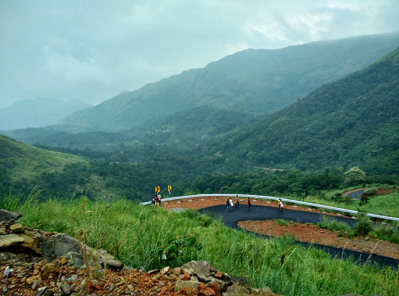
Most visitors travel by road to the approach area and continue on foot toward the hilltop; confirm the current drop-off and parking arrangements locally. Local buses and private buses serve towns in the wider region, while autos or taxis may be useful for the last road leg, subject to availability. Agree the return plan with a driver before leaving, especially outside busy periods. Roads in the hill country can be narrow, steep and slow, and conditions may worsen in rain. The final walk is described as less than a kilometre, but its surface and gradient make it more demanding than the distance alone suggests. There are no public ferries serving this inland hill site.
Hours, tickets & permissions
Access arrangements can change with weather, maintenance, safety conditions or local decisions. Entry may be subject to a ticket, a designated route, a guide requirement or forest-related permission, but these requirements should be confirmed locally rather than assumed. Camera or other equipment rules may also apply. No opening hours or current fees are stated here. Before setting out, check with the managing authority or local visitor information point about whether the site is open, which approach is permitted and whether any identification or other documentation is required.
Facilities
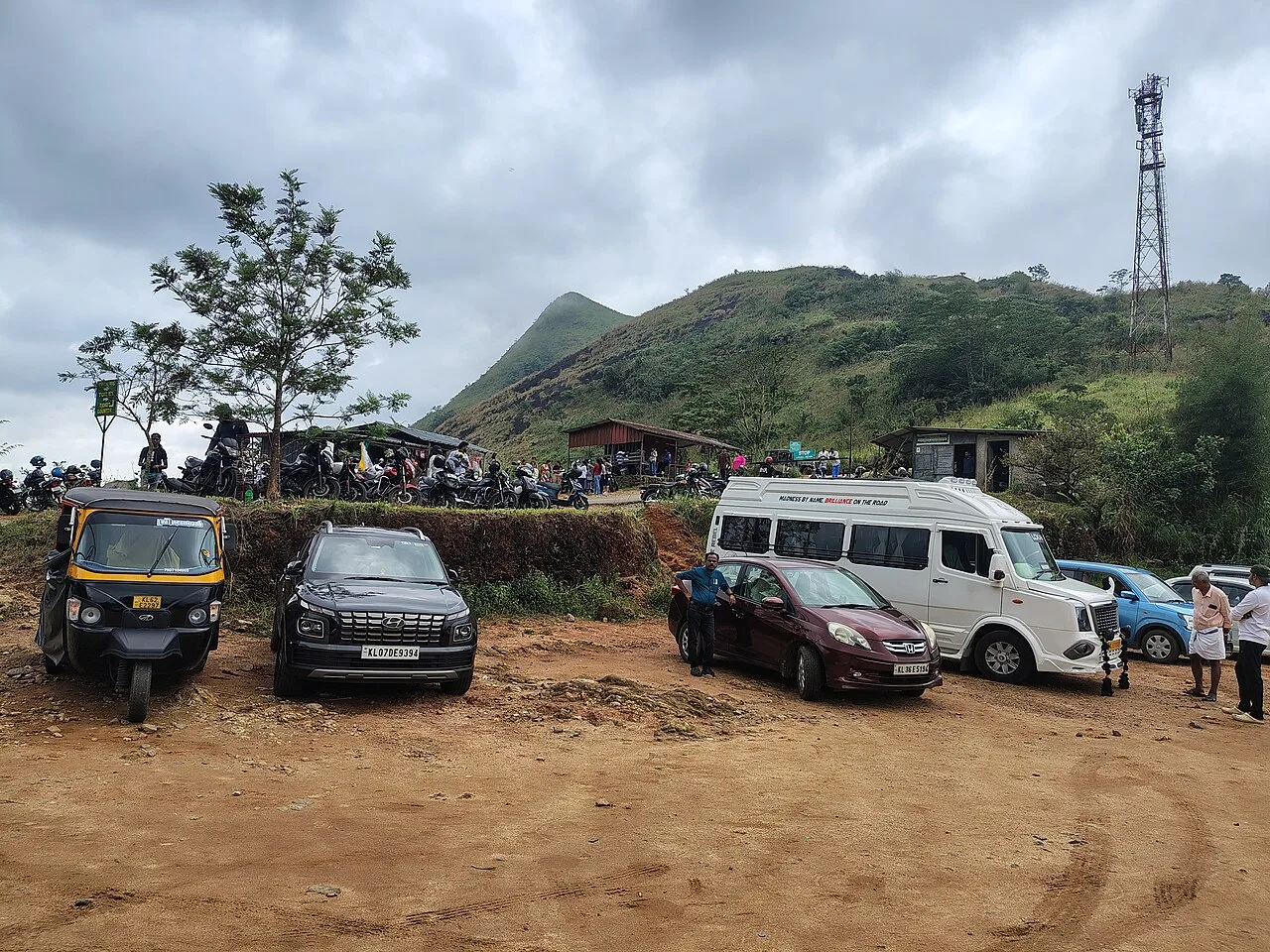
Facilities at the hill itself may be limited and can change, so check locally for toilets, drinking water, food stalls, parking and visitor assistance before travelling. Food and basic services are more likely to be available in nearby towns than at the summit. Do not rely on an ATM, mobile signal, public drinking water or a guide being available at the site. Carry water and any essentials you need for the walk, and take rubbish back with you. Ask whether an authorised guide or local assistance is available if the weather or route is unfamiliar.
Accessibility
The approach includes a hill walk on uneven terrain, and the summit area has exposed rock and steep sections. Although the walk is described as less than a kilometre, distance does not reflect the gradient or footing. The route may be muddy or slippery after rain, and shade can be limited on exposed stretches. Wheelchairs and strollers are unlikely to manage the summit route; do not assume ramps, handrails or lifts are provided. Older visitors and anyone with balance, heart or mobility concerns should assess conditions carefully and may prefer a lower viewpoint if one is open and reachable. Ask locally about the current path before setting out.
No permit is needed to visit Kerala. Several major temples, including Sree Padmanabhaswamy in Thiruvananthapuram and Guruvayur, admit only Hindus and enforce a strict dress code — men wear a mundu (dhoti) and remove shirts, women wear a saree or long skirt. Forest activities in Periyar, Eravikulam, Silent Valley, Parambikulam and Thattekad must be booked with the Kerala Forest Department, and Eravikulam National Park usually closes in February and March for the Nilgiri tahr calving season. Carry a photo ID at all times and save the emergency number 112 and your accommodation's contact offline. Stay on marked paths, keep away from cliff edges and fast water, and never approach wild animals.
Visitor rules
Follow instructions from the site manager or local authorities, stay on permitted paths and keep away from unstable edges or closed areas. Wear secure footwear and weather-appropriate clothing; conditions can change quickly. Carry rubbish out and avoid single-use plastic where possible. Do not damage, mark or climb fragile rock formations, disturb plants or wildlife, or leave offerings outside designated places. Ask before photographing residents, workers or worshippers. Respect local customs and any restrictions around religious events or private land. Check whether guides, permits or other access conditions are required before entering.
Photography
The ridgelines and rock shapes can be especially striking in soft morning or late-afternoon light, when weather permits. Cloud, mist and rain may obscure distant views, so allow flexibility rather than planning around a guaranteed panorama. Use accepted viewpoints and keep a safe distance from exposed edges. Personal photography is generally expected at a scenic destination, but confirm any site-specific restrictions, especially for commercial equipment. Do not use a drone without checking current aviation and local rules. Ask permission before photographing people, homes, religious activity or community gatherings.
Choose a stay by the full journey to Illickal Kallu, not just the district name. Kerala Tourism's classified homestays are good value and a way to taste home cooking; beach towns have everything from hostels to Ayurveda resorts. In summer, check air-conditioning and backup power; in the monsoon, check that the property is accessible if roads flood. Book in advance for weekends, festivals and the peak season (September to March; June to August for monsoon Ayurveda and green landscapes). Confirm the exact location, meals included, check-in time and cancellation terms in writing. Avoid sending money to unverified contacts or touts at stations. Carry some cash, as card and digital payments can be unreliable in remote areas.
Marmala Waterfalls, in the Teekoy area, is a possible nature stop to combine with Illickal Kallu, but check its current access and safety conditions before travelling. Poonjar Palace is another known heritage attraction in Kottayam district. Vagamon, in the neighbouring hill-country region, offers a different landscape and may suit a longer day or overnight plan; check the route and weather before combining it with the summit visit. Erattupetta and Teekoy are useful nearby town names when planning road access or seeking local services. These places are not necessarily close by road, so allow for slow hill travel and verify routes locally.
For couples, Illickal Kallu rewards a slow pace: arrive early for soft light and fewer crowds, share a local meal and keep the evening free. An overnight houseboat on Vembanad, a sunset on the Varkala cliffs or a misty morning walk through Munnar's tea estates makes the trip memorable. Public displays of affection can be frowned upon in conservative communities and at religious sites, so be discreet. Keep a buffer in your itinerary, because weather and road conditions can delay plans.
Q: How much time should I allow for Illickal Kallu? A: Allow at least a half day for the road approach, walk and time at the viewpoints; road conditions may extend the visit. Q: When is a good season to visit? A: September to March is generally a more comfortable period in Kerala, but hill weather can change in any season. Check conditions before travelling. Q: Is entry ticketed or does it require permission? A: Rules may change. Confirm current entry, ticket and any permit requirements with the managing authority before setting out. Q: Is the summit suitable for children or elderly visitors? A: The route is uneven and exposed in places. Decide based on fitness and conditions; a lower viewpoint may be a gentler choice if accessible. Q: Can I stay near Illickal Kallu? A: Check accommodation availability in nearby towns such as Teekoy or Erattupetta, or plan a stay in a larger regional centre and confirm road access.
Be the first to share photos, stories, advice or a helpful contact for Illickal Kallu.
Loading…