
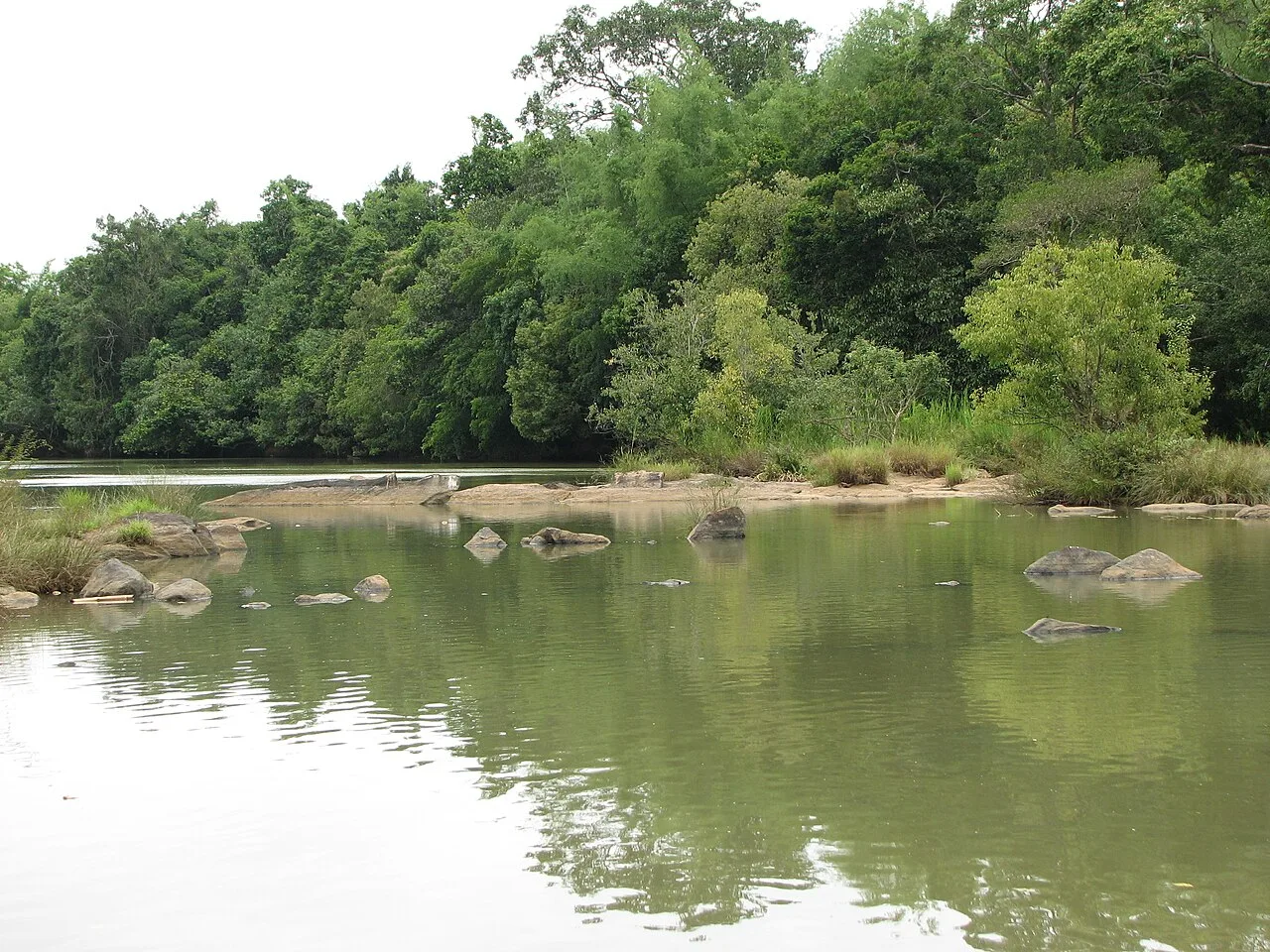
Kuruva Island (Kuruvadweep)
Kuruvadweep is a protected, forested river delta in Wayanad, Kerala, made up of uninhabited islands. Visitors come to experience its evergreen woodland and rare bird and insect life.
Key facts · verified by Ghumoopedia editors
- Type of place
- Natural attraction
- Best time to visit
- September to March; June to August for monsoon Ayurveda and green landscapes
- Nearest railway station
- Nilambur Road · about 63 km (straight line)
- Nearest airport
- Kannur International Airport · about 60 km (straight line)
- Verified
- 21 Nov 2026
Plan a trip from Kuruva Island (Kuruvadweep) — a day-by-day route through places nearby.
Kuruva Island, also called Kuruvadweep, is a protected delta covering 950 acres (3.8 km²) in Kerala’s Wayanad district. It lies beside tributaries of the Kabini River and consists of three forest-covered islands with no inhabitants, plus smaller satellite islands that can be submerged. The nearest town is 16.7 km away. Mananthavady lies 17 km east of the island group, while Pulpally is 10 km to its north-west. The area is also close to Karnataka. Evergreen forest blankets the islands, which are home to rare wildlife. The birds and insects found there include the Malabar trogon and Disparoneura apicalis. The wooded landscape and surrounding river environment make the delta a visitor attraction in the district. Visitors travel to the islands on rafts or fibre boats operated by the Kerala Tourism Department. Access is restricted and monitored by Kerala’s Forest Department to help protect the forest. Visitors must obtain a pass before going, as elephants and other animals are present on the islands. The islands are generally closed to the public from the end of May until early December, during the monsoon period. Heavy rainfall can flood the streams and raise the water to dangerous levels, making access unsafe. The smaller satellite islands may also be submerged, adding to the seasonal challenges of visiting this river delta. Kerala packs a lot into a narrow strip: the backwaters and houseboats of Alappuzha and Kumarakom, the tea hills of Munnar and the spice forests of Thekkady, the beaches of Kovalam, Varkala and Bekal, the colonial and Jewish heritage of Fort Kochi, and living art forms — Kathakali, Theyyam, Mohiniyattam and temple festivals with caparisoned elephants. Kerala is warm and humid at sea level all year. The southwest monsoon from June to September brings very heavy rain, and the northeast monsoon adds showers in October and November; the hill stations of Munnar, Wayanad and Vagamon are cool year-round and cold on winter nights. The usual best time to visit is September to March; June to August for monsoon Ayurveda and green landscapes. Timings, fees and access arrangements must be confirmed locally. For official information, see Kerala Tourism at https://www.keralatourism.org.
Why it matters
Kuruvadweep, also called Kuruva Island, is a protected river delta in Wayanad district, Kerala, covering about 950 acres (3.8 square kilometres), according to the existing destination guide. Its importance is primarily ecological and regional: wooded islands and smaller, seasonally submerged islets form a distinctive landscape along tributaries of the Kabini River. The uninhabited area provides habitat for birds, insects and other wildlife, and its access is restricted and monitored by Kerala’s Forest Department to help protect the forest. The guide also notes that official boats or rafts are used for access when the site is open. No UNESCO or Archaeological Survey of India designation is established here; visitors should rely on current notices from the managing authorities for its protection status and access arrangements.
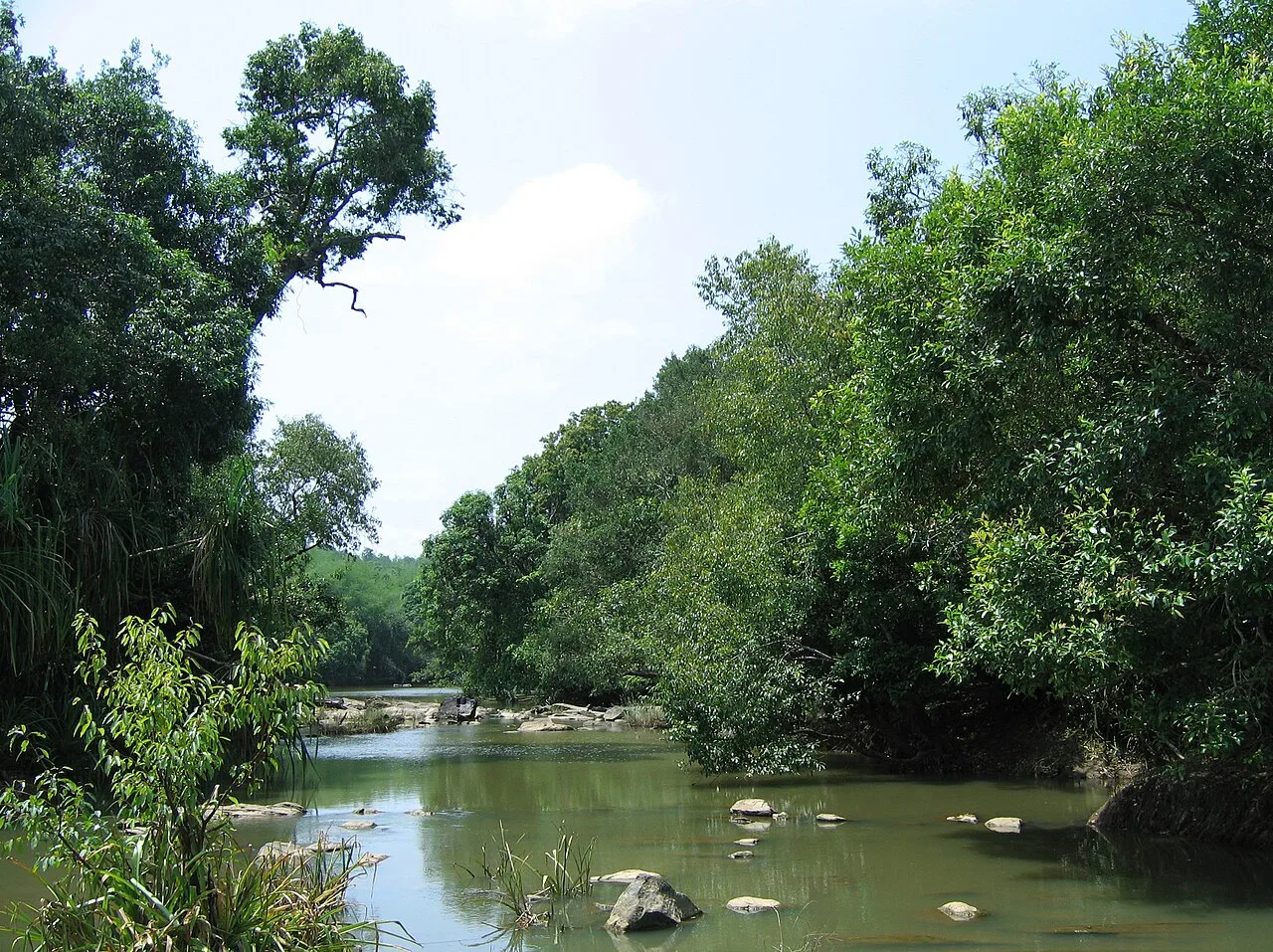
Kuruvadweep is a natural river delta rather than a built monument. Its islands and channels were formed by the movement and deposition of water and sediment along tributaries of the Kabini River. The area comprises three principal, densely wooded islands and smaller satellite islands that can be submerged as water levels change. The available account does not identify a founding community, builder or securely documented date of settlement, and the main islands are described as uninhabited. It is therefore better understood through its changing river landscape and forest ecology than through a sequence of architectural periods. In more recent tourism accounts, Kuruvadweep became a prominent nature destination in Wayanad. Increased visitor interest has been balanced with conservation measures: entry is restricted and monitored by Kerala’s Forest Department, and access may require prior permission. Boats or rafts provide the crossing when visits are permitted. Seasonal closures during the monsoon are intended to avoid dangerous flooding and protect the area.
Origin stories & folklore
No single, well-documented origin legend for Kuruvadweep is established in the available destination information. As in many forested parts of Wayanad, local stories and beliefs may express respect for rivers, trees and the living world, but accounts can differ between communities and should not be presented as verified history. The island’s quiet channels and dense evergreen growth can invite imaginative interpretations; visitors can appreciate that atmosphere without treating a newly heard story as an established tradition. Ask permission before recording or sharing personal stories, and do not seek out sacred or restricted knowledge.
Spend unhurried time at Kuruva Island (Kuruvadweep): walk the marked paths, use official viewpoints and ask locally whether a guide, entry ticket or forest permission is needed. Weather can change quickly, so carry a rain layer even on a clear morning. A comfortable itinerary is one main visit in the morning, a local meal at midday and a short nearby stop before an afternoon return. Use the district list on this site to find other places in Wayanad, but check the route and its condition before combining stops. If a festival is on — such as Onam, Thrissur Pooram, the Nehru Trophy snake-boat race on Punnamada Lake, the Theyyam season in Kannur and Kasaragod, or the Attukal Pongala — roads and stays can be busy, and the experience can be unforgettable. Leave no litter: many sites are protected by the communities around them.
Suggested itineraries
Half day: Check access and water conditions; take the authorised boat or raft; walk permitted paths and pause at official viewpoints; return by boat (allow roughly three to four hours, subject to local rules). Full day: Visit Kuruvadweep in the morning; have a meal in a nearby town; choose one nearby attraction such as Pazhassi Raja Tomb and Museum or Banasura Sagar Dam; return before evening (allow most of the day, with road conditions in mind). Gentler option: Confirm the shortest permitted route and boat arrangements with staff; enjoy a brief crossing and a nearby viewpoint, or remain at the entry area if paths or water conditions are unsuitable.
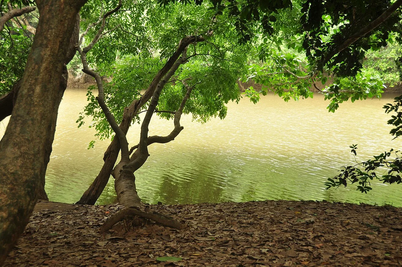
Kuruvadweep is chiefly a natural attraction, not a performance venue or cultural monument. The surrounding Wayanad district is home to diverse communities and living traditions; Malayalam is widely used, alongside other languages spoken locally. Visitors may encounter regional food, temple observances and customary hospitality in nearby towns and villages, but practices vary and should not be assumed to represent every resident. There is no regular dance, music programme or dress code established for the island itself. Keep voices low on forest paths, follow staff guidance and ask before photographing people, community spaces or religious observances.
Local communities
Kuruvadweep’s main islands are described as uninhabited, so visitors should not assume there is a resident island community or that the forest is open for independent use. The wider Wayanad region includes Adivasi communities, among them Paniyas, Kurichiyas, Kurumas and Kattunayakans; these are distinct peoples, not a single group, and their knowledge and customs should not be treated as tourist material. Across the district, livelihoods include farming, local services and tourism, with people also involved in conservation and forest-related work. Use local businesses respectfully and seek consent before taking photographs.
Festivals & events
No festival is established as being held on Kuruvadweep itself. In nearby Wayanad communities, Onam, usually celebrated around August or September, and Vishu, generally in April, are observed alongside local temple festivals whose dates and customs vary. Theyyam performances are part of traditions in parts of northern Kerala, including the wider region, but are not a scheduled island attraction. Festival periods can bring extra visitors and busier roads or accommodation in nearby towns. Check local announcements before travelling, and do not enter a ritual space or photograph a ceremony without permission.
Local food in Kerala includes appam with stew, puttu with kadala curry, idiyappam, the vegetarian sadya served on a banana leaf, Kerala parotta with beef or chicken fry, Malabar biryani and pathiri in the north, karimeen pollichathu (pearl-spot fish in banana leaf), toddy-shop fish curry, banana chips and many kinds of payasam. Ask what is fresh that day; many small eateries cook a limited daily menu. Coconut oil and coconut are used in most dishes; ask for less spice if needed. Toddy shops serve some of the best fish curry in Kerala, and a full sadya is the highlight of Onam. Remote sites may have no restaurant at all. Carry water and snacks, eat a proper breakfast before long drives, and ask your accommodation for a packed lunch if you are heading out early. Try a home-cooked or local thali meal when you can — it is often the best food on the route. Choose clean places, drink sealed or filtered water, and carry your packaging back with you.
Shopping & local experiences
There is no substantial shopping area on the island, and visitors should not expect stalls along forest paths. In nearby towns, look for Wayanad-grown coffee, spices and locally made food products from established shops or markets. Small craft and souvenir options vary by location and season; ask sellers about the maker and source rather than assuming an item is locally produced. A meal in a nearby town can be a good way to experience regional cooking. Avoid buying wildlife products, plants or items made from protected natural materials.
Kuruvadweep is a wooded river delta along tributaries of the Kabini, with three principal islands and smaller islets that may be submerged when water levels rise. The guide describes dense evergreen forest and identifies the Malabar trogon and the damselfly Disparoneura apicalis among the rare wildlife associated with the area; sightings are never guaranteed. Birds, insects and other fauna inhabit the forest, while the surrounding water and vegetation make the landscape sensitive to seasonal change. Monsoon rainfall can raise streams rapidly and flood routes, which is why public access is usually suspended during part of the wet season. Stay on permitted paths, do not feed wildlife, and leave plants, animals and natural materials undisturbed.
September to March; June to August for monsoon Ayurveda and green landscapes
The nearest principal railway station by straight-line distance is Nilambur Road, roughly 63 km away. The nearest operating airport by straight-line distance is Kannur International Airport, roughly 60 km away. These figures are calculated from map coordinates — actual road distance is longer. Thiruvananthapuram, Kollam, Kottayam, Ernakulam, Thrissur, Shoranur, Kozhikode and Kannur are the main rail stops along the coast line; Kochi, Thiruvananthapuram, Kozhikode and Kannur have international airports. For the final leg, KSRTC buses (from ordinary to air-conditioned Swift services), fast private buses, metered autos, app cabs and the Water Transport Department's public ferries in the backwaters link the towns. Distances look short on the map, but road and town traffic are slow, so allow extra time. When comparing train, bus and flight, count the complete door-to-door time: a flight saves the most time only if the onward road transfer is short, while an overnight train can save a hotel night. Kerala's coastal rail line is busy, so reserve trains early; KSRTC buses are frequent and often quicker to hill stations. Book your return before you leave, because seats fill quickly on weekends, festivals and holidays. Current train numbers, timings, return services and fares are not listed here; check IRCTC and NTES for trains and the airline's own schedule for flights. No permit is needed to visit Kerala. Several major temples, including Sree Padmanabhaswamy in Thiruvananthapuram and Guruvayur, admit only Hindus and enforce a strict dress code — men wear a mundu (dhoti) and remove shirts, women wear a saree or long skirt. Forest activities in Periyar, Eravikulam, Silent Valley, Parambikulam and Thattekad must be booked with the Kerala Forest Department, and Eravikulam National Park usually closes in February and March for the Nilgiri tahr calving season.
Confirm onward and return timings on IRCTC / NTES, the state bus operator or your airline before travel. A dash means current timings or fares have not been verified.
Getting around
Reach the authorised entry point using a local bus, taxi or auto-rickshaw from a nearby town, then follow staff directions for the crossing. Access to the islands is by the official rafts or boats when these are operating; visitors should not attempt to cross independently or use an unauthorised craft. Once on the island, movement is on foot along routes permitted by staff. Parking may be available near the access area, but facilities and space can vary, so check locally. Arrange a return pickup in advance if travelling by hired vehicle, particularly outside busy periods.
Hours, tickets & permissions
Access is controlled and may depend on seasonal conditions, Forest Department permission, available official boats or rafts, and other current entry rules. The island is usually closed to visitors from around the end of May until early December because monsoon rain can make streams dangerous, but the actual opening period may change. Tickets, permits, identification requirements and camera rules can also vary. Confirm current access, hours and fees with Kerala’s Forest Department or the relevant local tourism authority before setting out; do not rely on old online listings.
Facilities
Facilities on the island may be limited and can change with the operating season. Toilets, drinking water, food stalls, guides and visitor services should not be assumed to be available on the forest paths; check locally and carry water in a reusable bottle. Food and more extensive services are more likely in nearby towns. Parking may be provided near the authorised access point, but capacity is not guaranteed. ATMs are generally more likely in larger nearby towns than at the island. Take all rubbish back with you and follow staff instructions about facilities and restricted areas.
Accessibility
Access involves a boat or raft crossing followed by walking on natural forest paths. Surfaces may be uneven, muddy, slippery or affected by water levels, and shade is available beneath the trees but does not remove the demands of the route. Steps, narrow sections or other obstacles may occur; conditions can change seasonally. Wheelchair and stroller access should not be assumed, and the crossing may be unsuitable for some visitors with limited mobility. Older visitors should check the route and current conditions with staff before boarding, travel with a companion if needed, and turn back if the path feels unsafe.
No permit is needed to visit Kerala. Several major temples, including Sree Padmanabhaswamy in Thiruvananthapuram and Guruvayur, admit only Hindus and enforce a strict dress code — men wear a mundu (dhoti) and remove shirts, women wear a saree or long skirt. Forest activities in Periyar, Eravikulam, Silent Valley, Parambikulam and Thattekad must be booked with the Kerala Forest Department, and Eravikulam National Park usually closes in February and March for the Nilgiri tahr calving season. Carry a photo ID at all times and save the emergency number 112 and your accommodation's contact offline. Stay on marked paths, keep away from cliff edges and fast water, and never approach wild animals.
Photography
Soft morning light can suit the forest and water, while shaded paths may require patience and steady handling. Photograph only from permitted paths and official viewpoints, and treat wildlife sightings as a possibility rather than an expectation. Ask permission before taking portraits or photographing workers and local residents. Avoid disturbing birds or insects for a picture, and never leave paths to approach wildlife. Drone use may be restricted in this protected area; obtain explicit permission from the managing authority before bringing or flying one. Follow any posted camera or photography rules.
Choose a stay by the full journey to Kuruva Island (Kuruvadweep), not just the district name. Kerala Tourism's classified homestays are good value and a way to taste home cooking; beach towns have everything from hostels to Ayurveda resorts. In summer, check air-conditioning and backup power; in the monsoon, check that the property is accessible if roads flood. Book in advance for weekends, festivals and the peak season (September to March; June to August for monsoon Ayurveda and green landscapes). Confirm the exact location, meals included, check-in time and cancellation terms in writing. Avoid sending money to unverified contacts or touts at stations. Carry some cash, as card and digital payments can be unreliable in remote areas.
Wayanad offers several places that can be combined with a visit if road conditions and time allow. Mananthavady has the Pazhassi Raja Tomb and Museum, associated with the history of Pazhassi Raja. Banasura Sagar Dam is another established district attraction. Edakkal Caves, known for prehistoric rock engravings, and Thirunelli Temple are also in Wayanad, though they are separate outings and may require substantial travel from the island.
For couples, Kuruva Island (Kuruvadweep) rewards a slow pace: arrive early for soft light and fewer crowds, share a local meal and keep the evening free. An overnight houseboat on Vembanad, a sunset on the Varkala cliffs or a misty morning walk through Munnar's tea estates makes the trip memorable. Public displays of affection can be frowned upon in conservative communities and at religious sites, so be discreet. Keep a buffer in your itinerary, because weather and road conditions can delay plans.
Q: How much time should I allow for Kuruvadweep? A: Allow roughly half a day for the authorised crossing and a permitted walk; the visit depends on access rules and conditions. Q: When is the best season to visit? A: The usual visitor season is after the monsoon closure, but confirm the current opening period with the managing authority. Q: Do I need permission or an entry ticket? A: Entry is controlled and may require permission or a ticket. Check current requirements before travelling. Q: Is the island suitable for children or elderly visitors? A: It may suit visitors comfortable with a boat crossing and uneven paths. Check water and trail conditions, and supervise children closely. Q: Where can I stay nearby? A: Look for accommodation in nearby Wayanad towns, including Mananthavady, and confirm the route and availability before booking.
Be the first to share photos, stories, advice or a helpful contact for Kuruva Island (Kuruvadweep).
Loading…