
Pangong Tso
Pangong Tso is a high-altitude, landlocked lake stretching between eastern Ladakh and Tibet. Travellers visit to see its great length and the way it crosses the India–China border.
Key facts · verified by Ghumoopedia editors
- Type of place
- Natural attraction
- Best time to visit
- June to September; October for clear skies with colder nights; January–February only for winter trips such as the Chadar trek
- Nearest railway station
- Srinagar (Nowgam) · about 380 km (straight line)
- Verified
- 21 Nov 2026
Plan a trip from Pangong Tso — a day-by-day route through places nearby.
In Ladakh’s Leh district, Pangong Tso extends from India into Ngari Prefecture in Tibet. The lake has no outlet to the sea and lies about 14,200 feet (4,300 metres) above sea level. It covers approximately 604 square kilometres (233 square miles), extends for 134 kilometres (83 miles) and reaches a maximum breadth of 5 kilometres (3.1 miles). A raised ridge separates the lake’s basin from the Indus drainage system. Its waters are saline in the west and alkaline in the east. During winter, the lake freezes. China administers about two-thirds of the lake, while India controls the remainder. The Line of Actual Control, which marks the boundary between the countries, runs across it. Both nations claim part of the lake as part of their wider border dispute. The area saw fighting during the 1962 Sino-Indian War and clashes in 2020–2021. Ladakh is a high-altitude desert between the Karakoram and the Great Himalaya, with Tibetan Buddhist monasteries such as Hemis, Thiksey, Diskit and Lamayuru, the Shia and Balti culture of Kargil and Turtuk, the Brokpa villages of Dha-Hanu, the turquoise lakes Pangong Tso and Tso Moriri, and some of the world's highest motorable passes. Summers (June to September) are sunny and dry, with warm days and cold nights; winters are long and severe, often far below −15 °C, and the high passes close with snow. The sun is intense at this altitude, and weather on the passes can change within an hour. The usual best time to visit is June to September; October for clear skies with colder nights; January–February only for winter trips such as the Chadar trek. Timings, fees and access arrangements must be confirmed locally. For official information, see Ladakh Tourism at https://tourism.ladakh.gov.in.
Why it matters
Pangong Tso is a high-altitude endorheic lake in eastern Ladakh, extending across territory administered by India and China. Its scale, changing colours and setting within the Changthang region make it one of Ladakh’s best-known natural attractions and a prominent stop on journeys from Leh. The lake also has strategic significance: the Line of Actual Control passes through it, and parts of the wider border area are disputed. Visitors should follow current security instructions and stay within areas open to the public. Pangong Tso is not identified here as a UNESCO World Heritage Site or an ASI-protected monument; it is a natural landscape, not a built heritage site.
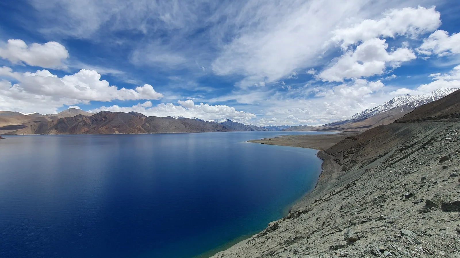
Pangong Tso is a natural lake formed in a landlocked basin, not a reservoir built by a ruler or community. Its geological history is tied to the formation of the high Himalayan and Tibetan Plateau landscape. The basin is separated from the Indus River basin by an elevated ridge, and the lake has no outlet to the sea. Water conditions vary across its length: the western part is saline and the eastern part alkaline. The lake freezes in winter. For generations, the surrounding Changthang plateau has been used by pastoral communities, while routes across Ladakh connected settlements and trading areas. The lake later became internationally known through travel writing, photography and film, though this visibility should not be confused with its much longer natural and local history. In the modern period, its location along the India–China frontier has made it strategically sensitive. The Line of Actual Control crosses the lake, and the area was affected by conflict during the 1962 Sino-Indian War and by India–China skirmishes in 2020–2021. Access arrangements can therefore change. There is no conventional restoration history: conservation depends on responsible visitation, waste management and respect for local and security rules.
Origin stories & folklore
There is no single, well-documented origin legend for Pangong Tso that is consistently associated with the lake. Across Himalayan and Tibetan cultural regions, lakes and springs may be treated with respect and linked in local belief to powerful natural beings; traditions differ between communities and places. Such beliefs should not be presented as a verified account of how Pangong Tso formed. Its geological origin is natural, within a high-altitude basin. Visitors can show respect by avoiding litter, not disturbing wildlife or the shoreline, and asking before photographing people or any local observance. Do not assume that a particular ritual or story applies to every community around the lake.
Spend unhurried time at Pangong Tso: use marked paths and official viewpoints, and ask locally whether a guide, ticket or permission is needed. At this altitude, keep your stay short, walk slowly and avoid exertion — the air is thin and the cold is severe even in summer. A comfortable itinerary is one main visit in the morning, a local meal at midday and a short nearby stop before an afternoon return. Start early: high passes are clearer and safer in the morning, and wind rises in the afternoon at lakes such as Pangong. Use the district list on this site to find other places in Leh, but check the route and its condition before combining stops. If a festival is on — such as Hemis Tsechu in summer, Losar in winter, the Ladakh Festival in September or a monastery masked-dance festival — transport and stays can be busy, and the experience can be unforgettable. Ladakh's water is scarce and its waste is hard to remove — refill bottles at water points, use dry toilets as instructed and carry your rubbish back to Leh.
Suggested itineraries
Half day: From a lakeside stay, take a slow walk to an approved viewpoint (30–60 minutes), rest and enjoy the shoreline from permitted ground (1–2 hours), then have a local meal and return to your lodging. Allow extra time for altitude and weather. Full day: Travel from Leh early (several hours each way, depending on road conditions); stop only at authorised viewpoints, have a meal near the lake, spend a short, unhurried period by the water, and stay overnight in the area rather than relying on a same-day return. Confirm the route locally. Gentler option: Use a vehicle to reach an approved viewpoint, remain close to the vehicle, and enjoy the view with frequent rests instead of walking along the shore.
The cultural setting reflects Ladakh’s links with Tibetan-speaking regions, while the lake itself is not a permanent settlement or a regular venue for public performances. Ladakhi and related Tibetan languages are spoken in the region, alongside Hindi and other languages used in travel and administration. Buddhist monasteries and festivals are part of wider Ladakhi life, while Muslim communities and traditions are also important across the region. Visitors may encounter locally made woollen clothing and practical high-altitude dress, but everyday customs vary. Ask permission before photographing residents, homes or religious observances, and follow guidance at monasteries and other cultural sites.
Local communities
The wider Changthang region is associated with pastoral livelihoods, including the keeping of sheep, goats and yaks; some Changpa pastoralists use seasonal grazing grounds across the plateau. Settlements and services along visitor routes also support farming, transport, hospitality and small businesses. Pangong’s shoreline is not a large year-round town, and services can be seasonal. Ladakh’s communities are diverse, with Buddhist, Muslim and other cultural traditions represented across the region. Visitors should not enter grazing areas or photograph people and livestock at close range without permission, and should respect local requests and land-use boundaries.
Festivals & events
There is no major annual festival known to be held on Pangong Tso’s shoreline. Visitors can experience festivals in Leh and at monasteries elsewhere in Ladakh, including Hemis Tsechu, usually held in summer, and the Ladakh Festival, usually held in September. Monastery masked-dance events take place at different sites and seasons; dates vary by local calendar and should be checked before travel. Losar, the Ladakhi New Year, is observed in winter. Festival periods can make transport and accommodation busier, especially in Leh, so confirm schedules locally and do not expect celebrations at the lake itself.
Local food in Ladakh includes thukpa and skyu noodle soups, steamed momos, tingmo bread, paba and tsampa (roasted barley), chhurpi cheese, butter tea (gur gur cha), apricot jam and dried apricots from Kargil and Turtuk, seabuckthorn juice and, in Kargil and Drass, Balti and Kashmiri dishes. Ask what is fresh that day; many small eateries cook a limited daily menu. Leh's Main Bazaar and Changspa road have cafés for every taste, but outside Leh menus are short and simple. Eat light for the first two days while you acclimatise, avoid alcohol, and drink plenty of warm water and soups. Remote sites may have no restaurant at all. Carry water and snacks, eat a proper breakfast before long journeys, and ask your accommodation for a packed lunch if you are heading out early. Try a home-cooked or local meal when you can — it is often the best food on the route. Choose busy, clean places, drink sealed or filtered water, and carry your packaging back with you.
Shopping & local experiences
There is no large shopping district at Pangong Tso. Small local businesses may offer meals, tea, snacks and basic travel necessities, with selection varying by season. In Leh, look for locally made woollen goods, handicrafts and regional foods through established shops and markets; ask about materials and provenance rather than assuming an item is locally produced. Buying from local businesses can support residents, but avoid purchasing wildlife products or anything of uncertain origin. Carry reusable containers where practical, minimise packaging and take rubbish back to a suitable disposal point.
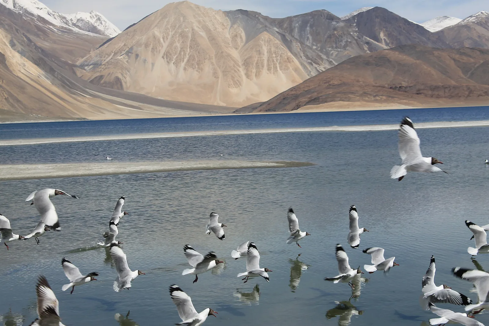
Pangong Tso lies in a stark, high-altitude landscape of open water, bare mountains, gravelly shores and sparse alpine-steppe vegetation. At about 4,300 metres, conditions are cold and dry, and the lake freezes in winter. Its water is saline in the western part and alkaline in the eastern part. Colour can shift with light, cloud and viewing angle; the lake is not a freshwater swimming destination. The wider Changthang region supports hardy steppe plants and wildlife adapted to high elevations. Waterbirds may use the lake and nearby wetlands, but sightings vary by season and conditions and are never guaranteed. Keep distance from birds and other animals, stay on permitted ground and take all rubbish away.
June to September; October for clear skies with colder nights; January–February only for winter trips such as the Chadar trek
The nearest principal railway station by straight-line distance is Srinagar (Nowgam), roughly 380 km away. The nearest operating airport by straight-line distance is Kushok Bakula Rimpochee Airport, Leh, roughly 133 km away. These figures are calculated from map coordinates — actual road distance is longer, and mountain roads and checkposts mean even short distances can take hours. Leh airport has year-round flights from Delhi and other cities. By road, the Srinagar–Kargil–Leh highway over Zoji La usually opens from about April–May to November, and the Manali–Leh highway from about June to October; both close in winter. The nearest railheads are Srinagar and Jammu Tawi, a long road journey away. From Leh, hire a union-rate taxi from the Leh taxi stand or through your guesthouse, or join a shared taxi; passes and lakes are usually visited as day trips or one- or two-night circuits, and roads can close after snowfall even in summer. When comparing train, bus and flight, count the complete door-to-door time: a flight saves the most time only if the onward transfer is short, while an overnight train can save a hotel night. For Ladakh, flying into Leh saves the most time, but you must rest for two full days on arrival because you go straight to 3,500 m. Arriving by road from Manali or Srinagar takes two days but helps your body adjust to the altitude. Book your return before you leave, because seats fill quickly on weekends, festivals and holidays. Current train numbers, timings, return services, ferry departures and fares are not listed here; check IRCTC and NTES for trains, the airline's own schedule for flights and the official operator for ships and ferries. Permit rules for Ladakh have changed several times, so check the current requirement on the Leh district administration's permit portal (lahdclehpermit.in) before you travel. Indian visitors to protected areas such as Nubra, Turtuk, Pangong, Tso Moriri, Hanle and Dha-Hanu are usually asked to register online and pay environment and wildlife fees; foreign nationals need a Protected Area Permit arranged through a registered Leh travel agent, and should carry several photocopies for checkposts. Prepaid mobile SIMs from outside Jammu & Kashmir and Ladakh do not work here — bring a postpaid connection.
Confirm onward and return timings on IRCTC / NTES, the state bus operator or your airline before travel. A dash means current timings or fares have not been verified.
Getting around
Most visitors reach the accessible Indian-side lake area by road from Leh, using a hired taxi, an organised tour or a shared vehicle when available. Local transport options can be limited, so arrange the return journey and confirm road conditions before departure. Vehicles use designated roads and stopping areas; obey security instructions and do not drive onto the shore or unmarked ground. Walking between viewpoints is possible in places, but distances, wind and altitude can make even short walks tiring. Parking is generally informal or limited near visitor areas. Do not expect regular autos, boats or a dependable local bus service at the lake.
Hours, tickets & permissions
Pangong Tso is an outdoor natural attraction, but access is subject to road, weather and security conditions rather than a dependable public opening schedule. Permit, registration or checkpost requirements may apply and can change; carry valid identification and confirm current rules before setting out. Stay only in areas currently open to visitors and follow official signs and instructions. There may be local entry or facility charges, and arrangements can vary. Confirm current access, hours where applicable and fees with the relevant local authority or Ladakh Tourism before travel.
Facilities
Facilities are limited and vary by season and settlement. Guesthouses, camps or homestays may operate near the visitor area, and simple meals and toilets are usually available through local accommodation or businesses; check before relying on them. Drinking water, waste bins, medical help and mobile connectivity may be limited, so carry water and essential supplies and take rubbish back with you. Parking is generally near road-accessible stops rather than at every viewpoint. ATMs are not reliably available at the lake; arrange cash and other essentials in Leh. Guides or drivers can be arranged through local operators, subject to current access rules.
Accessibility
The lake is at high altitude, and the cold, thin air can affect visitors even on level ground. Shoreline terrain is uneven, often gravelly or rocky, with little shade; viewpoints reached from roads may still involve short walks over rough surfaces. There is no reason to expect continuous paved paths, wheelchair access, ramps or accessible toilets. Wheelchair and stroller movement may be difficult, and older visitors or anyone with mobility or heart or lung conditions should seek medical advice before travel. Keep exertion low, take frequent rests and avoid going higher or farther on foot than feels comfortable. Seek help promptly if altitude symptoms worsen.
Permit rules for Ladakh have changed several times, so check the current requirement on the Leh district administration's permit portal (lahdclehpermit.in) before you travel. Indian visitors to protected areas such as Nubra, Turtuk, Pangong, Tso Moriri, Hanle and Dha-Hanu are usually asked to register online and pay environment and wildlife fees; foreign nationals need a Protected Area Permit arranged through a registered Leh travel agent, and should carry several photocopies for checkposts. Prepaid mobile SIMs from outside Jammu & Kashmir and Ladakh do not work here — bring a postpaid connection. Carry a photo ID at all times and save the emergency number 112 and your accommodation's contact offline. Altitude sickness (acute mountain sickness) is the main risk everywhere in Ladakh: rest completely for the first 36–48 hours in Leh, climb gradually, avoid alcohol and smoking, drink water, and descend or seek medical help at once if you develop a severe headache, breathlessness at rest, vomiting or confusion. People with heart or lung conditions, young children and pregnant women should consult a doctor before going. This place is above about 4,000 m: go only after acclimatising in Leh, keep the visit short, and turn back if anyone in your group feels unwell.
Photography
The lake can photograph well in clear morning light, while clouds and changing light alter its colour and contrast. Use established, permitted viewpoints and check local advice on where photography is allowed, especially near security-sensitive areas. Ordinary handheld photography is generally suitable in public visitor areas, but rules can change. Do not photograph military installations, checkpoints or personnel where prohibited. Drone use may be restricted or require authorisation; do not fly without confirming current rules. Ask permission before photographing residents, workers, children or religious observances, and avoid blocking roads or disturbing wildlife for a shot.
Choose a stay by the full journey to Pangong Tso, not just the district name. Leh has the widest choice, from family guesthouses in Changspa and Karzoo to hotels near the Main Bazaar; Nubra, Pangong, Tso Moriri and Hanle have homestays and seasonal camps, and Kargil and Padum have simple hotels and guesthouses. Nights are cold even in summer — check heating, hot water and extra blankets, and expect power cuts and limited mobile signal outside Leh and Kargil. Book in advance for weekends, festivals and the peak season (June to September; October for clear skies with colder nights; January–February only for winter trips such as the Chadar trek). Confirm the exact location, meals included, check-in time and cancellation terms in writing. Avoid sending money to unverified contacts or touts at stations, airports and jetties. Carry some cash, as card and digital payments can be unreliable in remote areas.
On the road from Leh, visitors commonly pass through or stop near Chang La and the village of Tangtse; check which stops are currently open and appropriate. In Leh district, Thiksey Monastery, Hemis Monastery and Shey Palace are well-known cultural sites, but they are separate visits and should not be treated as quick lakeside stops. Leh itself offers markets, museums and services before or after the journey. Road conditions and travel time can make combining distant places tiring, so plan the lake as a substantial trip and verify routes locally. Do not cross into restricted areas or attempt to approach the international boundary.
For couples, Pangong Tso rewards a slow pace: arrive early for soft light and fewer crowds, share a local meal and keep the evening free. Sunset from Shanti Stupa, a night under the stars at Hanle or Tso Moriri, a camel ride on the Hunder dunes or a quiet morning at Pangong makes the trip memorable. Public displays of affection can be frowned upon in conservative communities and at religious sites, so be discreet. Keep a buffer in your itinerary, because weather and transport can delay plans.
Q: How much time should I allow for Pangong Tso? A: The lake itself can be enjoyed in a short, unhurried visit, but travel from Leh takes several hours each way. Many visitors plan an overnight stay to avoid a rushed return. Q: When is the best season to visit? A: June to September is the usual travel season. October can bring clear skies and colder nights; winter visits require careful planning and confirmed access. Q: Is a permit or entry ticket required? A: Requirements can change and may include permits, registration or checkpost procedures. Confirm current rules and any fees with local authorities before travelling. Q: Is the lake suitable for children and older visitors? A: The high altitude can affect anyone. Keep activity gentle, watch for symptoms, and seek medical advice for people with health concerns; children should be closely supervised near the water. Q: Can I stay near the lake? A: Seasonal camps, guesthouses or homestays may be available near visitor areas. Confirm current operation and facilities in advance; Leh has a wider choice of accommodation.
Be the first to share photos, stories, advice or a helpful contact for Pangong Tso.
Loading…