
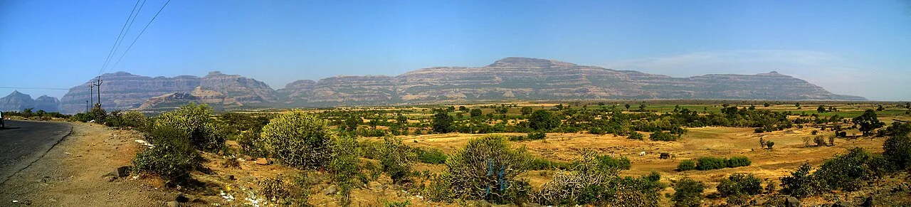
Harishchandragad
Harishchandragad is a hill fort in Maharashtra’s Ahilyanagar district, within the Western Ghats. Visitors come to see its rock-cut caves, temples, water cisterns and Kedareshwar cave shrine.
Key facts · verified by Ghumoopedia editors
- Type of place
- Heritage monument
- Best time to visit
- October to March; June to September for green monsoon landscapes on the Ghats (expect closures)
- Nearest railway station
- Igatpuri · about 40 km (straight line)
- Nearest airport
- Shirdi Airport · about 70 km (straight line)
- Verified
- 21 Nov 2026
Plan a trip from Harishchandragad — a day-by-day route through places nearby.
Set amid the Western Ghats, Harishchandragad is a hill fort in Maharashtra’s Ahilyanagar district. Its features include caves carved into rock, temples and water cisterns, bringing religious structures and water installations together within the fort. Caves cut into rock are found alongside the temples, while cisterns form another part of the site. These features give the fort a combination of cave spaces, religious monuments and water storage. The Kedareshwar cave shrine is among the monuments at Harishchandragad. Visitors can see it alongside the fort’s other temples, caves and cisterns. Maharashtra spans Mumbai's Gothic and Art Deco skyline, the rock-cut cave temples of Ajanta, Ellora, Karla and Elephanta, the hill forts of Chhatrapati Shivaji Maharaj, the Konkan's sea forts and beaches, and the great pilgrimages of Pandharpur, Shirdi and the Jyotirlingas. The coast is hot and humid most of the year with very heavy monsoon rain from June to September; the Western Ghats hill stations are cool and misty in the monsoon and pleasant in winter; the Deccan and Vidarbha are dry, with harsh summers above 40°C in Nagpur and Chandrapur. The usual best time to visit is October to March; June to September for green monsoon landscapes on the Ghats (expect closures). Timings, fees and access arrangements must be confirmed locally. For official information, see Maharashtra Tourism at https://www.maharashtratourism.gov.in.
Why it matters
Harishchandragad is a historic hill fort in the Western Ghats of Ahilyanagar district, Maharashtra. Its hilltop temples, rock-cut caves and water cisterns reflect the religious and practical uses of a fortified landscape. The site is important locally as a place of worship and regionally as part of the Sahyadri fort heritage; it is also visited by trekkers drawn to its high plateau and views. The Kedareshwar cave shrine and Harishchandreshwar temple are among its best-known features. No UNESCO World Heritage designation is known for the fort, and visitors should not assume a particular protection status or managing authority without checking current official information. Its heritage is best approached with care for both the structures and the living religious use of the site.
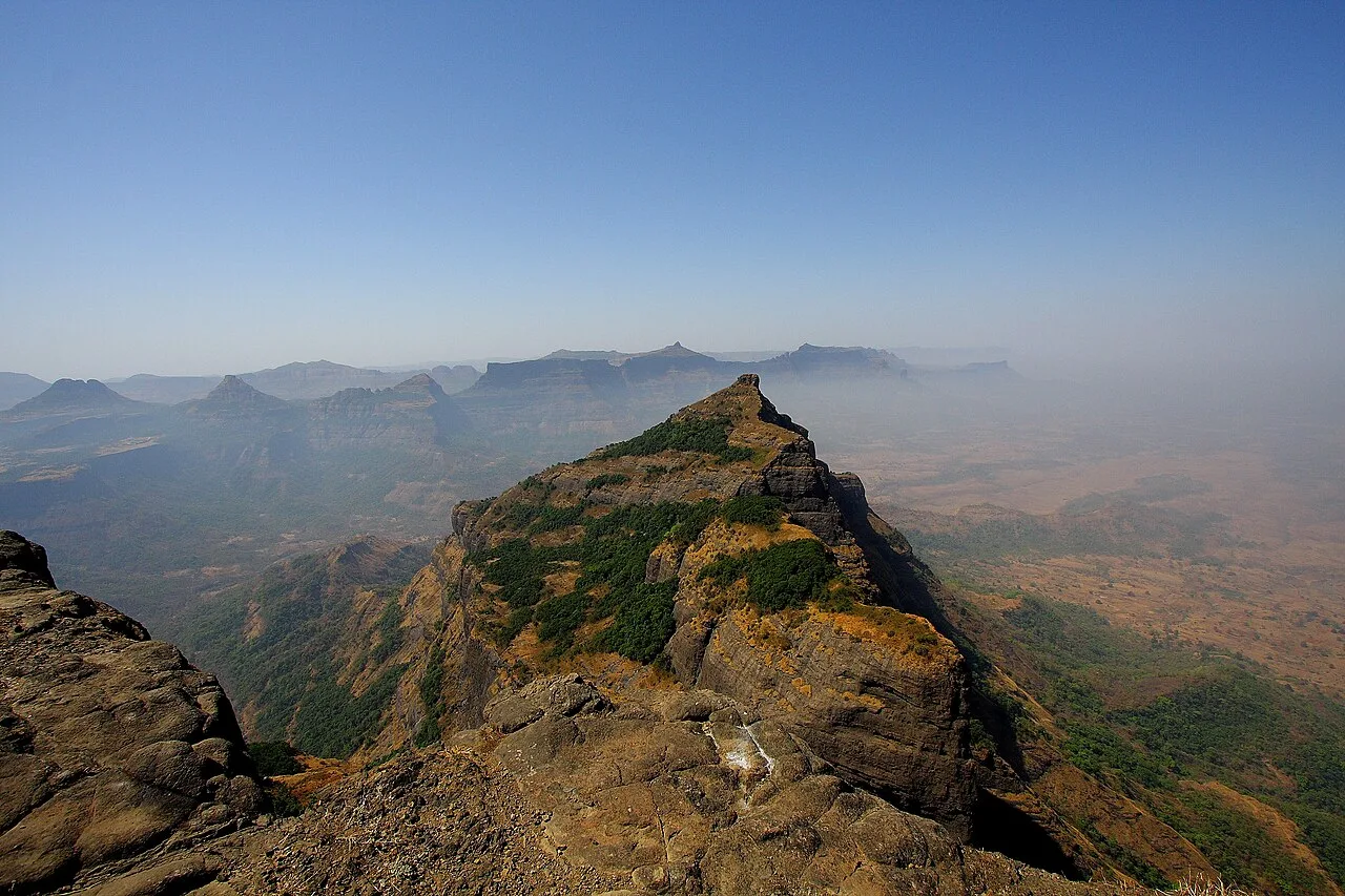
The precise beginnings of Harishchandragad are uncertain. Some historical accounts place its origins in an early-medieval period, sometimes associating it with the Kalachuri era, but the surviving remains do not establish a single date for the fort or all its structures. The temples and caves indicate that the hill was also a place of worship, not merely a defensive position. Over time, the fort's location in the Sahyadris gave it strategic value for watching routes across the hills and plateau. Accounts of its later history describe changes of control between regional powers. The fort is reported to have passed to Mughal control in the mid-eighteenth century and to have been captured by Maratha forces soon afterwards; details should be treated in light of the historical source consulted. Its buildings and water features have endured exposure to monsoon weather and erosion. No comprehensive modern restoration history can be confidently stated here. Today, the fort remains an open hilltop heritage site, and visitors should avoid disturbing masonry, shrines or archaeological remains.
Origin stories & folklore
Local tradition connects the name Harishchandragad with the legendary king Harishchandra, remembered in Hindu stories for his truthfulness and steadfastness. This association is a matter of belief rather than a verified account of the fort's founding. Another widely repeated belief concerns the Kedareshwar cave shrine and its Shiva lingam, which stands amid water. Stories describe four supporting pillars, with the broken pillars linked symbolically to past ages; some say the collapse of the remaining support would mark the end of the present age. Interpretations and details vary among tellings. These stories form part of how visitors understand the sacred landscape, but they should not be confused with archaeological evidence.
Architecture & design
Harishchandragad combines natural rock formations with built and rock-cut features across a broad hilltop. The plateau includes caves, temples and water cisterns, with steep approaches over uneven terrain. The Kedareshwar shrine occupies a cave and centres on a Shiva lingam surrounded by water; the water level and condition can vary with the season. The Harishchandreshwar temple is built of stone and displays regional Hindu temple forms, with carved surfaces and a defined shrine space. The fort's religious structures are sometimes associated with regional medieval building traditions, though precise dates and stylistic attributions are not uniform. Cisterns cut into or beside the rock provided water storage, an essential feature for a hill fort and its visitors. The setting itself is integral to the design: cliffs, ridges and the plateau form both a natural defence and a dramatic backdrop. The exposed stonework is vulnerable to weathering, so climbing on or removing material from the structures should be avoided.
Important objects & sculptures
The principal sacred object to look for is the Shiva lingam in the Kedareshwar cave shrine. Its setting within a water-filled cave is a distinctive feature, though water depth and access can change seasonally. At the Harishchandreshwar temple, notice the stone construction and carved details around the shrine rather than touching or climbing on them. The caves and rock-cut cisterns are also important remains: they show how the hill was used for worship, shelter and water storage. Carvings may be worn or difficult to identify, and there is no museum collection on the plateau. Do not assume that loose stones or fragments are souvenirs; leave all archaeological and religious material in place.
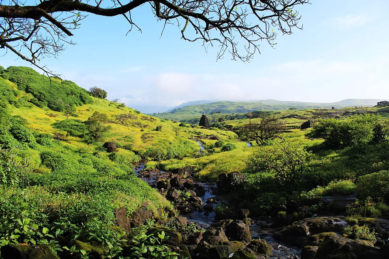
Explore Harishchandragad slowly and read the interpretation boards, use the official audio guide where available or hire an authorised guide to understand its history. Hill forts involve steep climbs on uneven stone steps; start early, carry water and descend well before dark. Early morning gives softer light, cooler air and smaller crowds. A comfortable itinerary is one main visit in the morning, a local meal at midday and a short nearby stop before an afternoon return. Use the district list on this site to find other places in Ahilyanagar, but check the route and its condition before combining stops. If a festival is on — such as Ganeshotsav, Gudi Padwa or the Ashadhi Wari to Pandharpur — roads and stays can be busy, and the experience can be unforgettable. Leave no litter: many sites are protected by the communities around them.
Suggested itineraries
Half day: From a suitable trailhead, hike up at a steady pace (allow several hours each way, depending on route and conditions); visit the main temple and cave shrine; begin the descent with ample daylight. Full day: Start early; hike to the plateau; explore the Harishchandreshwar temple, Kedareshwar cave and nearby cisterns; take a rest and meal; visit a viewpoint only if conditions and energy allow; descend before dark. Gentler option: If the climb is unsuitable, enjoy the surrounding village and landscape from an accessible base area, and arrange a local cultural or food experience rather than attempting the steep ascent.
Harishchandragad remains a place of worship as well as a trekking destination. Visitors may encounter people praying at the shrines, so keep voices low and follow any local guidance about offerings or entry into sacred spaces. Marathi is widely used in the surrounding region; guides and hosts may also communicate in other languages, but arrangements should be confirmed in advance. Local residents and guides can help visitors understand the routes and the site's traditions. Trekking is now a visible part of the area's visitor culture, especially in cooler months and during monsoon season, but it should not override the site's religious character. Dress modestly near shrines, ask before photographing people, and carry out all waste.
Festivals & events
Mahashivratri is an important observance at Shiva shrines across Maharashtra, and worshippers may visit the Kedareshwar and Harishchandreshwar shrines around the festival season; the scale of activity at the fort can vary. Other Hindu observances may be marked by visitors or nearby communities, but not all district-wide festivals are organised at the fort itself. Ganeshotsav and Gudi Padwa are prominent in the wider region and can affect travel on busy routes. During religious gatherings or popular trekking periods, trails and limited overnight facilities may be busier. Check locally before planning a visit around a festival, and be considerate of worshippers.
Local food in Maharashtra includes vada pav, misal pav, pav bhaji, poha, puran poli, modak at Ganesh Chaturthi, Kolhapuri mutton with tambda and pandhra rassa, Malvani fish curry and sol kadhi on the Konkan coast, and Nagpur oranges and saoji food in Vidarbha. Ask what is fresh that day; many small eateries cook a limited daily menu. Vegetarian travellers eat well across the state, and most towns also have fish and meat dishes. Remote sites may have no restaurant at all. Carry water and snacks, eat a proper breakfast before long drives, and ask your accommodation for a packed lunch if you are heading out early. Try a home-cooked or local thali meal when you can — it is often the best food on the route. Choose busy, clean places, drink sealed or filtered water, and carry your packaging back with you.
Shopping & local experiences
There is no major shopping centre on the fort. Near trailheads, visitors may find simple refreshments or locally prepared food, depending on the season and local arrangements. In nearby towns, look for regional snacks, produce and everyday goods rather than assuming that a dedicated craft market operates for fort visitors. Buy from local vendors where available and ask before photographing or handling products. Avoid purchasing stones, carvings or other material removed from the hill. Carry reusable water bottles and take packaging and other waste back with you.
October to March; June to September for green monsoon landscapes on the Ghats (expect closures)
The nearest principal railway station by straight-line distance is Igatpuri, roughly 40 km away. The nearest operating airport by straight-line distance is Shirdi Airport, roughly 70 km away. These figures are calculated from map coordinates — actual road distance is longer. Mumbai and Pune are the main rail and air gateways in the west, Chhatrapati Sambhajinagar (Aurangabad) for Ajanta and Ellora, Nagpur for Vidarbha and the tiger reserves, and the Konkan Railway serves the coast down to Sindhudurg. For the final leg, Maharashtra State Road Transport Corporation (MSRTC) buses, including Shivneri and Shivshahi coaches, private sleeper buses and shared jeeps and autos link district towns. A private taxi gives more flexibility for remote sites. When comparing train, bus and flight, count the complete door-to-door time: a flight saves the most time only if the onward road transfer is short, while an overnight train can save a hotel night. Book your return before you leave, because seats fill quickly on weekends, festivals and holidays. Current train numbers, timings, return services and fares are not listed here; check IRCTC and NTES for trains and the airline's own schedule for flights. No permit is needed to visit Maharashtra. Tiger safaris in Tadoba, Pench and Melghat must be booked in advance through the official online portals. Many hill forts are popular monsoon treks: since several accidents, some districts restrict access to waterfalls, forts and ghats during heavy rain — check current district orders before setting out. Ganeshotsav (August–September) brings very large crowds to Mumbai and Pune.
Confirm onward and return timings on IRCTC / NTES, the state bus operator or your airline before travel. A dash means current timings or fares have not been verified.
Getting around
The fort is reached on foot from surrounding trailhead villages, including routes commonly approached from Khireshwar or Pachnai. Local transport to these villages can be limited, so arrange a return journey before starting the trek. Autos or taxis may be available in larger nearby settlements, but should not be relied on at remote trailheads without prior confirmation. There is no practical vehicle transport across the hilltop; walking is required between the caves, temples and viewpoints. Parking arrangements at trailheads vary and may be informal. Local buses may serve some settlements, but check routes and service locally.
Hours, tickets & permissions
Access arrangements can vary with the approach route, weather, local conditions and any directions from the relevant local or managing authority. Do not assume that a staffed entrance, ticket office, permit system or camera-fee rule is in place. Ask locally whether trekking registration or other access requirements apply, and confirm current entry rules, hours and fees with the managing authority before travel. Follow any closures or safety instructions, particularly during heavy rain or hazardous trail conditions. Keep identification available if requested by an authorised official.
Facilities
Facilities on the hill are basic and can change by season. Small food or refreshment services and simple overnight arrangements may be available through local providers, but should be confirmed before setting out. Do not count on reliable drinking-water supplies, public toilets, medical help or mobile connectivity on the plateau. Carry sufficient water and essential supplies, and take rubbish back down. Parking, guides and food options may be available near some trailheads, though availability varies. ATMs and broader services are more likely in larger towns; carry suitable cash for remote areas and confirm arrangements locally.
Accessibility
Reaching the fort involves a substantial uphill walk on uneven, rocky terrain; some routes include steep sections and exposed areas. Once on the plateau, movement between features also involves irregular surfaces, and the cave shrine may have difficult footing. Shade is limited on open stretches. The site is generally unsuitable for wheelchairs and strollers, and the climb can be demanding for older visitors or anyone with mobility, balance, heart or respiratory concerns. There are no accessible routes or lifts that can be confidently confirmed. Choose a route only after checking current conditions, go with an experienced local guide where appropriate, and turn back if weather or fatigue makes the walk unsafe.
No permit is needed to visit Maharashtra. Tiger safaris in Tadoba, Pench and Melghat must be booked in advance through the official online portals. Many hill forts are popular monsoon treks: since several accidents, some districts restrict access to waterfalls, forts and ghats during heavy rain — check current district orders before setting out. Ganeshotsav (August–September) brings very large crowds to Mumbai and Pune. Carry a photo ID at all times and save the emergency number 112 and your accommodation's contact offline. Heat in summer and heavy rain in the monsoon are the main weather risks; carry water, avoid midday sun and allow extra time when roads flood. On forts, keep away from unfenced edges, especially in mist or rain, and do not climb after dark.
Photography
Early morning often offers softer light and cooler conditions; clear periods can provide broad views from the plateau and surrounding ridges. Conditions change quickly in the monsoon, when mist and wet rock may affect both visibility and safety. Photography is generally possible in open areas, but follow any local restrictions inside shrines and ask before photographing worshippers or guides. Avoid flash where it may disturb people or rituals. Drone rules and permissions can vary, so do not fly without confirming current aviation requirements and local restrictions. Keep away from cliff edges while composing a shot.
Choose a stay by the full journey to Harishchandragad, not just the district name. Mumbai, Pune, Nashik and Chhatrapati Sambhajinagar offer the widest choice; hill stations and Konkan beaches have resorts and family homestays, and MTDC resorts are reliable value. In summer, check air-conditioning; in the monsoon, check that the property is accessible if roads flood. Book in advance for weekends, festivals and the peak season (October to March; June to September for green monsoon landscapes on the Ghats (expect closures)). Confirm the exact location, meals included, check-in time and cancellation terms in writing. Avoid sending money to unverified contacts or touts at stations. Carry some cash, as card and digital payments can be unreliable in remote areas.
Bhandardara, in Ahilyanagar district, is a well-known base for exploring the Western Ghats and includes Wilson Dam and the seasonal Randha Falls. Kalsubai, Maharashtra's highest peak, is another prominent trekking destination in the district, but it requires a separate route and should not be casually combined with a fort visit in one day. Malshej Ghat lies in the broader neighbouring hill region and is known for its escarpments and monsoon scenery. Road conditions and travel times can vary, especially during heavy rain, so check routes before combining places. Choose one additional stop rather than overloading a day already involving a long trek.
For couples, Harishchandragad rewards a slow pace: arrive early for soft light and fewer crowds, share a local meal and keep the evening free. Sunset on Marine Drive, a misty monsoon morning in Mahabaleshwar or a quiet Konkan beach makes the trip memorable. Public displays of affection can be frowned upon in conservative communities and at religious sites, so be discreet. Keep a buffer in your itinerary, because weather and road conditions can delay plans.
Q: How much time should I allow for Harishchandragad? A: Allow most of a day for the hike, exploring the plateau and returning safely. The time varies with the chosen route, weather and fitness. Q: When is a good season to visit? A: October to March is generally more suitable for trekking conditions. The monsoon brings green scenery but also slippery trails, heavy rain and possible access disruptions. Q: Is there an entry ticket or permit? A: Entry rules can vary, and a ticket or permit should not be assumed. Confirm current requirements with the relevant local or managing authority before travelling. Q: Is the fort suitable for children or older visitors? A: The climb is strenuous and uneven, so suitability depends on fitness and the route. It is not wheelchair- or stroller-accessible; avoid the ascent if anyone in the group cannot manage steep, rocky walking safely. Q: Can I stay nearby? A: Simple local stays or overnight arrangements may be available near some routes, but options are limited and seasonal. Confirm accommodation and transport in advance, especially for remote trailheads.
Be the first to share photos, stories, advice or a helpful contact for Harishchandragad.
Loading…