
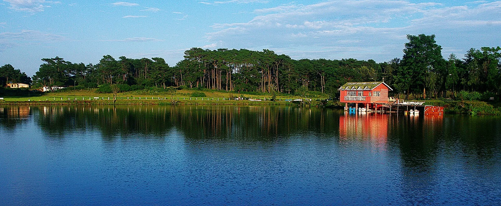
Jowai
Jowai is Meghalaya’s West Jaintia Hills administrative centre, where visitors find district-wide business and educational services and encounter the Pnar community’s matrilineal traditions.
Key facts · verified by Ghumoopedia editors
- Type of place
- Natural attraction
- Best time to visit
- October to May; the monsoon is dramatic for waterfalls but roads and treks become slippery
- Nearest railway station
- Haflong Hill · about 90 km (straight line)
- Nearest airport
- Shillong Airport (Umroi) · about 35 km (straight line)
- Verified
- 21 Nov 2026
Plan a trip from Jowai — a day-by-day route through places nearby.
Jowai serves as the administrative headquarters of West Jaintia Hills district in Meghalaya, India. It is home to the Pnar, a Khasi sub-group. The town occupies a plateau with the Myntdu river enclosing it on three sides; Bangladesh lies to its south, around 50 km from the Indo-Bangladesh border. At 1,365 metres above sea level, Jowai has warm summers, while winters are cool or chilly. Its importance extends across the district as a centre for business and education, with schools, colleges, hospitals and postal facilities. Educational services also cater to learners from nearby areas of Assam and Bangladesh. Among the Pnar, as among the Khynriam community of Nongphlang, family life follows a matriarchal system: daughters inherit family property. The Khasi, Jaintia and Garo communities follow matrilineal traditions, and community councils manage much of the land visitors pass through. Meghalaya is among the wettest places on earth: Sohra and Mawsynram receive extreme monsoon rainfall. Shillong is cool all year, and fog can close viewpoints at any season. The usual best time to visit is October to May; the monsoon is dramatic for waterfalls but roads and treks become slippery. Days are short in Northeast India: the sun can set before 5 pm in winter, so plan to reach and leave Jowai in daylight. Timings, fees and access arrangements must be confirmed locally. For official information, see Meghalaya Tourism at https://www.meghalayatourism.in.
Why it matters
Jowai is the administrative headquarters of West Jaintia Hills and an important service, education and trading centre for the surrounding region. It is home to the Pnar, a sub-tribe of the Khasi people, and offers visitors a way to learn about Pnar life and the wider Jaintia Hills. The town occupies a plateau bordered on three sides by the Myntdu River, with the Bangladesh border to the south. Nearby sites include riverside landscapes and places of cultural and historical interest. Jowai is not itself a single protected natural monument, and visitors should check the status and access rules of individual sites with local authorities or community managers.
Jowai lies in the Jaintia Hills, homeland of the Pnar people and part of the wider region historically associated with the Jaintia kingdom. The kingdom’s political history is documented across the hills, but the precise early origins and development of Jowai as a settlement are not consistently recorded; it is safer to describe the town’s growth in general terms than to assign it a founding date. British rule expanded into the Jaintia Hills in the nineteenth century, and the kingdom was annexed by the British in 1835. The area subsequently became part of colonial administrative arrangements and later of independent India’s Assam, before Meghalaya became a state in 1972. Jowai developed as a regional centre for administration, commerce and education. West Jaintia Hills is now a separate district, with Jowai as its headquarters. The surrounding landscape and community institutions remain closely connected to local life. At nearby Syntu Ksiar, a memorial honours freedom fighter Kiang Nangbah, who led resistance to British rule and was executed in the nineteenth century. Visitors can learn about this history at the site while following local guidance and respecting memorial spaces.
Origin stories & folklore
Stories associated with the Jaintia Hills are part of living oral traditions, and versions may differ between families and communities. Local accounts connect the Myntdu River and the landscape around Jowai with the histories and identities of the Pnar people. Syntu Ksiar, a scenic riverside area near town, is also associated with remembrance of Kiang Nangbah and the struggle against British rule; its historical significance should not be confused with a single origin myth. Ask a local guide or host whether a story is appropriate to share at a particular place. Do not treat sacred or family-held knowledge as public folklore, and avoid presenting one version as universal.
Use Jowai as a base to understand local life: walk through the market area, visit community-run attractions and ask your host about nearby viewpoints and short excursions. Always ask before photographing people, homes or ceremonies. A comfortable itinerary is one main visit in the morning, a local meal at midday and a short nearby stop before an afternoon return. Use the district list on this site to find other places in West Jaintia Hills, but check the actual road route and its condition before combining stops. If a festival is on, local roads and stays can be busy — and the experience can be unforgettable. Leave no litter: many sites in Meghalaya are protected by the communities who own them.
Suggested itineraries
Half day: Market walk (about 1 hour), visit Syntu Ksiar (about 1–2 hours), then return to town for a meal. Full day: Explore Jowai market and local life (about 1–2 hours), visit Syntu Ksiar (about 1–2 hours), then choose one nearby attraction such as Thadlaskein Lake or Tyrshi Falls (allow several hours including the road journey). Gentler option: Spend a relaxed morning in central Jowai, take a short taxi outing to a viewpoint or accessible riverside area after checking the ground conditions, and return to town for lunch.
Pnar culture is an important part of daily life in Jowai and the surrounding Jaintia Hills. Pnar is widely spoken, alongside Khasi, English and other languages used in education and commerce. Matrilineal customs shape inheritance and family identity: traditionally, daughters inherit family property. Music, dance, ceremonial dress and community gatherings are visible during festivals, though practices vary by locality and occasion. Visitors may encounter local foods and produce in the market and can learn more through respectful conversation. Ask before photographing people, homes, performances or ceremonies, and follow any guidance from organisers or community members.
Local communities
The Pnar, a sub-tribe of the Khasi people, are closely connected with Jowai and the surrounding hills. Khasi and other communities also live, work and study in the district. Livelihoods include trade, public services, education, farming and other local businesses; the town serves as a hub for nearby villages. Community councils and local institutions have important roles in managing land and community affairs. Some attractions are on community-managed land, so visitors should respect local rules, seek permission where appropriate and avoid assuming that every place is open for unrestricted access.
Festivals & events
Behdeinkhlam, an important Pnar festival associated with Jowai, is generally celebrated during the monsoon season, usually in July. Its processions and community events can draw visitors and make local roads and accommodation busier. Other Jaintia celebrations, including agricultural and seasonal festivals, take place in the wider region; observances and public access vary by community and year. Confirm locally whether an event is open to visitors and whether photography is welcome. During festival periods, allow extra time for travel and follow instructions from organisers, residents and community authorities.
Local food in Meghalaya includes jadoh (rice cooked with meat), dohneiiong (pork with black sesame), tungrymbai (fermented soybean), pumaloi and Garo dishes such as kapa. Ask what is fresh that day; many small eateries cook a limited daily menu. Pork, beef, fish and fermented ingredients are common in tribal cuisines, so vegetarian travellers should explain their needs clearly — rice, dal, vegetables and eggs are usually possible in towns. Remote sites may have no restaurant at all. Carry water and snacks, eat a proper breakfast before long drives, and ask your accommodation for a packed lunch if you are heading out early. Try a homestay-cooked meal when you can — it is often the best food in the hills. Choose busy, clean places and carry your packaging back to town.
Shopping & local experiences
Jowai’s market is a practical place to browse local produce, everyday goods and regional food. Look for seasonal fruits and vegetables, locally made or woven items where available, and packaged foods from the area. Availability varies, and not every item sold as a souvenir is locally produced; ask sellers about its origin. Trying a meal at a local eatery can be a good way to experience regional flavours. Buy respectfully, avoid bargaining in a way that dismisses a maker’s work, and ask before photographing stalls or vendors.
Jowai sits on a plateau at about 1,365 metres above sea level, with the Myntdu River curving around three sides of the town and the Bangladesh border to the south. The surrounding West Jaintia Hills include river valleys, hillsides, cultivated land and patches of forest. Nearby waterfalls and lakes provide opportunities to experience the region’s varied terrain, especially after the rains, when paths can be slippery and water conditions change. Meghalaya’s monsoon brings heavy rainfall, so visibility and access may vary. Local birds and other wildlife may be present, but sightings are never guaranteed. Keep to established paths, avoid disturbing wildlife and carry litter back out.
October to May; the monsoon is dramatic for waterfalls but roads and treks become slippery
The nearest principal railway station by straight-line distance is Haflong Hill, roughly 90 km away. The nearest operating airport by straight-line distance is Shillong Airport (Umroi), roughly 35 km away. These figures are calculated from map coordinates — hill roads in Meghalaya wind a lot, so actual road distance and travel time are usually much longer. Guwahati is the main rail and air hub for the region, and most long-distance journeys connect through it. For the final leg, Meghalaya Transport Corporation (MTC) and shared taxis from Shillong’s Police Bazaar and Anjalee terminals link district towns; shared taxis usually leave early in the morning and depart only when full. A private taxi gives more flexibility for remote sites. When comparing train, bus and flight, count the complete door-to-door time: a flight saves the most time only if the onward road transfer is short, while an overnight train to Guwahati plus a road journey can save a hotel night. Book your return before you leave, because seats on shared vehicles and the few daily flights fill quickly. Current train numbers, timings, return services and fares are not listed here; check IRCTC and NTES for trains and the airline’s own schedule for flights. No Inner Line Permit is needed for Indian visitors to Meghalaya. Many villages, caves, waterfalls and living root bridges charge a small community entry or parking fee, and some sites have their own visitor rules.
Confirm onward and return timings on IRCTC / NTES, the state bus operator or your airline before travel. A dash means current timings or fares have not been verified.
Getting around
Jowai is compact enough to explore parts of the town on foot, though slopes, traffic and weather can make walking tiring. Local taxis and shared vehicles are useful for reaching sites outside the centre; arrange a return journey in advance for less-visited places. Local buses or shared transport may serve some routes, but availability can vary. Ask your accommodation or a local driver about road conditions, pick-up points and suitable drop-offs. Parking is usually informal and site-dependent, so do not block access roads or community spaces. There are no visitor boat services to rely on for getting around.
Hours, tickets & permissions
Jowai is a town rather than a single ticketed attraction. Entry rules, opening arrangements and any fees vary among nearby sites, especially where access is managed by a community, religious institution or public authority. Some places may have restrictions on photography, ceremonies or access to particular areas. Carry identification if requested and follow posted notices or local instructions. Confirm current hours, fees and access arrangements with the site’s managing authority or a local host before setting out; do not assume that a site is open simply because the surrounding area is accessible.
Facilities
Jowai has shops, eateries, accommodation and everyday services, with facilities more limited at rural attractions. Food and drinking water are usually easier to find in town than at smaller sites; carry water and snacks for longer outings. Toilets, parking and seating may be available at popular locations but should not be assumed, so check locally. ATMs and medical services are available in town, though access can vary outside it. Local guides or drivers may be arranged through accommodation or community contacts. Take rubbish back with you where bins are absent.
Accessibility
Conditions vary between central Jowai and nearby natural sites. Town streets may have uneven surfaces, slopes, traffic and limited pedestrian space. Riverbanks, waterfalls and other outdoor attractions can involve steps, rough paths or slippery ground, especially in the monsoon; walking distances and shade also vary. Wheelchair and stroller access should not be assumed, and there may be no accessible toilets or handrails at rural locations. Visitors with limited mobility, elderly travellers and families with young children should check the specific route and recent conditions with a local host, and consider a taxi drop-off close to the site where permitted.
No Inner Line Permit is needed for Indian visitors to Meghalaya. Many villages, caves, waterfalls and living root bridges charge a small community entry or parking fee, and some sites have their own visitor rules. Carry a photo ID at all times; checkpoints are common. Save the emergency number 112 and your accommodation’s contact offline. Heat, humidity and sudden downpours are the main weather risks; carry water and rain protection. Respect community rules, private property and posted instructions. Avoid hill road travel after dark and during heavy rain, when landslides are more likely. Check official advisories for the region before travel, and follow local guidance if access changes.
Photography
Soft morning or late-afternoon light can suit the town, river and surrounding hills, but mist and cloud may obscure views. Syntu Ksiar and other riverside areas offer possible viewpoints; remain on safe ground and follow local signs. Photography in public areas is generally possible, but ask permission before photographing people, homes, performances or ceremonies. Respect restrictions at religious, memorial and community-managed sites. Drone use may require permissions and can be restricted; check current rules with the relevant authority before flying, and never fly over crowds or private land without consent.
Choose a stay by the full journey to Jowai, not just the district name. Main towns in West Jaintia Hills usually offer hotels, state tourism lodges and homestays with better transport, meals and medical access, while village homestays offer a closer connection to local life. In the plains and valleys, check fans or air-conditioning and mosquito nets in summer. Book in advance for weekends, festival dates and the peak season (October to May; the monsoon is dramatic for waterfalls but roads and treks become slippery). Confirm the exact location, meals included, check-in time and cancellation terms in writing. Many homestays accept payment on arrival; avoid sending money to unverified contacts. Mobile network and digital payments can be unreliable in remote areas, so carry some cash.
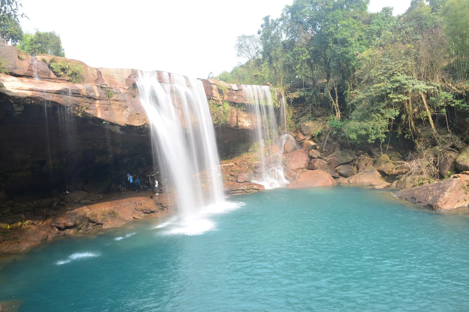
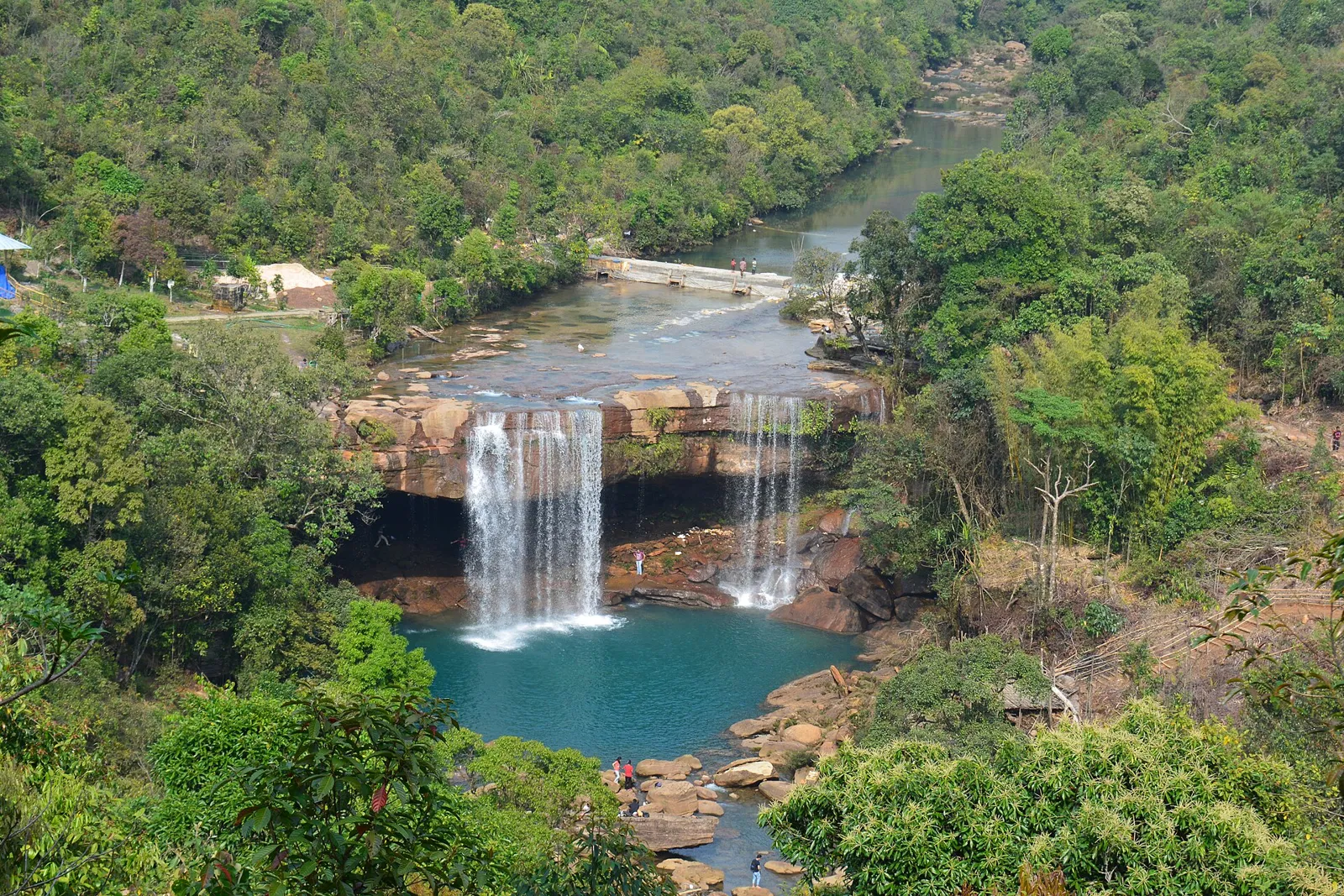
Within the wider Jaintia Hills, Syntu Ksiar is a riverside site near Jowai associated with Kiang Nangbah. Thadlaskein Lake is a well-known local outing, while Tyrshi Falls offers a waterfall visit when access and conditions permit. Nartiang is noted for its monoliths and the Nartiang Durga Temple, important cultural and historical sites in the region. Krang Suri Falls is another established attraction in West Jaintia Hills. These stops are not all close together, and road conditions can change, so check routes locally and avoid combining too many sites in one day.
For couples, Jowai rewards a slow pace: arrive early for soft light and fewer crowds, share a local meal and keep the evening free. Public displays of affection can be frowned upon in conservative communities and at religious sites, so be discreet. A homestay can make the trip memorable — confirm privacy, hot water and transport back. Keep a buffer day in your itinerary, because weather and road closures can delay plans in Meghalaya.
Q: How much time should I allow for Jowai? A: A half day can cover central Jowai and one nearby stop; allow a full day if you want to include a more distant attraction. Q: When is a good season to visit? A: October to May is generally more convenient for travel. Monsoon scenery can be dramatic, but rain may make roads and paths slippery. Q: Is there an entry fee for Jowai? A: Jowai is a town, not a single ticketed site. Rules and any fees depend on the individual attraction, so confirm locally. Q: Is Jowai suitable for children and elderly visitors? A: The town can be explored at a gentle pace, but outdoor sites may have uneven, steep or slippery paths. Check each route and conditions before visiting. Q: Can I stay near Jowai? A: Accommodation is available in and around town, though choice varies. Book ahead during festivals and confirm transport plans for rural attractions.
Be the first to share photos, stories, advice or a helpful contact for Jowai.
Loading…