
District · Meghalaya
West Jaintia Hills
West Jaintia Hills offers a mix of Pnar cultural heritage and Meghalaya’s upland scenery, with Jowai as its main town and practical base.
West Jaintia Hills brings together Meghalaya’s rolling uplands, waterfalls, lakes and river valleys with the cultural heritage of the Pnar people. Jowai, the district headquarters, is its principal urban base and a useful starting point for exploring the surrounding countryside. Nartiang, associated with the former Jaintia kingdom, preserves an important strand of the district’s history through its Durga Temple and monoliths. Thadlaskein Lake, also known as Pung Sajar Nangli, is a historic man-made lake, while Krang Suri Falls draws visitors to the district’s waterfall landscape. Farther south, Dawki lies beside the Umngot River near the Bangladesh border. Living traditions, village communities and sacred places are as much a part of the district’s character as its scenery.
West Jaintia Hills offers a mix of Pnar cultural heritage and Meghalaya’s upland scenery, with Jowai as its main town and practical base. Travellers come for places linked to the former Jaintia kingdom, including Nartiang’s temple and monoliths, as well as Thadlaskein Lake and Krang Suri Falls. Dawki and the Umngot River add a southern river-valley experience. The district is a useful way to explore the Jaintia Hills beyond Shillong, combining village landscapes, sacred places and regional traditions. Its appeal lies in these varied experiences rather than in a single sightseeing hub.
The district is part of the homeland of the Pnar, also widely called Jaintia. The Jaintia kingdom developed across parts of what are now Meghalaya and Bangladesh; Nartiang is associated with its earlier centres of power, while Jaintiapur, now in Bangladesh, became an important later capital. Nartiang’s monoliths and Durga Temple preserve links to the kingdom and to religious traditions shaped by both local and wider South Asian influences. British expansion brought the kingdom into conflict with colonial rule, and the British annexed the Jaintia Hills in 1835. The area was subsequently administered as part of the colonial province of Assam. Meghalaya became a state in 1972, and the Jaintia Hills formed a district within it. In 2012, that district was divided into East and West Jaintia Hills, creating the present district. Jowai became the headquarters of West Jaintia Hills. Pnar customs and community institutions remain important to local identity, alongside religious and historical sites that attract visitors.
5 destination guides · 4 on the map
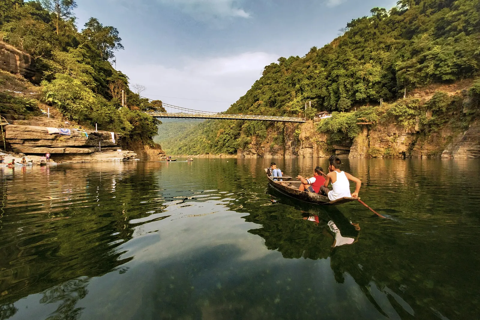
Dawki
Dawki, also known as Dauki, is a town in Meghalaya’s West Jaintia Hills district, India. People visit to see the town and learn its place within the district.
Jowai
Jowai is Meghalaya’s West Jaintia Hills administrative centre, where visitors find district-wide business and educational services and encounter the Pnar community’s matrilineal traditions.
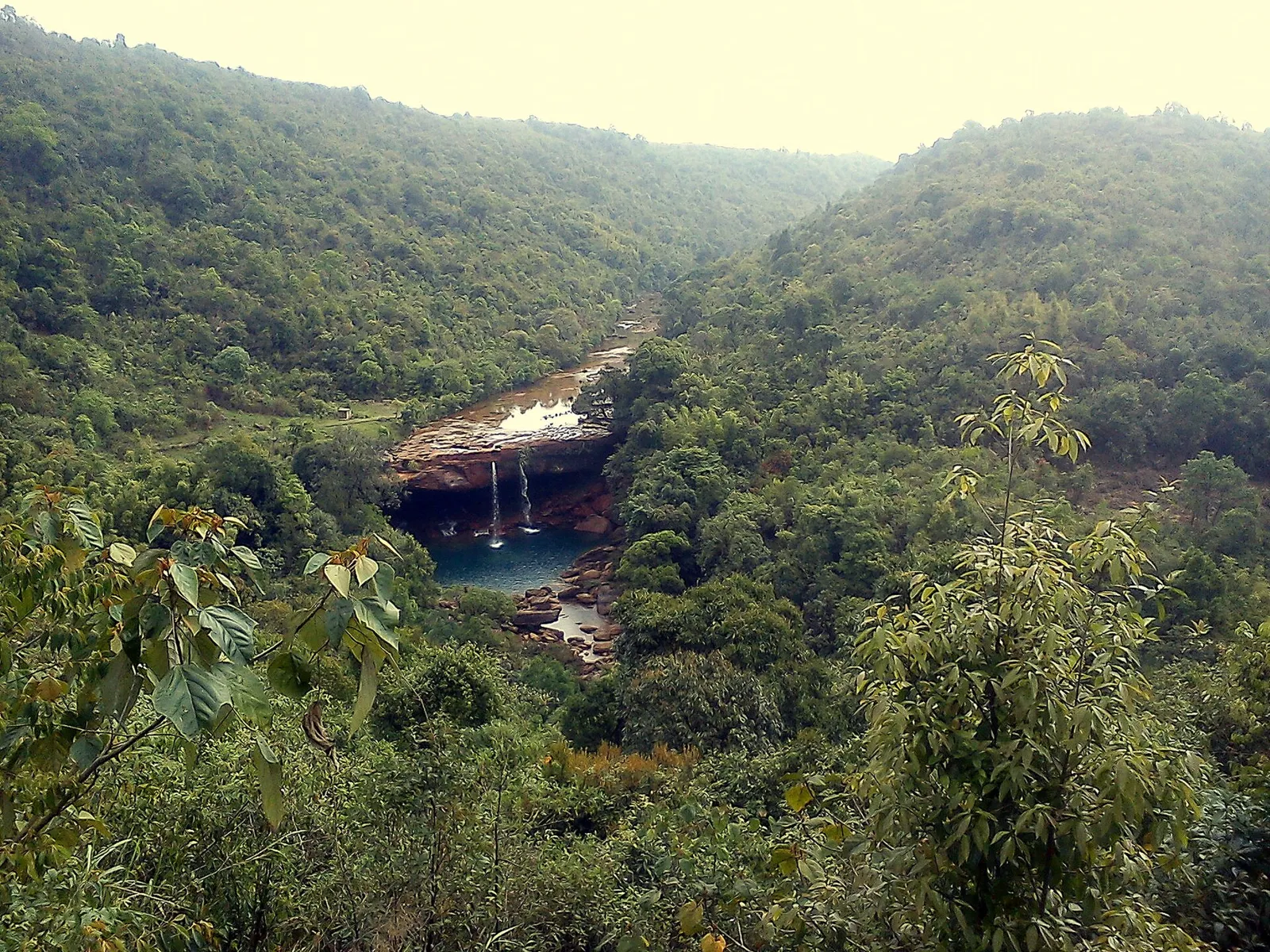
Krang Suri Falls
Krang Suri Falls is a waterfall in Meghalaya’s West Jaintia Hills district. People visit to see this natural feature of the region.
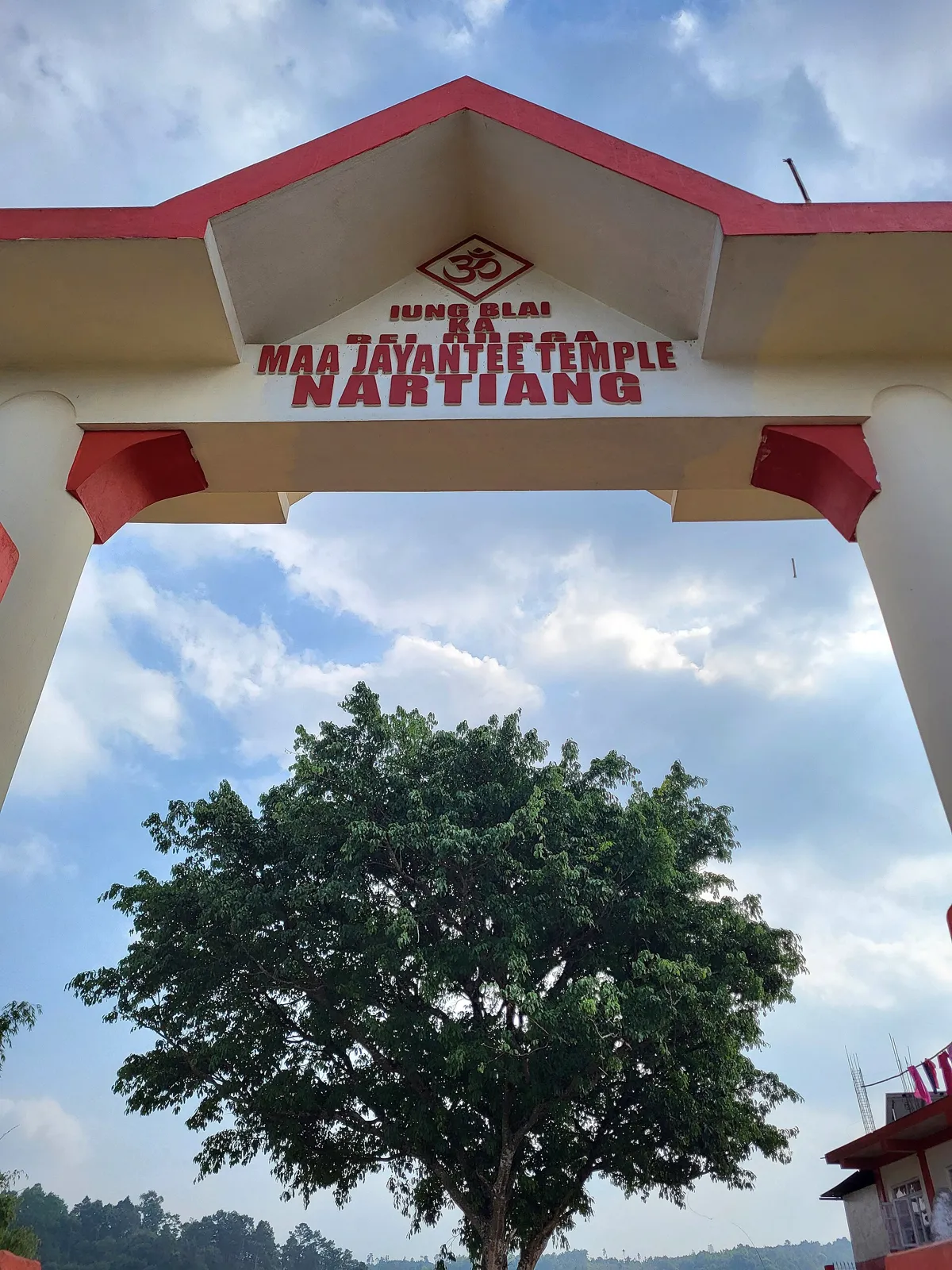
Nartiang Durga Temple
In Meghalaya’s West Jaintia Hills, Nartiang Durga Temple is a Hindu shrine revered in Shaktism. Pilgrims come for Durga Puja and to worship at a site counted among the 51 Shakta pithas.
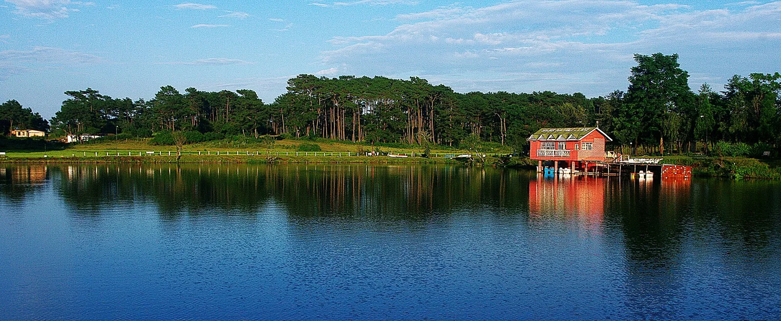
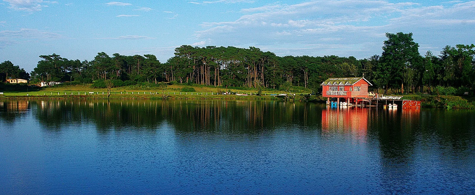
Thadlaskein Lake
Thadlaskein Lake, also called Pung Sajar Nangli, is a historic artificial lake in Meghalaya. Visitors can see the lake and hear the folktale of its creation by Sajar Nangli and his followers.
Food in the Khasi-Jaintia region commonly features rice, meat, seasonal vegetables and fermented ingredients. Dishes found more widely in Meghalaya include jadoh, rice cooked with meat; dohneiiong, pork with black sesame; tungrymbai, fermented soybean; and pumaloi, steamed powdered rice. These are regional foods rather than specialities exclusive to West Jaintia Hills. Small eateries often prepare a limited daily menu, so ask what is fresh. Vegetarian travellers should clarify whether dishes contain meat, stock or fish; rice, dal, vegetables and eggs may be available in towns. Carry water and snacks when visiting outlying sites, where food options can be sparse.
Bamboo and cane work belong to the wider craft traditions of Meghalaya, including the Khasi-Jaintia hills. Baskets and other practical household or agricultural objects reflect skills shaped by everyday rural life. Handwoven textiles also form part of the region’s cultural expression, with cloth used in traditional dress and ceremonial settings. These traditions should not be treated as exclusive to West Jaintia Hills. In Jowai and local markets, ask sellers where an item was made and whether it is handmade; buying directly from makers, where possible, supports local skills.
Behdienkhlam, a major Pnar festival, is celebrated in Jowai during the monsoon season, usually in July. Its processions, rituals and gatherings can draw visitors from across the region, so rooms and transport may be busier than usual. Durga Puja is observed at Nartiang and elsewhere in the autumn, with local religious gatherings. Festival arrangements and attendance vary by year; travellers hoping to visit during a celebration should check locally and arrange accommodation ahead. These events are living community traditions, so visitors should follow local guidance at ceremonies.
The district’s terrain ranges from rolling uplands and wooded slopes to steep valleys and river corridors. Jowai sits on the plateau, while waterfalls and streams descend through the surrounding hills. Thadlaskein Lake lies in the upland countryside, and the Umngot River flows past Dawki in the south. Forest patches, farmland and villages are interspersed across the area. These varied elevations and winding roads make journeys slower than map distances might suggest; rain can also affect access to rural stops and river areas.
West Jaintia Hills has a wet monsoon season, generally from late spring or early summer into autumn, when heavy rain can reduce visibility and make roads slippery. The warmer months before and during the monsoon are often humid. Winter is usually cooler and comparatively drier, making October through April a convenient period for sightseeing, though conditions can change across elevations. Pack a light rain jacket or umbrella in any season, sturdy footwear for wet paths, and warmer layers for evenings and winter mornings. Check local forecasts before setting out to waterfalls or rivers.
Shillong Airport at Umroi is a nearby air gateway, while Guwahati is the main regional hub for flights and long-distance rail travel. Guwahati railway station is a practical arrival point for onward road journeys into Meghalaya. Road access commonly runs through Shillong towards Jowai, with onward connections to Nartiang, Thadlaskein Lake, Dawki and other destinations. Shared taxis and buses serve main routes, but departures and connections vary; hired vehicles can be useful for waterfalls and dispersed rural stops. Allow extra time for winding hill roads, rain and traffic, and arrange return transport before visiting remote places. Check current services locally.
Jowai is the main road hub for the district, with road connections towards Shillong, Nartiang, Thadlaskein Lake, Krang Suri Falls and Dawki. Buses and shared jeeps operate on principal routes, but service frequency and connections can vary, especially for smaller villages and rural attractions. Taxis or a hired vehicle make it easier to combine dispersed stops; local autos may be available for shorter journeys around towns. Boating is offered on parts of the Umngot River near Dawki, subject to local conditions and arrangements. Confirm return transport before travelling to less-served places.
2 days: Jowai → Thadlaskein Lake → Nartiang Durga Temple; sleep in Jowai. 3 days: Jowai → Nartiang Durga Temple → Krang Suri Falls → Dawki; sleep in Jowai on night one and Dawki on night two. 4 days: Jowai → Thadlaskein Lake → Nartiang Durga Temple → Krang Suri Falls → Dawki; sleep in Jowai on nights one and two and Dawki on night three.
Jowai is the most practical base for Nartiang, Thadlaskein Lake and nearby countryside, with hotels, guesthouses and homestays generally the most useful options. For a circuit extending to Dawki, staying there can reduce backtracking; accommodation is more limited and may include guesthouses or homestays. Small-town and rural facilities are simpler than those in Shillong, and availability can be seasonal. Confirm that a government lodge or other institutional accommodation is open and accepts visitors before relying on it.
Hill roads are winding, and rain, fog, landslides or roadworks can disrupt travel; allow flexibility and avoid rushing after dark. Waterfall paths may be slippery, while river levels and currents can change quickly. Do not enter water or approach edges without checking local advice, and use authorised local operators for boating. Carry drinking water and use treated or sealed water where its safety is uncertain. Mobile connectivity can be patchy outside towns, so share plans and arrange return transport in advance. Keep a respectful distance from wildlife and follow local directions at sacred sites. Check official sources for any current permit or entry requirements before travel.
- Ri-Bhoiabout 36 km
- East Khasi Hillsabout 51 km
- Morigaon · Assamabout 87 km
- Kamrup Metropolitan · Assamabout 88 km
- Dima Hasao · Assamabout 88 km
- West Khasi Hillsabout 94 km
- Kamrup · Assamabout 104 km
- Darrang · Assamabout 122 km
Straight-line distance between the centres of each district's destinations; road distance is longer.
All districts of Meghalaya
Q: How many days should I spend in West Jaintia Hills? A: Two days can cover Jowai and nearby heritage or lake stops; allow three or four days to include Krang Suri Falls and Dawki at a more relaxed pace. Q: When is the best time to visit? A: October through April is generally convenient for sightseeing, while monsoon months bring heavier rain and more challenging road conditions. Q: What is the best base for exploring the district? A: Jowai is the most practical base for the northern and central sights; stay in Dawki as well if your route includes the Umngot River. Q: How do I get to West Jaintia Hills? A: Travel by road from Shillong or Guwahati, using Guwahati as a major air and rail gateway and arranging onward road transport to Jowai. Q: Is the district suitable for families or elderly travellers? A: Yes, with planning. Town visits are generally more manageable, but uneven paths, stairs, wet ground and long winding drives may limit access at waterfalls and rural sites.
This page draws on our 5 destination guides for West Jaintia Hills and is updated as our team checks it.
Be the first to share photos, stories, advice or a helpful contact for West Jaintia Hills.
Loading…