
District · Meghalaya
West Garo Hills
West Garo Hills offers a way to experience Meghalaya beyond its better-known eastern hill towns.
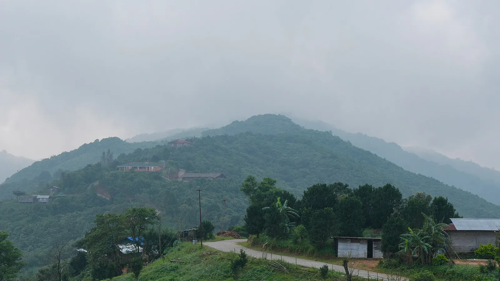
West Garo Hills occupies the western part of Meghalaya’s Garo Hills, a landscape of forested ridges, valleys, streams and settlements that descends toward the plains. Tura, the district’s principal town, is a hub for markets, administration and travel into the surrounding hills. The district is home to Garo communities, whose language, matrilineal traditions and village life shape its character. Nokrek National Park lies within the wider Nokrek Biosphere Reserve, an important area of forest and biodiversity near Tura. Agriculture and local trade remain part of everyday life, while festivals such as Wangala reflect Garo harvest traditions. The district brings together busy town life and quieter rural landscapes.
West Garo Hills offers a way to experience Meghalaya beyond its better-known eastern hill towns. Tura, the district’s principal town, is a practical base for exploring Garo Hills and a centre for local markets and services. The district is especially associated with Garo communities, whose matrilineal traditions, language and village life are part of the region’s identity. Forested Nokrek and the wider Nokrek Biosphere Reserve are notable for their biodiversity and provide a contrast to Tura’s busy streets and surrounding settlements. Wangala, a harvest festival of the Garo people, is another reason to learn about local culture. Come for a mix of hill scenery, community life and nature, allowing time for slower road journeys.
The history of West Garo Hills is rooted in Garo communities and their village-based systems of customary authority. Traditionally, a nokma—the head of a village and its land—has an important role in local affairs. Garo society is matrilineal, with descent and inheritance commonly traced through the mother’s line. The region was not shaped by a single long-standing dynasty in the way some parts of India were; village communities and customary institutions were central to its social organisation. British expansion into the Garo Hills in the late nineteenth century brought the area under colonial administration after military campaigns and resistance. Tura developed as an administrative centre during this period. After Indian independence, the Garo Hills formed part of Assam. Meghalaya became a state in 1972, and the former Garo Hills district was later divided; West Garo Hills was established as a separate district in 1976, with Tura as its headquarters. Administrative boundaries have since changed further as additional districts were created.
2 destination guides
Nokrek National Park
Nokrek National Park is a protected area in Meghalaya’s Garo Hills and the central part of the Nokrek Biosphere Reserve, known for its biodiversity and UNESCO recognition.
Tura
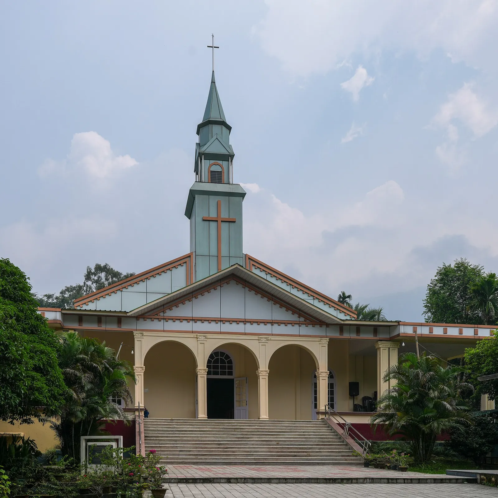
Tura is a municipality in Meghalaya’s West Garo Hills, serving as a cultural and administrative centre for the Garo people. Visitors find it among the foothills, valleys and streams.
Garo and wider Meghalaya food traditions are prominent in West Garo Hills. Rice is a staple; regional dishes include jadoh, rice cooked with meat, and dohneiiong, pork prepared with black sesame. Garo dishes such as kapa and fermented soybean, known regionally as tungrymbai, offer other local flavours. Pork, beef, fish and fermented ingredients are common, though recipes and menus vary between households and eateries. Small restaurants may cook only a limited selection each day, so ask what is fresh. Vegetarian travellers should explain their needs clearly; rice, dal, vegetables and eggs may be available in town. Carry water when visiting remote sites, where food outlets may be absent.
Garo weaving and bamboo and cane work are part of the craft traditions found in West Garo Hills and the wider region. Garo women traditionally weave garments, including the dakmanda, a wraparound cloth often associated with women’s dress. Bamboo and cane are used for baskets, mats and practical household or agricultural items. Designs, materials and availability vary between communities and makers, and many objects are made for everyday use rather than tourist markets. Visitors interested in buying locally made work can ask in Tura or nearby villages about its maker and where it was produced.
Wangala, the Garo harvest festival, is generally celebrated after the agricultural season, often in autumn, and features traditional music, dance and community gatherings. The 100 Drums Wangala Festival is a regional cultural event associated with this tradition; its programme and location can vary. Christmas is widely observed in the district, alongside village and community celebrations through the year. Festival periods can bring more visitors to Tura and busier local transport, while accommodation choices may be limited in smaller places. If travelling for a major event, check the current programme and arrange a room ahead.
The district’s terrain moves from forested Garo Hills ridges and uplands to valleys, streams and lower plains toward the west. Tura sits among hills, while the forested Nokrek area is part of the wider Nokrek Biosphere Reserve. Rivers and smaller waterways run through the valleys and settlements. Steep or winding roads and seasonal rain shape travel between town and rural areas; journeys can be slow even when places appear close on a map. Forest access and walking conditions vary, so check locally before setting out.
West Garo Hills has a warm, humid climate, with a pronounced monsoon season. The pre-monsoon months can feel hot, while the rains, usually from around June into September, may make roads muddy or slow. Winter, broadly from November to February, is generally drier and more comfortable for road travel and outdoor visits. October to April is often a convenient period to plan a trip, though conditions vary. Pack breathable clothing, a light layer for cooler evenings, sturdy shoes and rain protection; during the monsoon, carry waterproof bags and allow extra time for journeys.
Tura is the main road hub for West Garo Hills and can be reached by road from Guwahati and Shillong; journeys through the hills can take longer than map distances suggest. The nearest operating airport is Lokpriya Gopinath Bordoloi International Airport in Guwahati. Mendipathar is the nearest principal railway station, while Guwahati is a major rail hub for onward connections. Buses and shared or private taxis serve regional routes, and local vehicles can be useful for reaching places beyond Tura, including Nokrek. Transport choices may be limited in remote areas, so plan onward travel locally and check current services locally.
Tura is the district’s main transport hub, with road connections to other towns and regional routes toward Guwahati and Shillong. Local buses, shared jeeps and taxis serve common corridors, while private vehicles can be more practical for reaching rural areas or arranging a return journey. Autos are useful for some short trips within Tura, but should not be assumed to serve every route. Services can be less frequent beyond town, particularly in poor weather. Ask locally about the road condition and return options before travelling toward Nokrek or other remote areas.
2 days: Tura → Nokrek National Park; sleep in Tura. 3 days: Tura → Nokrek National Park → Tura; sleep in Tura both nights.
Tura is the most practical base for both a short town visit and an excursion toward Nokrek, with hotels and guesthouses and access to everyday services. Homestays may be available in some rural areas, but options and facilities vary, so arrange them in advance and confirm transport. Government accommodation may be available in some locations, but availability should be checked directly. For a short circuit, staying in Tura avoids changing lodging; remote-area visits are best planned around confirmed access and a reliable return to town.
Hill roads can be narrow, winding and affected by heavy rain, slips or poor surfaces; avoid rushing and check conditions before travelling. Wear sturdy footwear on uneven or muddy ground, and keep a respectful distance from wildlife in forest areas. Use treated or bottled water if the safety of local drinking water is uncertain. Mobile connectivity can be patchy outside Tura, so share plans and do not rely on a signal for navigation or emergencies. Before visiting Nokrek, confirm current access, guide arrangements and any protected-area permissions with the relevant forest authorities; do not assume entry is unrestricted.
- Dhubri · Assamabout 66 km
- South Garo Hillsabout 71 km
- Goalpara · Assamabout 84 km
- Kokrajhar · Assamabout 92 km
- West Khasi Hillsabout 109 km
- Cooch Behar · West Bengalabout 115 km
- Barpeta · Assamabout 139 km
- Alipurduar · West Bengalabout 142 km
Straight-line distance between the centres of each district's destinations; road distance is longer.
All districts of Meghalaya
Q: How many days should I spend in West Garo Hills? A: Two days can cover Tura and a planned visit toward Nokrek; allow three days if you want a less hurried schedule and flexibility for road conditions. Q: When is the best time to visit? A: The drier months, broadly October to April, are often easiest for travel. Monsoon scenery is lush, but rain can disrupt road journeys. Q: Where is the best base? A: Tura is the most practical base for transport, services and arranging onward travel around the district. Q: How do I get to West Garo Hills? A: Travel by road to Tura, commonly via Guwahati or Shillong. Guwahati is the nearest operating airport and a major rail hub; Mendipathar is the nearest principal railway station. Q: Is the district suitable for families or elderly travellers? A: Tura is manageable for many visitors, but winding roads, uneven paths and limited services in remote areas may make some excursions challenging. Choose outings to suit mobility and check conditions locally.
This page draws on our 2 destination guides for West Garo Hills and is updated as our team checks it.
Be the first to share photos, stories, advice or a helpful contact for West Garo Hills.
Loading…