
District · Meghalaya
Ri-Bhoi
Ri-Bhoi is a useful introduction to Meghalaya for travellers arriving from Guwahati, and a quieter counterpoint to time in Shillong.
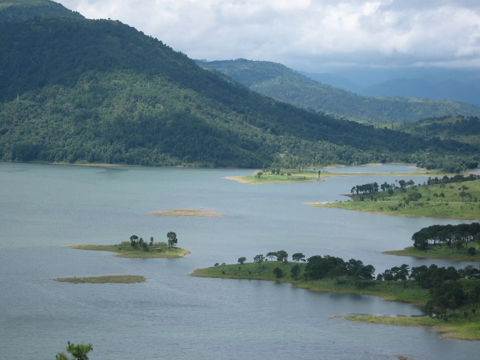
Ri-Bhoi forms an important gateway to Meghalaya, with wooded hills, cultivated valleys and villages along the road between Guwahati and Shillong. Nongpoh is the district headquarters, while Umiam Lake, also called Bara Pani, is its best-known waterside landscape. This reservoir, created for hydroelectric development, brings broad stretches of water into the surrounding hills. Established in 1992 after being separated from East Khasi Hills district, Ri-Bhoi combines busy roadside settlements with quieter agricultural countryside. Its character is shaped by Bhoi communities within the wider Khasi cultural world, alongside other communities. Markets, farming and everyday village life offer context beyond the lake views, making the district more than a transit corridor.
Ri-Bhoi is a useful introduction to Meghalaya for travellers arriving from Guwahati, and a quieter counterpoint to time in Shillong. Its best-known sight is Umiam Lake, or Bara Pani, a broad reservoir set among wooded hills and created for hydroelectric development. The district also offers a view of everyday life beyond the main road: Nongpoh’s markets, cultivated valleys and villages shaped by Bhoi communities within the wider Khasi cultural world. It suits visitors who want a waterside pause, a road-based exploration of the countryside or an overnight stop between Assam and the Meghalaya capital.
The area now called Ri-Bhoi has long been part of the Khasi cultural and political landscape. Khasi society was organised through local communities and principalities governed by Syiems and other traditional authorities; the histories and boundaries of these polities do not always correspond to modern district lines. During British expansion into the Khasi Hills in the nineteenth century, conflict with Khasi rulers culminated in the Anglo-Khasi War of 1829–33 and the extension of colonial influence over the region. British administration and later Indian state administration reshaped governance, while customary institutions continued to matter in community life. Meghalaya became a state in 1972. Ri-Bhoi was created as a separate district in 1992, carved out of East Khasi Hills, with Nongpoh as its headquarters. Umiam Lake reflects a more recent chapter: the reservoir was developed for hydroelectric generation and became a prominent feature of the district’s landscape and travel identity.
Food in Ri-Bhoi draws on the wider Khasi and Meghalaya repertoire rather than a single district-specific cuisine. Dishes to look for include jadoh, rice cooked with meat; dohneiiong, pork with black sesame; tungrymbai, fermented soybean; and pumaloi, a steamed rice preparation. Rice, meat, seasonal vegetables and fermented ingredients feature in regional food traditions. Small eateries may prepare only a limited daily menu, so ask what is fresh. Vegetarian travellers should explain whether they avoid meat stocks and fermented fish as well as meat. Carry drinking water and snacks when visiting places away from towns.
Ri-Bhoi is associated with eri silk work, particularly around Umden and Diwon, where spinning and weaving remain important textile traditions. Eri yarn can be woven into shawls, wraps and other fabrics, and natural dyes are part of the area's craft practice. Across the wider Khasi and Meghalaya region, bamboo and cane are also used for baskets, carrying containers and everyday household objects. When buying textiles or basketry, ask who made them and which materials were used. Visits to working households or weaving groups are best arranged with permission.
Festival calendars vary between communities and villages. Khasi cultural celebrations observed across the wider region include Shad Suk Mynsiem, generally held in spring, and the Nongkrem festival, usually associated with autumn; the best-known Nongkrem observances take place outside Ri-Bhoi. Local community and harvest gatherings may also be important, so visitors should check locally rather than assume a district-wide event. Festival periods can bring extra visitors to regional centres and busier roads, while accommodation in Nongpoh, Shillong and around Umiam may be more sought after.
Ri-Bhoi is an inland district of rolling, often wooded hills, cultivated valleys and settlements strung along the Guwahati–Shillong road. Umiam Lake spreads through a hilly basin, while smaller streams and drainage channels cross the countryside. The terrain makes road travel the practical way to explore, but slopes, winding sections and rain can slow journeys. Villages and agricultural land lie beyond the main corridor, where local roads may be narrower or less direct. The changing elevation and tree cover give the district a greener, more rural feel away from busy roadside stretches.
Ri-Bhoi has a broadly seasonal hill climate. Summer, before the main rains, can be warm and humid, while the monsoon brings frequent rain, mist and occasional disruption on roads. Winter is generally cooler and drier, especially in the mornings and evenings. The drier months from autumn into spring are often the most comfortable for road trips and lakeside visits, though conditions vary from year to year. Pack layers, a light waterproof jacket and footwear with good grip; bring sun protection for clear days. In the rainy season, allow extra travel time and check conditions before setting out.
Shillong Airport at Umroi, within Ri-Bhoi, is the nearest airport for Umiam Lake, though flight options should be checked before planning around it. Guwahati is the main regional gateway for longer journeys, with Lokpriya Gopinath Bordoloi International Airport and rail connections through Guwahati railway station and Kamakhya Junction. The Guwahati–Shillong road passes through Nongpoh and provides the district's principal access route. Buses and shared taxis serve the main corridor; hired taxis are useful for lakeside stops and villages away from it. Hill roads, rain and traffic can lengthen journeys. Check current services locally.
The Guwahati–Shillong highway is the district’s main travel spine, passing through Nongpoh and near Umiam. Buses and shared vehicles serve the principal corridor, while shared jeeps, local taxis and autos may be available for shorter journeys around larger settlements. A hired taxi offers more flexibility for lakeside stops and villages away from the highway, where public transport can be less frequent. Confirm onward transport locally, particularly later in the day. Boating may be offered at Umiam through local operators, subject to current conditions and availability; it is not a substitute for road transport between places.
2 days: Umiam Lake; overnight near Umiam, then sleep in Nongpoh. 3 days: Umiam Lake, with time for a slower second visit; sleep near Umiam on the first night and in Nongpoh on the second.
Umiam and Nongpoh are practical bases for a short district visit: Umiam suits time by the lake, while Nongpoh offers access to services and the main road. Accommodation generally includes hotels and guesthouses, with some homestays or lodge-style options in the wider area; availability can be limited outside the main settlements. Shillong, just beyond the district, provides a broader choice of stays for travellers using Ri-Bhoi as a day trip or part of a longer circuit. Confirm location and transport arrangements before booking.
Hill roads can be winding, and monsoon rain, fog or landslides may affect travel; avoid rushing and check local road updates. Use care on wet or uneven ground near the lake, follow operator guidance for water activities and supervise children at the water’s edge. Do not drink untreated stream or lake water. Wildlife is not usually the main concern around settled routes, but avoid approaching animals and keep to established paths. Mobile coverage can be inconsistent away from the highway. Check official notices for any temporary access requirements or activity rules before travel.
- West Jaintia Hillsabout 36 km
- East Khasi Hillsabout 43 km
- Kamrup Metropolitan · Assamabout 57 km
- West Khasi Hillsabout 67 km
- Morigaon · Assamabout 68 km
- Kamrup · Assamabout 70 km
- Barpeta · Assamabout 102 km
- South Garo Hillsabout 105 km
Straight-line distance between the centres of each district's destinations; road distance is longer.
All districts of Meghalaya
Q: How many days should I spend in Ri-Bhoi? A: One or two days can cover Umiam Lake and a relaxed stop in Nongpoh; allow longer if you want unhurried countryside travel. Q: When is the best time to visit? A: The drier months from autumn into spring are generally more convenient. Monsoon visits are possible, but rain can slow road journeys. Q: Where is the best base? A: Stay near Umiam for the lake or in Nongpoh for services and access along the main road. Shillong is another option nearby. Q: How do I get to Ri-Bhoi? A: Travel by road from Guwahati or Shillong. Guwahati is the main regional air and rail gateway; check current connections before setting out. Q: Is Ri-Bhoi suitable for families or elderly travellers? A: Yes, especially for a road-based visit to Umiam Lake, but check access and walking surfaces in advance and plan for hills, rain and limited services outside main settlements.
This page draws on our 1 destination guides for Ri-Bhoi and is updated as our team checks it.
Be the first to share photos, stories, advice or a helpful contact for Ri-Bhoi.
Loading…