
Kynrem Falls
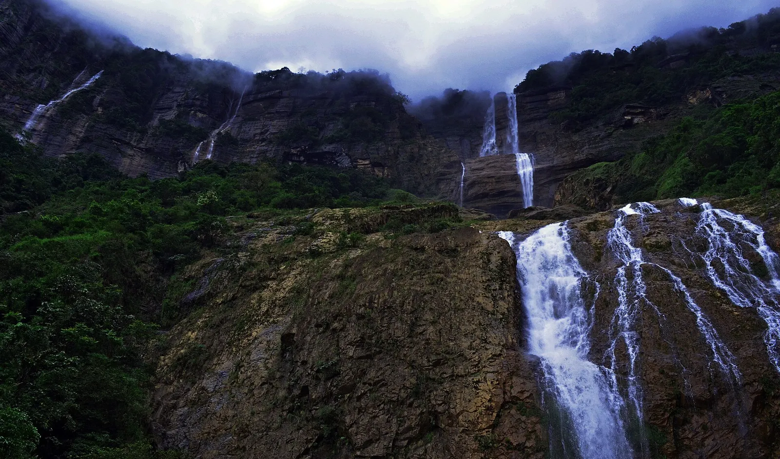
Kynrem Falls is a high, three-stage waterfall in Thangkharang Park, Meghalaya. Visitors come to see its long descent and the two streams that join near the foot of the cascade.
Key facts · verified by Ghumoopedia editors
- Type of place
- Natural attraction
- Best time to visit
- October to May; the monsoon is dramatic for waterfalls but roads and treks become slippery
- Nearest railway station
- Kamakhya Junction · about 105 km (straight line)
- Nearest airport
- Shillong Airport (Umroi) · about 60 km (straight line)
- Verified
- 21 Nov 2026
Plan a trip from Kynrem Falls — a day-by-day route through places nearby.
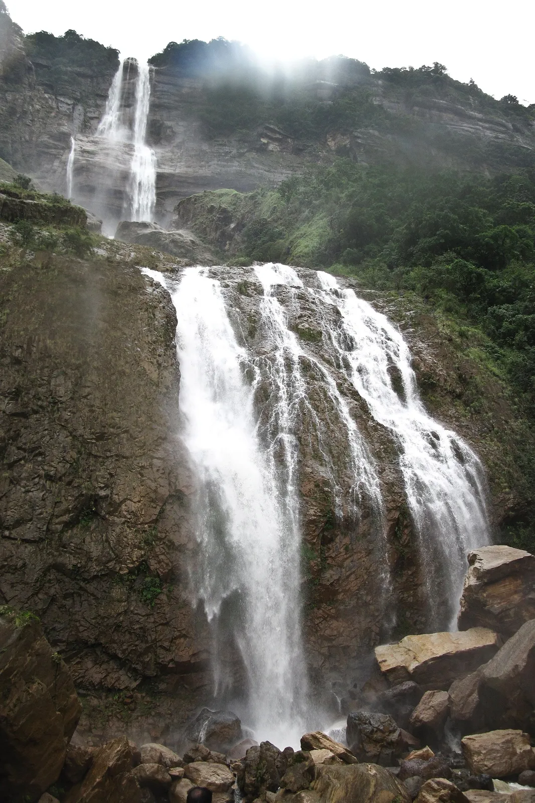
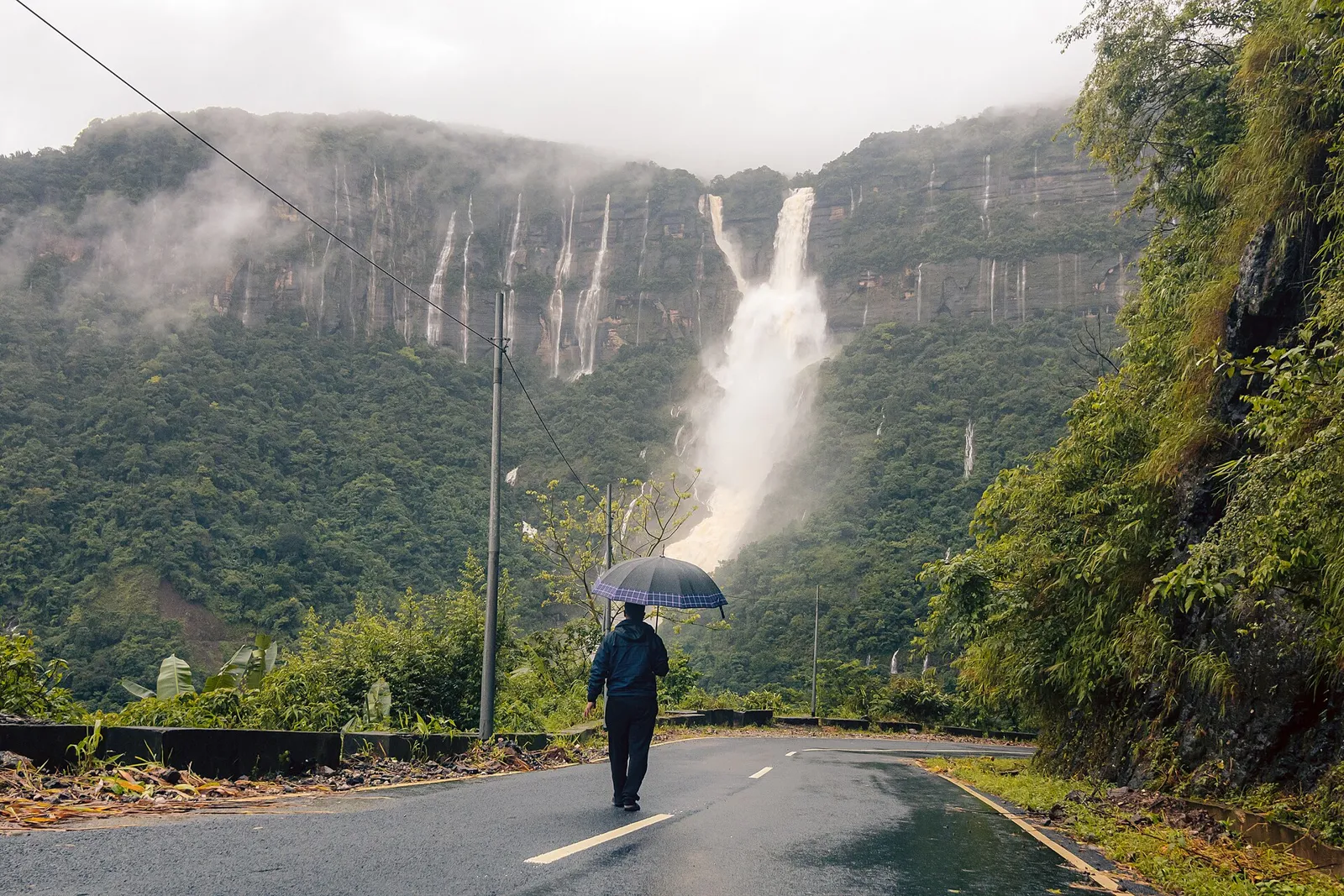
Kynrem Falls lies in Meghalaya’s East Khasi Hills district, within Thangkharang Park and about 12 kilometres from Cherrapunji. Its park location places the waterfall near the town. The water descends 305 metres across three successive levels. Kynrem is ranked as India’s seventh-highest waterfall, and its cascade is divided into distinct stages. As the water falls, it splits into two rivulets. They gather momentum on their way down and meet along the final stretch of the lowest stage, the third tier. The Khasi, Jaintia and Garo communities follow matrilineal traditions, and community councils manage much of the land visitors pass through. Meghalaya is among the wettest places on earth: Sohra and Mawsynram receive extreme monsoon rainfall. Shillong is cool all year, and fog can close viewpoints at any season. The usual best time to visit is October to May; the monsoon is dramatic for waterfalls but roads and treks become slippery. Days are short in Northeast India: the sun can set before 5 pm in winter, so plan to reach and leave Kynrem Falls in daylight. Timings, fees and access arrangements must be confirmed locally. For official information, see Meghalaya Tourism at https://www.meghalayatourism.in.
Why it matters
Kynrem Falls is a prominent natural attraction in East Khasi Hills, about 12 kilometres from Cherrapunji (Sohra), according to the existing destination guide. Its three tiers descend through the landscape within Thangkharang Park, making the falls a notable stop for visitors exploring the Sohra area. The guide describes a total height of 305 metres and ranks it as India’s seventh-highest waterfall; such rankings can vary by source and measurement method. Its regional importance is also connected to Meghalaya’s monsoon-fed scenery and community-managed landscapes. No UNESCO, Archaeological Survey of India or other formal heritage designation for the falls is confirmed here; visitors should not assume that a scenic site has a particular protected status.
Kynrem Falls is a natural feature rather than a structure with a known builder. No well-documented written account establishes when the waterfall was first named, when people began visiting it, or a specific historical event associated with it. Its setting within Thangkharang Park is the clearest part of its present-day visitor context: the park provides a managed landscape from which visitors can approach designated viewing areas. The falls and surrounding slopes have been shaped over time by flowing water, weathering and the exceptionally heavy rainfall characteristic of the Sohra region. Khasi communities have longstanding connections with the wider East Khasi Hills, and land management in Meghalaya can involve local community institutions; that broader context should not be mistaken for a specific account of who established this park or its visitor facilities. The destination guide identifies Kynrem Falls as a three-tier waterfall, but does not record a restoration campaign, construction project or major change in its form. For current management and conservation arrangements, ask locally or consult Meghalaya Tourism.
Origin stories & folklore
Khasi oral traditions and place-based stories are part of the wider region’s living heritage, but a general regional tradition should not be presented as a specific tale about this waterfall. Visitors may hear local explanations or stories from residents and guides; these can vary between tellers and communities. Treat such accounts as oral tradition or personal belief unless a knowledgeable local source identifies them more precisely. Ask permission before recording a storyteller, and avoid repeating sacred or restricted knowledge. The waterfall’s known description is geological and geographical: it descends in three tiers, with two streams joining as they flow down the final section.
Spend unhurried time at Kynrem Falls: walk the marked paths, use official viewpoints and ask locally whether a guide, entry ticket or permit is needed. Admire the water from safe points rather than climbing wet rocks or swimming in unknown currents. Wildlife sightings are never guaranteed — patience and quiet improve your chances. A comfortable itinerary is one main visit in the morning, a local meal at midday and a short nearby stop before an afternoon return. Use the district list on this site to find other places in East Khasi Hills, but check the actual road route and its condition before combining stops. If a festival is on, local roads and stays can be busy — and the experience can be unforgettable. Leave no litter: many sites in Meghalaya are protected by the communities who own them.
Suggested itineraries
Half day: Travel from Sohra to Thangkharang Park, spend about 1–2 hours at the Kynrem Falls viewpoints, then return or make one nearby stop. Full day: Visit Kynrem Falls in the morning, allow about 1–2 hours in the park, have a local meal, then choose one or two nearby Sohra attractions before returning in daylight. Gentler option: Use the nearest suitable viewpoint reached by the park’s marked route, take frequent rests, and keep the visit flexible; confirm the walking conditions locally.
The falls sit in a Khasi-majority region where Khasi language and community life are central to local identity. English and other languages may also be used with visitors. Khasi cultural expression includes distinctive music, dance, clothing and customary practices, with forms varying between communities and occasions. In the wider district, festivals and community gatherings provide opportunities to experience these traditions respectfully, but they are not necessarily held at Kynrem Falls. Visitors should follow local guidance on photography, dress and conduct, particularly at community events or places with customary protocols. The Khasi, Jaintia and Garo communities are known for matrilineal traditions, though family customs and individual experiences are diverse; avoid treating one description as universal.
Local communities
Khasi communities are closely connected with the wider East Khasi Hills landscape, including the area around Sohra. People in the region make their livelihoods through a mix of farming, trade, services, transport and tourism-related work; the balance varies from place to place and household to household. Community councils and customary institutions have roles in managing land in parts of Meghalaya, so visitors should respect signs, boundaries and local instructions rather than assuming every route is public. Guides, drivers, food sellers and accommodation providers may be local residents. Ask before photographing people or entering community-managed areas, and support local businesses where practical.
Festivals & events
Kynrem Falls is not known as the venue for a regular festival. In the wider Khasi region, Shad Suk Mynsiem is generally associated with spring, while the Nongkrem Dance Festival is held in the autumn in the Smit area near Shillong. These are distinct cultural events, not performances scheduled for visitors at the falls. Dates vary by year and should be checked locally before planning. Festival travel can bring extra demand for transport and accommodation, and roads or public spaces may be busy. Attend only public events, follow community guidance and ask before photographing dancers, participants or ceremonies.
Local food in Meghalaya includes jadoh (rice cooked with meat), dohneiiong (pork with black sesame), tungrymbai (fermented soybean), pumaloi and Garo dishes such as kapa. Ask what is fresh that day; many small eateries cook a limited daily menu. Pork, beef, fish and fermented ingredients are common in tribal cuisines, so vegetarian travellers should explain their needs clearly — rice, dal, vegetables and eggs are usually possible in towns. Remote sites may have no restaurant at all. Carry water and snacks, eat a proper breakfast before long drives, and ask your accommodation for a packed lunch if you are heading out early. Try a homestay-cooked meal when you can — it is often the best food in the hills. Choose busy, clean places and carry your packaging back to town.
Shopping & local experiences
There may be few or no shopping facilities at the waterfall itself, so look for local produce, snacks and crafts in Sohra or other settlements along your route. Meghalaya markets can offer woven goods, locally made items and seasonal foods, but availability varies and products are not always made in the place where they are sold. Ask sellers about an item’s origin rather than assuming it represents a particular community. Trying Khasi food at a local eatery can be a meaningful part of the visit; ask about ingredients and preparation if you have dietary needs. Carry reusable bags and avoid buying wildlife products or items made from protected species.
Kynrem Falls drops through three tiers in the humid, steep terrain of the Sohra region. The destination guide gives its height as 305 metres and describes two streams that merge while descending the final tier. Heavy seasonal rain feeds the falls and can make the water dramatic, while flow and visibility vary with weather. The surrounding landscape includes forested slopes and vegetation typical of Meghalaya’s high-rainfall environment; plant and animal sightings depend on season and conditions. The broader region supports diverse birdlife and wildlife, but no particular sighting is guaranteed at the falls. Fog, rain and wet surfaces can arrive quickly. Stay on marked paths and viewing areas, and do not climb slick rocks or enter unfamiliar water.
October to May; the monsoon is dramatic for waterfalls but roads and treks become slippery
The nearest principal railway station by straight-line distance is Kamakhya Junction, roughly 105 km away. The nearest operating airport by straight-line distance is Shillong Airport (Umroi), roughly 60 km away. These figures are calculated from map coordinates — hill roads in Meghalaya wind a lot, so actual road distance and travel time are usually much longer. Guwahati is the main rail and air hub for the region, and most long-distance journeys connect through it. For the final leg, Meghalaya Transport Corporation (MTC) and shared taxis from Shillong’s Police Bazaar and Anjalee terminals link district towns; shared taxis usually leave early in the morning and depart only when full. A private taxi gives more flexibility for remote sites. When comparing train, bus and flight, count the complete door-to-door time: a flight saves the most time only if the onward road transfer is short, while an overnight train to Guwahati plus a road journey can save a hotel night. Book your return before you leave, because seats on shared vehicles and the few daily flights fill quickly. Current train numbers, timings, return services and fares are not listed here; check IRCTC and NTES for trains and the airline’s own schedule for flights. No Inner Line Permit is needed for Indian visitors to Meghalaya. Many villages, caves, waterfalls and living root bridges charge a small community entry or parking fee, and some sites have their own visitor rules.
Confirm onward and return timings on IRCTC / NTES, the state bus operator or your airline before travel. A dash means current timings or fares have not been verified.
Getting around
Visitors commonly reach the Sohra area by taxi or shared vehicle from Shillong, then arrange local transport for the park and other stops. Local taxis can offer more flexibility for a day of sightseeing; confirm the planned route and return arrangements with the driver before departure. Shared vehicles may serve district towns, but routes and availability should be checked locally. Within the park, expect to continue on foot from the vehicle drop-off or parking area, following marked routes. Do not count on autos, local buses or on-demand transport at the waterfall itself. In rain or fog, allow extra travel time and avoid walking along roads without a safe verge.
Hours, tickets & permissions
Entry arrangements are associated with Thangkharang Park, but current access rules can change. A ticket, permit, camera permission or other condition may apply, and rules can differ for particular areas or activities. Do not assume that access to the park automatically permits entry to every trail or viewpoint. Check current hours, entry requirements and fees with the park’s managing authority or locally before setting out. Carry identification if requested by the operator, follow posted notices, and confirm whether weather or maintenance has affected access.
Facilities
Facilities at or near the falls may be limited and can vary with season or park operations. Thangkharang Park may have basic visitor arrangements, but do not assume that toilets, drinking water, food stalls, guides or accessible facilities will be available when you arrive. Food and other services are more likely to be found in nearby settlements than at a viewpoint. Parking or a vehicle drop-off may be available near the park entrance; check locally and use designated areas. Carry drinking water, snacks and any essential medicines, and confirm current facilities and access arrangements with the park manager before travel.
Accessibility
The visit involves outdoor paths and uneven natural terrain, and surfaces may become muddy or slippery in rain. Reaching a viewpoint may require walking, and the exact distance and gradient can depend on the route open that day. Do not assume there are ramps, handrails or step-free access throughout the park. Wheelchair and stroller suitability is therefore uncertain and should be checked with the managing authority before visiting. Older visitors or anyone with limited mobility may prefer a short, unhurried visit to the nearest manageable viewpoint, with a companion and rest breaks. Fog, steep edges and wet ground make careful footwear and daylight travel especially important.
No Inner Line Permit is needed for Indian visitors to Meghalaya. Many villages, caves, waterfalls and living root bridges charge a small community entry or parking fee, and some sites have their own visitor rules. Carry a photo ID at all times; checkpoints are common. Save the emergency number 112 and your accommodation’s contact offline. Heat, humidity and sudden downpours are the main weather risks; carry water and rain protection. Stay on marked paths, keep away from cliff edges and fast water, and never approach wild animals. Avoid hill road travel after dark and during heavy rain, when landslides are more likely. Check official advisories for the region before travel, and follow local guidance if access changes.
Photography
The falls are often most striking when water flow is strong, but mist and rain can obscure the view, so conditions matter more than a fixed time of day. Use designated viewpoints and keep a safe distance from edges; wet rocks are hazardous. Ordinary personal photography may be possible, but check park rules before using tripods, commercial equipment or taking images in restricted areas. Drone use may require permission and can be restricted for safety, privacy or conservation reasons; do not fly without explicit approval. Ask before photographing local people, and be especially respectful around ceremonies or community gatherings.
Choose a stay by the full journey to Kynrem Falls, not just the district name. Main towns in East Khasi Hills usually offer hotels, state tourism lodges and homestays with better transport, meals and medical access, while village homestays offer a closer connection to local life. In the plains and valleys, check fans or air-conditioning and mosquito nets in summer. Book in advance for weekends, festival dates and the peak season (October to May; the monsoon is dramatic for waterfalls but roads and treks become slippery). Confirm the exact location, meals included, check-in time and cancellation terms in writing. Many homestays accept payment on arrival; avoid sending money to unverified contacts. Mobile network and digital payments can be unreliable in remote areas, so carry some cash.
Kynrem Falls is within Thangkharang Park, so allow time to enjoy the park as well as the waterfall. In the wider Sohra area, visitors may consider Nohkalikai Falls, the Seven Sisters Falls (Nohsngithiang Falls), Mawsmai Cave and Arwah Cave. These are established attractions, but road conditions, access and the time needed can vary. Check the route before combining stops, particularly during the monsoon, and avoid trying to fit too many sites into a short daylight window. Shillong offers further attractions in East Khasi Hills, but it is not an immediate walkable extension of the falls; plan that journey separately.
For couples, Kynrem Falls rewards a slow pace: arrive early for soft light and fewer crowds, share a local meal and keep the evening free. Public displays of affection can be frowned upon in conservative communities and at religious sites, so be discreet. A homestay can make the trip memorable — confirm privacy, hot water and transport back. Keep a buffer day in your itinerary, because weather and road closures can delay plans in Meghalaya.
Q: How much time should I allow for Kynrem Falls? A: Allow roughly one to two hours for the park visit and viewpoints, plus travel time from Sohra and any nearby stops. Q: When is the best season to visit? A: October to May is generally more practical for travel. Monsoon rains can make the falls dramatic but paths and roads slippery. Q: Is there an entry ticket or permit? A: Entry requirements may apply through Thangkharang Park and can change. Confirm current rules and fees with the managing authority. Q: Is the visit suitable for children and elderly visitors? A: Families can visit with care, but wet, uneven paths and viewpoint edges need supervision. People with limited mobility should check route conditions before going. Q: Where can I stay nearby? A: Sohra has visitor accommodation, with further choices in Shillong. Check availability and transport plans before travelling.
Be the first to share photos, stories, advice or a helpful contact for Kynrem Falls.
Loading…