
Bhitarkanika National Park
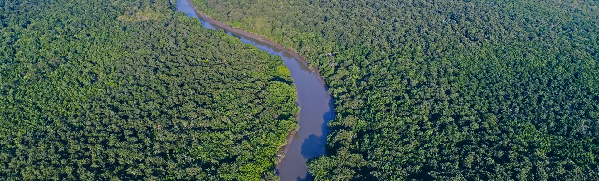
Bhitarkanika National Park is a wetland and mangrove landscape in Kendrapada, Odisha. Visitors travel its waterways by boat to see crocodiles, deer, water monitors and birds.
Key facts · verified by Ghumoopedia editors
- Type of place
- National park / sanctuary
- Best time to visit
- October - March
- Verified
- 21 Nov 2026
Plan a trip from Bhitarkanika National Park — a day-by-day route through places nearby.
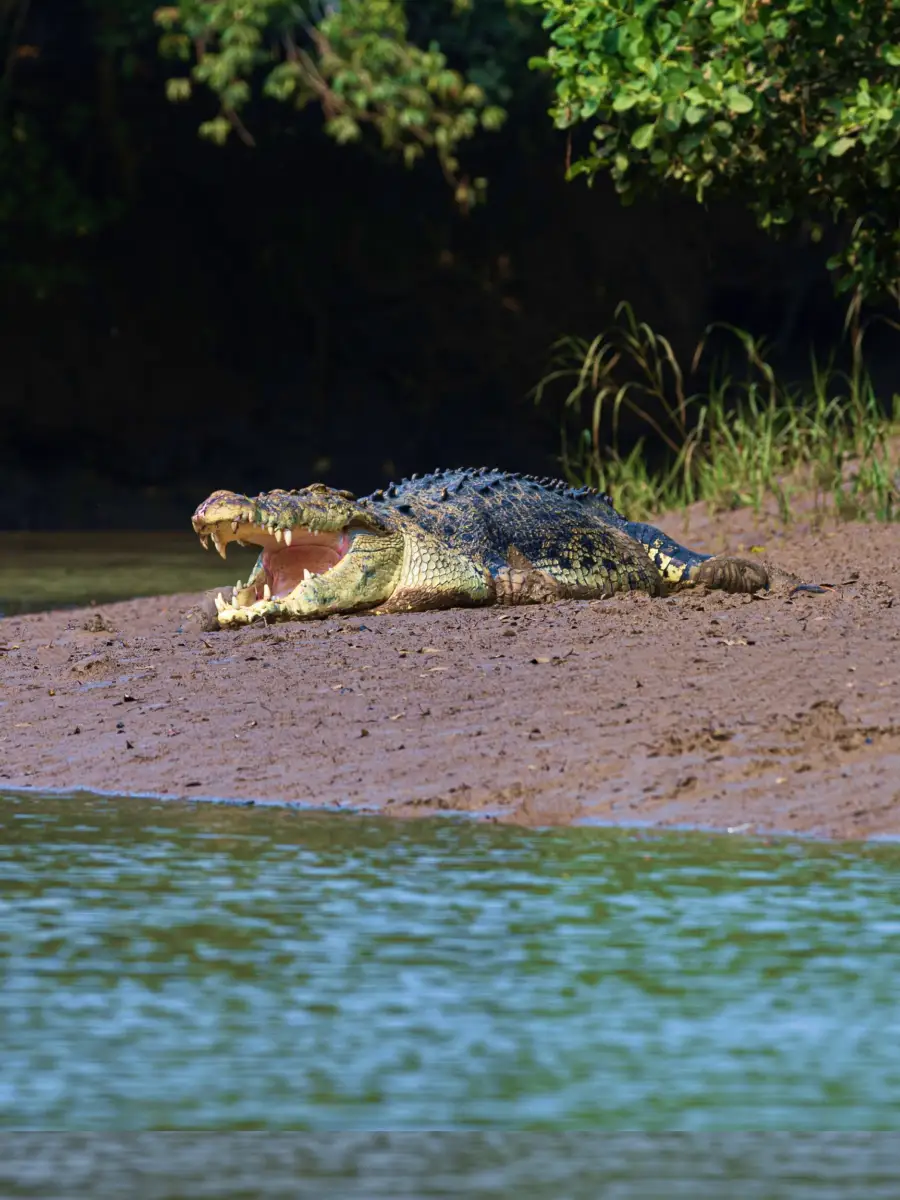
The park lies in Pattamundai/Rajnagar, in Kendrapada district, Odisha. It covers a coastal delta crossed by tidal channels and estuaries, with dense mangroves. The Brahmani, Baitarani and Dhamra rivers flow through this landscape before reaching the Bay of Bengal. Known also as India’s mini-Amazon, Bhitarkanika has Ramsar Site status in recognition of its ecological importance. Boat journeys through the creeks provide opportunities to observe the wetland and its wildlife, in a landscape shaped by tides. Saltwater crocodiles are a prominent feature, and Bhitarkanika has India’s largest population of them. Water monitors and spotted deer are also found here. The park’s birdlife includes resident and migratory species, among them several kinds of kingfisher. Plan your visit around October - March. The official suggested visit duration is 1–2 days; treat this as time at the attraction, not the complete journey from your hotel. Odisha’s coast and plains can be hot and humid, while southern hill districts may feel cooler after sunset. Heavy monsoon rain can affect road travel and access to outdoor sites. Check the local forecast before setting out, and keep a flexible alternative for bad weather. Official destination reference: https://odishatourism.gov.in/en/places/bhitarkanika-national-park
Why it matters
Bhitarkanika is a protected mangrove and estuarine landscape in Kendrapara district, important for its wildlife habitat and the livelihoods connected to its waterways. Odisha Tourism describes it as a national park, wildlife sanctuary and crocodile conservation centre. The park forms part of a wider protected wetland landscape that includes creeks, tidal rivers and coastal habitats. Its saltwater crocodile population is a major focus of conservation, alongside its role as habitat for resident and migratory birds. The site is also recognised internationally as a Ramsar Wetland of International Importance, designated in 2002. These protections make it a significant place for wetland conservation in Odisha; access and activities are managed to safeguard its sensitive habitats.
Bhitarkanika’s landscape has been shaped over time by tides and sediment carried through the Brahmani, Baitarani and Dhamra river systems. It is not a built monument with a single founding date or known builder: it is a living delta where generations of local residents have depended on waterways and surrounding land for fishing, farming and other livelihoods. The area was notified as a wildlife sanctuary in 1975 and became a national park in 1998. A saltwater crocodile conservation programme also began in the region in 1975, with breeding and conservation work associated with Dangmal. The park’s Ramsar designation in 2002 brought international recognition to its wetland value. Since these milestones, management has centred on protecting mangroves and wildlife, monitoring species and regulating visitor access. The area’s conservation history is therefore closely tied to both habitat protection and the continuing presence of local communities. Visitors should follow current forest-department guidance, since access to particular creeks and sites can be restricted for conservation or safety.
Begin with the main attraction at Bhitarkanika National Park and leave time to understand its setting in Kendrapara. Use marked viewpoints and permitted trails, and ask whether a forest permit, guide or boat booking is required. Observe animals from a safe distance; a wildlife visit never guarantees a particular sighting. Waterfalls and riverbanks are best enjoyed from protected viewing areas rather than by climbing wet rocks. Keep a simple itinerary: arrive in daylight, enjoy the main visit, take a shaded meal break, then decide whether one nearby stop fits your return plan. Use the district index to find nearby places, but check the actual road route before combining them. Reserve a little time for photographs from permitted public viewpoints and avoid blocking paths while taking pictures.
Suggested itineraries
Half day: Check in with the forest or boat operator, take a permitted creek boat ride, visit an accessible interpretation or visitor area if open, and allow time for a shaded break and return travel (about 4–5 hours, subject to access and tides). Full day: Start with the authorised boat journey through the creeks, pause at permitted stops such as Dangmal if available, take a meal and rest break, then continue with bird and mangrove observation before returning (about 6–8 hours, depending on route and conditions). Gentler option: Choose a shorter boat route with minimal boarding and walking; confirm assistance and landing conditions before setting out.
Life around Bhitarkanika is closely connected to the seasons, tides and waterways. Odia is widely spoken in the district, alongside local speech and languages used by residents and visitors. Fishing, agriculture, local markets and seasonal work shape everyday life in nearby settlements. Regional customs, food and celebrations reflect wider Odia traditions, including community worship, folk performance and family gatherings. Dress is generally practical for humid weather and village life. Visitors can be considerate by asking before photographing people, respecting religious spaces and following local guidance around boats, markets and forest areas. Cultural experiences are part of the surrounding communities, not performances guaranteed as part of a park visit.
Local communities
Residents of villages around the park include fishing and farming households, as well as people engaged in transport, hospitality, guiding and other local services. Tidal creeks and coastal waters support livelihoods, while agriculture and markets connect settlements to the wider Kendrapara district. Some residents work in or alongside conservation and tourism activities. The protected landscape also affects where and how people can travel, fish or gather resources, so visitor access is regulated. Treat local knowledge and work with respect: use authorised services, ask before taking photographs and do not assume that every resident is available as a guide.
Festivals & events
Nearby communities observe regional festivals such as Raja Parba, Durga Puja and Kartik Purnima, with celebrations varying by village and year. Kendrapara town is known for festivities associated with Baladevjew Temple and its Rath Yatra. These occasions can bring larger crowds, local processions and busier roads or markets, particularly around town and temple areas. Festival activity is not necessarily part of a park visit, and events may affect travel plans or accommodation availability. Check locally before combining a festival visit with a forest excursion, and be respectful around worship and processions.
For a visit to Bhitarkanika National Park, plan food around your base in Kendrapara and do not assume that a remote entrance has a full restaurant. Odisha offers rice-based meals, dalma, vegetable preparations and sweets such as chhena poda. Availability varies by district and outlet; ask what is freshly prepared rather than expecting every local dish at every stop. Choose busy, clean establishments and tell staff about allergies, spice preferences or dietary restrictions before ordering. Carry sealed drinking water and a small snack if you are travelling beyond a town. In hot weather, take regular water breaks instead of waiting until you feel exhausted. For early starts, arrange breakfast in advance and ask your accommodation whether a packed meal is practical. Keep all packaging with you until you find an appropriate waste bin.
Shopping & local experiences
Markets in Kendrapara and nearby towns are practical places to look for everyday goods, regional snacks and Odisha-made textiles or handicrafts. Selection varies, and a particular craft should not be assumed to be made locally. Ask vendors about the origin of items and favour locally made goods where available. Regional Odia food can be sampled at eateries in nearby settlements, subject to what is being served. Do not buy wildlife products, shells or other items that may come from protected species or habitats. Carry reusable bags and avoid leaving packaging in villages or the park.
Bhitarkanika is a tidal delta of mangrove forest, estuaries, creeks and mudflats where river water meets the Bay of Bengal. Mangroves help shelter the shoreline and provide habitat for a diverse range of wetland wildlife. Saltwater crocodiles are a prominent conservation focus; water monitors and spotted deer are also among the animals reported in the area. The park supports resident and migratory birds, including several kinds of kingfishers, and some sites are important for seasonal bird activity. Wildlife sightings depend on conditions and are never assured. The landscape changes with tides and weather, so visitors should remain on permitted routes, keep a safe distance from animals and follow boat-crew or forest staff instructions.
October - March
Start by choosing a practical overnight base in or near Kendrapara, rather than assuming every attraction has its own railway station. Odisha Tourism lists this rail access: Nearest railway station – Bhadrak. The listed air access is: Nearest airport – Biju Patnaik International Airport, Bhubaneswar. Road access: Accessible by road via Rajnagar. Compare train, bus and flight options door to door. Rail can suit overnight journeys and travellers who prefer to avoid a long drive. A bus may be useful between district towns, but the last service may finish before your visit ends. A flight only saves time if airport transfers, check-in and the final road leg are included. Reserve the return leg before departure and allow time for traffic, meals and weather. Check IRCTC and NTES for trains, OSRTC for buses, and the airline’s own schedule for flights. Do not rely on an unconfirmed connection or assume taxis will wait at a remote site.
Confirm onward and return timings on IRCTC / NTES, the state bus operator or your airline before travel. A dash means current timings or fares have not been verified.
Getting around
Plan the road journey to an approved entry point or local base in advance; Rajnagar is a road gateway, but the park itself is explored by boat rather than by car. Local buses may connect district towns and settlements, while hired cars or taxis can be more practical for the final road leg. Autos may be available around towns and villages, but availability varies. Use authorised boats and follow the operator’s instructions on boarding and landing. Walking is limited to permitted paths and visitor areas. Check locally about parking at your chosen jetty, return transport and whether the day’s tide or weather affects boat access.
Hours, tickets & permissions
Entry is controlled by the forest authorities, and visitors may need to arrange a permit, authorised boat or guide depending on their route and current rules. Camera use or access to particular areas may also be subject to conditions. Requirements can vary with season, weather, conservation work and the chosen entry point. Confirm current visiting hours, entry procedures, permitted routes and any fees directly with the managing authority or an authorised local operator before travelling. Do not assume that a boat can depart on arrival or that every creek is open to visitors.
Facilities
Facilities vary by entry point and may be limited inside the protected area. A visitor or interpretation facility and basic services may be available at some locations, but confirm what is open before travelling. Toilets, drinking water, food and parking are more likely to be found near settlements or designated access points than along remote creeks. Boat services and guides should be arranged through authorised local channels. Carry water and any essential personal supplies, and do not rely on finding an ATM or a meal once you are inside the park. Check locally about waste disposal and facilities at your chosen jetty.
Accessibility
The park is a wetland reached by road and explored mainly by boat, so access involves getting on and off a vessel as well as any permitted walking. Jetties, boat steps, uneven ground and muddy or wet paths may be difficult for wheelchair users, people using strollers and visitors with limited mobility. Walking distances and shade depend on the route; humid conditions can make exertion tiring. Do not assume that ramps, accessible toilets or assistance are available. Older visitors and anyone with balance or mobility concerns should discuss boarding, seating, route length and landing conditions with the operator before booking, and choose a shorter outing if appropriate.
At Bhitarkanika National Park, local access rules take priority over any suggested itinerary. Reconfirm opening arrangements, entry eligibility, permits and weather restrictions shortly before arrival. Keep the emergency number 112 available and save your accommodation’s contact details offline. A map pin identifies a general location, not an assurance that the approach road or walking path is safe. Ask local staff which entrance visitors should use. Do not cross barriers, approach wildlife or enter deep water. Slippery rocks, steep edges and sudden changes in river flow can be dangerous. Leave exposed trails if a storm develops, and never take a forest shortcut without authorization. Carry only necessary valuables, keep rubbish out of the site, and leave enough daylight for the return journey.
Visitor rules
Follow forest-department instructions and remain within authorised routes, jetties and viewing areas. Keep a safe distance from crocodiles and other wildlife; never feed, approach or attempt to attract animals. Wear practical clothing and secure footwear suitable for humid, potentially muddy conditions. Take all litter back with you and avoid single-use plastic where possible. Keep noise low, do not damage mangroves or disturb birds, and respect closures and restricted areas. Photography may be limited at particular sites or during certain activities, so check before taking pictures. Do not fly a drone without explicit permission.
Photography
Soft morning or late-afternoon light can bring out the textures of mangroves and tidal creeks, but access and boat schedules determine what is practical. Photograph only from permitted boats, paths and viewpoints, and follow crew instructions; wildlife may be distant or absent. Check whether camera use is restricted at a particular site. Drone use requires prior permission and should never be assumed to be allowed in a protected area. Ask people before photographing them, and avoid intrusive images of worship, private life or children. Do not use flash or make noise to provoke an animal for a picture.
Choose accommodation by the complete journey to Bhitarkanika National Park, not by the district name alone. A room in a well-connected town in Kendrapara may offer easier transport, meals and medical access than a property advertised as being close to the attraction. Check the exact location, recent guest feedback, reception hours and cancellation terms. Ask how you will reach the site and return after the visit, especially if you are not driving. Nature camps and forest stays may require advance reservations and have seasonal restrictions. Confirm meals, electricity, phone coverage, guided activities and the last permitted entry time directly with the operator. Book only through a trusted accommodation channel, avoid sending payments to an unverified personal contact, and keep written confirmation of the services included.
Dangmal is within the Bhitarkanika area and may be included on an authorised visit when access is available. Gahirmatha Marine Wildlife Sanctuary is part of the wider coastal region; it is a protected area, so access and wildlife viewing are subject to separate rules and should not be assumed. In Kendrapara town, Baladevjew Temple is a notable cultural stop. These places can involve different road routes and permissions, so check travel conditions and opening arrangements locally before combining them. Avoid planning a tight same-day schedule around boat access, tides or weather.
For couples visiting Bhitarkanika National Park, keep the day relaxed: one main visit, a meal break and a return transfer arranged in advance. Choose public viewpoints for photographs and respect religious or community expectations around behaviour and clothing. Confirm the accommodation’s check-in requirements before booking. Avoid secluded paths after dark and do not trade a safe return plan for a late photograph. A quieter weekday may suit you, but opening and access arrangements still need local confirmation.
Q: How much time should I allow for a visit? A: The attraction’s suggested visit duration is 1–2 days. A shorter outing may be possible, but boat access, tides and permits affect the plan. Q: When is a good season to visit? A: October to March is a commonly suggested period. Check the local forecast and current access conditions before setting out. Q: Do I need to arrange entry in advance? A: Entry and boat arrangements are managed under current forest rules. Confirm permits, authorised routes and requirements with the managing authority or a local operator. Q: Is the park suitable for children and elderly visitors? A: It can be, with close supervision and a route suited to the visitor. Boat boarding, uneven paths, heat and limited facilities may be challenging. Q: Where should I stay nearby? A: Use an overnight base in or near Kendrapara or another suitable local settlement, and confirm lodging and onward transport before travelling.
Be the first to share photos, stories, advice or a helpful contact for Bhitarkanika National Park.
Loading…