
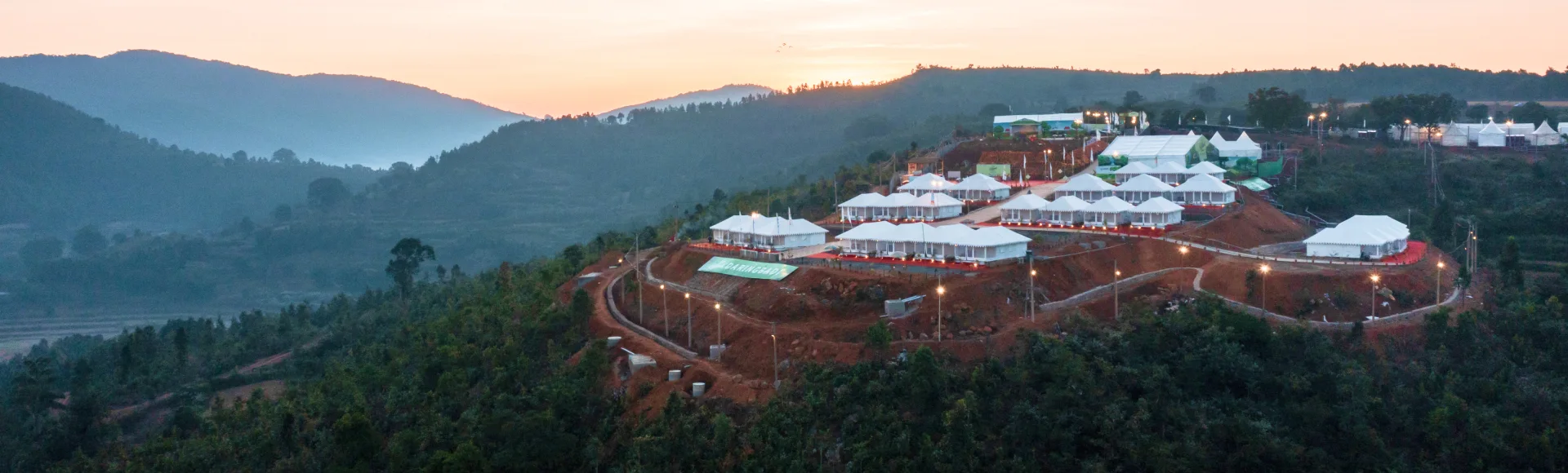
Daringbadi Hill Station
Daringbadi is an Odisha hill station known for its cool highland climate and scenery of pine woods, coffee plantations, waterfalls and misty valleys, attracting visitors in search of nature and a slower pace.
Key facts · verified by Ghumoopedia editors
- Type of place
- Natural attraction
- Best time to visit
- October - February
- Verified
- 21 Nov 2026
Plan a trip from Daringbadi Hill Station — a day-by-day route through places nearby.
In Kandhamala district, Odisha, Daringbadi is a hill station whose local nickname compares it with Kashmir. Pine woods, coffee plantations, waterfalls and mist over the valleys shape its surroundings. The climate is cool beside that of the plains; in winter, temperatures can sometimes approach freezing, an unusual occurrence in Odisha. Agriculture is central to the local economy. Organic turmeric, spices and coffee are important products, and they have gained increasing recognition across India. Indigenous communities also contribute to the region’s character through their traditions, food and festivals. Visitors can look beyond the scenery to learn about local culture and everyday life. Odisha Walks, due to launch soon, is planned as a collection of curated experiences exploring Daringbadi’s landscapes, culture and daily routines. These activities are intended to offer a closer understanding of the area beyond its views. Plan your visit around October - February. The official suggested visit duration is 1–2 days; treat this as time at the attraction, not the complete journey from your hotel. Odisha’s coast and plains can be hot and humid, while southern hill districts may feel cooler after sunset. Heavy monsoon rain can affect road travel and access to outdoor sites. Check the local forecast before setting out, and keep a flexible alternative for bad weather. Official destination reference: https://odishatourism.gov.in/en/places/daringbadi-hill-station
Why it matters
Daringbadi is a hill station in Kandhamal district, Odisha, valued for its cooler highland setting, pine-covered slopes, coffee plantations, waterfalls and valley views. Its popular nickname, “Kashmir of Odisha,” is a tourism descriptor rather than an official designation. Odisha Tourism lists the destination among the state’s hill, scenic-spot, eco-tourism and trekking attractions. The area is also known for agriculture, including coffee, turmeric and other spices, and for the cultural life of its local communities. It offers a different landscape from Odisha’s coastal plains and is a regional destination for nature-focused trips. No UNESCO or ASI-protected status is identified for the hill station itself in the cited tourism information.
Daringbadi is a lived-in highland region, not a single monument with a documented builder or founding date. Its history is closely connected to the communities who have made a home in Kandhamal and to livelihoods shaped by the district’s forests, slopes and agricultural land. Cultivation of crops such as turmeric, spices and coffee remains an important part of the local economy. The available official destination information presents Daringbadi primarily as a scenic and tourism destination; it does not give a definitive account of when the settlement began or who first established it, so a precise origin date should not be assumed. In recent decades, improved road access and growing interest in Odisha’s hill landscapes have made the area more accessible to visitors. Tourism now sits alongside farming and everyday community life, bringing more visitors to viewpoints, waterfalls and plantations. The nickname “Kashmir of Odisha” reflects its reputation for a cooler climate and green scenery; it is not evidence of a historical link to Kashmir. Visitors can learn about the region’s past most responsibly through local interpretation and community knowledge, while respecting that not all cultural knowledge is meant for public display.
Origin stories & folklore
No single, well-documented origin legend for Daringbadi is established in the official destination information. The name is sometimes discussed locally, but visitors should treat popular explanations of its origin as oral accounts rather than verified history. The familiar phrase “Kashmir of Odisha” is a modern descriptive nickname inspired by the area’s cooler weather and scenic highlands, not an old legend. Kandhamal has rich oral traditions connected with its communities and landscapes; stories may differ between families and villages. If residents share a story, listen respectfully and ask whether it is appropriate to record or repeat it.
Begin with the main attraction at Daringbadi Hill Station and leave time to understand its setting in Kandhamal. Use marked viewpoints and permitted trails, and ask whether a forest permit, guide or boat booking is required. Observe animals from a safe distance; a wildlife visit never guarantees a particular sighting. Waterfalls and riverbanks are best enjoyed from protected viewing areas rather than by climbing wet rocks. Keep a simple itinerary: arrive in daylight, enjoy the main visit, take a shaded meal break, then decide whether one nearby stop fits your return plan. Use the district index to find nearby places, but check the actual road route before combining them. Reserve a little time for photographs from permitted public viewpoints and avoid blocking paths while taking pictures.
Suggested itineraries
Half day: Start at a main viewpoint (about 45–60 minutes), visit a nearby pine or coffee-growing area (about 1–2 hours, where access is permitted), then take a meal break before returning. Full day: Begin with a viewpoint (about 1 hour), explore a permitted plantation or forest-side stop (about 1–2 hours), pause for lunch, visit one nearby waterfall or scenic stop (about 1–2 hours), then return in daylight. Gentler option: Choose one accessible viewpoint, take a seated break at a nearby food stop, and skip uneven trails or waterfall approaches.
Culture around Daringbadi is part of the wider, diverse life of Kandhamal. Indigenous traditions, Christian communities and other local influences are present in the district, with customs varying between villages and families. Odia and regional languages are used in everyday life; visitors may also hear community languages, including Kui. Farming seasons, food and family gatherings shape much of local life. Music, dance, dress and ceremonial practices are not uniform across the region, so it is best to follow local guidance rather than treating one performance or custom as representative of everyone. Ask before photographing people or ceremonies.
Local communities
Kandhamal is home to Indigenous communities, including Kondh (also written Kandha) people, as well as Pana and other communities. Their histories and cultural practices are diverse, and should not be reduced to a single description. Agriculture is an important livelihood in the region; turmeric, spices and coffee are among the products associated with the area, alongside other farming and local work. Tourism also supports some transport, food and accommodation services. Visitors can support local livelihoods by buying produce or services directly where available, asking permission before taking photographs, and avoiding intrusive questions about personal or cultural matters.
Festivals & events
Festival observances in Kandhamal vary by community and village. Nuakhai, associated with the new harvest, is celebrated in parts of western Odisha, while local harvest observances and Christian festivals are also part of the district’s varied calendar. Dussehra and other widely observed Hindu festivals may be marked in nearby towns and villages. The season and scale of celebrations differ locally, so confirm with residents or accommodation hosts if you hope to attend an event. Festival periods can bring busier roads, crowded market areas and changes to normal services. Visitors should participate only when welcome and follow guidance about photography and access.
For a visit to Daringbadi Hill Station, plan food around your base in Kandhamal and do not assume that a remote entrance has a full restaurant. Odisha offers rice-based meals, dalma, vegetable preparations and sweets such as chhena poda. Availability varies by district and outlet; ask what is freshly prepared rather than expecting every local dish at every stop. Choose busy, clean establishments and tell staff about allergies, spice preferences or dietary restrictions before ordering. Carry sealed drinking water and a small snack if you are travelling beyond a town. In hot weather, take regular water breaks instead of waiting until you feel exhausted. For early starts, arrange breakfast in advance and ask your accommodation whether a packed meal is practical. Keep all packaging with you until you find an appropriate waste bin.
Shopping & local experiences
Look for locally produced turmeric, spices and coffee, which reflect the agricultural character of the area. Availability, packaging and sales locations vary, so ask accommodation hosts or local shopkeepers where products are sourced. Small markets may also offer everyday goods and seasonal produce. Choose items sold by local producers when possible, and ask before photographing stalls or workers. Do not buy wildlife products, forest materials or objects whose origin is unclear. A meal featuring regional ingredients can be a useful way to experience local food; ask about ingredients and preparation if you have dietary needs.
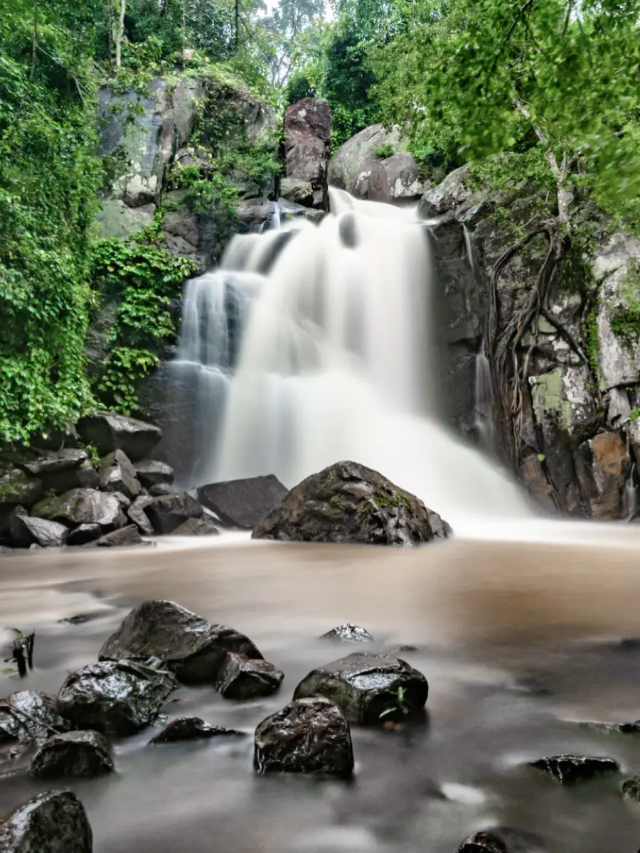
Daringbadi sits in the highlands of Kandhamal, where forested slopes, pine plantations, coffee-growing areas and misty valleys define much of the scenery. Seasonal streams and nearby waterfalls add to the landscape, though water levels and access vary with rainfall. The region’s vegetation reflects a mix of cultivated land and forest; visitors should stay on permitted paths and avoid collecting plants. Birds and other wildlife may be present in forest habitats, but sightings are never guaranteed. Monsoon weather can make trails and rocks slippery and may affect road access. Enjoy waterfalls from safe, designated viewing areas, and do not enter fast-flowing water or climb wet rock faces.
October - February
Start by choosing a practical overnight base in or near Kandhamal, rather than assuming every attraction has its own railway station. Odisha Tourism lists this rail access: Nearest railway station – Brahmapur. The listed air access is: Nearest airport – Biju Patnaik International Airport, Bhubaneswar. Road access: Accessible by road via Phulbani. Compare train, bus and flight options door to door. Rail can suit overnight journeys and travellers who prefer to avoid a long drive. A bus may be useful between district towns, but the last service may finish before your visit ends. A flight only saves time if airport transfers, check-in and the final road leg are included. Reserve the return leg before departure and allow time for traffic, meals and weather. Check IRCTC and NTES for trains, OSRTC for buses, and the airline’s own schedule for flights. Do not rely on an unconfirmed connection or assume taxis will wait at a remote site.
Confirm onward and return timings on IRCTC / NTES, the state bus operator or your airline before travel. A dash means current timings or fares have not been verified.
Getting around
Daringbadi and its surrounding attractions are most practical to explore by private vehicle or locally arranged taxi, as stops are spread out and public transport options may be limited. Ask your accommodation about trusted local drivers and road conditions before planning a route. Local buses may connect Daringbadi with district towns, but they may not serve every viewpoint or waterfall conveniently. Walking suits short visits around a single accessible area, not necessarily travel between attractions. Check parking arrangements at each stop, avoid blocking narrow roads, and arrange your return transport in advance, especially after visiting places outside the main settlement.
Hours, tickets & permissions
Entry arrangements depend on the specific viewpoint, plantation, waterfall or other stop you visit; there may not be one shared ticketing system for the whole hill station. Some forest areas or managed attractions may require permission, a local guide or compliance with site-specific rules. Camera and drone restrictions can also vary. Carry identification if requested by an operator or authority, and follow signs and staff instructions. Confirm current opening arrangements, entry requirements and any fees with the relevant managing authority or locally before setting out. Do not assume every trail or forest area is open to visitors.
Facilities
Facilities vary between the main settlement and individual natural sites. Daringbadi usually has places to eat and accommodation options in or near the town, while viewpoints and waterfall stops may have few or no services. Toilets, drinking water, seating, guides and marked parking are not guaranteed at every attraction, so check locally and carry water and any essentials. ATMs and other services may be easier to find in larger towns; do not rely on finding one beside a trail. Take litter back with you and use locally available guides where required.
Accessibility
The terrain around Daringbadi is hilly, and natural attractions can involve uneven ground, slopes, steps or unpaved paths. Walking distances and surfaces vary by site; reaching a waterfall may require more effort than viewing the landscape from a roadside stop. Shade and seating are inconsistent, so plan rests and avoid the hottest part of the day where possible. Wheelchair and stroller access should not be assumed, and some stops may be unsuitable without assistance. Older visitors or anyone with limited mobility can choose a vehicle-accessible viewpoint and confirm the approach with a local operator before travelling.
At Daringbadi Hill Station, local access rules take priority over any suggested itinerary. Reconfirm opening arrangements, entry eligibility, permits and weather restrictions shortly before arrival. Keep the emergency number 112 available and save your accommodation’s contact details offline. A map pin identifies a general location, not an assurance that the approach road or walking path is safe. Ask local staff which entrance visitors should use. Do not cross barriers, approach wildlife or enter deep water. Slippery rocks, steep edges and sudden changes in river flow can be dangerous. Leave exposed trails if a storm develops, and never take a forest shortcut without authorization. Carry only necessary valuables, keep rubbish out of the site, and leave enough daylight for the return journey.
Photography
Soft morning or late-afternoon light can bring out the contours of the hills, plantations and valleys; mist and cloud cover change quickly. Use public, permitted viewpoints and keep paths clear for other visitors. Photography is often suitable in open outdoor areas, but rules may differ at managed sites, plantations or forest locations. Ask permission before photographing residents, workers or private property, and do not photograph ceremonies unless invited. Drone use may be restricted by aviation rules or local authorities; confirm permissions before flying and never launch near people, wildlife or sensitive sites.
Choose accommodation by the complete journey to Daringbadi Hill Station, not by the district name alone. A room in a well-connected town in Kandhamal may offer easier transport, meals and medical access than a property advertised as being close to the attraction. Check the exact location, recent guest feedback, reception hours and cancellation terms. Ask how you will reach the site and return after the visit, especially if you are not driving. Nature camps and forest stays may require advance reservations and have seasonal restrictions. Confirm meals, electricity, phone coverage, guided activities and the last permitted entry time directly with the operator. Book only through a trusted accommodation channel, avoid sending payments to an unverified personal contact, and keep written confirmation of the services included.
Within the wider Kandhamal region, visitors may consider Putudi Waterfall near Phulbani, Belghar and the Kotgarh area, depending on road conditions and available time. These are separate journeys rather than guaranteed quick add-ons, so check routes and local access before combining them with Daringbadi. Nearby stops around Daringbadi may include local viewpoints, pine-covered areas, coffee-growing sites and waterfalls, but access and facilities can change seasonally. Phulbani is a useful district-town reference for planning services and onward travel. Confirm that each place is open and reachable before setting out, especially during heavy rain.
For couples visiting Daringbadi Hill Station, keep the day relaxed: one main visit, a meal break and a return transfer arranged in advance. Choose public viewpoints for photographs and respect religious or community expectations around behaviour and clothing. Confirm the accommodation’s check-in requirements before booking. Avoid secluded paths after dark and do not trade a safe return plan for a late photograph. A quieter weekday may suit you, but opening and access arrangements still need local confirmation.
Q: How much time should I allow for Daringbadi? A: The suggested visit is 1–2 days at the attraction; allow extra time for the road journey and nearby stops. Q: When is the best season to visit? A: October to February is the suggested period. Check weather and road conditions, as rain can affect access. Q: Is there one entry ticket for the hill station? A: Entry arrangements vary by site. Confirm any ticket, permit or guide requirement with the relevant local authority. Q: Is Daringbadi suitable for children and older visitors? A: It can suit a relaxed visit, but uneven paths and slippery waterfall approaches may be difficult. Choose accessible viewpoints and supervise children near water. Q: Can I stay near Daringbadi? A: Accommodation is available in or near the town, but options and availability vary. Confirm your stay locally and plan onward transport in advance.
Be the first to share photos, stories, advice or a helpful contact for Daringbadi Hill Station.
Loading…