
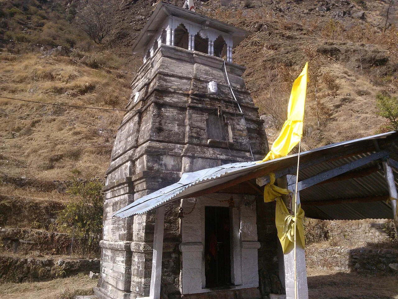
Deoria Tal
Deoria Tal is a lake in Uttarakhand’s Rudraprayag district, visited for its forested setting, snow-covered mountain backdrop and religious significance.
Key facts · verified by Ghumoopedia editors
- Type of place
- Natural attraction
- Best time to visit
- March to June and September to November; December to February for snow in the hills; July to September only for the Valley of Flowers
- Nearest railway station
- Yog Nagari Rishikesh · about 94 km (straight line)
- Verified
- 21 Nov 2026
Plan a trip from Deoria Tal — a day-by-day route through places nearby.
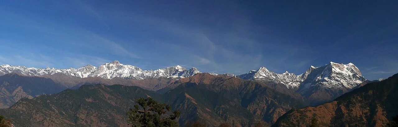
Also called Devaria or Deoriya, Deoria Tal lies about 3 km from Sari and Mastura, along the Ukhimath–Chopta road in Uttarakhand. At an elevation of 2,438 metres in the Garhwal Himalayas, the lake is surrounded by dense woodland and lush vegetation. Snow-covered peaks rise behind it, including Chaukhamba. The lake holds sacred significance for many people in India, including Hindus, Jains, Buddhists, Sikhs and members of other religious communities. Uttarakhand, the Devbhumi or land of the gods, spans the Garhwal and Kumaon Himalaya: the Char Dham shrines and Panch Prayag confluences, Haridwar and Rishikesh on the Ganga, colonial hill stations such as Mussoorie, Nainital and Ranikhet, Corbett and Rajaji tiger reserves, the alpine Valley of Flowers, and Garhwali, Kumaoni, Jaunsari and Bhotiya communities with their folk songs, temple fairs and Aipan art. The plains around Haridwar and Udham Singh Nagar are hot from April to June; hill towns stay mild in summer and cold in winter, with snow above about 2,000 m from December to February. The monsoon (July to September) brings heavy rain, landslides and frequent road closures. High shrines such as Kedarnath and Badrinath open only from about late April or May until around Diwali. The usual best time to visit is March to June and September to November; December to February for snow in the hills; July to September only for the Valley of Flowers. Timings, fees and access arrangements must be confirmed locally. For official information, see Uttarakhand Tourism at https://uttarakhandtourism.gov.in.
Why it matters
Deoria Tal is a high-altitude lake in Rudraprayag district, set among wooded slopes with views of the Garhwal Himalaya, including Chaukhamba in suitable conditions. Its importance is both natural and cultural: visitors come for the mountain landscape, while local and regional traditions associate the lake with sacred stories. The existing guide describes it as sacred to Hindus, Jains, Buddhists, Sikhs and other groups; specific beliefs and practices can differ, so visitors should approach the site respectfully. The lake is also a starting point for walking in the surrounding hills and supports local nature-based tourism.
Deoria Tal is a natural lake, not a documented man-made reservoir or a site with a known builder. Reliable written records establishing when it formed or when people first began visiting it are not readily available, so a precise origin date should not be assigned. Its long-standing significance is expressed chiefly through oral tradition and religious association rather than a well-documented construction history. The name also appears in variant forms, including Devaria and Deoriya. The lake lies above the villages of Sari and Mastura, on the Ukhimath–Chopta route, in a region shaped by pastoral life, farming and pilgrimage travel. In more recent decades, trekking and sightseeing have brought additional visitors, particularly those seeking Himalayan views and a walk from Sari. This has made responsible waste handling and care for the lake’s surroundings increasingly important. For current details about trail management, access rules or conservation work, visitors should ask local authorities or the relevant forest office.
Origin stories & folklore
According to a widely repeated Mahabharata-associated tradition, Deoria Tal is linked with the story of the Pandavas and the Yaksha who questioned them. Retellings often connect the lake with the episode known as the Yaksha Prashna, though details vary and should be understood as legend, not verified local history. Some accounts also describe the water as a place where gods or celestial beings bathed, an idea reflected in the lake’s sacred reputation. Such stories help explain why some visitors treat the setting with particular reverence. They are part of a broader Himalayan landscape of pilgrimage, oral storytelling and sacred geography; there is no single version shared by every community.
Spend unhurried time at Deoria Tal: walk the marked paths, use official viewpoints and ask locally whether a guide, entry ticket or forest permission is needed. Enjoy the water from safe, marked points; rocks near falls and dams are slippery and currents are dangerous, especially in the monsoon. A comfortable itinerary is one main visit in the morning, a local meal at midday and a short nearby stop before an afternoon return. In the mountains, mornings are clearest; clouds often roll in by noon, so start early for Himalayan views. Use the district list on this site to find other places in Rudraprayag, but check the route and its condition before combining stops. If a festival is on — such as the Kumbh and Ardh Kumbh at Haridwar, the Kanwar Yatra in July, Ganga Dussehra, the Nanda Devi Raj Jat, Phool Dei and Harela, or the Uttarayani fair at Bageshwar — roads and stays can be busy, and the experience can be unforgettable. Leave no litter: the Himalayan valleys have little waste collection, so carry a refillable bottle and bring your rubbish back down.
Suggested itineraries
Half day: From Sari, walk up to Deoria Tal (allow roughly 1–2 hours each way, depending on pace); spend 45–90 minutes at the lake and viewpoints; return to Sari for a meal. Full day: Start early from Sari; walk to the lake and take time at permitted viewpoints (about 3–5 hours including breaks); return to Sari for lunch; if road and weather conditions allow, continue by vehicle toward Ukhimath for a short town or temple visit, then return. Gentler option: If the uphill trail is too demanding, enjoy a short, easy outing in Sari and nearby roadside viewpoints instead; confirm suitable access locally rather than attempting the lake walk.
Life around Deoria Tal is part of the wider Garhwali cultural region. Garhwali is widely spoken locally, alongside Hindi, and visitors may hear other languages in this well-travelled part of Uttarakhand. Folk songs, devotional singing, temple observances and seasonal fairs remain part of regional cultural life, although the lake itself is not known for a regular performance programme. Traditional clothing is worn especially for religious or family occasions, while everyday dress is practical for mountain work and changing weather. Customs vary by village and household. Visitors can show respect by keeping noise low near worshippers, asking before photographing people, and following local guidance about sacred places and the lake’s edge.
Local communities
The villages of Sari and Mastura are closely connected to access and visitor services around Deoria Tal. Garhwali residents of the wider area sustain livelihoods through a mix of farming, livestock keeping, small businesses, public services and seasonal tourism. Local people may provide food, accommodation, transport coordination or guiding, depending on availability. The wider district includes varied communities and traditions; it is best not to assume that every household shares the same customs or religious practice. Visitors can support local livelihoods by using locally run services, asking permission before taking portraits, and packing out waste rather than leaving it for residents to manage.
Festivals & events
Deoria Tal is not known for a large annual festival held at the lakeshore. Nearby Ukhimath has important temple traditions, including observances associated with Maha Shivaratri, generally in late winter or early spring; local celebrations can draw additional visitors. Regional Hindu festivals and village fairs may also take place in the surrounding area, but programmes and scale vary from year to year. The Nanda Devi Raj Jat is a major regional pilgrimage held at long intervals, not an annual event at the lake. During festival periods, roads, local services and accommodation may be busier than usual. Confirm locally before planning a visit around a religious event.
Local food in Uttarakhand includes kafuli (spinach curry), phaanu and chainsoo (lentil dishes), aloo ke gutke, bhatt ki churkani, mandua (finger-millet) rotis, jhangora kheer, singori and bal mithai from Almora, with rhododendron (buransh) squash in spring. Ask what is fresh that day; many small eateries cook a limited daily menu. Hill food is simple and warming, with plenty of vegetarian options; in pilgrim towns many eateries serve only vegetarian food without onion or garlic, and alcohol and meat are banned in places such as Haridwar, Rishikesh and the Char Dham towns. Remote sites may have no restaurant at all. Carry water and snacks, eat a proper breakfast before long drives, and ask your accommodation for a packed lunch if you are heading out early. Try a home-cooked or local thali meal when you can — it is often the best food on the route. Choose busy, clean places, drink sealed or filtered water, and carry your packaging back with you.
Shopping & local experiences
Shopping options at Deoria Tal are limited. Sari and nearby towns may have small shops for snacks and basic supplies, while larger markets are found in regional towns such as Ukhimath or Rudraprayag. Depending on availability, look for locally made woollens, simple handicrafts, regional pulses and packaged Garhwali foods rather than assuming a particular craft stall will be open. Buy directly from local makers or shops where possible, and avoid purchasing wildlife products, plants or items taken from the forest. A meal at a locally run eatery or homestay can be a good way to experience regional cooking; ask about ingredients and availability.
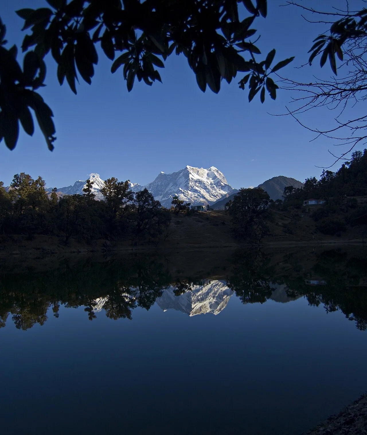
At about 2,438 metres above sea level, Deoria Tal sits in a forested Himalayan setting above the villages on the Ukhimath–Chopta road. The lake’s still water can reflect nearby woods and snow-covered peaks, including Chaukhamba when skies are clear. Coniferous and broadleaf trees grow in the surrounding mountain landscape, with vegetation changing by elevation and season. The area provides habitat for Himalayan wildlife and forest birds, but sightings are never assured; keep distance from animals and do not feed them. Weather can shift quickly, and monsoon rain may make paths muddy or unsafe. Stay on established trails, avoid disturbing plants and wildlife, and take all rubbish back down. Swimming is not advised; respect any local safety instructions around the water.
March to June and September to November; December to February for snow in the hills; July to September only for the Valley of Flowers
The nearest principal railway station by straight-line distance is Yog Nagari Rishikesh, roughly 94 km away. The nearest operating airport by straight-line distance is Jolly Grant Airport, Dehradun, roughly 98 km away. These figures are calculated from map coordinates — actual road distance is longer, and mountain roads mean even short distances can take hours. Haridwar, Rishikesh (Yog Nagari Rishikesh) and Dehradun stations and Dehradun's Jolly Grant Airport are the gateways to Garhwal; Kathgodam station and Pantnagar Airport serve Kumaon; Ramnagar station serves Corbett. Beyond these, travel is by road. From Haridwar, Rishikesh, Dehradun or Kathgodam, take a Uttarakhand Roadways (UTC) or GMOU bus, a shared jeep or a reserved taxi; in the hills, shared jeeps leave early from town taxi stands and fill up fast, while a reserved taxi gives flexibility for temples and viewpoints. Mountain roads close at night in many areas, so plan to arrive before dark. When comparing train, bus and flight, count the complete door-to-door time: a flight saves the most time only if the onward road transfer is short, while an overnight train can save a hotel night. For the Garhwal hills, an overnight train to Haridwar, Rishikesh or Dehradun (or a flight to Jolly Grant Airport, Dehradun) is the usual start; for Kumaon, trains run to Kathgodam and flights to Pantnagar. The road journey into the mountains takes most of a day, so do not plan sightseeing on arrival. Book your return before you leave, because seats fill quickly on weekends, festivals and holidays. Current train numbers, timings, return services and fares are not listed here; check IRCTC and NTES for trains and the airline's own schedule for flights. No permit is needed for most of Uttarakhand, but Char Dham pilgrims (Yamunotri, Gangotri, Kedarnath and Badrinath) and Hemkund Sahib pilgrims must register online with Uttarakhand Tourism before travelling, and areas near the Tibet border such as Adi Kailash, Om Parvat, Niti and Nelong valleys need an Inner Line Permit.
Confirm onward and return timings on IRCTC / NTES, the state bus operator or your airline before travel. A dash means current timings or fares have not been verified.
Getting around
Most visitors travel by road to Sari, the usual starting point for the walk to the lake. Buses and shared vehicles serve towns on the wider Ukhimath–Chopta corridor, but onward connections can be limited; a reserved taxi may offer more flexibility. Ask locally about road conditions, vehicle access and where to park before beginning the walk. There is no regular public transport around the lakeshore, and visitors generally explore on foot using marked or locally indicated paths. Do not rely on autos or boats being available. Arrange your return ride in advance if travelling by shared vehicle, and avoid walking the mountain road in poor visibility.
Hours, tickets & permissions
Access arrangements can change with season, weather and local management. A ticket, forest entry permission, registration or other rule may apply, and camera or drone restrictions may also be in force. Do not assume that access is unrestricted simply because the lake is outdoors. Ask at Sari or the relevant local or forest authority about current entry requirements, permitted routes and any closures before setting out. Carry identification if local officials request it.
Facilities
Facilities at the lake itself are limited and may vary with season and management. Basic toilets, seating, drinking water or small refreshment options may be available near the approach, but visitors should check locally and carry water and snacks rather than depend on them. Sari and nearby settlements are more likely to have simple meals, homestays and basic services. Parking arrangements may be informal or subject to local direction. Guides may be available through local providers, but are not guaranteed. ATMs and larger medical facilities are not expected at the lake; plan for these in a larger town before travelling.
Accessibility
The usual approach from Sari is an uphill walk on a mountain trail, with uneven ground, rocks and sections that may become muddy or slippery after rain. The route requires stamina and suitable footwear; allow extra time for breaks and altitude. Shade varies along the trail, so sun protection and water are useful. The path is not known to have continuous wheelchair access, and it is generally unsuitable for wheelchairs and strollers. Older visitors or anyone with mobility, balance or heart and breathing concerns should assess the climb conservatively and seek local advice before starting. There may be no reliable accessible toilet or resting infrastructure on the trail.
No permit is needed for most of Uttarakhand, but Char Dham pilgrims (Yamunotri, Gangotri, Kedarnath and Badrinath) and Hemkund Sahib pilgrims must register online with Uttarakhand Tourism before travelling, and areas near the Tibet border such as Adi Kailash, Om Parvat, Niti and Nelong valleys need an Inner Line Permit. Carry a photo ID at all times and save the emergency number 112 and your accommodation's contact offline. Mountain roads are narrow and prone to landslides, especially from July to September; travel in daylight, use experienced local drivers, check the state disaster authority's road updates and keep a spare day in your plan for closures. Char Dham pilgrims must register online with Uttarakhand Tourism before travelling. Waterfalls, lakes and dams are dangerous in the monsoon: keep behind barriers, never swim in unmarked spots and leave the area if the water rises suddenly.
Photography
Clear mornings often offer the best chance of seeing mountain reflections before cloud builds, though conditions change quickly. Use established paths and locally permitted viewpoints, and avoid stepping onto fragile banks or entering the water for a photograph. Ordinary personal photography is commonly practised, but confirm any camera restrictions or fees with local managers. Drone use may be restricted by forest, safety or aviation rules; do not fly without the required permissions. Ask before photographing residents, workers or worshippers, and avoid interrupting prayers or other observances.
Choose a stay by the full journey to Deoria Tal, not just the district name. GMVN (Garhwal Mandal Vikas Nigam) and KMVN (Kumaon Mandal Vikas Nigam) run tourist rest houses across the hills, alongside homestays registered under the state's homestay scheme and small hotels; in pilgrim towns, dharamshalas and temple committee guesthouses are common. Nights are cold for much of the year — check heating, hot water and extra blankets. Book in advance for weekends, festivals and the peak season (March to June and September to November; December to February for snow in the hills; July to September only for the Valley of Flowers). Confirm the exact location, meals included, check-in time and cancellation terms in writing. Avoid sending money to unverified contacts or touts at stations. Carry some cash, as card and digital payments can be unreliable in remote areas.
Ukhimath is a nearby town with the Omkareshwar Temple, an important centre of regional worship. The Chopta area is known for mountain scenery and as an approach toward Tungnath, with Chandrashila reached by a further hike; these outings require separate time and suitable conditions. Rudraprayag town, at the confluence of the Alaknanda and Mandakini rivers, is another regional stop. These places are not all practical additions to a short visit, and road travel can take longer than map distances suggest. Check weather, trail status and road conditions before combining destinations.
For couples, Deoria Tal rewards a slow pace: arrive early for soft light and fewer crowds, share a local meal and keep the evening free. Sunrise over the Himalaya from a ridge-top homestay, a forest walk or an evening by a quiet lake makes the trip memorable. Public displays of affection can be frowned upon in conservative communities and at religious sites, so be discreet. Keep a buffer in your itinerary, because weather and road conditions can delay plans.
Q: How much time should I allow for Deoria Tal? A: Allow a half day for the walk from Sari, time by the lake and the return. A full day gives more flexibility for breaks or a nearby stop. Q: When is a good season to visit? A: Spring and autumn often offer pleasant walking conditions; summer is also popular. Monsoon rain can bring slippery trails and road disruption, while winter may bring cold and snow. Check conditions before travelling. Q: Is entry free, and do I need a permit? A: Rules can change. Ask the local or forest authority about any entry ticket, registration, permission or other requirement before setting out. Q: Can children or elderly visitors make the walk? A: The uphill trail is uneven and can be strenuous. Suitability depends on fitness, health and weather; consider a shorter outing if the climb is not appropriate. Q: Where can I stay nearby? A: Sari and nearby settlements may have homestays or guest accommodation, with more options in larger regional towns. Availability varies, so confirm and book locally in advance.
Be the first to share photos, stories, advice or a helpful contact for Deoria Tal.
Loading…