
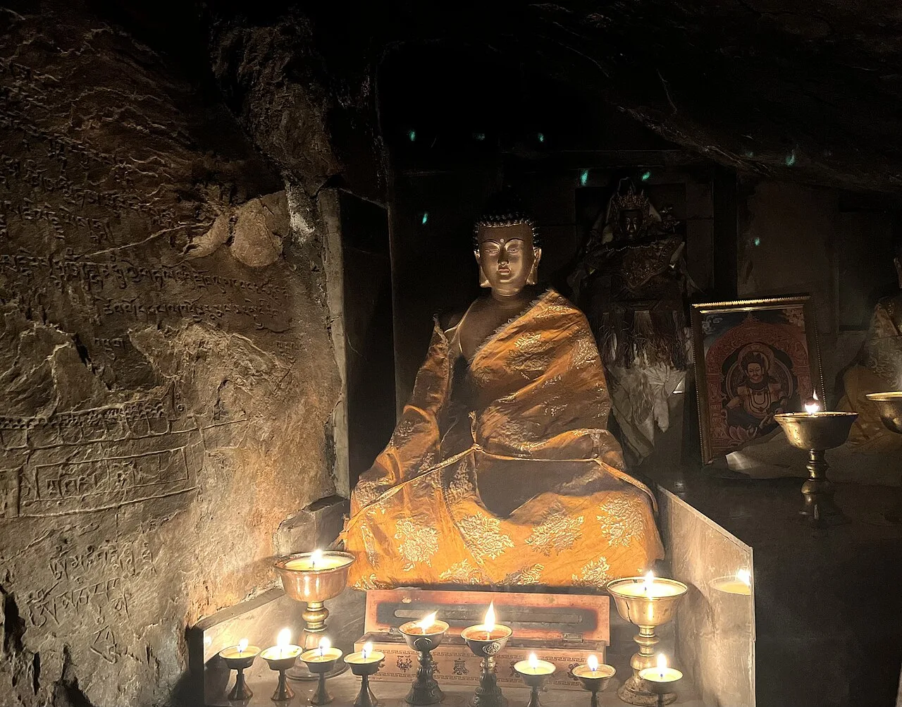
Dharchula
Dharchula is a Himalayan town in Uttarakhand’s Pithoragarh district, drawing visitors for its borderland culture, mountain setting and place on the Kailash Mansarovar pilgrimage route.
Key facts · verified by Ghumoopedia editors
- Type of place
- Destination
- Best time to visit
- March to June and September to November; December to February for snow in the hills; July to September only for the Valley of Flowers
- Nearest railway station
- Tanakpur · about 96 km (straight line)
- Nearest airport
- Pithoragarh (Naini Saini) Airport (limited flights) · about 41 km (straight line)
- Verified
- 21 Nov 2026
Plan a trip from Dharchula — a day-by-day route through places nearby.
At around 940 metres (3,080 feet) above sea level, Dharchula lies among the Himalayan ranges. The Mahakali River runs through the town, with the Indian settlement on one bank and a Nepali one on the other. People living on both sides have strong cultural, linguistic and social connections shaped by a shared heritage. Local residents can cross the river without passports or visas, supporting everyday contact and trade. The river marks an international boundary, but longstanding links continue across it; movement between the settlements helps neighbours maintain social ties and conduct commerce. Khas, Kumaoni, Dotyali and Rung communities contribute to the area's varied traditions. Dharchula is about 92 kilometres north of Pithoragarh, the district headquarters, and lies on the Pithoragarh–Lipulekh Pass Highway. It is also on the Kailash Mansarovar Yatra, a pilgrimage of importance to Hindus, Buddhists and Jains. The Panchachuli peaks can be seen to the west, and trekking routes pass through the surrounding region. Uttarakhand, the Devbhumi or land of the gods, spans the Garhwal and Kumaon Himalaya: the Char Dham shrines and Panch Prayag confluences, Haridwar and Rishikesh on the Ganga, colonial hill stations such as Mussoorie, Nainital and Ranikhet, Corbett and Rajaji tiger reserves, the alpine Valley of Flowers, and Garhwali, Kumaoni, Jaunsari and Bhotiya communities with their folk songs, temple fairs and Aipan art. The plains around Haridwar and Udham Singh Nagar are hot from April to June; hill towns stay mild in summer and cold in winter, with snow above about 2,000 m from December to February. The monsoon (July to September) brings heavy rain, landslides and frequent road closures. High shrines such as Kedarnath and Badrinath open only from about late April or May until around Diwali. The usual best time to visit is March to June and September to November; December to February for snow in the hills; July to September only for the Valley of Flowers. Timings, fees and access arrangements must be confirmed locally. For official information, see Uttarakhand Tourism at https://uttarakhandtourism.gov.in.
Why it matters
Dharchula is a border town in Pithoragarh district, Uttarakhand, on the Indian bank of the Mahakali River, which separates it from Darchula in Nepal. Its position makes it a place where everyday life, trade and family connections span an international boundary. Residents on both sides share close cultural and linguistic ties; local people have traditionally been permitted to cross the river without passports or visas, though other visitors should follow current border rules. Dharchula is also a staging point on the Pithoragarh–Lipulekh Pass Highway and a stop on the Kailash Mansarovar pilgrimage route. Its regional importance comes from this border and route-setting, as well as its role as a service centre for surrounding Himalayan communities. It is not principally known as a UNESCO site or protected monument.
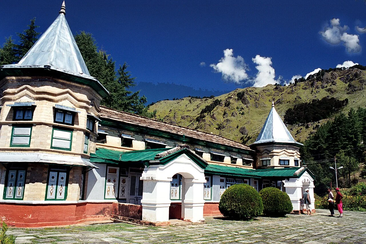
The history of Dharchula is closely tied to the Mahakali River valley and the communities living on both sides of what is now the India–Nepal border. The town’s name and early settlement history are not consistently documented in widely available sources, so a precise founding date or builder cannot be stated with confidence. Khas, Kumaoni, Dotyali and Rung communities have contributed to the area’s social and cultural life, while family links and exchange across the river long pre-date modern transport infrastructure. The river became an international boundary, but everyday connections between the settlements continued; local cross-border movement and trade remain distinctive features of the town. In more recent times, road development connected Dharchula more directly with Pithoragarh and the upper Kali valley. The Pithoragarh–Lipulekh Pass Highway serves local travel and forms part of the route towards high Himalayan passes and the Kailash Mansarovar pilgrimage. This has brought visitors, pilgrims and logistical activity alongside the town’s role as a local market and administrative centre. There is no widely established account of a major restoration campaign or historic monument defining Dharchula; its significance is primarily in its living border-town setting.
Use Dharchula as a base to understand local life: walk through the market, look for local crafts such as Kumaoni Aipan art, ringaal bamboo craft, Pashmina and woollen shawls, copperware from Almora, Bal Mithai and local pulses and honey and ask your host about nearby viewpoints and short excursions. Always ask before photographing people, homes or ceremonies. A comfortable itinerary is one main visit in the morning, a local meal at midday and a short nearby stop before an afternoon return. In the mountains, mornings are clearest; clouds often roll in by noon, so start early for Himalayan views. Use the district list on this site to find other places in Pithoragarh, but check the route and its condition before combining stops. If a festival is on — such as the Kumbh and Ardh Kumbh at Haridwar, the Kanwar Yatra in July, Ganga Dussehra, the Nanda Devi Raj Jat, Phool Dei and Harela, or the Uttarayani fair at Bageshwar — roads and stays can be busy, and the experience can be unforgettable. Leave no litter: the Himalayan valleys have little waste collection, so carry a refillable bottle and bring your rubbish back down.
Suggested itineraries
Half day: Walk through the market (about 1–2 hours), pause for a local meal (about 1 hour), then ask locally about a nearby viewpoint or short excursion (about 1–2 hours). Full day: Start with a morning market walk (about 1–2 hours), take a locally arranged excursion towards a nearby viewpoint or attraction (about 3–4 hours), return for a meal and a relaxed riverside or town-centre walk (about 1–2 hours); check road conditions before departure. Gentler option: Keep to a short, seated visit near the town centre, with frequent rests and a meal close to your accommodation; ask your host to advise on level routes.
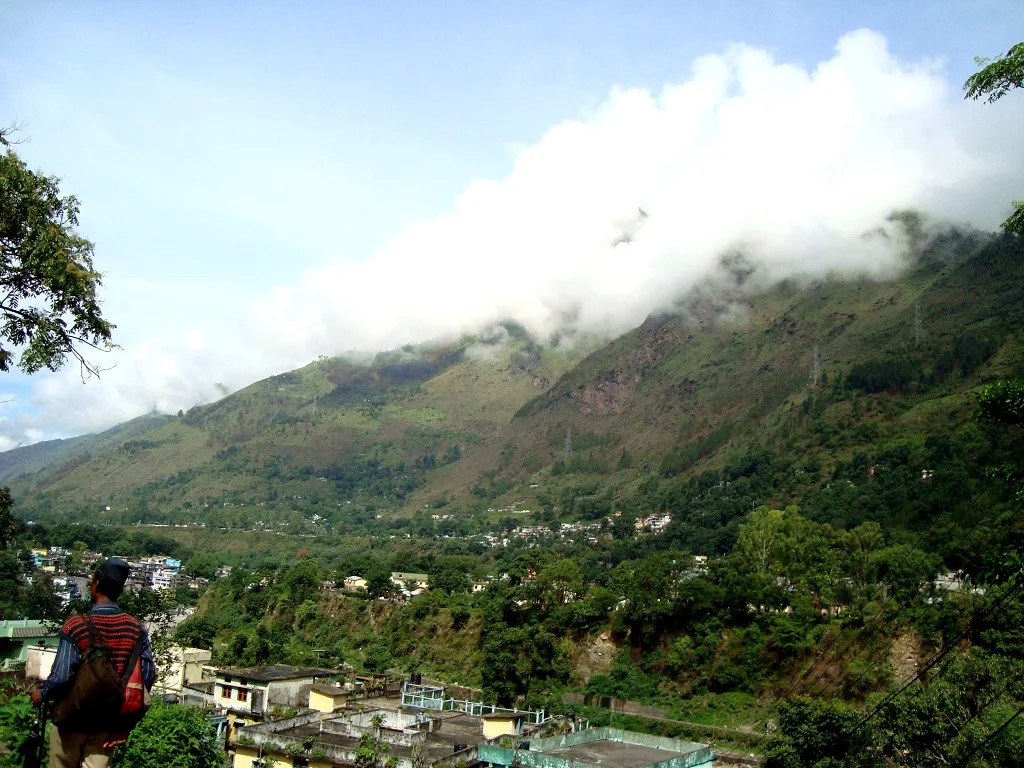
Dharchula’s culture reflects its position in the eastern Kumaon Himalaya and its connections across the Mahakali River. Khas, Kumaoni, Dotyali and Rung communities contribute to a varied local identity. Languages and speech forms heard in the wider area include Kumaoni, Hindi and regional varieties associated with communities on both sides of the border. Family visits, market exchange and shared social ties are part of life here, subject to current border arrangements. Local food and household traditions draw on Himalayan grains, pulses and seasonal produce. Woollen clothing and shawls are practical in the cold mountain climate. Music, dance and ceremonial customs differ between communities and occasions; visitors should ask locally rather than assume a performance is staged for tourists.
Festivals & events
Harela, a seasonal festival associated with the Kumaon region, is generally observed during the monsoon season, while Uttarayani fairs take place in parts of Kumaon in winter. Community and religious observances among Rung and other local groups may also be important, though dates and practices vary by village and year. Nearby market towns can become busier during fairs, and accommodation or road travel may be affected. Dharchula is also associated with the Kailash Mansarovar pilgrimage season, when pilgrims and support activity can add to local traffic. Ask residents or local authorities about events during your visit, and be respectful when attending ceremonies.
Local food in Uttarakhand includes kafuli (spinach curry), phaanu and chainsoo (lentil dishes), aloo ke gutke, bhatt ki churkani, mandua (finger-millet) rotis, jhangora kheer, singori and bal mithai from Almora, with rhododendron (buransh) squash in spring. Ask what is fresh that day; many small eateries cook a limited daily menu. Hill food is simple and warming, with plenty of vegetarian options; in pilgrim towns many eateries serve only vegetarian food without onion or garlic, and alcohol and meat are banned in places such as Haridwar, Rishikesh and the Char Dham towns. Remote sites may have no restaurant at all. Carry water and snacks, eat a proper breakfast before long drives, and ask your accommodation for a packed lunch if you are heading out early. Try a home-cooked or local thali meal when you can — it is often the best food on the route. Choose busy, clean places, drink sealed or filtered water, and carry your packaging back with you.
Shopping & local experiences
Browse Dharchula’s market for everyday local goods and ask about products made in the surrounding region. Kumaoni Aipan designs, ringaal bamboo craft, woollen shawls and Pashmina may be available, but origin and material can vary; check with sellers rather than assuming an item is locally made. Copperware associated with Almora, Bal Mithai, local pulses and honey are other regional products to look for. Availability is seasonal and may be limited. Buying directly from a maker or small shop can support local livelihoods. Carry reusable bags and avoid purchasing wildlife products or items of uncertain origin.
March to June and September to November; December to February for snow in the hills; July to September only for the Valley of Flowers
The nearest principal railway station by straight-line distance is Tanakpur, roughly 96 km away. The nearest operating airport by straight-line distance is Pithoragarh (Naini Saini) Airport (limited flights), roughly 41 km away. These figures are calculated from map coordinates — actual road distance is longer, and mountain roads mean even short distances can take hours. Haridwar, Rishikesh (Yog Nagari Rishikesh) and Dehradun stations and Dehradun's Jolly Grant Airport are the gateways to Garhwal; Kathgodam station and Pantnagar Airport serve Kumaon; Ramnagar station serves Corbett. Beyond these, travel is by road. From Haridwar, Rishikesh, Dehradun or Kathgodam, take a Uttarakhand Roadways (UTC) or GMOU bus, a shared jeep or a reserved taxi; in the hills, shared jeeps leave early from town taxi stands and fill up fast, while a reserved taxi gives flexibility for temples and viewpoints. Mountain roads close at night in many areas, so plan to arrive before dark. When comparing train, bus and flight, count the complete door-to-door time: a flight saves the most time only if the onward road transfer is short, while an overnight train can save a hotel night. For the Garhwal hills, an overnight train to Haridwar, Rishikesh or Dehradun (or a flight to Jolly Grant Airport, Dehradun) is the usual start; for Kumaon, trains run to Kathgodam and flights to Pantnagar. The road journey into the mountains takes most of a day, so do not plan sightseeing on arrival. Book your return before you leave, because seats fill quickly on weekends, festivals and holidays. Current train numbers, timings, return services and fares are not listed here; check IRCTC and NTES for trains and the airline's own schedule for flights. No permit is needed for most of Uttarakhand, but Char Dham pilgrims (Yamunotri, Gangotri, Kedarnath and Badrinath) and Hemkund Sahib pilgrims must register online with Uttarakhand Tourism before travelling, and areas near the Tibet border such as Adi Kailash, Om Parvat, Niti and Nelong valleys need an Inner Line Permit.
Confirm onward and return timings on IRCTC / NTES, the state bus operator or your airline before travel. A dash means current timings or fares have not been verified.
Getting around
Dharchula’s market and central streets can be explored on foot, though the terrain is hilly and roads may be steep or uneven. Local taxis and shared vehicles are the practical options for reaching outlying villages, viewpoints and regional attractions; availability can vary, so ask locally and agree on the destination before travelling. Local buses and shared jeeps connect the town with other settlements, but services may be limited or affected by road conditions. There is no need to assume that the river crossing is a public tourist ferry. Check where vehicles may park, and avoid blocking narrow roads or access for local traffic.
Hours, tickets & permissions
Dharchula is a town rather than a ticketed attraction, so ordinary public streets and market areas do not generally have a single visitor entry gate. There may be separate rules for border crossings, restricted areas, pilgrimage routes or specific religious sites. Local residents’ cross-river arrangements should not be assumed to apply to other visitors; carry identification and check current border requirements before approaching a crossing. Pilgrims may need advance registration or permits. Confirm current access rules, opening arrangements and any fees with the relevant managing authority before setting out.
Facilities
Dharchula is a working town, and visitors can usually find basic shops, food and accommodation in or near the market area. Simple meals and everyday supplies are more readily available in town than on outlying routes. Toilets, drinking-water refill points, parking and cash services may be limited or vary by location, so check locally and carry essentials when leaving town. Guides or drivers for regional excursions may be arranged through accommodation providers or local contacts, but availability is not guaranteed. Bring any medicines you need, and do not rely on mobile connectivity or card acceptance everywhere.
Accessibility
Dharchula lies in mountainous terrain, and streets can be sloped, uneven or narrow, with vehicle traffic in busy areas. A market visit may involve walking on rough surfaces and negotiating changes in level; conditions can worsen in rain. There is no reliable basis to assume continuous step-free access, ramps or accessible public toilets. Wheelchair users and visitors with strollers may find independent movement difficult, especially beyond the central streets. Older visitors or anyone with limited mobility may prefer short outings, frequent rests and a vehicle arranged close to the destination. Ask accommodation staff about the day’s route and surface conditions before setting out.
No permit is needed for most of Uttarakhand, but Char Dham pilgrims (Yamunotri, Gangotri, Kedarnath and Badrinath) and Hemkund Sahib pilgrims must register online with Uttarakhand Tourism before travelling, and areas near the Tibet border such as Adi Kailash, Om Parvat, Niti and Nelong valleys need an Inner Line Permit. Carry a photo ID at all times and save the emergency number 112 and your accommodation's contact offline. Mountain roads are narrow and prone to landslides, especially from July to September; travel in daylight, use experienced local drivers, check the state disaster authority's road updates and keep a spare day in your plan for closures. Char Dham pilgrims must register online with Uttarakhand Tourism before travelling. Watch your belongings in crowds and on public transport, and follow posted instructions.
Photography
Morning often offers the clearest Himalayan views; cloud can build later, so ask locally about current visibility and suitable viewpoints. The river, market streets and surrounding landscape can make interesting subjects, but viewpoints and access may be affected by weather or local restrictions. Photography in ordinary public areas is generally possible, but rules can differ near border or security installations, checkpoints and restricted locations; follow signs and instructions. Do not use a drone without checking applicable permissions and airspace rules. Ask before photographing people, homes, shops, ceremonies or religious activity, and respect anyone who declines.
Choose a stay by the full journey to Dharchula, not just the district name. GMVN (Garhwal Mandal Vikas Nigam) and KMVN (Kumaon Mandal Vikas Nigam) run tourist rest houses across the hills, alongside homestays registered under the state's homestay scheme and small hotels; in pilgrim towns, dharamshalas and temple committee guesthouses are common. Nights are cold for much of the year — check heating, hot water and extra blankets. Book in advance for weekends, festivals and the peak season (March to June and September to November; December to February for snow in the hills; July to September only for the Valley of Flowers). Confirm the exact location, meals included, check-in time and cancellation terms in writing. Avoid sending money to unverified contacts or touts at stations. Carry some cash, as card and digital payments can be unreliable in remote areas.
Possible regional excursions include Jauljibi, a market settlement near the confluence of the Gori and Kali rivers, and Narayan Ashram, a remote ashram in the wider Pithoragarh district. Chirkila Dam and Askot Wildlife Sanctuary are other names to ask about when planning locally; access and road conditions can vary. The routes towards Adi Kailash and Om Parvat are high-altitude journeys, not casual short stops, and may require permits, registration or local arrangements. Pithoragarh town can be considered for a longer regional circuit. Confirm that roads and sites are accessible before combining destinations, particularly during the monsoon or pilgrimage season.
For couples, Dharchula rewards a slow pace: arrive early for soft light and fewer crowds, share a local meal and keep the evening free. Sunrise over the Himalaya from a ridge-top homestay, a forest walk or an evening by a quiet lake makes the trip memorable. Public displays of affection can be frowned upon in conservative communities and at religious sites, so be discreet. Keep a buffer in your itinerary, because weather and road conditions can delay plans.
Q: How much time should I allow for Dharchula? A: A half day can cover the market and a meal; allow a full day if arranging a nearby excursion, and longer for high-altitude routes. Q: What is the best season to visit? A: March to June and September to November are generally suitable for travel in Uttarakhand; monsoon rain can disrupt mountain roads. Q: Is there an entry ticket or can visitors cross into Nepal? A: The town is not a ticketed attraction, but border-crossing rules apply. Do not assume local residents’ crossing arrangements apply to visitors; confirm requirements locally. Q: Is Dharchula suitable for children and elderly visitors? A: A short town visit may suit many, but steep or uneven streets and long road journeys can be tiring. Plan rests and check conditions. Q: Can I stay nearby? A: Dharchula has accommodation options, though availability and facilities vary. Confirm a place to stay before travelling, especially during busy pilgrimage periods.
Be the first to share photos, stories, advice or a helpful contact for Dharchula.
Loading…