
Tehri Dam
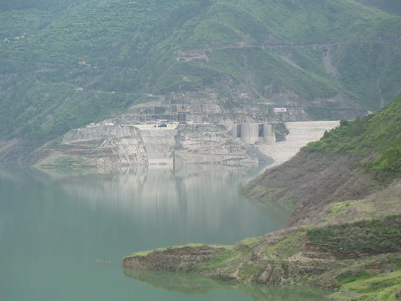
Located on the Bhagirathi in Uttarakhand’s Tehri Garhwal district, Tehri Dam is a major water-storage and power structure. Visitors come to view its scale and reservoir.
Key facts · verified by Ghumoopedia editors
- Type of place
- Natural attraction
- Best time to visit
- March to June and September to November; December to February for snow in the hills; July to September only for the Valley of Flowers
- Nearest railway station
- Yog Nagari Rishikesh · about 37 km (straight line)
- Verified
- 21 Nov 2026
Plan a trip from Tehri Dam — a day-by-day route through places nearby.
At New Tehri, the dam spans the Bhagirathi and is built as a rock-and-earth embankment. Its height of 260.5 metres (855 feet) makes it India’s tallest dam and the world’s thirteenth-tallest. It is the principal dam of THDC India Ltd. and the Tehri hydroelectric complex. The reservoir stores water for irrigation and municipal supply, while the project also generates hydroelectricity. Its roles bring water storage and power production together at one site. Construction began in 1978 and was finished in 2006. A variable-speed pumped-storage scheme with a capacity of 1,000 MW is nearing completion. Uttarakhand, the Devbhumi or land of the gods, spans the Garhwal and Kumaon Himalaya: the Char Dham shrines and Panch Prayag confluences, Haridwar and Rishikesh on the Ganga, colonial hill stations such as Mussoorie, Nainital and Ranikhet, Corbett and Rajaji tiger reserves, the alpine Valley of Flowers, and Garhwali, Kumaoni, Jaunsari and Bhotiya communities with their folk songs, temple fairs and Aipan art. The plains around Haridwar and Udham Singh Nagar are hot from April to June; hill towns stay mild in summer and cold in winter, with snow above about 2,000 m from December to February. The monsoon (July to September) brings heavy rain, landslides and frequent road closures. High shrines such as Kedarnath and Badrinath open only from about late April or May until around Diwali. The usual best time to visit is March to June and September to November; December to February for snow in the hills; July to September only for the Valley of Flowers. Timings, fees and access arrangements must be confirmed locally. For official information, see Uttarakhand Tourism at https://uttarakhandtourism.gov.in.
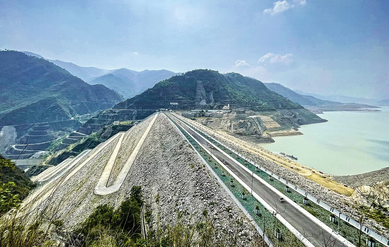
Spend unhurried time at Tehri Dam: walk the marked paths, use official viewpoints and ask locally whether a guide, entry ticket or forest permission is needed. Enjoy the water from safe, marked points; rocks near falls and dams are slippery and currents are dangerous, especially in the monsoon. A comfortable itinerary is one main visit in the morning, a local meal at midday and a short nearby stop before an afternoon return. In the mountains, mornings are clearest; clouds often roll in by noon, so start early for Himalayan views. Use the district list on this site to find other places in Tehri Garhwal, but check the route and its condition before combining stops. If a festival is on — such as the Kumbh and Ardh Kumbh at Haridwar, the Kanwar Yatra in July, Ganga Dussehra, the Nanda Devi Raj Jat, Phool Dei and Harela, or the Uttarayani fair at Bageshwar — roads and stays can be busy, and the experience can be unforgettable. Leave no litter: the Himalayan valleys have little waste collection, so carry a refillable bottle and bring your rubbish back down.
Local food in Uttarakhand includes kafuli (spinach curry), phaanu and chainsoo (lentil dishes), aloo ke gutke, bhatt ki churkani, mandua (finger-millet) rotis, jhangora kheer, singori and bal mithai from Almora, with rhododendron (buransh) squash in spring. Ask what is fresh that day; many small eateries cook a limited daily menu. Hill food is simple and warming, with plenty of vegetarian options; in pilgrim towns many eateries serve only vegetarian food without onion or garlic, and alcohol and meat are banned in places such as Haridwar, Rishikesh and the Char Dham towns. Remote sites may have no restaurant at all. Carry water and snacks, eat a proper breakfast before long drives, and ask your accommodation for a packed lunch if you are heading out early. Try a home-cooked or local thali meal when you can — it is often the best food on the route. Choose busy, clean places, drink sealed or filtered water, and carry your packaging back with you.
March to June and September to November; December to February for snow in the hills; July to September only for the Valley of Flowers
The nearest principal railway station by straight-line distance is Yog Nagari Rishikesh, roughly 37 km away. The nearest operating airport by straight-line distance is Jolly Grant Airport, Dehradun, roughly 36 km away. These figures are calculated from map coordinates — actual road distance is longer, and mountain roads mean even short distances can take hours. Haridwar, Rishikesh (Yog Nagari Rishikesh) and Dehradun stations and Dehradun's Jolly Grant Airport are the gateways to Garhwal; Kathgodam station and Pantnagar Airport serve Kumaon; Ramnagar station serves Corbett. Beyond these, travel is by road. From Haridwar, Rishikesh, Dehradun or Kathgodam, take a Uttarakhand Roadways (UTC) or GMOU bus, a shared jeep or a reserved taxi; in the hills, shared jeeps leave early from town taxi stands and fill up fast, while a reserved taxi gives flexibility for temples and viewpoints. Mountain roads close at night in many areas, so plan to arrive before dark. When comparing train, bus and flight, count the complete door-to-door time: a flight saves the most time only if the onward road transfer is short, while an overnight train can save a hotel night. For the Garhwal hills, an overnight train to Haridwar, Rishikesh or Dehradun (or a flight to Jolly Grant Airport, Dehradun) is the usual start; for Kumaon, trains run to Kathgodam and flights to Pantnagar. The road journey into the mountains takes most of a day, so do not plan sightseeing on arrival. Book your return before you leave, because seats fill quickly on weekends, festivals and holidays. Current train numbers, timings, return services and fares are not listed here; check IRCTC and NTES for trains and the airline's own schedule for flights. No permit is needed for most of Uttarakhand, but Char Dham pilgrims (Yamunotri, Gangotri, Kedarnath and Badrinath) and Hemkund Sahib pilgrims must register online with Uttarakhand Tourism before travelling, and areas near the Tibet border such as Adi Kailash, Om Parvat, Niti and Nelong valleys need an Inner Line Permit.
Confirm onward and return timings on IRCTC / NTES, the state bus operator or your airline before travel. A dash means current timings or fares have not been verified.
No permit is needed for most of Uttarakhand, but Char Dham pilgrims (Yamunotri, Gangotri, Kedarnath and Badrinath) and Hemkund Sahib pilgrims must register online with Uttarakhand Tourism before travelling, and areas near the Tibet border such as Adi Kailash, Om Parvat, Niti and Nelong valleys need an Inner Line Permit. Carry a photo ID at all times and save the emergency number 112 and your accommodation's contact offline. Mountain roads are narrow and prone to landslides, especially from July to September; travel in daylight, use experienced local drivers, check the state disaster authority's road updates and keep a spare day in your plan for closures. Char Dham pilgrims must register online with Uttarakhand Tourism before travelling. Waterfalls, lakes and dams are dangerous in the monsoon: keep behind barriers, never swim in unmarked spots and leave the area if the water rises suddenly.
Choose a stay by the full journey to Tehri Dam, not just the district name. GMVN (Garhwal Mandal Vikas Nigam) and KMVN (Kumaon Mandal Vikas Nigam) run tourist rest houses across the hills, alongside homestays registered under the state's homestay scheme and small hotels; in pilgrim towns, dharamshalas and temple committee guesthouses are common. In summer, check air-conditioning; in the monsoon, check that the property is accessible if roads flood. Book in advance for weekends, festivals and the peak season (March to June and September to November; December to February for snow in the hills; July to September only for the Valley of Flowers). Confirm the exact location, meals included, check-in time and cancellation terms in writing. Avoid sending money to unverified contacts or touts at stations. Carry some cash, as card and digital payments can be unreliable in remote areas.
For couples, Tehri Dam rewards a slow pace: arrive early for soft light and fewer crowds, share a local meal and keep the evening free. Sunrise over the Himalaya from a ridge-top homestay, a forest walk or an evening by a quiet lake makes the trip memorable. Public displays of affection can be frowned upon in conservative communities and at religious sites, so be discreet. Keep a buffer in your itinerary, because weather and road conditions can delay plans.
Be the first to share photos, stories, advice or a helpful contact for Tehri Dam.
Loading…