
District · Sikkim
Mangan
Mangan district covers much of northern Sikkim, linking the Teesta valley and forested middle hills with high Himalayan landscapes near the Tibetan border.
Mangan district occupies much of northern Sikkim, rising from forested valleys and the Teesta River to high Himalayan terrain near the Tibetan border. Its scenery shifts from subtropical slopes and villages to alpine meadows, glaciers and lakes, including the celebrated landscapes around Yumthang and Gurudongmar. The district headquarters, Mangan, is a small mountain town and a gateway to the north. The area is home to Lepcha communities and has a long history of cultural exchange among Sikkim’s communities. At Kabi Lungchok, local tradition recalls an agreement between Lepcha and Bhutia leaders. Monasteries such as Phodong and Labrang reflect the enduring presence of Tibetan Buddhist traditions.
Mangan district covers much of northern Sikkim, linking the Teesta valley and forested middle hills with high Himalayan landscapes near the Tibetan border. Travellers come for the contrast between villages and mountain roads, alpine meadows and glacial lakes. The district is best known for routes to Yumthang Valley, Gurudongmar Lake and the high settlements of Lachen and Lachung, as well as monasteries such as Phodong and Labrang. Kabi Lungchok and Dzongu offer opportunities to learn about Lepcha heritage and local traditions. Mangan town is the administrative centre and a useful gateway, though journeys beyond it depend on road conditions and permits.
The region has long been home to Lepcha communities and has also seen settlement and cultural exchange involving Bhutia and other Sikkimese communities. Local tradition associates Kabi Lungchok with an agreement between Lepcha leader Thekong Tek and Bhutia leader Khye Bumsa, remembered as a bond between the communities. Sikkim became a kingdom under the Namgyal dynasty in the seventeenth century. From the late nineteenth century, British influence grew, and Sikkim became a British protectorate; it remained a monarchy after India’s independence before becoming an Indian state in 1975. Monasteries including Phodong and Labrang reflect the region’s enduring Tibetan Buddhist traditions. The high northern valleys also formed part of historical routes linking Sikkim with Tibet, though cross-border movement changed substantially after the 1962 India-China conflict. In modern administration the area was known as North Sikkim district; during Sikkim’s district reorganisation in 2021, it was renamed Mangan district.
13 destination guides · 11 on the map
Dzongu
Dzongu is a village in Mangan district, Sikkim. The information provided does not name particular attractions or activities, so it does not specify what might draw visitors to the village.
Gurudongmar Lake
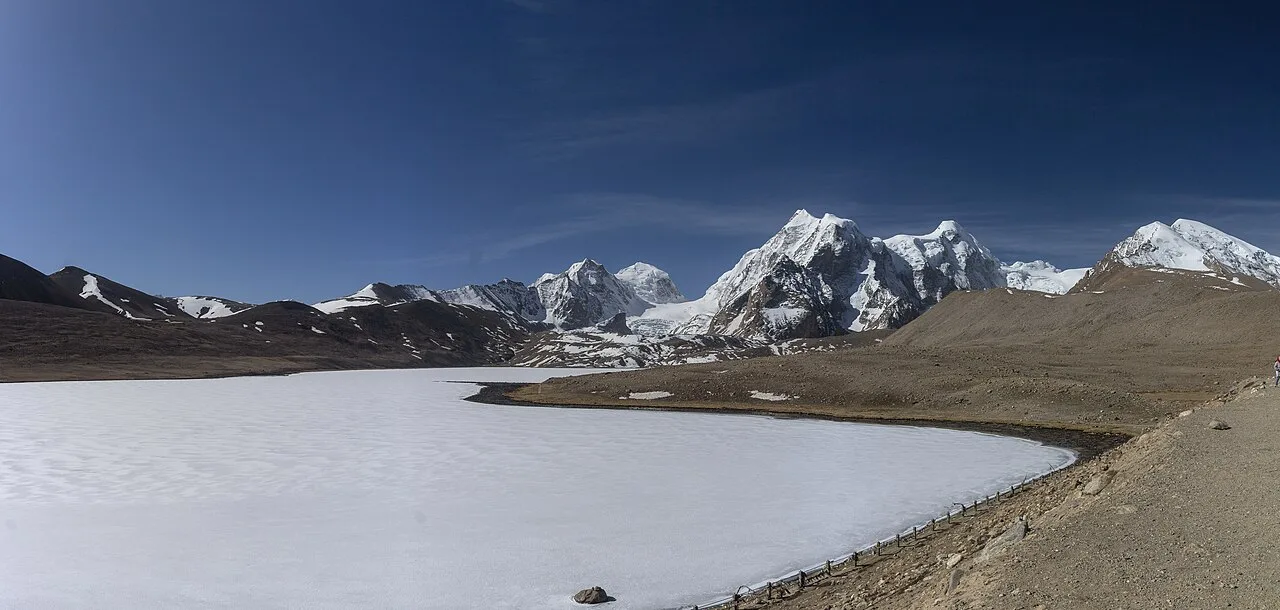
Gurudongmar Lake lies high in Sikkim’s Great Himalayas, at an elevation of 5,430 m according to the state government. Visitors are drawn by its sacred importance to Buddhists and its link with Padmasambhava.
Kabi Lungchok
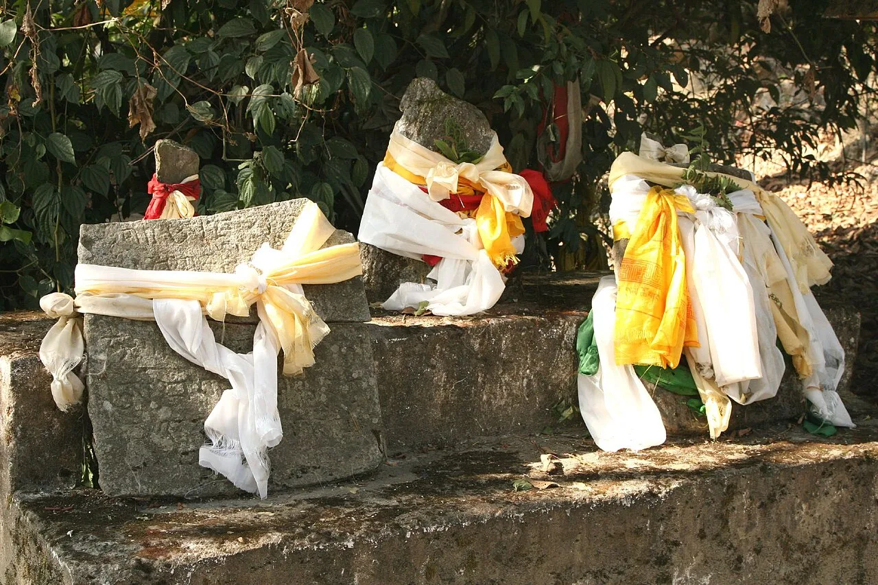
Kabi Lungchok is a historic site north of Gangtok, associated with the Lepcha-Bhutia Treaty of Blood Brotherhood. Visitors see its stone markers and statues of the two signatories.
Khangchendzonga National Park
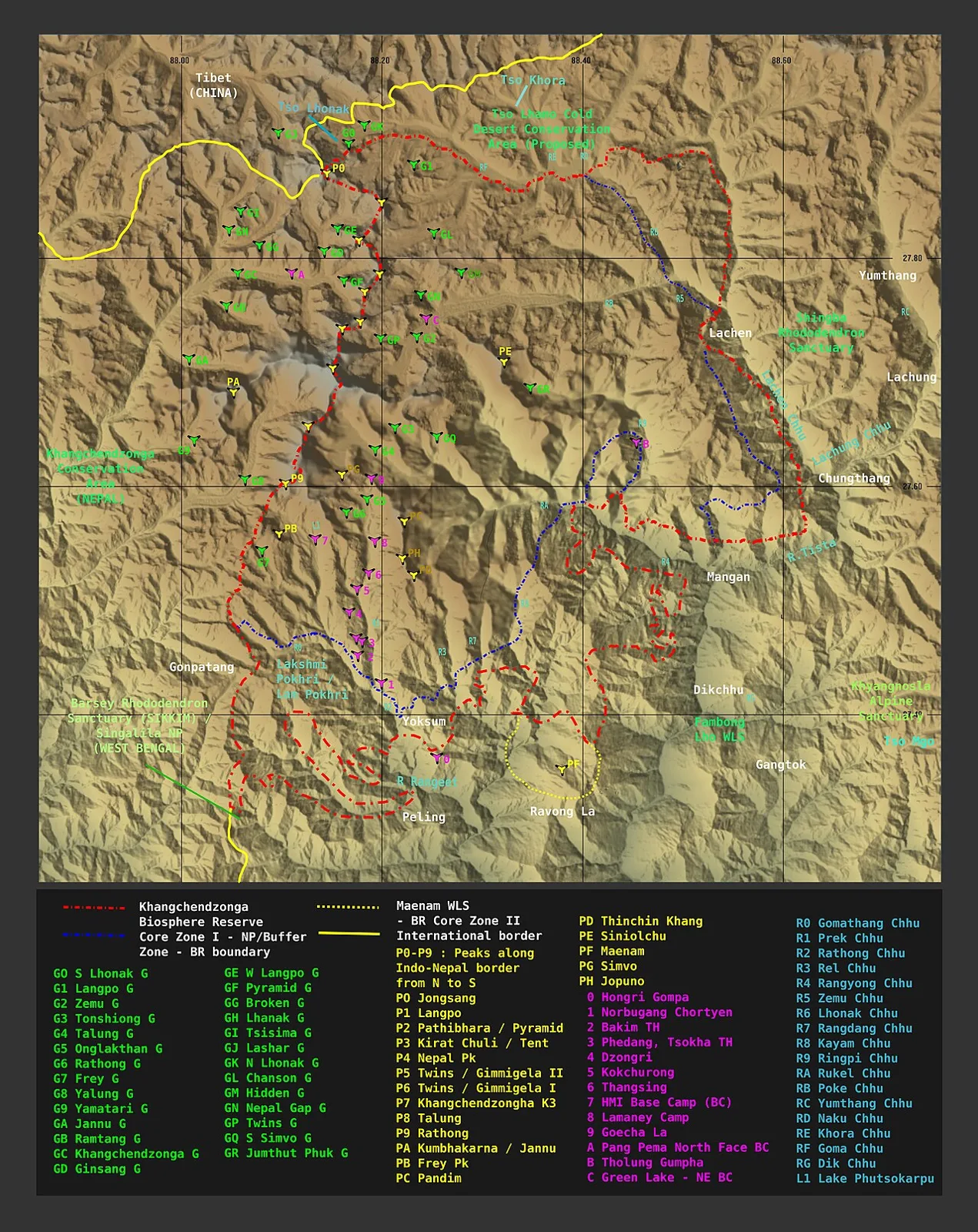
Khangchendzonga National Park is a protected area in Sikkim and part of a biosphere reserve. Visitors are drawn to its association with Kangchenjunga, the world’s third-highest mountain.
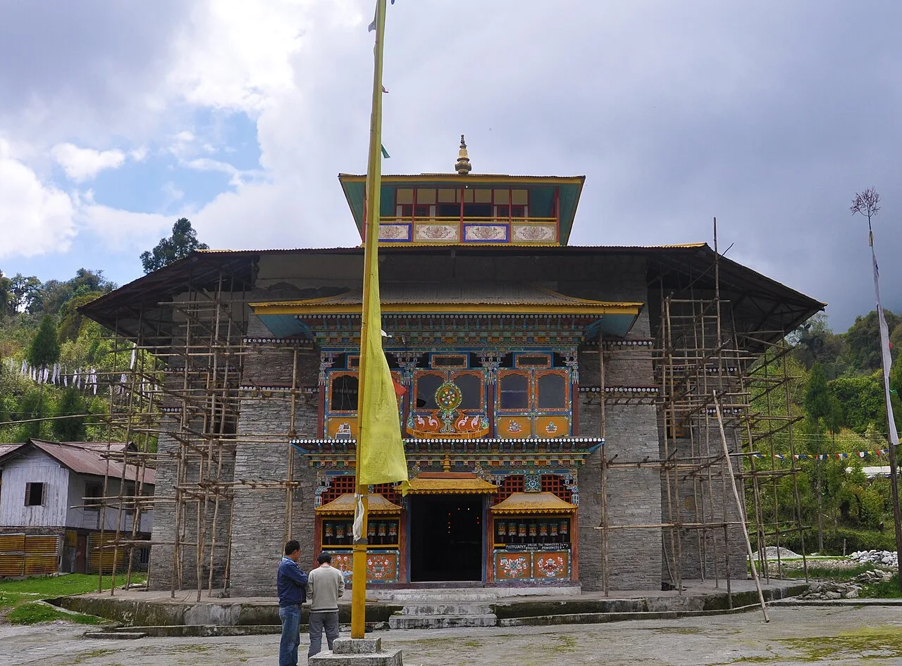
Labrang Monastery, Phodong
Labrang Monastery is a Buddhist place of worship in Mangan district, Sikkim. Visitors come to see the monastery and its Buddhist character.
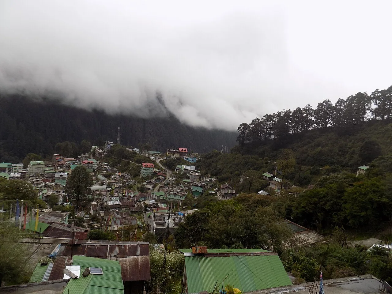
Lachen
Lachen is a high-altitude settlement in Sikkim’s Mangan district, close to the Indo-Tibetan frontier. Travellers use it as a starting point for journeys to Gurudongmar Lake.
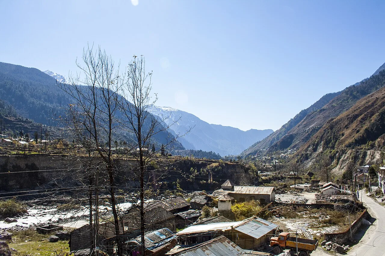
Lachung
Lachung is a Sikkimese hill town in Mangan district, visited as a base for trips to Yumthang Valley and Lachung Monastery, and for trekking and seasonal scenery.
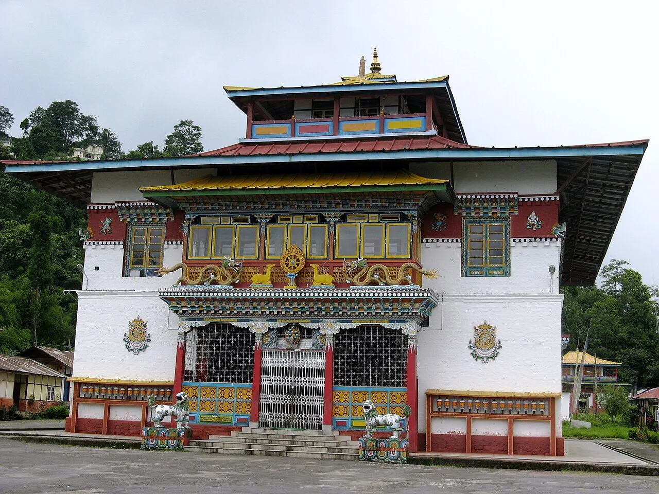
Phodong Monastery
Phodong Monastery is a historic religious site in Sikkim, visited for its Buddhist heritage, monastic community and collection of old murals.
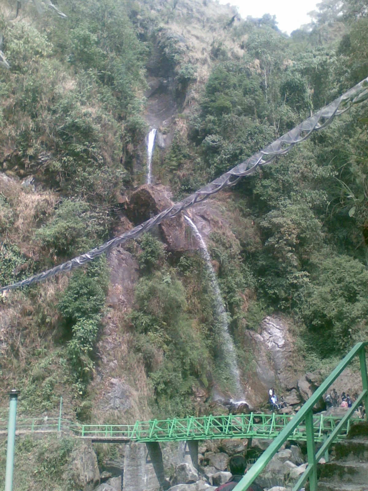
Seven Sisters Waterfall
Seven Sisters Waterfall is a waterfall in Mangan district, Sikkim. Visitors come to see this natural feature and its setting within the district.
Food in Mangan reflects the wider cuisine of Sikkim and the eastern Himalaya. Momos and warming noodle soups such as thukpa and thenthuk are common choices, while phagshapa combines pork with radish. Fermented greens, including gundruk and sinki, add a distinctive sour flavour to meals; churpi, a local cheese, is eaten in several forms. Sel roti is a traditional rice-based bread, and tongba, a warm millet drink, is associated with the hill region. Menus in small eateries may be limited, so ask what is freshly prepared. Dalle khursani chilli paste can be very hot; try a little first.
Craft traditions found in Mangan and the wider Sikkim region include Lepcha weaving, bamboo and cane work, wood carving, carpet weaving and Buddhist thangka painting. Lepcha textiles are associated with distinctive patterns and traditional garments, though styles and production vary between communities and makers. Monasteries and religious settings also sustain skills in painting and decorative arts. Visitors may encounter handmade goods in local markets or through cultural organisations, but availability can be seasonal and limited. Ask about the maker and materials, and seek permission before photographing people or their work.
Losoong, also observed as Namsoong among Lepcha communities, marks the Sikkimese harvest and new year, usually around December or January. Losar, the Tibetan New Year, is generally celebrated in February or March, while Saga Dawa falls around May or June. Monasteries and communities may hold prayer ceremonies, dances and local gatherings; dates and observances vary by community and year. These are regional Sikkimese traditions rather than events confined to Mangan district. Festival periods can bring more visitors to popular routes and reduce room availability in small towns, so booking ahead and checking local schedules is sensible.
The district rises from the Teesta River and wooded valleys through steep, forested slopes to high alpine terrain, glaciers and lakes. Rhododendron forests and meadows feature around Yumthang and Shingba, while the routes beyond Lachen reach sparse, exposed high-altitude country. Dzongu’s villages and forested hills occupy a distinct landscape in the lower north. Rivers, landslide-prone slopes and narrow mountain roads shape travel: journeys are slow, routes can be disrupted, and conditions change sharply with elevation. The high lakes and valleys are not interchangeable day trips from Mangan town; reaching them generally involves overnight stops and careful planning.
Spring and autumn are generally the most convenient seasons for travel, with clearer conditions often found from April to May and October to November. Summer brings milder weather to many lower settlements, but the monsoon, usually from June into September, can bring heavy rain, landslides, road closures and poor visibility. Winter is cold, especially in Lachen, Thangu and other high areas, where snow or ice may affect access. Conditions vary greatly with altitude and can change within a day. Pack warm layers, a waterproof outer layer, sturdy footwear and sun protection; carry extra warm clothing for high-altitude journeys in every season. Check local forecasts and road updates before travelling.
Bagdogra Airport in West Bengal and New Jalpaiguri railway station near Siliguri are the main gateways commonly used for journeys to Mangan. Pakyong Airport is closer to parts of Sikkim, but flights are limited and weather-dependent. From the Siliguri area, road travel usually continues through Gangtok and north along mountain highways; travel times can vary considerably with weather, roadwork and landslides. Taxis and shared vehicles are commonly used between towns, while local transport options may be sparse in remote areas. Some northern destinations require permits, so check requirements before setting out. Check current road conditions, permits and transport services locally.
Mountain roads connect Mangan with Gangtok to the south and with settlements including Lachen and Lachung to the north. Shared jeeps and taxis are common for inter-town travel, while local buses may serve some routes but are limited in remote areas. Visitors often arrange a vehicle through a local operator for high-valley journeys, where road access, permits and weather can affect the plan. Autos are not a dependable option across the district, and there are no practical boat services for sightseeing. Confirm the day’s road conditions and transport availability locally, and allow flexibility for delays.
Mangan is a practical base for Kabi Lungchok, the monasteries around Phodong and onward travel toward Dzongu. Lachung suits visits to Yumthang Valley and Shingba Rhododendron Sanctuary, while Lachen is the usual overnight base for journeys toward Thangu and Gurudongmar Lake. Accommodation includes hotels, homestays and basic lodges; options become simpler and fewer in remote settlements. Government accommodation may be available at selected places, but availability and access should be confirmed in advance. Staying overnight at high-altitude bases helps avoid attempting long journeys in a single day.
High altitude, steep roads and rapidly changing weather require care. Ascend gradually where possible, avoid strenuous activity if unwell, and seek medical advice before high-altitude travel, especially for existing health conditions. Carry drinking water and use treated or sealed water; do not rely on streams being safe. Wildlife and livestock may be present near forest and meadow routes, so keep a respectful distance. Landslides, snow and roadwork can interrupt travel, and mobile connectivity may be patchy. Restricted-area and protected-area permits apply to some routes, with requirements varying by destination and traveller; confirm current rules with official authorities before setting out. Allow for crowds and limited rooms during busy periods.
- Gangtokabout 43 km
- Namchiabout 52 km
- Pakyongabout 55 km
- Gyalshingabout 58 km
- Kalimpong · West Bengalabout 73 km
- Sorengabout 74 km
- Darjeeling · West Bengalabout 85 km
- Jalpaiguri · West Bengalabout 106 km
Straight-line distance between the centres of each district's destinations; road distance is longer.
Q: How many days should I spend in Mangan district? A: Allow at least three or four days for one high-valley route; a longer stay gives more flexibility for weather, acclimatisation and road disruption. Q: When is the best time to visit? A: April to May and October to November are often convenient, though conditions vary by altitude and high routes may be affected by snow or road closures. Q: What is the best base for sightseeing? A: Mangan suits the lower district and monastery visits; Lachung and Lachen are bases for their respective high-altitude routes. Q: How do I get to Mangan? A: Most visitors travel by road from the Siliguri area via Gangtok. Bagdogra Airport and New Jalpaiguri railway station are common gateways; check current services and road conditions. Q: Is the district suitable for families or elderly travellers? A: Lower-altitude visits may suit many families, but high roads, long drives, limited facilities and altitude can be challenging. Choose routes to match everyone’s health and mobility, and seek medical advice where appropriate.
This page draws on our 13 destination guides for Mangan and is updated as our team checks it.
Be the first to share photos, stories, advice or a helpful contact for Mangan.
Loading…