
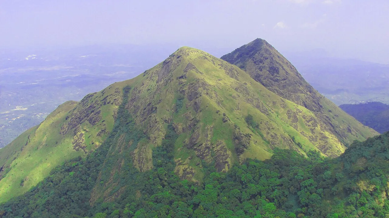
Chembra Peak
A 2,100-metre mountain in Kerala’s Wayanad hills, Chembra Peak is visited for organised treks and its place among the Western Ghats’ highest summits.
Key facts · verified by Ghumoopedia editors
- Type of place
- Natural attraction
- Best time to visit
- September to March; June to August for monsoon Ayurveda and green landscapes
- Nearest railway station
- Nilambur Road · about 30 km (straight line)
- Verified
- 21 Nov 2026
Plan a trip from Chembra Peak — a day-by-day route through places nearby.
Chembra Peak, also called Chembra Mala, rises to 2,100 m above sea level in Kerala. It is the loftiest point in the Wayanad hills and ranks among the Western Ghats’ tallest summits. The mountain is situated in Wayanad and Malappuram districts, within reach of Kalpetta town and Nilambur taluk. It stands alongside the Nilgiri Hills and Vellarimala; walkers can make their way to the peak on foot from Meppadi. Trekking visits are arranged by Chempra Peak VSS, under the South Wayanad Forest Development Agency, which provides guides for the walk. The District Tourism Promotion Council also makes guides and trekking equipment available for a fee. Banasura Sagar Dam and Banasura Hills are nearby. Kerala packs a lot into a narrow strip: the backwaters and houseboats of Alappuzha and Kumarakom, the tea hills of Munnar and the spice forests of Thekkady, the beaches of Kovalam, Varkala and Bekal, the colonial and Jewish heritage of Fort Kochi, and living art forms — Kathakali, Theyyam, Mohiniyattam and temple festivals with caparisoned elephants. Kerala is warm and humid at sea level all year. The southwest monsoon from June to September brings very heavy rain, and the northeast monsoon adds showers in October and November; the hill stations of Munnar, Wayanad and Vagamon are cool year-round and cold on winter nights. The usual best time to visit is September to March; June to August for monsoon Ayurveda and green landscapes. Timings, fees and access arrangements must be confirmed locally. For official information, see Kerala Tourism at https://www.keralatourism.org.
Why it matters
Chembra Peak, also called Chembra Mala, is a prominent mountain in Kerala’s Wayanad district, rising to about 2,100 m above sea level. The existing destination guide describes it as the highest peak in the Wayanad hills and one of the higher peaks of the Western Ghats. Its elevation and walking routes make it an important nature and trekking destination near Meppadi and Kalpetta. The peak lies within a forested hill region, so access is managed: the Chempra Peak VSS organizes visits under the South Wayanad Forest Development Agency, with trekking guidance provided.
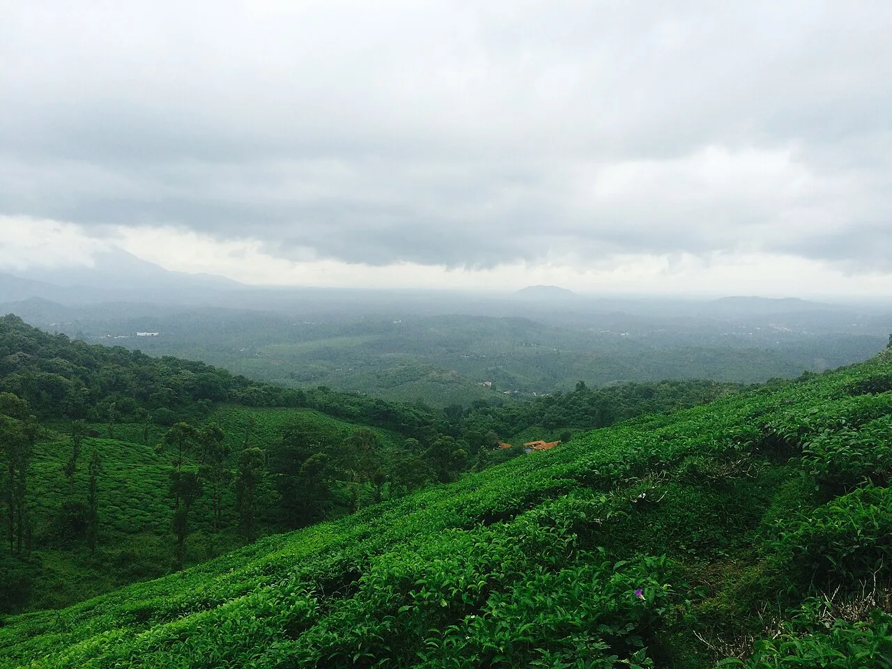
Chembra is a natural mountain, not a built monument, and the available destination references do not identify a builder, foundation date or major historical construction on the peak. Its landforms belong to the Western Ghats, a long-established mountain region, but a precise geological account of Chembra itself should not be inferred from its tourism history. The name Chembra Mala is used for the mountain in local and regional references. The peak’s modern public profile is chiefly connected with trekking and nature visits from Meppadi, with Kalpetta serving as a nearby town. Visits are organized by the Chempra Peak VSS under the South Wayanad Forest Development Agency, and guides are provided for trekking; the District Tourism Promotion Council has also been described as supplying guides and equipment for a fee. These arrangements reflect forest oversight rather than a restoration project. Access and permitted routes can change with weather, conservation needs or administrative decisions, so older accounts may not describe current conditions.
Origin stories & folklore
The best-known local story associated with Chembra is the heart-shaped lake encountered on the trekking route, often called Hridaya Saras in tourism accounts. Its outline is popularly said to resemble a heart, and some accounts describe it as perennial. These are local beliefs and descriptions, not guarantees about its appearance or water level; rainfall, season and viewpoint can affect what visitors see. The lake and its name have helped shape the mountain’s romantic image, but visitors should treat the site as a natural feature and follow guide instructions. No single authoritative origin legend for the peak’s name is established in the available information.
Spend unhurried time at Chembra Peak: walk the marked paths, use official viewpoints and ask locally whether a guide, entry ticket or forest permission is needed. Mist can roll in within minutes in the hills, so carry a rain layer and start back before the light fades. A comfortable itinerary is one main visit in the morning, a local meal at midday and a short nearby stop before an afternoon return. Use the district list on this site to find other places in Wayanad, but check the route and its condition before combining stops. If a festival is on — such as Onam, Thrissur Pooram, the Nehru Trophy snake-boat race on Punnamada Lake, the Theyyam season in Kannur and Kasaragod, or the Attukal Pongala — roads and stays can be busy, and the experience can be unforgettable. Leave no litter: many sites are protected by the communities around them.
Suggested itineraries
Half day: Reach the authorized access point from Meppadi, check in with the trekking staff or guide, walk the permitted route and return before weather or fading light becomes a concern; allow several hours, depending on current access and fitness. Full day: Start with the guided Chembra visit, return to Meppadi or Kalpetta for a meal, then choose one nearby stop such as Kanthanpara Falls if route conditions and time allow. Gentler option: Skip the summit trek; enjoy a short, locally approved viewpoint or an easy stop near Meppadi, with a meal and rest in Kalpetta.
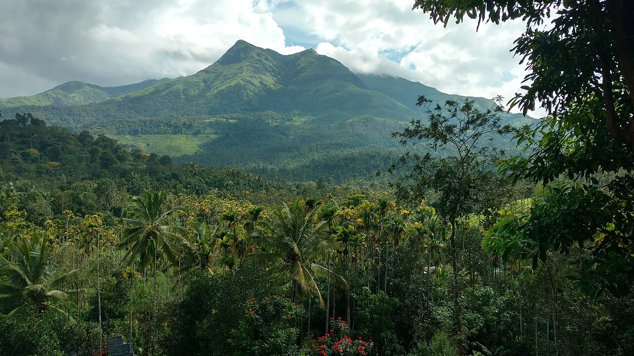
The cultural life around Chembra is part of wider Wayanad, where Malayalam is widely used and Kannada and Indigenous languages are also spoken in different communities. Local customs include everyday temple, church and mosque observances, seasonal gatherings and hospitality shaped by hill-town life. Kathakali and Mohiniyattam are well-known Kerala art forms, while Theyyam is especially associated with northern Kerala; performances are not a regular feature of the peak itself. Visitors may encounter local food traditions and produce markets in nearby towns rather than cultural facilities on the mountain. Ask before photographing people or ceremonies, and follow guidance about forest paths and community spaces.
Local communities
People living in Wayanad include long-established Indigenous communities as well as families engaged in farming, trade, tourism and public services. Communities such as Paniya, Kuruma, Kurichiya, Adiya and Kattunaikka are among those associated with the wider district; this does not imply that any one group manages or owns the trekking site. Around the Chembra approach, livelihoods may include cultivation, guiding, transport, food service and small businesses. The trekking route is overseen through forest and tourism arrangements, with guides helping visitors navigate the area. Be respectful of residents’ privacy and do not assume that cultural knowledge or access to community lands is open to visitors.
Festivals & events
Chembra Peak is primarily a trekking destination rather than a festival venue. In nearby Wayanad towns and villages, Onam, Vishu and local temple, church and mosque festivals bring seasonal gatherings; their timing varies by community and year. Kerala-wide celebrations such as Onam can increase demand for accommodation and transport, while local events may cause short-term traffic or parking pressure. Festival programmes are arranged locally and are not guaranteed to coincide with a visit. Check with local tourism or community sources before planning around an event, and observe any requests about photography, access or participation.
Local food in Kerala includes appam with stew, puttu with kadala curry, idiyappam, the vegetarian sadya served on a banana leaf, Kerala parotta with beef or chicken fry, Malabar biryani and pathiri in the north, karimeen pollichathu (pearl-spot fish in banana leaf), toddy-shop fish curry, banana chips and many kinds of payasam. Ask what is fresh that day; many small eateries cook a limited daily menu. Coconut oil and coconut are used in most dishes; ask for less spice if needed. Toddy shops serve some of the best fish curry in Kerala, and a full sadya is the highlight of Onam. Remote sites may have no restaurant at all. Carry water and snacks, eat a proper breakfast before long drives, and ask your accommodation for a packed lunch if you are heading out early. Try a home-cooked or local thali meal when you can — it is often the best food on the route. Choose clean places, drink sealed or filtered water, and carry your packaging back with you.
Shopping & local experiences
There is no dependable shopping destination on the trekking trail, so browse in Meppadi or Kalpetta before or after the visit. Wayanad shops and markets commonly offer locally grown coffee, spices, tea and packaged regional foods; availability and origin vary by seller. Small handicrafts and souvenirs may be found in town, but visitors should ask about materials and buy respectfully. A meal featuring Kerala dishes or local produce is often a more practical way to experience the region than shopping at the mountain. Avoid buying wildlife products or anything collected from the forest.
The peak rises above Wayanad’s hill country, with steep slopes, open highland views and forested surroundings. The broader region includes wet evergreen and moist forest habitats, with grassier high-elevation areas and patches of shola-like vegetation; the precise mix varies along the route. Monsoon rain can bring mist, wet trails and fast-changing visibility, while drier months may offer clearer views. Streams and small water features are influenced by seasonal rainfall, and the heart-shaped lake is a well-known stop on the trekking route. Wayanad supports diverse birds, insects and mammals, but sightings are never assured. Keep noise low, stay on authorized paths, do not feed wildlife and carry all litter back out.
September to March; June to August for monsoon Ayurveda and green landscapes
The nearest principal railway station by straight-line distance is Nilambur Road, roughly 30 km away. The nearest operating airport by straight-line distance is Calicut International Airport, Karipur, roughly 44 km away. These figures are calculated from map coordinates — actual road distance is longer. Thiruvananthapuram, Kollam, Kottayam, Ernakulam, Thrissur, Shoranur, Kozhikode and Kannur are the main rail stops along the coast line; Kochi, Thiruvananthapuram, Kozhikode and Kannur have international airports. For the final leg, KSRTC buses (from ordinary to air-conditioned Swift services), fast private buses, metered autos, app cabs and the Water Transport Department's public ferries in the backwaters link the towns. Distances look short on the map, but hill roads and town traffic are slow, so allow extra time. When comparing train, bus and flight, count the complete door-to-door time: a flight saves the most time only if the onward road transfer is short, while an overnight train can save a hotel night. Kerala's coastal rail line is busy, so reserve trains early; KSRTC buses are frequent and often quicker to hill stations. Book your return before you leave, because seats fill quickly on weekends, festivals and holidays. Current train numbers, timings, return services and fares are not listed here; check IRCTC and NTES for trains and the airline's own schedule for flights. No permit is needed to visit Kerala. Several major temples, including Sree Padmanabhaswamy in Thiruvananthapuram and Guruvayur, admit only Hindus and enforce a strict dress code — men wear a mundu (dhoti) and remove shirts, women wear a saree or long skirt. Forest activities in Periyar, Eravikulam, Silent Valley, Parambikulam and Thattekad must be booked with the Kerala Forest Department, and Eravikulam National Park usually closes in February and March for the Nilgiri tahr calving season.
Confirm onward and return timings on IRCTC / NTES, the state bus operator or your airline before travel. A dash means current timings or fares have not been verified.
Getting around
Meppadi is the usual approach for reaching Chembra Peak on foot, while Kalpetta is a practical nearby town for arranging onward transport. Local buses serve towns in the area, but visitors may need to arrange an auto-rickshaw or taxi for the final leg; confirm availability for the return journey before starting a trek. Walking is necessary on the authorized trail, and local guides can advise on the route. Parking availability near the access point should be checked locally, especially during busy periods. Hill roads can be narrow and slow, so allow extra time and avoid relying on map distance alone.
Hours, tickets & permissions
Entry is controlled through the local forest and trekking arrangements, and visitors may need advance permission, a ticket, an authorized guide or to join an approved route. Requirements can change with weather, conservation restrictions or forest decisions. Camera rules, identity checks and limits on group access should be confirmed before setting out. Do not assume that independent access to the summit or lake is permitted. Confirm current opening arrangements, fees and any closures with the Chempra Peak VSS, the South Wayanad Forest Development Agency or the District Tourism Promotion Council before travel.
Facilities
Facilities at the mountain access point may be basic and can change; check locally for toilets, drinking water, parking, guide services and any equipment available for hire. Do not assume that food, shops or reliable phone service are available on the trail. Carry water and snacks as advised by local staff, and take rubbish back with you. Meppadi and Kalpetta offer a wider choice of meals, shops and accommodation, and visitors can look there for ATMs and other services. Confirm what is open before travelling, particularly during heavy rain or periods of restricted forest access.
Accessibility
Chembra is a mountain trekking destination, not an accessible paved attraction. The authorized route involves uneven natural ground, slopes and potentially muddy or slippery sections; walking distance and permitted access depend on current forest rules. Shade and shelter may be limited, and mist or rain can make footing difficult. The summit route is generally unsuitable for wheelchairs and strollers, and may be strenuous for elderly visitors or anyone with mobility, balance or heart concerns. There may be no step-free route to the lake or higher viewpoints. Ask the managing staff about current trail conditions and the gentlest permitted alternative before setting out.
No permit is needed to visit Kerala. Several major temples, including Sree Padmanabhaswamy in Thiruvananthapuram and Guruvayur, admit only Hindus and enforce a strict dress code — men wear a mundu (dhoti) and remove shirts, women wear a saree or long skirt. Forest activities in Periyar, Eravikulam, Silent Valley, Parambikulam and Thattekad must be booked with the Kerala Forest Department, and Eravikulam National Park usually closes in February and March for the Nilgiri tahr calving season. Carry a photo ID at all times and save the emergency number 112 and your accommodation's contact offline. Hill roads are narrow and winding with sudden fog; avoid driving after dark and watch for landslides in the monsoon. Stay on marked paths, keep away from cliff edges and fast water, and never approach wild animals.
Photography
Clear conditions after rain or in the morning can offer expansive hill views, but mist may move in quickly and obscure the landscape. Use only authorized viewpoints and do not leave the marked route for a photograph. Ordinary personal photography may be possible, but check current forest rules for cameras, commercial shoots and any additional permissions. Drone use may be restricted or require formal approval; do not launch one without confirmation from the managing authority. Ask permission before photographing guides, residents or other visitors, and avoid intrusive photography around rituals or private spaces.
Choose a stay by the full journey to Chembra Peak, not just the district name. Hill stations in Kerala fill up on long weekends; many resorts are far from town on narrow roads, so check the final approach before booking. Nights in the hills are cool all year — check hot water and blankets. Book in advance for weekends, festivals and the peak season (September to March; June to August for monsoon Ayurveda and green landscapes). Confirm the exact location, meals included, check-in time and cancellation terms in writing. Avoid sending money to unverified contacts or touts at stations. Carry some cash, as card and digital payments can be unreliable in remote areas.
Banasura Sagar Dam and Banasura Hills are notable nearby Wayanad-area stops, though road conditions and travel time should be checked before combining them with a trek. Kanthanpara Falls and Soochipara Falls are other natural attractions in the district; access can be affected by rain and local safety restrictions. Pookode Lake is another established Wayanad visitor destination. Edakkal Caves, near Ambalavayal, offer a different kind of visit and are farther across the district, so they may suit a separate day. Choose one additional stop rather than overloading a day, and verify each site's current access arrangements.
For couples, Chembra Peak rewards a slow pace: arrive early for soft light and fewer crowds, share a local meal and keep the evening free. An overnight houseboat on Vembanad, a sunset on the Varkala cliffs or a misty morning walk through Munnar's tea estates makes the trip memorable. Public displays of affection can be frowned upon in conservative communities and at religious sites, so be discreet. Keep a buffer in your itinerary, because weather and road conditions can delay plans.
Q: How much time should I allow for Chembra Peak? A: Allow several hours for the authorized trek, with extra time for transport, check-in and changing weather. Current route access can affect the visit. Q: When is a good season to visit? A: September to March is generally a more comfortable period in Kerala’s hills. Monsoon months can be very wet, and trail access may be restricted. Q: Do I need permission or a guide? A: Trekking is managed through local forest arrangements. Confirm current entry rules and whether an authorized guide or advance permission is required before travelling. Q: Is the trek suitable for children or elderly visitors? A: The sloping, uneven trail can be strenuous. Suitability depends on fitness and current conditions; seek local advice and choose an easier nearby option if needed. Q: Where can I stay nearby? A: Meppadi and Kalpetta have accommodation options. Check availability and road conditions locally, especially during holidays and festival periods.
Be the first to share photos, stories, advice or a helpful contact for Chembra Peak.
Loading…