
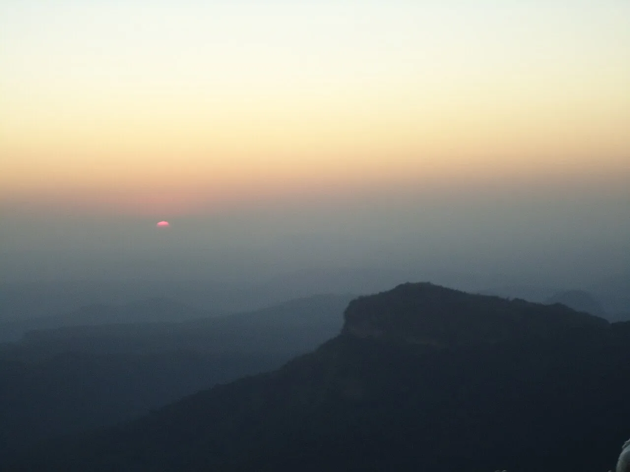
Dhupgarh Peak
Dhupgarh, also known as Dhoopgarh, is a summit in Madhya Pradesh’s Satpura Range. Visitors go to the peak in Pachmarhi to watch the sun set.
Key facts · verified by Ghumoopedia editors
- Type of place
- Natural attraction
- Best time to visit
- October to March
- Nearest railway station
- Pipariya (for Pachmarhi) · about 35 km (straight line)
- Verified
- 21 Nov 2026
Plan a trip from Dhupgarh Peak — a day-by-day route through places nearby.
Rising to 1,352 metres (4,436 ft), Dhupgarh is the tallest summit in the Satpura Range and the highest point in Madhya Pradesh. It lies at Pachmarhi, a hill station in Hoshangabad district, Madhya Pradesh. The peak is known by the alternative spelling Dhoopgarh. Its summit is a popular place for watching sunsets, drawing visitors to the high point above Pachmarhi. The site’s distinction as the state’s highest peak and its setting within the Satpura Range are central features of its identity. Madhya Pradesh holds three UNESCO World Heritage Sites — the temples of Khajuraho, the Buddhist stupas of Sanchi and the Bhimbetka rock shelters — plus the forts and palaces of Gwalior, Orchha and Mandu, the marble gorges of Bhedaghat, the pilgrim towns of Ujjain and Omkareshwar, and some of India's best tiger country in Kanha, Bandhavgarh, Pench and Satpura. The state has very hot summers from March to June (often above 42°C in the north and west), a monsoon from late June to September that greens the forests but closes the tiger reserves' core zones, and a cool, pleasant winter from November to February — the best season for almost everything. The usual best time to visit is October to March. Timings, fees and access arrangements must be confirmed locally. For official information, see Madhya Pradesh Tourism at https://www.mptourism.com.
Why it matters
Dhupgarh, also called Dhoopgarh, is a summit in Pachmarhi and the highest point in Madhya Pradesh, at about 1,352 metres above sea level. It is the highest peak of the Satpura Range in the state and is known locally as a place to take in broad hill and forest views, especially around sunset. The peak is part of the Pachmarhi landscape, which lies within the wider Pachmarhi Biosphere Reserve, recognised by UNESCO under its Man and the Biosphere Programme. That designation applies to the biosphere reserve, not to Dhupgarh as an individual monument or World Heritage Site. The summit is a natural attraction rather than a documented archaeological site.
Dhupgarh is a natural summit, not a built monument, and no well-documented account identifies a builder, construction date or major restoration project. Its importance comes from its position above Pachmarhi and its prominence in the Satpura highlands. Pachmarhi’s plateau, ravines and forested slopes have long been part of the central Indian landscape, with Indigenous communities and other residents connected to the wider region over generations. During British rule, Pachmarhi developed as a hill station and cantonment; its cooler setting and surrounding scenery attracted visitors and officials. This period helped establish Pachmarhi as a destination, but it should not be taken as the origin of Dhupgarh’s local significance. In modern times, the summit is visited for its views and sunset setting. The broader area is included in the Pachmarhi Biosphere Reserve, while parts of the surrounding landscape have conservation protections associated with the Satpura region. Specific access arrangements can change, so visitors should check with local authorities before setting out. There is no reliable basis for attributing a particular structure or historic event to the summit itself.
Origin stories & folklore
Local stories about the Satpura hills may link particular caves, rocks and peaks with religious figures or events, but a specific, consistently documented origin legend for Dhupgarh is not readily established. Visitors may hear different explanations from residents or guides; these are best understood as local tradition rather than verified history. The name is sometimes written as Dhoopgarh, but a definitive account of its linguistic origin should not be assumed. Pachmarhi has religiously significant sites elsewhere, including Jata Shankar, yet their traditions should not automatically be transferred to this summit. Ask respectfully if someone shares a story, and avoid presenting a personal or community belief as fact.
Spend unhurried time at Dhupgarh Peak: walk the marked paths, use official viewpoints and ask locally whether a guide, entry ticket or forest permission is needed. Weather can change quickly, so carry a rain layer even on a clear morning. A comfortable itinerary is one main visit in the morning, a local meal at midday and a short nearby stop before an afternoon return. Use the district list on this site to find other places in Hoshangabad, but check the route and its condition before combining stops. If a festival is on — such as the Khajuraho Dance Festival, the Tansen Samaroh in Gwalior, Lokrang in Bhopal or the Simhastha Kumbh at Ujjain — roads and stays can be busy, and the experience can be unforgettable. Leave no litter: many sites are protected by the communities around them.
Suggested itineraries
Half day: Check local access guidance; travel from Pachmarhi to the permitted approach, walk the marked route and spend time at the viewpoint (allow roughly 2–4 hours, depending on conditions). Full day: Visit Dhupgarh in the morning, return to Pachmarhi for a meal, then choose one nearby attraction such as Jata Shankar or the Pandav Caves (allow roughly 6–8 hours, including travel and breaks). Gentler option: Arrange vehicle access as far as locally permitted, take a short walk only if the surface feels manageable, and enjoy a nearby Pachmarhi viewpoint or town visit instead if conditions are unsuitable.
Pachmarhi’s present-day culture reflects its hill-station setting and the wider traditions of Madhya Pradesh. Hindi is widely used, alongside regional languages and Indigenous languages in the surrounding area. Visitors may encounter local music, folk performance and craft traditions at community events or cultural programmes, though these are not necessarily held at Dhupgarh itself. Everyday customs are shaped by local life, tourism and the seasons. The summit is primarily a viewpoint, not a performance venue or a place with a fixed ritual programme. Dress comfortably for walking and changing weather, and ask before photographing people, performers or religious activity.
Local communities
Pachmarhi and the surrounding Satpura region are home to diverse residents, including Gond and Korku communities in the wider area, as well as people engaged in tourism and public services. Livelihoods include farming, forest-related work, guiding, transport, hospitality, small shops and other local services. Experiences vary between villages and households, so avoid assuming that one practice represents everyone. Visitors can support local livelihoods by choosing locally run services where available, following forest and community rules, and asking permission before photographing individuals or homes. Do not seek access to private land or restricted cultural knowledge.
Festivals & events
Pachmarhi and nearby towns observe regional Hindu festivals and local fairs, with celebrations often bringing more visitors and activity to the area. Cultural programmes may also be organised in Pachmarhi, but schedules and scale can vary by year; confirm locally rather than planning around an assumed event. Narmada Jayanti is observed in Narmadapuram, formerly Hoshangabad, usually in the winter season, and can draw crowds to the riverfront there. Festivals elsewhere in Madhya Pradesh, such as the Khajuraho Dance Festival, are not held at Dhupgarh. During popular holiday periods or local events, accommodation and road travel around Pachmarhi may be busier.
Local food in Madhya Pradesh includes poha with jalebi for breakfast, bhutte ka kees, dal bafla and dal baati, Indore's sarafa night-market snacks, Bhopal's seekh kebabs and biryani, mawa-bati and gajak sweets, and mahua-based tribal dishes in forest districts. Ask what is fresh that day; many small eateries cook a limited daily menu. Vegetarian travellers eat well across the state, and most towns also have good non-vegetarian food; Indore's Sarafa Bazaar turns into a famous night food market. Remote sites may have no restaurant at all. Carry water and snacks, eat a proper breakfast before long drives, and ask your accommodation for a packed lunch if you are heading out early. Try a home-cooked or local thali meal when you can — it is often the best food on the route. Choose busy, clean places, drink sealed or filtered water, and carry your packaging back with you.
Shopping & local experiences
Pachmarhi has small shops and market stalls where visitors can look for locally made crafts, practical travel supplies and packaged regional foods. Availability varies, and an item described as local may come from elsewhere, so ask about its origin if that matters to you. Consider buying directly from local makers or small businesses when possible. Nearby food options may include familiar Madhya Pradesh dishes and simple snacks, though menus differ between establishments. Avoid collecting plants, stones or other natural material from the landscape, and choose reusable containers to reduce waste.
Dhupgarh rises above the forested plateau and valleys of Pachmarhi in the Satpura hills. The surrounding landscape includes rocky slopes, wooded ravines and seasonal streams and waterfalls; water levels and conditions vary with the monsoon. The broader area supports central Indian dry and moist deciduous forest types, with tree cover and undergrowth changing across elevations and seasons. Wildlife in the Satpura landscape includes mammals and many bird species, but sightings at the summit are never guaranteed. Take care near exposed edges, stay on authorised paths and do not feed or approach wildlife. The monsoon brings greener scenery but can also mean slippery routes and changing access. Carry water and take all rubbish back with you.
October to March
The nearest principal railway station by straight-line distance is Pipariya (for Pachmarhi), roughly 35 km away. The nearest operating airport by straight-line distance is Raja Bhoj Airport, Bhopal, roughly 141 km away. These figures are calculated from map coordinates — actual road distance is longer. Bhopal, Indore, Jabalpur and Gwalior are the main rail and air gateways; Khajuraho has its own airport and station, Jhansi (UP) serves Orchha and Datia, and Pipariya is the railhead for Pachmarhi. For the final leg, Madhya Pradesh State Road Transport Corporation buses, private sleeper coaches between the big cities, and shared jeeps and autos in smaller towns link district towns. A private taxi gives more flexibility for remote sites such as forts, caves and forest gates. When comparing train, bus and flight, count the complete door-to-door time: a flight saves the most time only if the onward road transfer is short, while an overnight train can save a hotel night. Book your return before you leave, because seats fill quickly on weekends, festivals and holidays. Current train numbers, timings, return services and fares are not listed here; check IRCTC and NTES for trains and the airline's own schedule for flights. No permit is needed to visit Madhya Pradesh. Tiger safaris in Kanha, Bandhavgarh, Pench, Satpura and Panna must be booked in advance on the official MP Forest online portal — zones and gates sell out weeks ahead in peak season, and the core zones are closed during the monsoon (roughly July to mid-October). Boating and angling in the National Chambal Sanctuary also need forest-department bookings.
Confirm onward and return timings on IRCTC / NTES, the state bus operator or your airline before travel. A dash means current timings or fares have not been verified.
Getting around
Pachmarhi is the practical base for visiting Dhupgarh. Within the hill station, visitors commonly use local taxis or other locally arranged vehicles; walking may suit some routes, but terrain and distance should be checked before setting out. Ask a local operator or accommodation staff about the authorised route, road conditions and whether vehicles may reach the permitted viewpoint. Parking availability can vary and should not be assumed at the summit. Local buses may serve parts of the area, but they may not provide a convenient final connection. Avoid driving after dark on unfamiliar hill roads, and follow forest or traffic instructions.
Hours, tickets & permissions
Access arrangements may depend on the route, weather, forest regulations and local management. A visitor may need to use an authorised approach, follow checkpoint instructions or obtain a ticket or permission where required; rules can change. Do not assume that the summit is open at all times or that access is unrestricted. Confirm current hours, entry requirements, fees and any camera rules with the relevant local or forest authority before travelling. Follow notices on site, remain on permitted paths and carry identification if officials request it.
Facilities
Facilities directly at the summit may be limited and can change with access arrangements. Toilets, drinking water, food, shops and parking are more likely to be available in Pachmarhi than at the viewpoint; check locally before leaving town. Do not rely on finding an ATM, refreshments or a guide on the route. Local operators or accommodation staff may be able to advise about transport and guiding, but confirm what is authorised. Carry water, any personal medication and a way to take rubbish back. Check current visitor services with local authorities before your visit.
Accessibility
The route may include uneven ground, slopes, rocks or steps, and conditions can be more difficult after rain. The amount of walking and vehicle access depends on current rules and the approach in use. Shade may be limited at exposed viewpoints, so plan for sun and changing weather. Do not assume that wheelchair ramps, accessible toilets or step-free access are available. Strollers may be difficult to manage on rough paths. Older visitors or anyone with limited mobility should check the route in advance, go at a comfortable pace and avoid slippery or crowded conditions. A nearby, easier viewpoint may be a better alternative.
No permit is needed to visit Madhya Pradesh. Tiger safaris in Kanha, Bandhavgarh, Pench, Satpura and Panna must be booked in advance on the official MP Forest online portal — zones and gates sell out weeks ahead in peak season, and the core zones are closed during the monsoon (roughly July to mid-October). Boating and angling in the National Chambal Sanctuary also need forest-department bookings. Carry a photo ID at all times and save the emergency number 112 and your accommodation's contact offline. Pachmarhi and the Satpura hills have steep ravines and sudden fog; keep to marked trails and avoid cliff edges in rain. Stay on marked paths, keep away from cliff edges and fast water, and never approach wild animals.
Photography
The summit is popular for landscape and sunset photographs; clear mornings can also offer views across the hills. Use authorised viewpoints and keep a safe distance from edges, especially in poor weather or crowds. Photography is generally suitable for personal use in open public areas, but confirm any local restrictions or camera rules before visiting. Do not fly a drone without checking applicable permissions and local rules; protected landscapes may have additional restrictions. Ask consent before photographing residents, workers or visitors, and be discreet around religious sites and ceremonies.
Choose a stay by the full journey to Dhupgarh Peak, not just the district name. Bhopal, Indore, Gwalior and Jabalpur offer the widest choice; Khajuraho, Orchha and Pachmarhi have hotels and MP Tourism lodges, which are reliable value, and pilgrim towns have dharamshalas. In the hills, nights are cold from November to February — check heating and hot water. Book in advance for weekends, festivals and the peak season (October to March). Confirm the exact location, meals included, check-in time and cancellation terms in writing. Avoid sending money to unverified contacts or touts at stations. Carry some cash, as card and digital payments can be unreliable in remote areas.
Within Pachmarhi, visitors may consider Jata Shankar, the Pandav Caves, Bee Fall and Apsara Vihar, subject to current access and route conditions. These are distinct attractions and should not be treated as stops on the Dhupgarh summit path. The wider area is associated with Satpura National Park and other protected landscapes; entry to protected areas follows separate rules and may require advance planning. Pachmarhi town provides the main base for meals and accommodation. Pipariya is a railhead commonly used for travel to Pachmarhi. Check road conditions and local advice before combining several stops in one day.
For couples, Dhupgarh Peak rewards a slow pace: arrive early for soft light and fewer crowds, share a local meal and keep the evening free. Sunset over the marble rocks at Bhedaghat, a boat ride on the Narmada at Maheshwar or a night drive under the stars near a forest lodge makes the trip memorable. Public displays of affection can be frowned upon in conservative communities and at religious sites, so be discreet. Keep a buffer in your itinerary, because weather and road conditions can delay plans.
Q: How much time should I allow for Dhupgarh? A: Allow a half day for the summit visit, including travel and time at the viewpoint; conditions and the permitted route affect the total. Q: When is a good season to visit? A: October to March is generally a comfortable period in Madhya Pradesh. Monsoon scenery can be lush, but rain may make paths slippery or affect access. Q: Is there an entry ticket or permit? A: Requirements can change with local and forest rules. Confirm current entry, permission and fee details with the managing authority before travelling. Q: Is Dhupgarh suitable for children and elderly visitors? A: It can be enjoyable with careful planning, but uneven, sloping or slippery ground may be challenging. Check the route and choose a gentler alternative if needed. Q: Where should I stay nearby? A: Pachmarhi is the nearest practical base, with accommodation options that vary by season. Book ahead during busy holiday periods and confirm current availability.
Be the first to share photos, stories, advice or a helpful contact for Dhupgarh Peak.
Loading…