
Gagron Fort
Gagron Fort is a historic stronghold in Rajasthan’s Hadoti region, known for its river defences and UNESCO recognition. Visitors come to explore its history and distinctive setting.
Key facts · verified by Ghumoopedia editors
- Type of place
- Heritage monument
- Best time to visit
- October to March
- Nearest railway station
- Jhalawar City · about 5 km (straight line)
- Verified
- 21 Nov 2026
Plan a trip from Gagron Fort — a day-by-day route through places nearby.
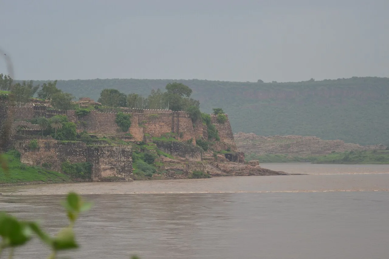
Gagron Fort stands in Jhalawar district, within Rajasthan’s Hadoti region, around five kilometres from Jhalawar city, the district’s administrative centre. Its defences combine elevated ground with water barriers. Visitors come to see its historic fortifications and learn about its past. Raja Madho Bhil is credited with laying its foundations. In the twelfth century, the fort came under Bijaldev Singh Dod, a Panwar Rajput king. Sher Shah and Akbar also controlled it in later periods. The succession of rulers adds to its historical interest. Gagron occupies the meeting point of the Ahu and Kali Sindh rivers. Water borders three sides, while a moat protects the remaining side; this arrangement gave the fort the name Jaladurg. In 2013, during the World Heritage Committee’s 37th session in Phnom Penh, Cambodia, it was declared a UNESCO World Heritage Site alongside five other Rajasthani forts, as part of Hill Forts in Rajasthan. Rajasthan is the land of Rajput forts and palaces, painted havelis, desert folk music, puppetry and colourful fairs such as the Pushkar camel fair. Rajasthan is very hot from April to June — often above 45 °C in the desert — with a short monsoon in July–September. Winter days are pleasant and nights are cold, especially in the Thar Desert. Mount Abu is the state's only hill station and stays cooler. The usual best time to visit is October to March. Timings, fees and access arrangements must be confirmed locally. For official information, see Rajasthan Tourism at https://www.tourism.rajasthan.gov.in.
Why it matters
Gagron Fort is a major heritage site in Rajasthan’s Hadoti region, in Jhalawar district. Its setting at the confluence of the Ahu and Kali Sindh rivers gives it the defining character of a hill-and-water fort: water borders three sides, while a moat protects the fourth. The fort is part of the UNESCO World Heritage property Hill Forts of Rajasthan, inscribed in 2013 together with five other forts in the state. The designation recognises the forts as examples of Rajput military strongholds adapted to their landscapes. Gagron is also locally important as a landmark in Jhalawar’s history and as a place associated with devotional and Sufi traditions.
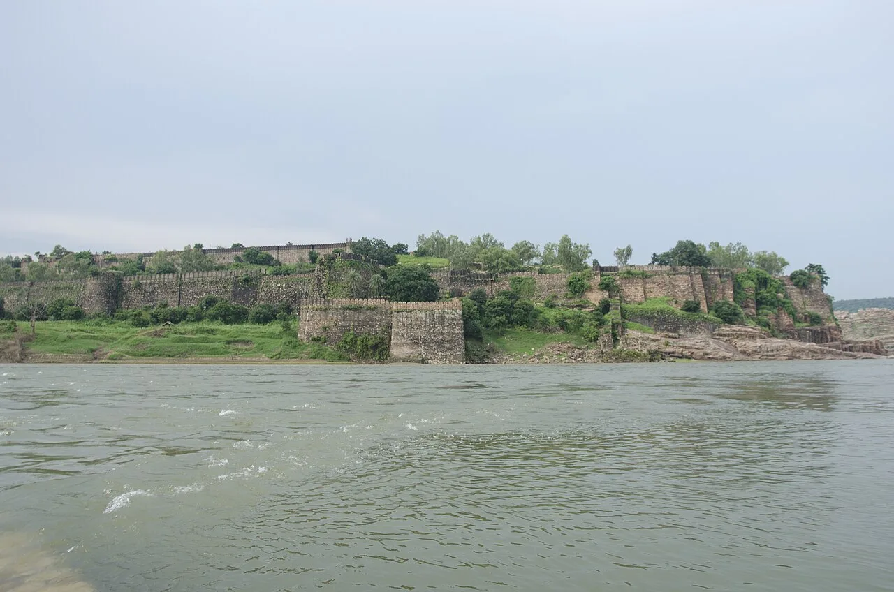
Tradition attributes the earliest foundation of Gagron Fort to Raja Madho Bhil. Historical accounts associate its later control with Bijaldev Singh Dod, a Panwar (Paramara) Rajput ruler, in the twelfth century. The fort’s position between rivers made it a strategically significant stronghold in the Hadoti region, and its ownership changed over the centuries. Gagron is also linked in regional tradition with the Bhakti saint Pipa, remembered as a ruler who turned to a devotional life. The fort’s fabric and surviving structures reflect its long use and successive phases rather than one single building campaign. Its defensive setting, gateways and remains of internal buildings speak to its roles as a fort and residence. In 2013, Gagron became one of the six components of the UNESCO-listed Hill Forts of Rajasthan. Visitors should distinguish this formal recognition from claims about individual repairs: detailed restoration histories are not assumed here, and current conservation work should be checked with the responsible authority.
Origin stories & folklore
According to local tradition, Raja Madho Bhil laid the foundation of Gagron Fort before it passed into the hands of later rulers. Regional devotional accounts also associate Gagron with the saint Pipa, who is said to have been a ruler before renouncing worldly power for spiritual practice; versions of his life differ, so this is best understood as a tradition rather than a complete historical record. The fort’s title Jaladurg, or water fort, is often explained through its river-bound setting and moat. These stories add cultural meaning to the site, but visitors can separate them from the documented UNESCO recognition and the fort’s visible defensive landscape.
Architecture & design
Gagron is classified as a hill-and-water fort, with its natural setting forming a major part of its defences. It stands at the confluence of the Ahu and Kali Sindh rivers; water surrounds three sides, while a moat protects the fourth. This arrangement gives the fort its association with the term Jaladurg, or water fort. Its walls, gateways and surviving internal structures were built for defence as well as occupation, though the remains visible today represent a site shaped over successive periods. The fort’s position on rising ground provides views across the rivers and surrounding landscape. Stone construction and robust defensive boundaries are characteristic of the surviving fabric. Within the enclosure, visitors may encounter remains of royal or residential buildings and religious structures, but not every area is intact or accessible. The combination of terrain, rivers, moat and fortifications is central to understanding its design; it should not be read as a building isolated from its landscape.
Important objects & sculptures
Gagron is primarily an architectural and landscape monument rather than a site known for a large on-site museum collection. Look for surviving stonework, gateways, wall details and traces of buildings within the fort, noting how defensive features relate to the rivers and moat. Religious remains and the shrine associated with the Sufi saint Mithe Shah are important parts of the site’s layered history; approach the shrine respectfully and follow any local instructions. Interpretation boards, where present, can help explain the fort’s phases and significance. The condition and visibility of individual carvings, inscriptions or architectural fragments may vary, so avoid treating an unlabelled feature as definitively identified.
Explore Gagron Fort slowly and read the interpretation boards, use the official audio guide where available or hire an authorised guide to understand its history. Check opening days, ticket counters and camera rules in advance; many monuments and museums close on one weekday and on some public holidays. Early morning gives softer light, cooler air and smaller crowds. A comfortable itinerary is one main visit in the morning, a local meal at midday and a short nearby stop before an afternoon return. Use the district list on this site to find other places in Jhalawar, but check the route and its condition before combining stops. If a festival or fair is on, roads and stays can be busy — and the experience can be unforgettable. Leave no litter: many sites are protected by the communities around them.
Suggested itineraries
Half day: Allow about 2–3 hours to explore the fort at an unhurried pace, read interpretation boards, visit accessible religious areas respectfully and pause at river-facing viewpoints. Full day: Spend about 2–3 hours at Gagron Fort in the morning, take a meal break in Jhalawar, then visit Jhalawar town’s museum or Bhawani Natyashala; add Jhalrapatan and its temples only if road conditions and energy allow. Gentler option: Arrange a vehicle drop as close to the permitted entrance as possible, focus on the most accessible viewpoints and nearby interpretation, and skip steep or uneven sections.
The fort sits within the Hadoti cultural region, where Hindi and the local Hadoti speech are commonly heard. Jhalawar’s living culture includes regional foodways, religious observances and the hospitality of town and village communities. Gagron’s heritage is associated with both Rajput history and devotional traditions, including the regional memory of saint Pipa and the Sufi shrine of Mithe Shah. Visitors may encounter worshippers or local visitors at religious spaces inside or near the fort; these are living places, not simply displays. Dress modestly around shrines, ask before photographing people, and follow requests about footwear or access. Customs and activity can vary by day and occasion.
Festivals & events
The Urs associated with the shrine of Sufi saint Mithe Shah is an important local devotional gathering; ask locally about its observance and arrangements, as dates and access can vary. Jhalawar district also observes major Rajasthan festivals such as Gangaur, Teej, Holi and Diwali. The Chandrabhaga fair near Jhalrapatan is a notable regional event, usually held in the Kartik season. Festival periods can bring more visitors, processions or busy roads around local religious sites and nearby towns. Confirm whether an event is taking place before planning a quiet visit, and be considerate of worshippers and community activities.
Local food in Rajasthan includes dal baati churma, gatte ki sabzi, ker sangri, laal maas, pyaaz kachori, mirchi vada, ghewar, mawa kachori and chaach (spiced buttermilk). Ask what is fresh that day; many small eateries cook a limited daily menu. Vegetarian travellers eat very well across this region, and most towns also have non-vegetarian options. Remote sites may have no restaurant at all. Carry water and snacks, eat a proper breakfast before long drives, and ask your accommodation for a packed lunch if you are heading out early. Try a home-cooked or dhaba meal when you can — it is often the best food on the route. Choose busy, clean places and carry your packaging back with you.
Shopping & local experiences
Jhalawar town is the most practical place to look for everyday shopping, locally made items and regional snacks. Small shops may carry craft products or souvenirs, but availability and provenance vary; ask sellers about the maker rather than assuming an item is locally produced. A visit can also include a meal or tea stop in town to sample Hadoti and wider Rajasthani flavours. There may be few or no dependable shopping facilities inside the fort, so buy essentials before arrival and avoid removing stones, plants or other material from the protected site.
October to March
The nearest principal railway station by straight-line distance is Jhalawar City, roughly 5 km away. The nearest operating airport by straight-line distance is Maharana Pratap Airport, Udaipur, roughly 230 km away. These figures are calculated from map coordinates — actual road distance is longer. Jaipur, Ajmer, Jodhpur, Udaipur and Kota are the main rail hubs, and Jaipur, Udaipur and Jodhpur have the most flights; Delhi is the usual gateway for the north-east of the state. For the final leg, Rajasthan State Road Transport Corporation (RSRTC) buses and private coaches link district towns; shared taxis usually leave early in the morning. A private taxi gives more flexibility for remote sites. When comparing train, bus and flight, count the complete door-to-door time: a flight saves the most time only if the onward road transfer is short, while an overnight train can save a hotel night. Book your return before you leave, because seats fill quickly on weekends, festivals and holidays. Current train numbers, timings, return services and fares are not listed here; check IRCTC and NTES for trains and the airline's own schedule for flights. No permit is needed to visit Rajasthan. Land close to the international border west of Jaisalmer and Barmer is restricted beyond certain points: places such as Tanot can be visited, but border outposts need Border Security Force permission. Forts and palaces charge entry and camera fees, and tiger-reserve safaris must be booked through the official forest department portal.
Confirm onward and return timings on IRCTC / NTES, the state bus operator or your airline before travel. A dash means current timings or fares have not been verified.
Getting around
Jhalawar town is the practical base for reaching the fort. From town, visitors can use an auto-rickshaw, local taxi or private vehicle; confirm the return arrangement before setting out, particularly if relying on a hired vehicle. Local buses may serve routes in the district, but coverage and convenience for the fort should be checked locally. Parking availability near the entrance can vary. Inside the complex, expect to explore on foot over uneven ground, and allow time to walk between features. Boat access should not be assumed: the rivers form part of the fort’s setting, but ordinary visitor transport is by road and on foot.
Hours, tickets & permissions
Entry arrangements can depend on the managing authority and may include a ticket, restrictions on certain areas, or separate rules for photography and equipment. Do not assume that all gates or structures are open on every visit. Dress respectfully, especially near the shrine, and follow posted directions and staff instructions. Confirm current opening days, hours, entry requirements and any camera rules with the monument’s managing authority or Rajasthan Tourism before travelling; fees and access arrangements can change.
Facilities
Facilities within the fort may be limited. Toilets, drinking water, food stalls, seating and guide services should not be assumed to be available throughout the site; check locally before entering and carry water, especially in warm weather. Food and other services are more likely to be found in Jhalawar town. Parking may be available near the approach, but arrangements can vary. Visitors needing cash should plan ahead, as an ATM is not guaranteed at the monument. Authorised guides or audio interpretation may be available, but confirm availability before relying on them.
Accessibility
The fort’s historic setting includes uneven surfaces, slopes and potentially steep or narrow sections. Exploring beyond the entrance can involve substantial walking, with limited shade in exposed areas. Wheelchair and stroller access should not be assumed: historic routes may not have step-free paths, and surfaces can be rough. Older visitors or anyone with limited mobility may prefer a short visit focused on accessible areas and river views, with a companion and frequent rests. Wear secure footwear and avoid pushing beyond comfort, particularly in heat or after rain. Check current access conditions with the site authority before travelling.
No permit is needed to visit Rajasthan. Land close to the international border west of Jaisalmer and Barmer is restricted beyond certain points: places such as Tanot can be visited, but border outposts need Border Security Force permission. Forts and palaces charge entry and camera fees, and tiger-reserve safaris must be booked through the official forest department portal. Carry a photo ID at all times and save the emergency number 112 and your accommodation's contact offline. Heat in summer and fog in winter are the main weather risks; carry water and allow extra travel time on foggy December–January mornings. Respect community rules, private property and posted instructions. Follow local guidance if access changes.
Photography
Early morning generally offers softer light, cooler conditions and fewer visitors; river-facing viewpoints can help show how the fort relates to its landscape. Photography for personal use is often possible at heritage sites, but rules may restrict flash, tripods, commercial shoots or photography in particular religious spaces. Check posted notices and current camera rules before taking equipment inside. Do not fly a drone without the required permissions and confirmation of current aviation and heritage-site restrictions. Ask before photographing worshippers, shrine activity or local residents, and avoid blocking paths.
Choose a stay by the full journey to Gagron Fort, not just the district name. Heritage havelis, fort hotels, state tourism (RTDC) hotels and desert camps offer distinctive stays; check that a desert camp is licensed and has proper toilets. In summer, check air-conditioning or coolers; in December and January, check heating and hot water. Book in advance for weekends, festivals and the peak season (October to March). Confirm the exact location, meals included, check-in time and cancellation terms in writing. Avoid sending money to unverified contacts or touts at stations. Carry some cash, as card and digital payments can be unreliable in remote areas.
In Jhalawar town, visitors can look for the Government Museum and Bhawani Natyashala, a historic performance venue. Jhalrapatan, a nearby town, is known for the Sun Temple and the temples around the Chandrabhaga area; the Chandrabhaga fair is also held nearby in the Kartik season. These places make possible additions to a Jhalawar visit, but road conditions and opening arrangements should be checked before combining them with the fort. Allow enough time for travel between stops rather than treating every site as a quick detour.
For couples, Gagron Fort rewards a slow pace: arrive early for soft light and fewer crowds, share a local meal and keep the evening free. A heritage hotel or a lakeside sunset makes the trip memorable. Public displays of affection can be frowned upon in conservative communities and at religious sites, so be discreet. Keep a buffer in your itinerary, because weather and traffic can delay plans.
Q: How much time should I allow for Gagron Fort? A: Allow a few hours for a relaxed visit; add more time if you want to explore nearby Jhalawar or Jhalrapatan. Q: What is the best season to visit? A: October to March is generally the most comfortable period in Rajasthan. Check local weather before travelling. Q: Is there an entry ticket? A: Entry requirements and fees can change. Confirm current rules with the managing authority or Rajasthan Tourism before your visit. Q: Is the fort suitable for children and elderly visitors? A: Families can visit, but uneven ground, slopes and exposed areas require care. Visitors with limited mobility may prefer a shorter route and should check access conditions. Q: Where can I stay nearby? A: Jhalawar town is the practical base for accommodation and services. Check current lodging options and availability before travelling.
Be the first to share photos, stories, advice or a helpful contact for Gagron Fort.
Loading…