
District · Mizoram
Champhai
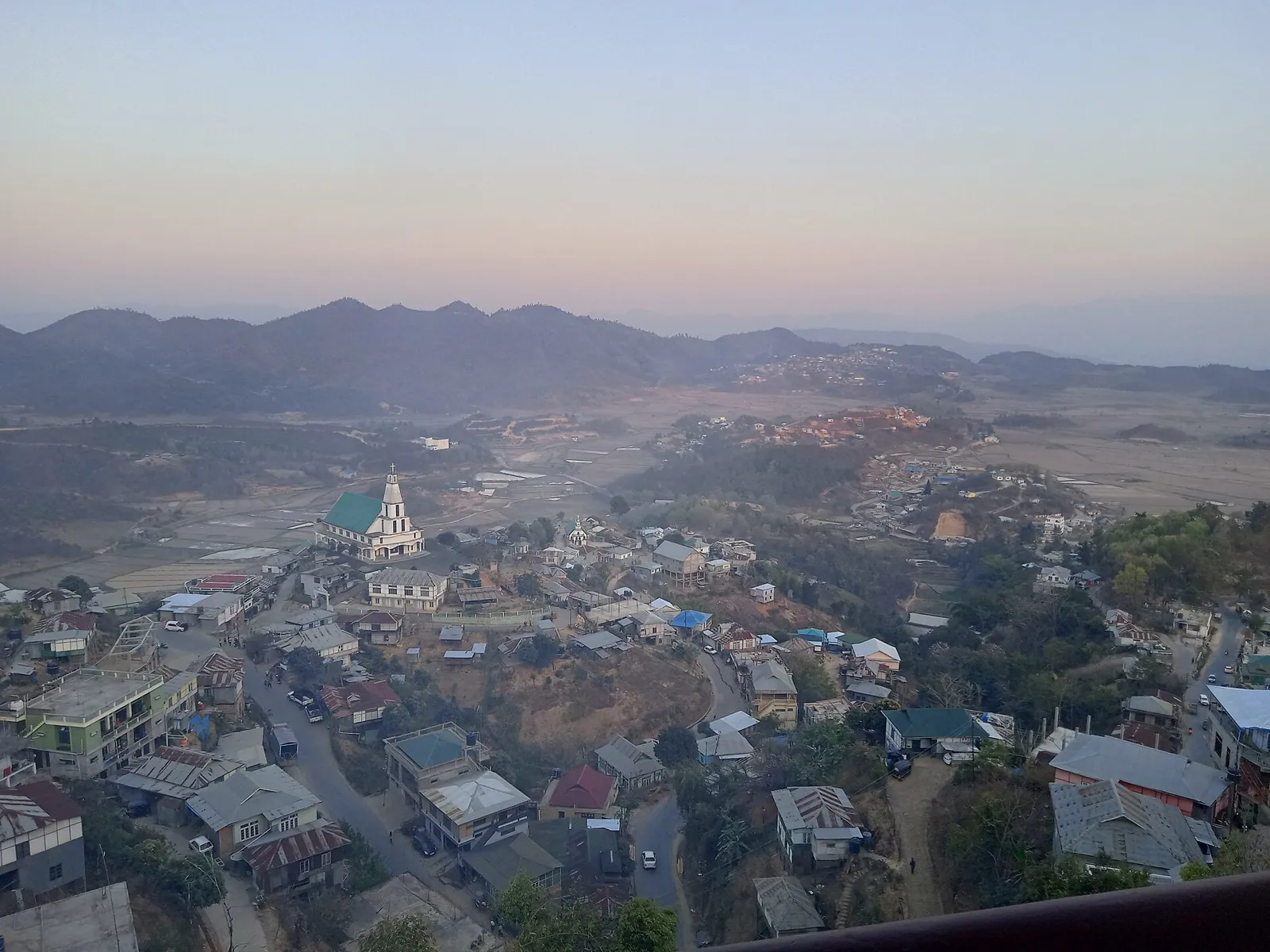
Champhai offers a view of eastern Mizoram, where a cultivated valley, forested ridges and borderland connections shape both the scenery and local life.
Champhai district lies in eastern Mizoram, where forested hills, ridges and cultivated valleys shape both the scenery and everyday life. The district headquarters, Champhai town, sits near the Myanmar border and is an important regional centre for trade and travel. Its broad valley is known for rice cultivation, while the surrounding landscape includes protected forest and wildlife areas, including Murlen National Park. Champhai is among Mizoram’s older Mizo settlements and has a history shaped by local communities and cross-border connections. The district’s character is distinctly Mizo: community life, local traditions and the rhythms of farming are closely connected to the hills and valleys.
Champhai offers a view of eastern Mizoram, where a cultivated valley, forested ridges and borderland connections shape both the scenery and local life. Champhai town is an important centre for travel and trade near Myanmar, and the broad valley is known for rice cultivation. Visitors can combine time in town with excursions to Murlen National Park and, with extra planning, Lengteng Wildlife Sanctuary in neighbouring Saitual district. The area is also a place to encounter Mizo community traditions and the rhythms of farming away from the state capital. Winding roads and changing conditions make a flexible itinerary worthwhile.
Champhai’s history is rooted in the settlement and community life of Mizo groups in the eastern hills. Local accounts associate the area with early Mizo settlements, and some describe Champhai as having served as a seat of Hmar rulers. Over time, the region’s position near the Myanmar frontier also connected it with cross-border movement and exchange. During the British period, the Lushai Hills came under colonial administration in the late nineteenth century; local chiefs and customary institutions remained important in community affairs. After Indian independence, the hills were administered within Assam before the Union Territory of Mizoram was established in 1972. Mizoram became a state in 1987. Champhai district was formed in 1998, separating it from the earlier Aizawl district administration. Its later development has centred on Champhai town as a regional service and trade hub, while agriculture, especially rice cultivation in the valley, continues to be closely tied to local life. District boundaries and administrative arrangements have changed over time, so older accounts may refer to a wider area than today’s district.
3 destination guides
Champhai
Champhai, in Mizoram’s Champhai district, is a historic town near Myanmar. Visitors come to a regional trading centre set within a high valley landscape.
Lengteng Wildlife Sanctuary
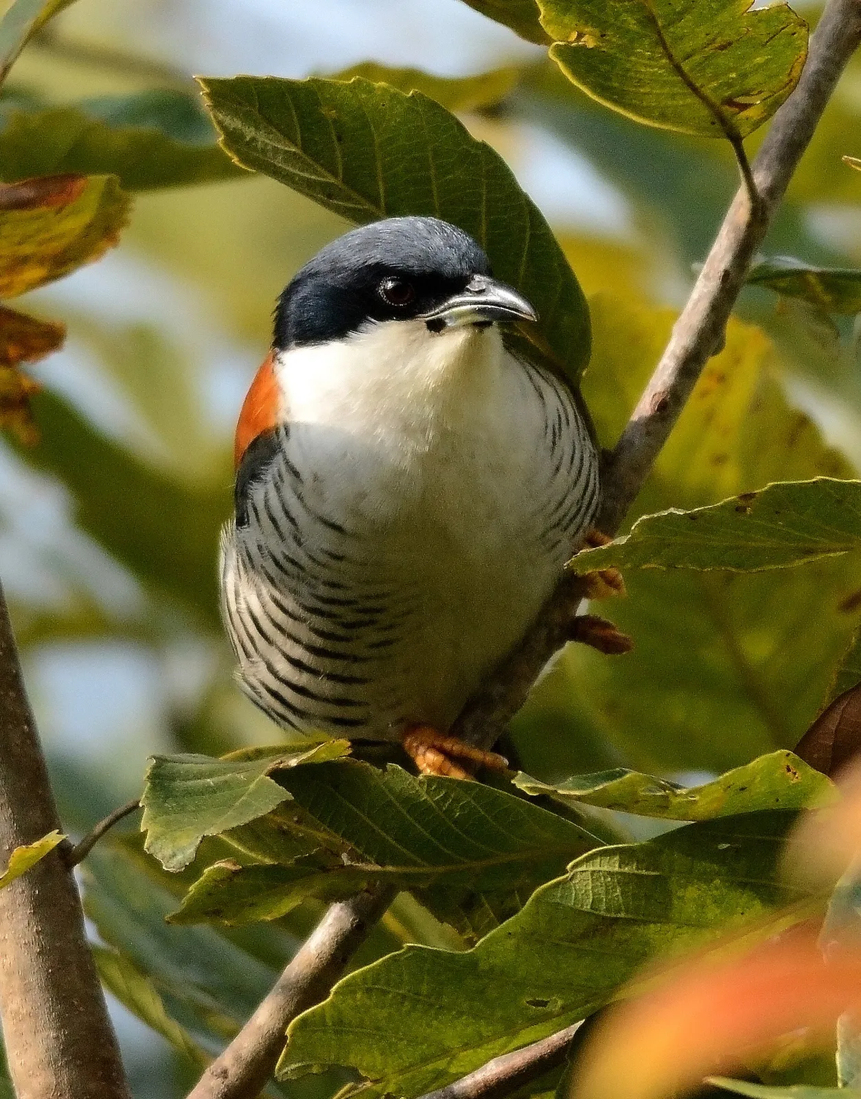
Lengteng Wildlife Sanctuary, in Mizoram, is described in relation to Champhai and Saitual districts. Its alpine forest, state’s second-highest peak and rare bird species are key reasons for interest in the area.
Murlen National Park
Murlen National Park is a protected area in Mizoram’s Champhai district, visited for its forest habitats and recorded diversity of mammals, birds and plant life.
Champhai’s food reflects wider Mizo culinary traditions. Bai, a stew commonly made with vegetables and bamboo shoot, and sawhchiar, a rice porridge often prepared with meat, are familiar dishes. Smoked pork, known as vawksa rep, and fresh chutneys may also appear on local menus. Pork, beef, fish and fermented ingredients are common in regional cooking, though recipes and daily offerings vary between households and eateries. Small restaurants may cook only a limited selection each day, so asking what is fresh can be helpful. Vegetarian travellers should explain their preferences clearly; rice, dal, vegetables and eggs may be available in town.
Handloom weaving is an important tradition across Mizoram, and Champhai’s local culture sits within this wider Mizo heritage. Woven puan cloths are valued for their colours and patterns and are used in everyday life as well as for cultural occasions. Bamboo and cane are also widely worked across the region into practical household goods, baskets and other woven items. These traditions are maintained by artisans and community groups, though what is available to visitors can vary. For locally made work, ask in town about current craft sellers or community outlets rather than assuming a particular item is made only in Champhai.
Chapchar Kut, Mizoram’s spring festival, is usually celebrated in March with community gatherings, traditional music and dance. Mim Kut and Pawl Kut are harvest-related festivals observed in the region, generally in late summer and winter respectively, though local practice and timing can vary. These are primarily community celebrations rather than large visitor fairs, but public events may make central areas busier and accommodation less available. Travellers hoping to attend should check local announcements and arrange rooms ahead, especially in Champhai town. Festival programmes and observance can differ between communities and years.
Champhai district is a landscape of steep, forested hills, long ridges and cultivated valleys. The broad Champhai valley, where rice is grown, contrasts with the surrounding uplands and wooded areas. The district lies beside Myanmar, with the Tiau River forming part of the international boundary in the region. Murlen National Park protects forested terrain in the district; Lengteng Wildlife Sanctuary is in neighbouring Saitual district. Roads follow the hills and valleys rather than straight routes, so journeys between settlements can take longer than a map suggests, and remote sites require advance planning.
The district has a generally mild hill climate, with seasonal variation and conditions changing with elevation. The warmer months of spring and early summer are suitable for town visits, while the monsoon, usually from around June into September, brings heavy rain, slippery roads and possible travel disruption. Autumn and winter are often more comfortable for road journeys and outdoor visits; evenings and higher areas can feel cool. November to April is a useful broad window for travel, with the drier months especially practical for reaching remote sites. Pack layers, a light rain jacket, sturdy footwear and protection from sun and insects. Check forecasts and road conditions before setting out.
Champhai is reached by road through Mizoram’s hill country, most commonly via Aizawl; expect winding routes and allow flexibility for changing road conditions. Lengpui Airport, near Aizawl, is the nearest operating airport. Sairang, serving the Aizawl area, is the nearest principal railway station. From Aizawl, shared vehicles and taxis are commonly used for onward travel, while local taxis can help with trips around Champhai. Public transport and vehicle availability may be limited for remote sites such as Murlen National Park, so arrange the final leg in advance where possible. Check current road conditions and transport services locally before setting out.
Champhai town is the main base for district travel, with road connections to Aizawl and other settlements through winding hill routes. Shared vehicles and taxis are commonly used for inter-town journeys, while local taxis can be arranged for nearby sights. Services may be infrequent, and public transport to Murlen National Park is limited, so arrange the last part of the journey in advance. Reaching Lengteng Wildlife Sanctuary involves travel in neighbouring Saitual district and should be planned as a separate road excursion. There are no routine visitor boat links between the district’s main sights. Confirm vehicle availability and road conditions locally.
2 days: Champhai (sleep in Champhai on night 1; sleep in Champhai on night 2). 3 days: Champhai > Murlen National Park > Champhai (sleep in Champhai on nights 1 and 2). 4 days: Champhai > Murlen National Park > Champhai > Lengteng Wildlife Sanctuary (sleep in Champhai on nights 1 and 2; sleep in or near Saitual on night 3). Lengteng is in neighbouring Saitual district; confirm the road route before setting out.
Champhai town is the most practical base for town visits and trips to Murlen National Park, with accommodation generally including hotels and homestays. For an excursion to Lengteng Wildlife Sanctuary, consider an overnight stay in or near Saitual district rather than making the return journey in one day; check what is currently available locally. Options outside the main towns may be limited, and government accommodation or community stays should not be assumed available without confirmation. Reserve ahead during festival periods and ask hosts about transport arrangements for remote sites.
Hill roads are winding and can become slippery or obstructed during heavy rain; allow extra time and avoid relying on tight connections. For forest visits, follow park guidance, stay on permitted routes and do not approach wildlife. Carry drinking water and suitable food for remote outings, and use treated or sealed water if water safety is uncertain. Mobile coverage can be patchy beyond towns, so share plans and arrange transport in advance. Indian visitors should check current Inner Line Permit requirements with official Mizoram authorities before travel. Confirm directly with park or district authorities whether any protected-area permissions or other rules apply to a planned visit.
- Saitualabout 38 km
- Aizawlabout 61 km
- Serchhipabout 66 km
- Mamitabout 83 km
- Lungleiabout 83 km
- Kolasibabout 93 km
- Bishnupur · Manipurabout 112 km
- Lawngtlaiabout 113 km
Straight-line distance between the centres of each district's destinations; road distance is longer.
Q: How many days should I spend in Champhai district? A: Two days can cover Champhai town, while three or more allow time for Murlen National Park or a carefully planned regional excursion. Q: When is the best time to visit? A: November to April is generally a practical period, with drier conditions useful for road travel; check weather locally. Q: What is the best base for visiting the district? A: Champhai town is the most convenient base for the town and Murlen National Park. Plan separately for Lengteng in Saitual district. Q: How do I get to Champhai? A: Travel by road, commonly via Aizawl. Lengpui Airport serves the Aizawl area, and Sairang is the principal railway station serving it; onward travel is by road. Q: Is Champhai suitable for families or elderly travellers? A: It can be, especially with a flexible town-based stay, but winding roads and limited access to remote sites may be tiring. Choose outings to suit mobility and check conditions in advance.
This page draws on our 3 destination guides for Champhai and is updated as our team checks it.
Be the first to share photos, stories, advice or a helpful contact for Champhai.
Loading…