
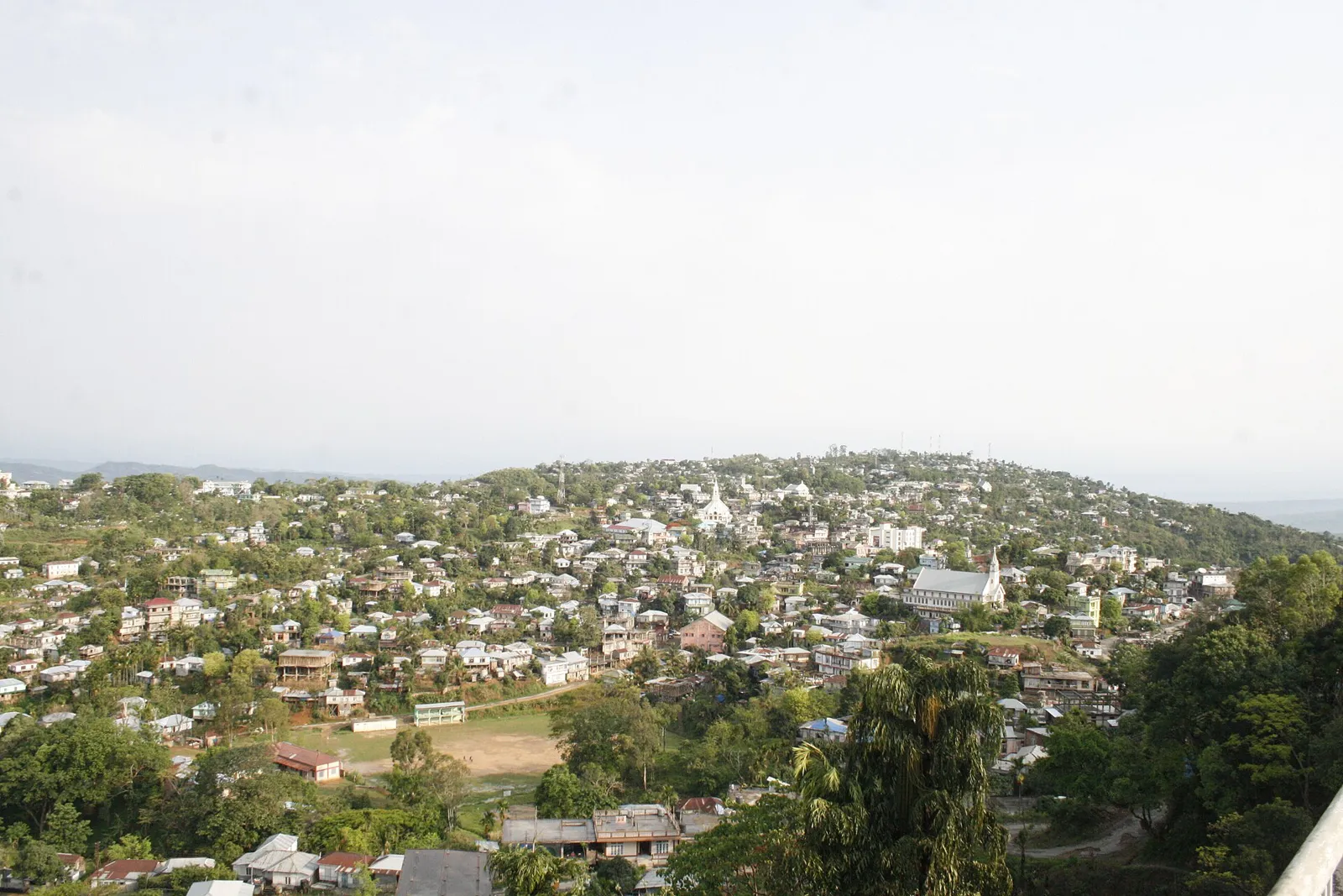
District · Mizoram
Kolasib
Kolasib is a northern gateway to Mizoram, near the Assam border and on the road corridor between the Barak Valley and Aizawl.
Kolasib district lies in northern Mizoram, adjoining Assam and forming an important gateway into the state. Forested hills, winding valleys and cultivated slopes shape its landscape, while Kolasib town serves as its administrative and commercial centre. Its character reflects the wider history of Mizo village society, with strong community ties and livelihoods traditionally linked to agriculture, including shifting cultivation. Road connections with Assam have also made trade and movement central to the district’s development. For travellers, Kolasib offers an introduction to Mizoram’s hill settlements and everyday life rather than a dense circuit of monuments. Journeys here are best approached slowly, allowing for winding roads and changing weather.
Kolasib is a northern gateway to Mizoram, near the Assam border and on the road corridor between the Barak Valley and Aizawl. Its town is an administrative and commercial centre, and the district offers a glimpse of everyday life in a hill region where community ties and agriculture remain important. Travellers are more likely to come for the transition from Assam’s valleys to Mizoram’s forested hills, and for a slower look at local settlements, than for a concentration of major monuments. Kolasib is best approached as a modest stop or unhurried base along a longer road journey.
The history of the area now called Kolasib is part of the wider history of Mizo society, shaped by village communities, customary practices and chiefly leadership. Agriculture, including shifting cultivation, supported many communities, while ties between settlements linked the hills across what are now administrative boundaries. British involvement in the Lushai Hills grew during the late nineteenth century, following military expeditions and the extension of colonial administration. These changes altered chiefly authority and brought new administrative and mission institutions to the region. After Indian independence, the Lushai Hills became a district within Assam, then a Union Territory in 1972; Mizoram became a state in 1987. Kolasib district was created in 1998 from territory that had been part of Aizawl district. Its position beside Assam has continued to shape trade, travel and movement between the hills and the Barak Valley. The present district’s identity reflects both this borderland role and the broader cultural history of Mizoram.
Food in Kolasib draws on wider Mizo traditions rather than a distinctly documented district cuisine. Bai, a preparation of vegetables often including bamboo shoots, and sawhchiar, a rice-and-meat porridge, are useful dishes to ask about. Vawksa rep, or smoked pork, reflects the regional importance of preserved meat. Rice commonly anchors meals, accompanied by vegetables, meat and fresh chutneys. Small eateries may prepare only a limited daily menu, so ask what is available. Vegetarian travellers should clarify whether dishes contain meat stock, fish or fermented ingredients. Carry drinking water and snacks when travelling beyond town.
Kolasib shares in Mizoram’s broader traditions of handloom weaving and bamboo-and-cane work. Puan, the woven cloth central to Mizo dress, is known for its stripes, patterned bands and varied colour combinations; particular styles have ceremonial or cultural associations. Bamboo and cane are used for baskets, carrying containers and other practical household objects, reflecting materials readily associated with the region’s hill environment. These are regional traditions, not crafts unique to Kolasib. Ask locally about handloom sellers or artisans, and distinguish locally woven pieces from factory-made textiles when buying.
Mizo festivals are observed in Kolasib as part of the wider cultural calendar of Mizoram. Chapchar Kut, usually held in March, is associated with the agricultural cycle and is marked by community celebrations and traditional performances. Mim Kut, generally in late summer, and Pawl Kut, usually in winter, are also celebrated in the region. Christmas is an important occasion for many local communities. Festival periods can bring more activity to town centres and make rooms or transport busier, especially around larger gatherings. Check locally for event schedules and arrange accommodation ahead when travelling during a major celebration.
Kolasib district lies among the forested hills and valleys of northern Mizoram, with cultivated slopes and settlements linked by winding roads. Its borderland position connects the hill landscape with the lower, broader routes of Assam. Rivers and streams run through the valleys, but travel between settlements is shaped more by steep terrain and road curves than by water transport. Forest cover and changing elevation give journeys varied scenery, while rain can make roads slower and conditions less predictable. Allow time for short distances to take longer than expected, particularly during the monsoon.
Kolasib has a humid monsoon climate. Summer months are generally warm and increasingly wet, while the main monsoon brings frequent rain that can slow road journeys and affect visibility. Winter is usually drier and cooler, particularly in the mornings and evenings. The post-monsoon months through winter are often a comfortable period for road travel; October to March is a useful general window, though conditions vary. Pack light layers, a warm layer for evenings, sturdy footwear and rain protection. In the wet season, carry waterproof bags and allow extra time for travel. Check local road and weather conditions before setting out.
Lengpui Airport is the main air gateway for reaching Kolasib, with onward travel by road. Bairabi is a nearby railway access point, though the most practical rail connection depends on current services and your onward route. Kolasib lies on the principal road corridor linking Assam with Aizawl, making approaches from Silchar and other parts of the Barak Valley useful options. Buses, shared taxis and hired vehicles are common ways to travel between towns; local taxi availability can vary. Hill roads and monsoon conditions can lengthen journeys considerably. Check current services locally.
Road is the practical way to move around Kolasib district. Kolasib town lies on the principal corridor between Assam and Aizawl, and buses and shared vehicles connect it with other towns when services are operating. Shared taxis and hired vehicles are useful for journeys beyond the main routes, though availability can vary and should be checked locally. In town, local taxis may be available; do not assume a regular auto-rickshaw service. There is no need to plan around boat travel for ordinary sightseeing. Hill roads are winding, and rain or road works can affect journey times, so keep plans flexible.
2 days: Kolasib; sleep in Kolasib overnight. 3 days: Kolasib; sleep in Kolasib on both nights. 4 days: Kolasib; sleep in Kolasib on all three nights.
Kolasib town is the most practical base for a short district visit and for travellers passing between Assam and Aizawl. Modest hotels and guesthouses are the most straightforward options, though standards and availability can vary; confirm arrangements before arrival. Homestays may be available, but visitors should not assume they can be found at short notice. Government accommodation, where offered, may require advance confirmation. For a longer stay, use Kolasib as a base and check locally about transport before planning outings. The district is not a large resort destination, so keep expectations simple.
Take care on narrow, winding hill roads, especially in heavy rain, fog or after dark; use a reliable driver and allow extra journey time. Wear shoes with good grip on wet or uneven ground, and do not approach wildlife or stray animals. Use treated or sealed drinking water if unsure of local supplies. Mobile connectivity can be patchy outside town, so share your route and keep essential information accessible offline. Check road conditions locally during the monsoon. Entry requirements for Mizoram, including any Inner Line Permit requirements for your circumstances, can change; confirm them through official sources before travel. Do not assume a separate district permit is needed.
- North Tripura · Tripuraabout 47 km
- Aizawlabout 55 km
- Saitualabout 61 km
- Unakoti · Tripuraabout 63 km
- Mamitabout 70 km
- Champhaiabout 93 km
- Serchhipabout 105 km
- Dima Hasao · Assamabout 106 km
Straight-line distance between the centres of each district's destinations; road distance is longer.
Q: How many days should I spend in Kolasib district? A: One or two nights suit a brief stop in Kolasib town; allow longer if you want a slower road journey or time to explore the area locally. Q: When is the best time to visit? A: October to March is generally a comfortable period for travel, while monsoon months bring heavier rain and slower roads. Q: What is the best base for visiting? A: Kolasib town is the most practical base, with the district’s main road connections and the broadest choice of local accommodation. Q: How do I get to Kolasib? A: Travel by road from Assam or Aizawl; Lengpui Airport and Bairabi railway access are possible parts of an onward journey, with road travel still needed. Q: Is Kolasib suitable for families or elderly travellers? A: It can suit visitors comfortable with long, winding road journeys. Families and older travellers should plan rest breaks, avoid rushing and check accommodation and road conditions in advance.
This page draws on our 1 destination guides for Kolasib and is updated as our team checks it.
Be the first to share photos, stories, advice or a helpful contact for Kolasib.
Loading…