
District · Nagaland
Wokha
Wokha offers a quieter, largely rural perspective on Nagaland, away from the state’s main urban centres.
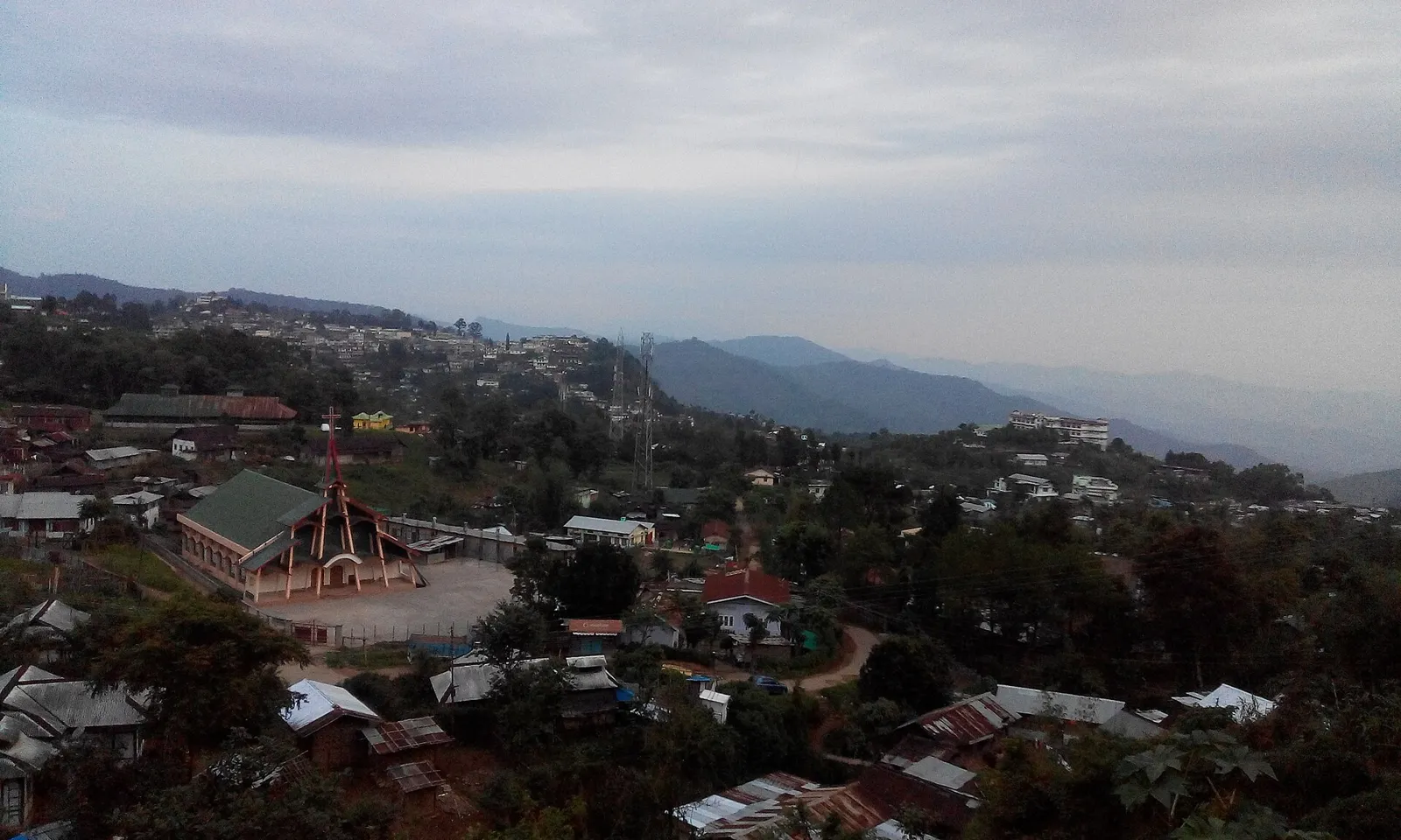
Wokha district lies in western Nagaland, where forested hills, cultivated slopes and river valleys shape daily life. The district headquarters, Wokha town, sits amid a landscape associated with Mount Tiyi and the Doyang River. Fields, orchards and village settlements are scattered across the hills, and journeys between them can be slow on winding roads. The area is the traditional homeland of the Lotha Naga people, whose language, community life and customs remain central to its character. Wokha became a separate district in 1973, having previously been part of Mokokchung district. Visitors will find a quieter, largely rural destination, with town markets and village life offering a glimpse of Nagaland beyond its main urban centres.
Wokha offers a quieter, largely rural perspective on Nagaland, away from the state’s main urban centres. In the west of the state, its hills, cultivated slopes and river valleys are closely connected with the life and traditions of the Lotha Naga people. The district is associated with Mount Tiyi, the Doyang River and Tokhu Emong, the Lotha harvest festival. Wokha town provides a base for experiencing local markets and the surrounding countryside, though journeys between settlements can take time on winding roads. It suits travellers interested in village life, regional culture and a slower-paced hill-country visit.
Wokha is part of the traditional homeland of the Lotha Naga people. Lotha communities have their own language, customs and histories, preserved through community life and oral traditions. As with other Naga areas, the region’s past is not best described through a succession of large kingdoms or dynasties; village and clan institutions were central to social and political life. British administration expanded into the Naga Hills during the colonial period, bringing new administrative boundaries and changes in the region’s relations with outside authorities. After Indian independence, the Naga Hills became part of the state of Nagaland when it was formed in 1963. Wokha was formerly included in Mokokchung district and became a separate district in 1973. Its later development has centred on Wokha town as the district headquarters, while many settlements have retained strong village identities and community traditions.
Food in Wokha reflects Lotha Naga traditions and the wider cuisine of Nagaland. Smoked pork with bamboo shoot, axone (fermented soybean), rice-based galho and relishes made with king chilli are familiar regional dishes; seasonal greens and other local ingredients vary. Many small eateries prepare a limited menu, so it is worth asking what is fresh that day. Pork, beef, fish and fermented foods are common across tribal cuisines in the state. Vegetarian meals may be possible in town, but explain dietary needs clearly and check ingredients, as broths and sauces may also contain meat or fermented products.
Lotha weaving is part of Nagaland’s broader handloom tradition, with shawls and wraparound cloths carrying patterns and colours associated with community identity. Designs and techniques can vary between villages and makers, so it is best not to assume that a particular motif belongs only to Wokha. Bamboo and cane are also widely worked across the state into practical household objects and baskets; wood carving is another regional craft tradition. In Wokha, ask locally about current makers, village markets or cooperative outlets, since craft availability can be seasonal and there may not be a dedicated shop.
Tokhu Emong, the Lotha harvest festival, is generally celebrated in November after the harvest. It brings communities together for feasting, traditional observances and social visits; village programmes and public events can make local accommodation busier. Dates and activities vary between communities, so visitors should check locally. Nagaland’s Hornbill Festival is held in December at Kisama, outside Wokha district; it may draw visitors travelling around the state, but is not a Wokha festival. Smaller village celebrations take place at different times of year and are best confirmed with local hosts.
Elsewhere in Nagaland
Wokha’s landscape is made up of forested hills, cultivated slopes, valleys and scattered settlements. Mount Tiyi is a notable local landmark, while the Doyang River and its valley form part of the district’s broader geography. Steep terrain and winding roads shape travel: routes between towns and villages can take longer than map distances suggest, and conditions may change with rain. Views and the character of the countryside vary along the roads, but reaching individual villages generally requires planning around road access and local transport.
The district has a hill climate with a warm, wetter summer and a cooler, drier winter. The monsoon, generally from around June into September, brings frequent rain that can make roads slower or harder to travel. October to April is often more suitable for road journeys and outdoor exploration, although winter days and nights can feel cool, especially at higher or exposed locations. Conditions vary with elevation and season. Pack layers, a light rain jacket or umbrella, sturdy shoes with grip and any personal medicines. Check the forecast and road conditions before travelling, particularly during the rainy season.
The nearest operating airport is Dimapur Airport, and the nearest principal railway station is Furkating Junction in Assam. Map distances do not reflect the longer, winding road journeys through the hills. Wokha is reached by road from other parts of Nagaland and from Assam; routes and journey times can vary with road conditions and weather. Shared taxis and hired vehicles are commonly used for travel between towns, while local transport options within Wokha may be limited. Confirm the route, vehicle availability and any entry-permit requirements before setting out, and check current services locally.
Roads are the main way to move around Wokha district. Wokha town is the practical base for local journeys, with shared taxis and hired vehicles commonly used for travel between towns and settlements. Local buses may serve some routes, but services and availability can be limited; ask locally before relying on them. Auto-rickshaws or other local vehicles may be available for short trips in town, but should not be assumed for village travel. There are no routine sightseeing boat services to rely on. Agree on the route and return arrangements with a driver, especially for rural trips.
2 days: Wokha; sleep in Wokha. 3 days: Wokha on each day; sleep in Wokha each night.
Wokha town is the most practical base for a short visit, local services and road connections. Simple hotels and guesthouses are the main options to look for; homestays may also be available through local contacts, though arrangements can vary. Accommodation choices are more limited outside town, so confirm a village stay in advance rather than expecting a wide range of lodges or guesthouses. For longer trips, staying in Wokha and making planned day journeys is usually more straightforward than changing base between settlements.
Hill roads can be narrow, winding and affected by rain, so allow flexibility and use a suitable vehicle and experienced local driver. Avoid walking unfamiliar routes after dark, and take care on wet or uneven paths. Do not approach wildlife, and use treated or boiled drinking water if safe supplies are uncertain. Mobile coverage and services may be limited outside town. Carry essential medicines and check local health-service access before remote trips. Visitors should check current Inner Line Permit requirements with official Nagaland authorities before travel; do not rely on informal or outdated advice.
- Zunhebotoabout 27 km
- Mokokchungabout 36 km
- Kohimaabout 56 km
- Dimapurabout 58 km
- Phekabout 64 km
- Jorhat · Assamabout 70 km
- Kiphireabout 81 km
- Majuli · Assamabout 97 km
Straight-line distance between the centres of each district's destinations; road distance is longer.
All districts of Nagaland
Q: How many days should I spend in Wokha? A: Two days can suit a brief visit centred on Wokha town; allow three days if you want a slower pace and time for planned journeys into the surrounding countryside. Q: When is the best time to visit? A: October to April is generally more convenient for travel, with November also bringing Tokhu Emong celebrations in Lotha communities. Check conditions before setting out. Q: What is the best base in the district? A: Wokha town is the most practical base for accommodation, local services and road connections. Q: How do I get to Wokha? A: The nearest operating airport is Dimapur Airport and the nearest principal railway station is Furkating Junction in Assam. Continue by road; routes and journey times depend on conditions. Q: Is Wokha suitable for families or elderly travellers? A: It can suit visitors comfortable with winding roads and a quieter, rural setting. Plan shorter journeys, confirm vehicle arrangements and consider mobility needs, as paths and services may be limited.
This page draws on our 1 destination guides for Wokha and is updated as our team checks it.
Be the first to share photos, stories, advice or a helpful contact for Wokha.
Loading…