
District · Arunachal Pradesh
Dibang Valley
Dibang Valley occupies a remote part of northeastern Arunachal Pradesh, in the eastern Himalayan region.
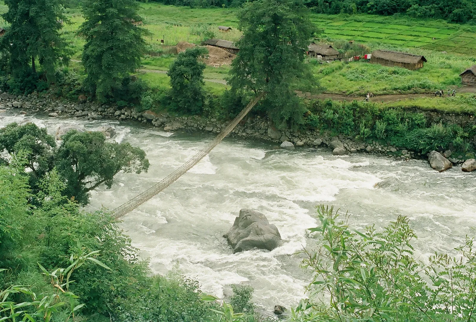
Dibang Valley is a remote, mountainous district in northeastern Arunachal Pradesh, shaped by the Dibang River and the forests and high ridges of the Mishmi Hills. Its terrain ranges from river valleys and dense subtropical forest to colder, high-altitude landscapes. Anini, the district headquarters, is a small settlement surrounded by dramatic mountain scenery. The district is home chiefly to Idu Mishmi communities, whose cultural life and knowledge of the region are closely connected to its forests and rivers. Dibang Valley was formed as a separate district in 2001. Its character is defined by limited road access, low-density settlements and a strong sense of connection to the surrounding natural environment.
Dibang Valley occupies a remote part of northeastern Arunachal Pradesh, in the eastern Himalayan region. Its district headquarters, Anini, is a small settlement and the principal base for travel in the district. The area is known for Idu Mishmi culture, forested Mishmi Hills and the Dibang River basin. Travellers come for a quieter, road-based experience of Arunachal’s mountain landscapes and for an introduction to a region whose communities and travel conditions differ from those of the state’s more accessible towns. Published visitor information is limited, so plans should allow time for the journey and changing road conditions.
The region is the homeland of Idu Mishmi communities, whose customary life and social organisation developed in the Mishmi Hills. The area did not form part of a well-documented, centralised kingdom comparable to the larger historic states of the plains; contact with neighbouring regions took place across difficult mountain routes. During the colonial period, British administration in this frontier area was limited and developed gradually, with the hills managed through frontier officials rather than ordinary provincial administration. After Indian independence, the area was administered within the North-East Frontier Agency (NEFA). NEFA became the Union Territory of Arunachal Pradesh in 1972 and the state of Arunachal Pradesh in 1987. Dibang Valley district was established in 1980, with Anini as its headquarters. In 2001, Lower Dibang Valley was separated as a distinct district, leaving Dibang Valley as a sparsely populated highland district. Its history is also shaped by continuing Idu Mishmi cultural traditions and the challenges of governing a remote border region.
Food in Dibang Valley reflects the wider culinary traditions of Arunachal Pradesh, with rice, local greens, bamboo shoots, smoked meat and fermented ingredients featuring in everyday cooking. Thukpa and momos are also found in the region, though menus vary between small eateries and households. Apong, a locally made rice beer, is associated with festivals and community gatherings in many parts of Arunachal Pradesh. Ingredients and dishes differ among communities, so it is worth asking what is fresh and how a meal is prepared. Meat and fermented foods are common; vegetarian travellers should explain their needs clearly, as rice, dal, vegetables and eggs may be available in town.
Textile weaving is an important tradition among Mishmi communities, including the Idu Mishmi of Dibang Valley. Woven garments and cloths can feature bold geometric designs, with patterns and colours varying by community and maker. Beadwork and ornaments also form part of regional dress and cultural expression. Cane and bamboo are used across Arunachal Pradesh for practical household goods and woven items, although availability and styles vary locally. These crafts are part of living traditions rather than simply souvenirs; visitors interested in buying them can ask locally about makers and community-run outlets.
Reh, the major festival of the Idu Mishmi, is generally celebrated in February. It is a community and religious observance, with ceremonies and gatherings that offer visitors a chance to learn about local traditions when invited to do so respectfully. Other customary celebrations may be held in villages, but dates and practices can vary. Festival activity is local in scale; it should not be assumed to create large tourist crowds, though the small supply of rooms in Anini can fill more quickly around community events. Check locally and arrange accommodation ahead.
Dibang Valley is a large, sparsely populated mountain district of the Mishmi Hills, with steep slopes, forested valleys and high ridges. The Dibang River and its tributaries drain the region, while settlements and the main road occupy narrow valley corridors. Forest cover and rugged terrain make journeys scenic but slow; landslides, washouts and damaged road sections can interrupt travel, especially during and after heavy rain. Anini is the main town and road base. Distances on a map may not reflect journey times, and access to more remote areas should be checked locally.
Conditions vary with elevation. Summer is generally milder in the high settlements, while lower valleys can be warmer. The monsoon, broadly from late spring through early autumn, brings persistent rain and can make roads vulnerable to landslides and delays. Winter is colder, especially at night, and higher areas may experience very low temperatures. October to April is often the more practical period for a visit, although winter travel still requires preparation and road checks. Pack warm layers, a waterproof outer layer, sturdy footwear and any personal medicines; carry extra supplies in case weather disrupts the journey.
Anini is reached mainly by road, commonly via Roing, with the route passing through the mountain settlements around Mayudia and Hunli. Tezu Airport is the nearest operating airport by map proximity, while Murkongselek is the nearest principal railway station by map proximity; neither is a short onward journey from Anini. Roads can be winding and conditions may change with weather, so allow flexibility and arrange the final leg in advance. Shared vehicles and taxis may be available, but local transport is limited and schedules can vary. Check permit requirements and confirm current road and transport conditions locally before travelling.
Road travel is the main way to move around the district. Anini is linked by road with Roing, and visitors generally reach the district overland through Arunachal Pradesh from Assam. Shared vehicles and local taxis may be available, but services are limited and can change with weather and road conditions. Do not rely on frequent local buses or on finding a vehicle at short notice; arrange onward transport in advance where possible. There is no regular tourist boat network for getting between settlements. Allow generous time for road journeys and confirm current access locally.
2 days: Anini; sleep in Anini. 3 days: Anini, with a slower local visit; sleep in Anini on both nights.
Anini is the practical base for visits to the district because it is the headquarters and the main service centre. Accommodation is limited and is generally modest, with small hotels, homestays and some government guest-house options. Availability, facilities and booking arrangements can vary, so confirm directly before travelling and do not assume that rooms will be available on arrival. For a longer stay, keeping the same base in Anini is usually simpler than planning unverified overnight stops in remote villages.
Mountain roads can be narrow, rough and vulnerable to landslides, particularly during the monsoon; check conditions locally and avoid rushing after heavy rain. Weather changes quickly, so carry warm and waterproof clothing. Wildlife lives in the forests, and visitors should keep a respectful distance and follow local guidance. Use treated or reliably safe drinking water. Medical services, mobile coverage and supplies are limited outside the main settlement, so carry essential medicines and share plans with someone. Indian visitors generally need an Inner Line Permit for Arunachal Pradesh; foreign visitors may need applicable protected-area permissions. Confirm current requirements through official sources before travel.
- Lower Dibang Valleyabout 73 km
- East Siangabout 98 km
- Upper Siangabout 104 km
- Lohitabout 106 km
- Namsaiabout 114 km
- Anjawabout 131 km
- Tinsukia · Assamabout 147 km
- Changlangabout 151 km
Straight-line distance between the centres of each district's destinations; road distance is longer.
Q: How many days should I spend in Dibang Valley? A: Allow at least two or three days based in Anini, in addition to the time needed to travel to and from the district. Q: When is the best time to visit? A: October to April is often more practical for road travel; expect colder conditions in winter and check roads before departure. Q: What is the best base for exploring the district? A: Anini is the main base, with the district’s limited visitor accommodation and services. Q: How do I get to Dibang Valley? A: Most visitors travel overland via Roing from Assam, then continue by road to Anini; allow flexibility for road conditions. Q: Is Dibang Valley suitable for families or elderly travellers? A: It can suit travellers prepared for long, rough road journeys and limited services. Families and older visitors should plan conservatively, check health needs and avoid tight schedules.
This page draws on our 1 destination guides for Dibang Valley and is updated as our team checks it.
Be the first to share photos, stories, advice or a helpful contact for Dibang Valley.
Loading…