
District · Arunachal Pradesh
Papum Pare
Papum Pare is an important foothill district in central Arunachal Pradesh, best known as the home of Itanagar, the state capital and largest town.
Papum Pare lies in the foothills of the eastern Himalaya in western Arunachal Pradesh, where forested slopes, river valleys and settlements give way to the state capital region. Itanagar, the state’s largest town and capital, is the district’s best-known centre and a hub for administration, education and travel. The area’s cultural life is shaped especially by Nyishi communities, alongside people who have moved here from elsewhere in Arunachal Pradesh and India. Ita Fort is a reminder of the region’s older history, while modern institutions and expanding neighbourhoods reflect its contemporary role. Papum Pare offers a meeting of town and countryside, with access to nearby forests and the wider landscapes of Arunachal Pradesh.
Papum Pare is an important foothill district in central Arunachal Pradesh, best known as the home of Itanagar, the state capital and largest town. It offers a practical introduction to the state’s administrative and urban life, alongside forested surroundings and sites such as Ita Fort and Itanagar Wildlife Sanctuary. Gyakar Sinyi is also listed among the district’s attractions. Travellers can use Itanagar as a base for a short visit or as a starting point for journeys farther into Arunachal Pradesh. The district’s mix of regional heritage, town facilities and nearby nature makes it a useful first stop for exploring the state.
Papum Pare is part of the wider homeland of Nyishi communities, whose social and cultural traditions remain important in the district. Ita Fort in Itanagar is a prominent historical landmark. Its construction date and builders are not firmly established; the fort is generally assigned to the medieval period, and accounts of its origins vary. British influence expanded in the eastern Himalayan foothills during the colonial era, while administration of the frontier region later developed under independent India. The North-East Frontier Agency (NEFA) was created in the 1950s, became a Union Territory in 1972 and was renamed Arunachal Pradesh when the state was formed in 1987. Papum Pare district was formed in 1999 from the former Lower Subansiri district. Itanagar’s role as the state capital helped shape its growth as the district’s principal urban centre. The district’s modern history is therefore closely connected both to the development of Arunachal Pradesh’s administration and to the older communities of the region.
4 destination guides · 3 on the map
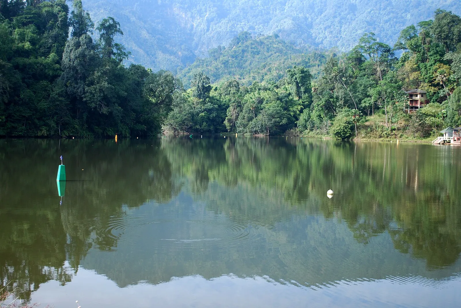
Gyakar Sinyi
Gyakar Sinyi is a lake in Papum Pare district, Arunachal Pradesh. People may visit to see the lake, which gives the place its identity in the district.
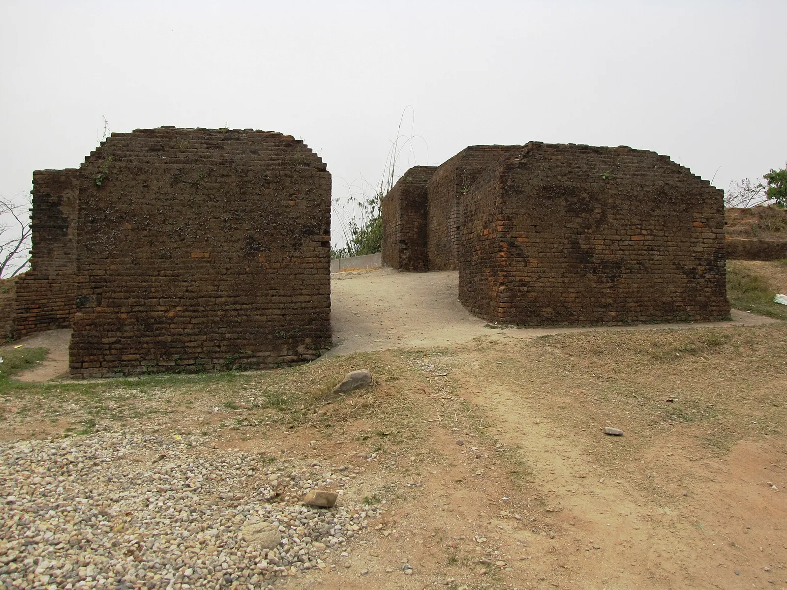
Ita Fort
Ita Fort is a brick-built historic site in Itanagar, associated with the Sutiya kingdom and the city’s name. Visitors come to see its unusual construction and archaeological finds displayed in the city.
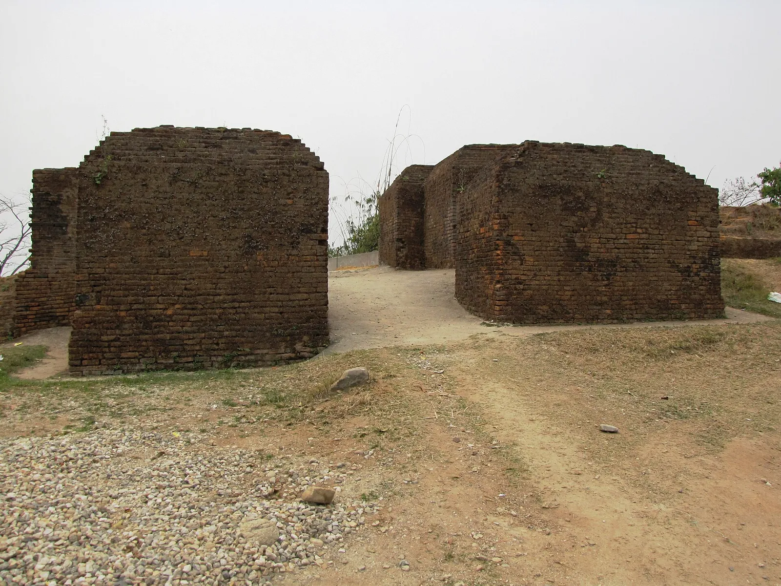
Itanagar
Itanagar is Arunachal Pradesh’s capital and largest town, and a centre for state administration. Visitors come for cultural, educational and recreational activities in the city and its surrounding urban area.
Itanagar Wildlife Sanctuary
Itanagar Wildlife Sanctuary protects biodiversity in the hills near Itanagar and provides a nearby setting for environmental education.
Food in Papum Pare reflects the diverse communities of the capital region as well as wider Arunachal Pradesh traditions. Thukpa and momos are easy to find, while local meals may include rice, leafy greens, bamboo shoots, smoked meat and fermented ingredients. Pika pila, a pungent pickle associated with the region, is another flavour to look out for. Small eateries may prepare a limited menu based on what is fresh that day. Pork, beef and fish are common in many local cuisines; vegetarian travellers should explain their requirements clearly. In town, rice, dal, vegetables and eggs are often available.
Nyishi and other Arunachal communities are associated with handwoven textiles, cane and bamboo work, bead ornaments and practical household crafts. In Papum Pare, these traditions sit alongside the more varied influences of Itanagar’s urban markets; not every item sold in town is made locally. Nyishi dress and ceremonial adornments are distinctive expressions of community identity, though styles and materials vary. Visitors interested in crafts can look for locally made baskets, woven goods and ornaments, and ask sellers about their makers and materials. These crafts belong to wider regional traditions rather than being exclusive to the district.
Nyokum Yullo, an important festival of Nyishi communities, is observed in Papum Pare and the surrounding region, usually in February. It brings people together for prayers, cultural performances and community gatherings; events can make accommodation in Itanagar busier, so booking ahead is sensible. The district’s capital is home to people from across Arunachal Pradesh, and other community festivals and public celebrations are observed there at different times of year. Their dates and scale vary by community and location, so visitors should check locally rather than assume a district-wide schedule.
Papum Pare lies in the foothills of the eastern Himalaya, with rolling slopes, forested ridges and settled valleys around Itanagar. Local rivers and streams, including the Dikrong river system, drain the area. Towns and roads occupy lower, more accessible ground, while routes beyond them can become winding and steep. Forest cover and uneven terrain make journeys slower than distances on a map might suggest, especially in wet weather. The district is landlocked; travel between sights is by road, not by boat.
The district has a generally humid foothill climate. Summer is warm and often humid, while the monsoon, usually from around June into September, brings heavy rain that can disrupt road journeys and make paths slippery. Winter is generally cooler and drier, and the period from October to April is often the most comfortable for sightseeing. Conditions vary with elevation and rain, so check the forecast before travelling. Pack light clothing for warm days, a warm layer for cooler evenings, sturdy shoes and rain protection; during the monsoon, allow extra time for road travel.
Papum Pare is reached mainly by road, with Itanagar serving as the principal base. Donyi Polo Airport at Hollongi is the nearest operating airport for the capital region, while Naharlagun is the nearest principal railway station; services and onward connections can vary. Guwahati is an important rail and air gateway for journeys into Arunachal Pradesh. Road connections link the district with Assam and other parts of the state; within the area, taxis and shared vehicles are commonly used, with APSTS buses serving some routes. Roads can be winding and conditions change with weather. Indian visitors generally need an Inner Line Permit to enter Arunachal Pradesh. Check current services locally.
Itanagar and nearby Naharlagun are the main centres for local road travel. Buses, shared jeeps and taxis connect urban areas and nearby settlements, while autos and taxis are useful for getting around Itanagar. Service frequency and availability can vary, particularly outside town, so arrange onward transport locally and allow time between sights. Roads to forest and hill locations may be narrow or affected by rain. There is no regular passenger boat transport for the listed attractions; visitors should confirm road access to Gyakar Sinyi before setting out.
2 days: Itanagar → Ita Fort → Itanagar Wildlife Sanctuary; sleep in Itanagar. 3 days: Itanagar → Ita Fort → Gyakar Sinyi; sleep in Itanagar each night, after confirming local access. 4 days: Itanagar → Itanagar Wildlife Sanctuary → Gyakar Sinyi → Ita Fort; sleep in Itanagar each night, after confirming local access.
Itanagar is the most practical base for visiting the district’s listed sights, with nearby Naharlagun offering another option for travellers using its transport links. Hotels and guesthouses are the most straightforward choices in the main urban areas; homestays may also be available. Government accommodation can be limited or subject to eligibility and booking arrangements, so confirm availability in advance. For the suggested circuits, staying in town avoids unnecessary changes of base. Accommodation options become fewer outside the main centres.
Roads can be winding, and heavy monsoon rain may cause slippery surfaces, delays or temporary access problems; check conditions locally before heading out. In forest areas, keep to established paths, do not approach or feed wildlife, and follow local guidance. Use treated or boiled water if the safety of tap water is uncertain. Mobile connectivity can be weaker beyond town, so share plans and avoid relying on a signal. Travellers from outside Arunachal Pradesh should confirm current Inner Line Permit requirements through official sources; foreign visitors should check current entry and protected-area rules officially. Ask locally about any site-specific access requirements.
- Golaghat · Assamabout 54 km
- Majuli · Assamabout 56 km
- Lower Subansiriabout 56 km
- Pakke-Kessangabout 75 km
- Jorhat · Assamabout 78 km
- Sonitpur · Assamabout 96 km
- Sivasagar · Assamabout 100 km
- Upper Subansiriabout 116 km
Straight-line distance between the centres of each district's destinations; road distance is longer.
Q: How many days should I spend in Papum Pare? A: Two days can cover the main Itanagar sights; allow three or four days if you want to include Gyakar Sinyi and have flexibility for local road conditions. Q: When is the best time to visit? A: October to April is generally the more comfortable period for sightseeing, while monsoon rain can make road travel less predictable. Q: What is the best base for visiting the district? A: Itanagar is the most practical base for the listed destinations; Naharlagun is another option for travellers using local transport connections. Q: How do I get to Papum Pare? A: You can travel by road from Assam, use rail services to Naharlagun, or check current flights to Donyi Polo Airport near Hollongi. Q: Is the district suitable for families or elderly travellers? A: Itanagar’s urban sights can suit many visitors, but uneven ground, stairs, road journeys and rain may be challenging. Plan breaks and check access conditions for each site.
This page draws on our 4 destination guides for Papum Pare and is updated as our team checks it.
Be the first to share photos, stories, advice or a helpful contact for Papum Pare.
Loading…