
District · Assam
Golaghat
Golaghat offers a view of Upper Assam where tea-growing country, farming settlements and the wooded edge of Karbi Anglong meet.
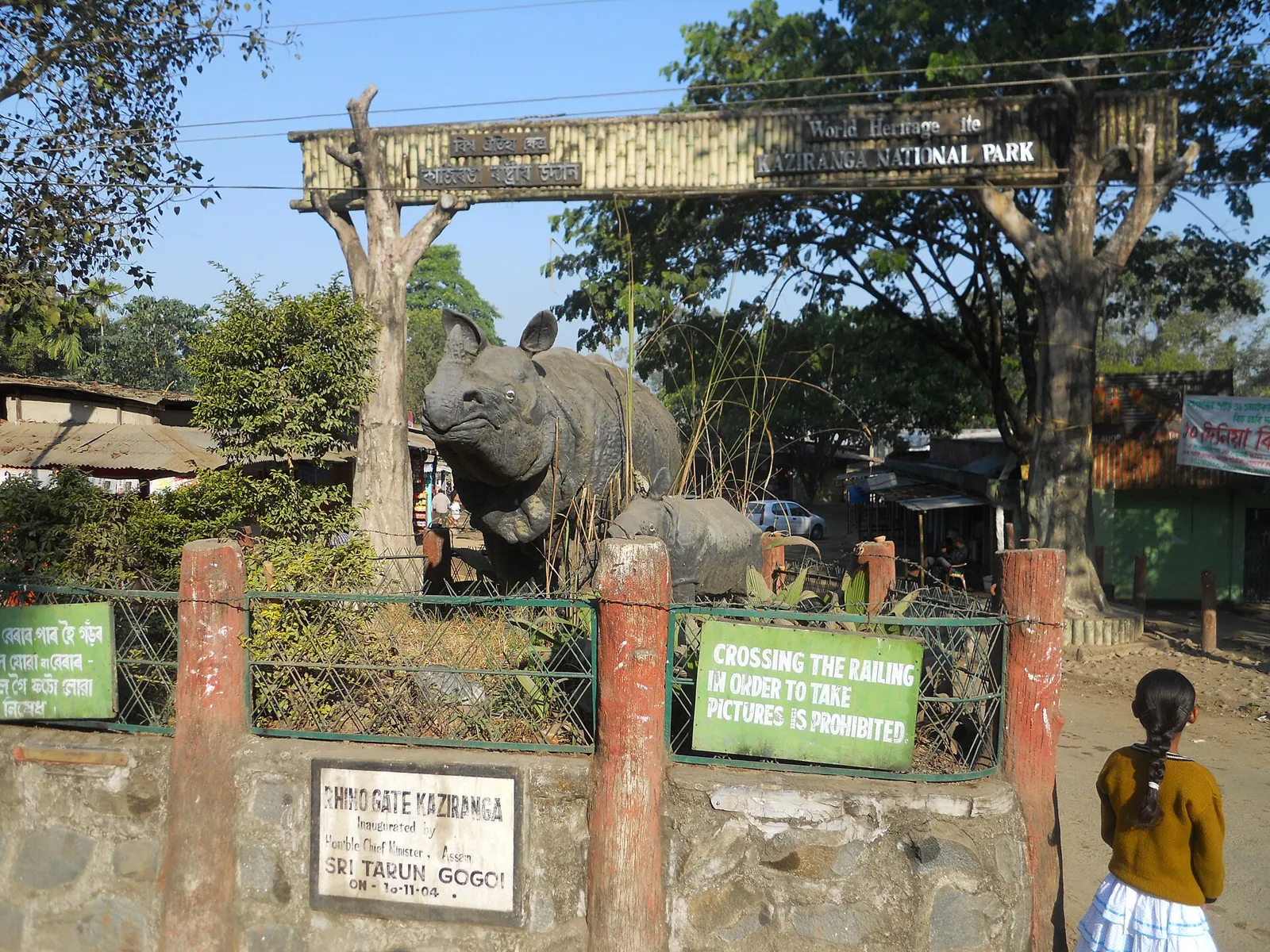
Golaghat lies in Assam’s Brahmaputra valley, where tea gardens, paddy fields and riverine plains meet the wooded foothills of Karbi Anglong. The Dhansiri is an important river in the district’s landscape. Its best-known attraction is Kaziranga National Park, a UNESCO World Heritage Site shared with neighbouring districts, whose grasslands and wetlands shelter the greater one-horned rhinoceros and abundant birdlife. The wider area formed part of the historical Ahom realm, while commercial tea cultivation helped shape its economy during the colonial period. Golaghat town serves as an administrative and trading centre. Beyond the town, village settlements, tea estates and seasonal agricultural rhythms give the district a character that extends well beyond wildlife tourism.
Golaghat offers a view of Upper Assam where tea-growing country, farming settlements and the wooded edge of Karbi Anglong meet. It is best known to visitors as one of the districts that share Kaziranga National Park, a UNESCO World Heritage Site celebrated for its grasslands, wetlands, greater one-horned rhinoceroses and rich birdlife. The Dhansiri River and the district’s tea estates add context to a visit beyond the park. Golaghat town is a useful administrative and trading centre, while the surrounding countryside reflects both Assam’s agricultural life and its long connection with tea cultivation.
The Golaghat region formed part of the wider Upper Assam landscape in which the Ahom kingdom grew and held power for centuries. Ahom rule expanded across the Brahmaputra valley from the medieval period, although the political boundaries of the time did not correspond to today’s districts. After the Treaty of Yandabo in 1826, Assam came under British rule. Commercial tea cultivation expanded during the nineteenth century, bringing plantations, labour migration and new links between settlements and markets. Kaziranga’s protected status developed in stages: it was declared a reserve forest in 1908, became a wildlife sanctuary in 1950 and a national park in 1974; UNESCO inscribed it as a World Heritage Site in 1985. Golaghat became a separate district in 1987, when it was carved out of the former Sibsagar district. Its present identity also reflects the many communities, agricultural settlements and tea estates of the region.
Food in Golaghat draws on wider Assamese traditions, with rice accompanied by dal, vegetables, fish and simple mashed preparations such as aloo pitika. Masor tenga, a tangy fish curry, and khar are familiar regional dishes; duck with ash gourd is another established Assamese preparation. Pitha rice cakes are associated particularly with festive occasions, including Bihu. Assam tea is closely connected to the district’s plantation landscape. Food traditions vary between communities, and some include pork and fermented ingredients. Vegetarian travellers should explain their requirements clearly and ask what has been cooked that day, especially at small eateries.
Handloom weaving is an important part of the wider Assamese cultural setting to which Golaghat belongs. Cotton textiles, woven gamosas and mekhela chadors reflect traditions maintained in households and weaving communities across the state. Assam is also known for muga, eri and pat silk, though buyers should check a textile’s fibre and place of production rather than assume it was woven locally. Bamboo and cane work, including baskets and everyday household objects, belongs to the region’s practical craft heritage. Local markets can offer opportunities to see these traditions alongside contemporary goods.
Bihu is widely celebrated across the district: Rongali Bihu in spring, Bhogali Bihu in midwinter and Kongali Bihu in autumn mark different points in the agricultural year. Community observances and local fairs may also take place around these seasons; practices vary between communities and villages. These festivities can bring extra movement on local roads and make some town accommodation busier, especially around major celebrations. The main visitor season for Kaziranga is also a busy period for accommodation near the park, so travellers should arrange a stay ahead of time rather than assume rooms will be available.
Elsewhere in Assam
Golaghat includes low-lying Brahmaputra valley plains, paddy fields, tea estates and riverine wetlands, rising towards the wooded foothills of Karbi Anglong. The Dhansiri is a major river in the district, and seasonal water levels shape parts of the countryside. Kaziranga’s grasslands and wetlands form part of this broader floodplain landscape. In the rainy season, heavy rain and flooding can affect roads and access to some areas; outside it, journeys between town, estates and park gateways are generally more straightforward. Rural routes may be slower than main roads.
Golaghat has warm, humid summers, a rainy monsoon season and cooler, generally milder winters. Monsoon rain can be heavy and may lead to flooding or travel disruption, so check local conditions before setting out. The cooler months, broadly from November to March, are often the most comfortable time to visit and coincide with the main wildlife-viewing season at Kaziranga; park access is seasonal and should be checked officially. Pack light clothing for warm days, a light layer for winter mornings and evenings, rain protection during the wet season, and shoes suitable for damp or uneven ground. Carry sun and insect protection in any season.
For Golaghat town, Jorhat Airport is a nearby air gateway, while Furkating Junction is an important railway access point. Guwahati offers broader air and rail connections for longer journeys. Roads link Golaghat with Jorhat, Furkating and the main highway corridor serving Kaziranga. If visiting the park, confirm your accommodation and entry range before arranging the final transfer, as Kaziranga extends across several districts. Buses and shared vehicles connect principal settlements; hired cars and local autorickshaws can help with shorter journeys. Allow extra time during heavy rain or flooding, and check current services locally.
Roads connect Golaghat town with Jorhat, Furkating and the highway corridor serving Kaziranga. Local buses and shared vehicles link principal settlements, though service frequency can vary outside town. Taxis or hired cars are useful for reaching park accommodation and moving between less-served places; autorickshaws are more practical for shorter journeys around town. Park transport and access depend on the visitor zone and current arrangements, so confirm these through official channels. There is no need to plan on river transport for ordinary district sightseeing. Allow extra time in heavy rain, during floods or when roads are busy.
2 days: Kaziranga National Park; sleep both nights in the Kohora area. 3 days: Kaziranga National Park; sleep both nights in the Kohora area. 4 days: Kaziranga National Park; sleep two nights in the Kohora area and one night in Golaghat town.
For a Kaziranga-focused visit, Kohora and the nearby Bokakhat area are practical bases, with hotels, lodges, resorts and some homestays. Choose accommodation after checking which park visitor zone you plan to use, since access points are spread across the larger park landscape. Golaghat town has hotels and guesthouses and works better for town-based errands or onward travel than for repeated park visits. Government accommodation may be available in the wider area but should be checked and booked through official channels. Options and services can be more limited in smaller settlements.
Follow park staff and guides’ instructions, keep to authorised visitor areas and never approach or feed wildlife. Kaziranga access, visitor zones and protected-area permits are subject to official rules; confirm current requirements and arrangements through park authorities before travel. Heavy monsoon rain and flooding can disrupt roads, while rural routes may be uneven or slow. Drink safe, treated water and carry essential medicines, as services may be limited away from towns. Mobile connectivity can be unreliable near park and rural areas. During busy wildlife seasons, allow extra time for road congestion and arrange accommodation in advance.
- Papum Pare · Arunachal Pradeshabout 54 km
- Sonitpurabout 55 km
- Pakke-Kessang · Arunachal Pradeshabout 67 km
- Majuliabout 88 km
- Dimapur · Nagalandabout 93 km
- Jorhatabout 95 km
- Darrangabout 102 km
- West Kameng · Arunachal Pradeshabout 110 km
Straight-line distance between the centres of each district's destinations; road distance is longer.
Q: How many days should I spend in Golaghat? A: Two or three days can suit a Kaziranga-focused visit; allow longer if you also want time in Golaghat town or the surrounding countryside. Q: When is the best time to visit? A: The cooler months, broadly November to March, are generally comfortable. Check the park’s current seasonal access before planning. Q: Where is the best base? A: Kohora or nearby Bokakhat is practical for Kaziranga; Golaghat town is more suitable for town-based travel and onward connections. Q: How do I get to Golaghat? A: Jorhat Airport is a nearby air gateway, and Furkating Junction is an important rail access point. Roads connect both with Golaghat town. Q: Is Golaghat suitable for families or elderly travellers? A: Yes, with planning. Choose accommodation with suitable facilities, allow extra time on rural roads and check walking, vehicle and park-access arrangements in advance.
This page draws on our 1 destination guides for Golaghat and is updated as our team checks it.
Be the first to share photos, stories, advice or a helpful contact for Golaghat.
Loading…