
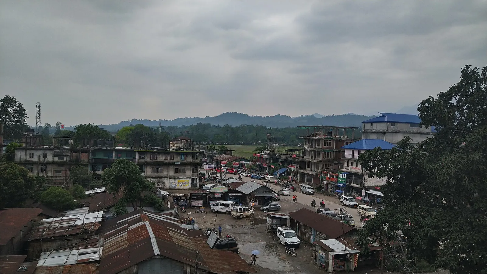
District · Arunachal Pradesh
East Siang
East Siang is a useful introduction to the meeting of Arunachal Pradesh’s foothills and the Assam plains.
East Siang lies where Arunachal Pradesh’s eastern Himalayan foothills meet the plains of Assam. The Siang River shapes its landscape, with broad channels, riverine grasslands, cultivated valleys and forested hills defining the district’s character. Pasighat, the district headquarters, was established as an administrative centre in 1911 and remains an important gateway to this part of Arunachal Pradesh. Adi communities are central to the area’s cultural life, with farming traditions, weaving and festivals such as Solung linking households to the agricultural calendar. The river islands and grasslands of Daying Ering Wildlife Sanctuary add a distinctive wetland setting. Travel here combines a working regional town with village landscapes and views towards the hills.
East Siang is a useful introduction to the meeting of Arunachal Pradesh’s foothills and the Assam plains. The Siang River, cultivated valleys and riverine grasslands give the district a character distinct from the higher Himalayan regions farther north. Pasighat, established as an administrative centre in 1911, is both the district headquarters and a gateway for travel into this part of the state. Adi communities shape local cultural life through farming traditions, weaving and seasonal festivals such as Solung. Travellers come for the riverside setting, village landscapes and the wetland and grassland habitats of Daying Ering Wildlife Sanctuary.
East Siang is part of the traditional homeland of Adi communities, whose social life has long been organised around villages, agriculture and customary institutions. Oral histories and local traditions are important sources for understanding the region; it is not generally described through a succession of large dynastic kingdoms. British colonial records often used the term “Abor” for Adi people and the surrounding region. After frontier expeditions in the early twentieth century, the British established an administrative post at Pasighat in 1911. Colonial administration remained limited and largely concerned with the frontier and its relations with neighbouring communities. After independence, the region was administered within the North-East Frontier Agency (NEFA), which became the Union Territory of Arunachal Pradesh in 1972 and a state in 1987. East Siang district was formed in 1980, with Pasighat as its headquarters. Subsequent administrative reorganisation created neighbouring districts and changed the boundaries of the wider Siang region.
Rice anchors many meals in East Siang, often accompanied by local greens, fish, meat and bamboo-shoot preparations. Adi food traditions include smoked ingredients and apong, a rice beer associated with hospitality and community celebrations. Across Arunachal Pradesh, momos and thukpa are also familiar options, though they should not be treated as specifically Adi dishes. Small eateries in Pasighat may offer only a limited daily menu, so asking what is freshly cooked is useful. Vegetarian travellers should explain whether they avoid meat stock, fish and fermented animal ingredients; rice, dal, vegetables and eggs may be available in town.
Adi weaving is an important craft tradition in East Siang and neighbouring areas. Women traditionally use backstrap or loin looms to make cloth for garments and household use, with stripes, borders and geometric patterns forming part of the textile vocabulary. Cane and bamboo work is also widespread across Arunachal Pradesh, including baskets, mats and practical objects used in farming, carrying and domestic life. These are living craft traditions rather than products unique to this district. In Pasighat, ask about locally woven textiles and their makers, since shops may also stock goods brought from elsewhere.
Solung, an important Adi agricultural festival, is usually observed around September, with prayers, community gatherings, songs and traditional activities linked to farming and well-being. Aran and Etor are among other Adi observances whose timing and customs can vary between communities. Cultural events and river-focused festivals may also be held in the wider region, but programmes change from year to year. Festival periods can bring more visitors to Pasighat and nearby settlements, while accommodation choices may be limited. Confirm local dates and book ahead if travelling during a major celebration.
The district descends from forested foothills towards the broad valleys and plains near Assam. The Siang is its defining river, with channels, sandbars and riverine grasslands shaping the surrounding countryside. Daying Ering Wildlife Sanctuary protects islands and wetland habitats within this river landscape. Cultivated areas and villages occupy the more accessible valleys, while hills and forest can make routes slower beyond the main roads. River levels and seasonal rain affect access to some areas, so travel plans are best kept flexible and local guidance is useful for excursions.
East Siang has a humid climate, with warm conditions in summer, a rainy monsoon season and generally milder, drier weather in winter. Heavy monsoon rain can affect roads, river conditions and access to rural areas. October to April is often the more convenient period for travel, with clearer opportunities for road journeys and outdoor visits, though conditions vary. Pack light, breathable clothing for warm days, a waterproof layer and shoes with good grip. In winter, bring a light warm layer for evenings. Carry sun protection and insect repellent, particularly for time near rivers and wetlands.
Pasighat Airport is the nearest airport to the district headquarters, while Murkongselek in Assam is the nearest principal railway station. Flight availability can be limited, and Guwahati remains a major air and rail gateway for longer journeys. Road access from Assam commonly approaches Pasighat through the Jonai side; onward routes connect the town with other parts of Arunachal Pradesh. Taxis and shared vehicles are practical options for local travel, but village connections may be infrequent. Allow flexibility during heavy rain, when road conditions can change. Arrange the applicable Arunachal Pradesh entry permit before travelling, and check current services locally.
Pasighat is the district’s main transport hub. Roads connect it with settlements across East Siang and with routes towards Assam and other parts of Arunachal Pradesh. Taxis and shared vehicles are practical for journeys beyond town, while local autos may be useful for short trips in Pasighat; services can be less frequent in villages. Local buses may operate on some routes, but do not assume a convenient service for every excursion. River travel is not a substitute for road transport; use a boat only where local operators or authorities confirm it is available and appropriate. Check road conditions before setting out.
2 days: Pasighat; sleep in Pasighat both nights. 3 days: Pasighat; sleep in Pasighat each night, allowing time for a locally arranged countryside or river-area excursion. 4 days: Pasighat; sleep in Pasighat each night, keeping an extra day flexible for weather or road changes.
Pasighat is the most practical base for all the listed circuits, with the widest choice of ordinary hotels and guest accommodation in the district. Homestays may be available in the town or surrounding villages, but arrangements and facilities vary, so confirm directly before travelling. Government accommodation can be limited and may require advance booking. Smaller settlements have fewer dependable options, making a return to Pasighat sensible when road conditions allow. There is no need to change bases for the short circuits suggested here.
Rain can make roads slippery or disrupt travel, and river levels and currents can change quickly; keep away from unstable banks and follow local advice near the water. Do not enter wildlife habitat or approach animals, and check whether sanctuary access requires permission before visiting. Carry safe drinking water and use reliable purification if needed. Mobile connectivity may be patchy outside Pasighat, so tell someone your plans and do not rely on a phone alone. Indian visitors from outside Arunachal Pradesh generally need an Inner Line Permit; foreign visitors follow separate permit rules. Confirm current requirements with official sources before travel.
- Lower Dibang Valleyabout 57 km
- Tinsukia · Assamabout 63 km
- Namsaiabout 71 km
- Upper Siangabout 73 km
- Lower Siangabout 77 km
- Lohitabout 94 km
- Dibang Valleyabout 98 km
- Upper Subansiriabout 109 km
Straight-line distance between the centres of each district's destinations; road distance is longer.
Q: How many days should I spend in East Siang? A: Two or three days can cover Pasighat and allow time for a locally arranged excursion. Add a day if you want flexibility for weather or roads. Q: When is the best time to visit? A: October to April is often the most convenient period, as monsoon rain can make road travel less predictable. Q: Where is the best base? A: Pasighat is the district headquarters and the most practical base for transport, accommodation and local arrangements. Q: How do I get to East Siang? A: Pasighat has an airport with limited flight availability. Road journeys commonly come from Assam, while Murkongselek is the nearest principal railway station; Guwahati is a major gateway. Q: Is East Siang suitable for families or elderly travellers? A: Pasighat can suit visitors who prefer a town base, but road journeys and uneven outdoor terrain may be tiring. Plan shorter outings, check access conditions and allow rest time.
This page draws on our 1 destination guides for East Siang and is updated as our team checks it.
Be the first to share photos, stories, advice or a helpful contact for East Siang.
Loading…