
District · Arunachal Pradesh
Lower Dibang Valley
Lower Dibang Valley is an eastern Arunachal Pradesh district where the road-accessible town of Roing meets the forested foothills of the eastern Himalaya.
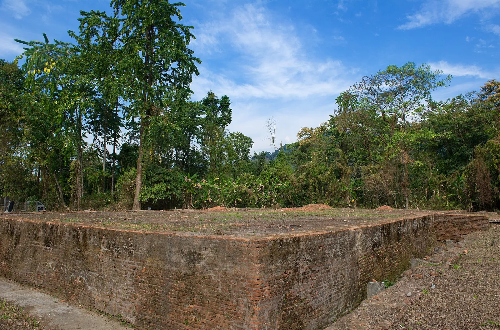
Lower Dibang Valley lies in eastern Arunachal Pradesh, where river plains and forested foothills rise toward the Eastern Himalaya. The Dibang River and its tributaries shape the landscape, while Roing serves as the district headquarters and a base for exploring the surrounding valleys. The area is home to diverse communities, including Idu Mishmi people, whose cultural traditions are part of the district’s character. Its history is visible at Bhismaknagar, an archaeological site associated with an early fortified settlement and often linked to the Chutia kingdom; its precise date and history remain subjects of study. Today, Lower Dibang Valley combines rural settlements, forests and agricultural land with a small but important administrative centre.
Lower Dibang Valley is an eastern Arunachal Pradesh district where the road-accessible town of Roing meets the forested foothills of the eastern Himalaya. It is best known for Mayodia Pass, a high mountain route that can see winter snowfall, and Bhismaknagar, an important archaeological site associated with the region’s past. The district is also a place to learn about Idu Mishmi and other local communities and their living traditions. Roing makes a practical base for exploring the listed sights, while the changing terrain—from valley roads to mountain passes—gives even a short visit a strong sense of the region’s geography.
Lower Dibang Valley is part of the ancestral region of Indigenous communities, including the Idu Mishmi and Adi, whose histories and cultural practices remain central to the district. Bhismaknagar is commonly associated with the medieval Chutia, or Sutiya, polity of the eastern Brahmaputra region. Its surviving remains point to a significant settlement, although its precise chronology and historical attribution are not always presented consistently. The area later came within the sphere of expanding Assamese and Ahom power, and British influence and administration extended into the eastern Himalayan frontier during the colonial period. After Indian independence, the region was administered as part of the North-East Frontier Agency (NEFA). NEFA became the Union Territory of Arunachal Pradesh in 1972 and the state of Arunachal Pradesh in 1987. Lower Dibang Valley was constituted as a separate district in 2001, when the larger Dibang Valley district was divided; Roing became its headquarters. These administrative changes took place within a region whose community histories long predate modern district boundaries.
3 destination guides
Bhismaknagar
Bhismaknagar is an archaeological site near Roing in Arunachal Pradesh. Visitors come to see its remains, which are associated with the Sutiyas and their rule in the Sadiya region.
Mayodia Pass
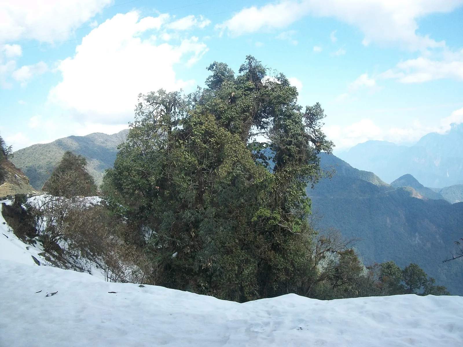
In Arunachal Pradesh, Mayodia Pass is a mountain pass associated with Lower Dibang Valley and Dibang Valley districts. Visitors come for snowfall between November and March, which is heaviest in January and February.
Roing
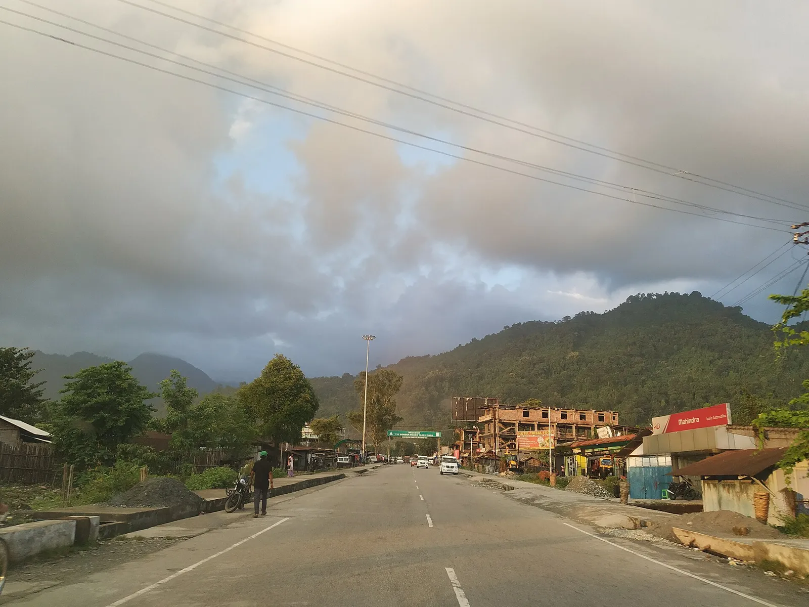
Roing is the administrative centre of Lower Dibang Valley district in Arunachal Pradesh. Travellers may visit for its role as a district hub and its position on India’s north-eastern frontier.
Food in Lower Dibang Valley reflects wider Arunachal Pradesh traditions, with rice, local greens, fish and meat featuring in everyday meals. Bamboo shoots and smoked or fermented ingredients are used in regional cooking, though recipes and preferences vary between communities and households. Thukpa and momos are also found in parts of the state. Apong, a locally brewed rice beer, is associated with community gatherings and festivals in several Arunachal communities. Small eateries may prepare only a limited menu each day, so it is useful to ask what is available. Vegetarian travellers should explain their requirements clearly; rice, vegetables, dal or eggs may be possible in town.
Handloom weaving is an important tradition among communities in Arunachal Pradesh, including the Idu Mishmi of this region. Textiles may feature strong colours and geometric designs, with patterns and techniques varying by community and maker. Cane and bamboo are also worked into practical household objects and baskets in the wider state. Craft production is often local and small-scale rather than organised around tourist markets, so availability can be seasonal or limited. When buying directly from makers or community outlets, ask about the item's origin and materials; this helps distinguish locally made work from goods brought in from elsewhere.
Reh, the principal festival of the Idu Mishmi, is generally observed in winter, often around February. Solung, celebrated by Adi communities in the wider region, is usually held in late summer or early autumn. These festivals involve community gatherings, customary observances, food and performances; the scale and dates can vary by locality. Visitors are welcome to be respectful observers and should ask before photographing ceremonies. Festival periods may bring more visitors to local towns and increase demand on the district’s limited rooms, so arranging a stay ahead is sensible, particularly if travelling with a group.
The district rises from settled valleys and river corridors into the forested foothills and higher ridges of the eastern Himalaya. The Dibang and its tributaries shape the lower terrain, while roads climb towards Mayodia Pass through steep, wooded slopes. Bhismaknagar lies in the lower, more accessible part of the district, and Roing is the main town and road hub. Rivers, hills and heavy forest mean that journeys can take longer than the map suggests; rain, landslides or road work may affect access, especially on higher routes.
Conditions change with elevation. Summer is generally warm in the lower valley, while the higher road towards Mayodia is cooler. The monsoon brings frequent rain, damp conditions and a greater chance of slippery roads or disruption. Winter is cooler and often more comfortable for valley sightseeing; Mayodia can be cold and may receive snow, which can affect access. October to April is generally a useful period to plan a visit, while checking conditions before heading uphill is important in any season. Pack light layers, a warm outer layer for the pass, rain protection, sturdy footwear and clothing that can dry quickly.
Roing is the district’s main road gateway. Visitors commonly travel through Assam and cross the Brahmaputra region using the Dhola–Sadiya Bridge before continuing to Roing; road conditions and journey times can vary. Tezu Airport is a nearby airport, but flight availability should be checked before planning around it. Murkongselek is a nearby railway station; onward travel requires road transport, and connections may take time to arrange. Shared vehicles and taxis are used locally, but services can be limited outside main routes, so arrange onward transport in advance where possible. Check current services locally before travelling.
Roing is the main base for road travel within the district. Roads connect it with Bhismaknagar and run north towards Mayodia Pass, where conditions and journey times can vary with weather and road work. Shared jeeps and local buses may operate on some routes, but service can be limited; taxis or hired vehicles offer more flexibility, especially for Mayodia. Local autos may be available around Roing, but should not be assumed for every journey. Confirm transport locally before setting out, and allow extra time for mountain roads. There are no passenger boat links that serve as a practical way to reach the listed sights.
2 days: Roing → Bhismaknagar; sleep in Roing on night 1. 3 days: Roing → Bhismaknagar → Mayodia Pass; sleep in Roing on nights 1 and 2.
Roing is the most practical base for both the archaeological site and a road excursion towards Mayodia Pass. It has the district’s broadest choice of accommodation, including hotels, guesthouses and some homestays; facilities and availability vary. Staying in Roing also makes it easier to adjust plans if mountain-road conditions change. Smaller settlements may have limited or informal options, so do not rely on finding a room near a remote sight without checking ahead. Government accommodation may be available in the region but should be confirmed directly through official channels.
Mountain roads can be narrow, winding and affected by rain, slips or maintenance; check conditions locally before travelling towards Mayodia and avoid rushing after dark. Cold, wind and poor visibility are possible at higher elevation, so carry warm clothing and water. Do not approach wildlife or enter forest areas without local guidance, and use treated or reliably safe drinking water. Mobile connectivity can be patchy outside Roing. Carry essential medicines and allow for limited medical services away from town. Indian visitors from outside Arunachal Pradesh generally need an Inner Line Permit; foreign visitors may have separate permit requirements. Confirm current rules through official sources before travel, including whether any additional permissions apply to your intended route.
- Namsaiabout 42 km
- Lohitabout 44 km
- East Siangabout 57 km
- Dibang Valleyabout 73 km
- Tinsukia · Assamabout 79 km
- Changlangabout 82 km
- Anjawabout 111 km
- Upper Siangabout 113 km
Straight-line distance between the centres of each district's destinations; road distance is longer.
Q: How many days should I spend in Lower Dibang Valley? A: Two days can cover Roing and Bhismaknagar; three days allow time for a Mayodia Pass excursion, subject to road conditions. Q: When is the best time to visit? A: October to April is generally a useful window. Winter can be cold at Mayodia, and monsoon rain may disrupt road travel. Q: What is the best base for visiting the district’s sights? A: Roing is the most practical base, with the widest choice of stays and road access to the listed destinations. Q: How do I get to Lower Dibang Valley? A: Travel by road from Assam into Arunachal Pradesh and continue to Roing. Check current routes and permits before departure. Q: Is the district suitable for families or elderly travellers? A: Roing and Bhismaknagar can suit many travellers, but Mayodia involves a mountain road and colder conditions; assess mobility and comfort before going.
This page draws on our 3 destination guides for Lower Dibang Valley and is updated as our team checks it.
Be the first to share photos, stories, advice or a helpful contact for Lower Dibang Valley.
Loading…