
District · Arunachal Pradesh
Shi Yomi
Shi Yomi offers a close look at the high mountain frontier of Arunachal Pradesh, where river valleys, forested slopes and small settlements shape daily life and travel.
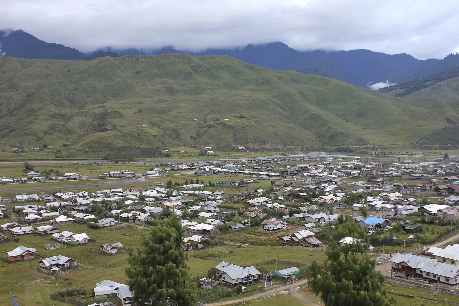
Shi Yomi lies in the mountainous north of Arunachal Pradesh, along India’s frontier with Tibet. Created in 2018 from West Siang district, it has its headquarters at Tato. Its landscape includes forested slopes, river valleys and high mountain country, with settlements linked by winding roads. Mechuka, also written Menchukha, is its best-known visitor destination, standing about 1,829 metres above sea level in the valley of the Yargyap Chu, or Siyom River. Memba and Adi communities contribute to the district’s cultural character. Buddhist monasteries around Mechuka form an important part of its heritage, alongside village traditions and livelihoods shaped by farming, forests and the mountain environment.
Shi Yomi offers a close look at the high mountain frontier of Arunachal Pradesh, where river valleys, forested slopes and small settlements shape daily life and travel. Formed from West Siang district in 2018, it is centred administratively on Tato, while Mechuka (Menchukha) is its best-known visitor destination. The valley’s Memba and Adi communities, Buddhist monasteries and village traditions give the district a cultural character distinct from the lower valleys of the state. Travellers come for mountain scenery, a quieter pace and the experience of reaching a remote settlement near the Tibetan frontier; the journey itself is an important part of the visit.
Shi Yomi’s history is closely tied to the communities of the upper Siyom valley and their links with neighbouring Himalayan regions. Memba traditions and Buddhist institutions around Mechuka reflect longstanding cultural connections across the mountains, while Adi communities have their own village customs and histories. For much of the region’s past, local life was organised through villages and customary practices rather than a single centralised kingdom; detailed accounts are uneven, so precise timelines for local political changes should be treated cautiously. British influence reached this remote frontier gradually, and the area later came under the administration of the North-East Frontier Agency, the predecessor of Arunachal Pradesh’s modern administration. Arunachal Pradesh became a state in 1987. Shi Yomi was established as a separate district in 2018, carved out of West Siang district, with Tato as its headquarters. Mechuka’s monasteries and community traditions remain important to the region’s living heritage.
Food in Shi Yomi varies between communities and settlements. In Mechuka, travellers may find thukpa and momos, reflecting the wider Himalayan food culture. Rice, local greens, bamboo-shoot preparations and smoked meat belong to the broader Arunachal Pradesh food repertoire, rather than being specialities exclusive to this district. Rice beer is part of many community celebrations across the state, though names and preparations vary. Small eateries may cook only a limited daily menu, so ask what is fresh. Vegetarian travellers should clearly explain whether they avoid meat stock, fish and fermented animal ingredients; simple rice, dal, vegetables and eggs may be available in town.
Weaving and bamboo-and-cane work are important craft traditions across Arunachal Pradesh, including the wider cultural region around Shi Yomi. Handwoven clothing expresses community identity through patterns, colours and ways of wearing it; traditions differ between Memba, Adi and other groups. Baskets and other woven household objects reflect practical needs in farming and village life. Around Mechuka, Buddhist monasteries also offer a setting for religious painting and decorative art. Ask locally about locally made textiles and craftwork, since availability is variable and not every souvenir sold in the region is made within the district.
Losar, the Tibetan Buddhist New Year, is observed by Memba communities around Mechuka, usually in late winter or early spring according to the lunar calendar. Adi communities celebrate Solung, generally in the late monsoon season; customs and timing can vary between villages. These are community occasions rather than large, regular tourist fairs. Mechuka also hosts a regional adventure festival in some years, commonly in the cooler season, but its schedule and programme can change. Visitor numbers and room availability may rise around festival periods, so check local arrangements and book ahead where possible.
The district is mountainous, with steep forested slopes, high ridges and settlements scattered along river valleys. The Yargyap Chu, also known as the Siyom River, runs through the Mechuka valley and is central to its scenery and settlement pattern. Roads follow narrow valley floors and mountain contours rather than direct routes, making journeys slow and vulnerable to rain-related slips or landslides. Forest, elevation and changing river conditions also mean that weather and road access can differ between Tato, Mechuka and more remote villages.
Conditions vary with elevation. Summer is generally mild in the higher valley, though days can turn wet and cloudy as the monsoon approaches. The monsoon brings frequent rain and can make roads unreliable, with landslides or washouts possible. Winter is cold, especially at night, and snowfall or frost can affect higher areas and travel. October and November, and often March and April, are practical periods to consider, subject to current road conditions. Pack warm layers, rain protection, sturdy footwear and clothing suitable for cold evenings even when visiting in warmer months.
Shi Yomi is reached mainly by road, commonly through Aalo and onward to Tato and Mechuka. Pasighat Airport is a nearby air-access option, while Dibrugarh offers a principal railway connection in Assam; neither should be judged by straight-line proximity alone. Guwahati is a major regional hub for longer journeys. Mountain roads make travel slow, and rain or landslides can disrupt access. Shared vehicles may operate between larger settlements, but arrangements for smaller villages often require a locally hired vehicle. Arrange the applicable Arunachal Pradesh entry permits before travelling, and check current services locally.
Road travel is the main way to move around Shi Yomi. Tato connects onward towards Aalo and Mechuka, with the latter reached by a long mountain road. Shared jeeps or other shared vehicles may be available on busier routes, but services can be irregular and are less dependable for smaller villages. A locally hired vehicle is often the practical option for flexible stops or onward travel from Mechuka. Do not assume that local buses, taxis or autos operate routinely throughout the district; confirm current transport arrangements with your accommodation or local authorities.
Mechuka is the most practical base for visiting the district’s best-known destination, with local hotels and homestays among the usual options. Tato may suit travellers breaking the road journey or needing to be near the district headquarters, though visitor accommodation choices can be limited. In smaller settlements, arrangements may depend on local hosts and should be confirmed in advance. Government accommodation, where available, can have limited capacity or require advance arrangements. Do not assume that a particular type of lodging is open year-round, especially during the monsoon or winter.
Mountain roads are narrow and can be affected by heavy rain, landslides, snow or temporary closures; check conditions locally and allow spare time. Carry warm clothing, rain protection, personal medicines and drinking water, and use treated or sealed water if the source is uncertain. Mobile coverage and internet access can be patchy, so share plans and avoid relying on online maps alone. Keep a respectful distance from wildlife and follow local guidance on forest areas. Indian visitors from outside Arunachal Pradesh generally need an Inner Line Permit; foreign visitors may require a Protected Area Permit or other authorisation. Confirm current requirements through official sources before travel.
- Upper Subansiriabout 69 km
- Upper Siangabout 72 km
- Lower Siangabout 120 km
- Lower Subansiriabout 121 km
- East Siangabout 132 km
- Tinsukia · Assamabout 181 km
Straight-line distance between the centres of each district's destinations; road distance is longer.
Q: How many days should I spend in Shi Yomi? A: Allow at least two or three days around Mechuka, with additional time for the long road journey and possible weather delays. Q: When is the best time to visit? A: October-November and March-April are often practical months, though road and weather conditions should be checked before departure. Q: What is the best base for visitors? A: Mechuka is the most useful base for the district’s main visitor destination; Tato can work as a stop on the road journey. Q: How do I get to Shi Yomi? A: Most travellers go by road via Aalo towards Tato and Mechuka. Pasighat Airport and Dibrugarh railway connections may help with the wider journey, but onward road travel is required. Q: Is Shi Yomi suitable for families or elderly travellers? A: It can suit travellers comfortable with long, slow mountain journeys, but road conditions, limited services and patchy connectivity may make it challenging for some elderly visitors or young children.
This page draws on our 1 destination guides for Shi Yomi and is updated as our team checks it.
Be the first to share photos, stories, advice or a helpful contact for Shi Yomi.
Loading…