
District · Ladakh
Kargil
Kargil offers a view of western Ladakh beyond its high passes: river valleys, working villages, cultivated fields and apricot orchards shape a region where travel routes meet everyday life.
Kargil district lies in western Ladakh, where stark mountain slopes give way to river valleys, cultivated fields and apricot orchards. Kargil town is its administrative and trading centre, linking routes towards Kashmir, Leh and the Suru Valley. The district’s mountain scenery includes the Nun Kun massif, while the road towards Pensi La reaches Rangdum Monastery and views of the Drang-Drung Glacier. Zoji La forms the dramatic western approach from Kashmir. Historic trade and cultural exchanges have shaped a landscape of Muslim settlements and Buddhist religious sites, including Mulbekh’s monumental Maitreya carving. This is a lived-in Himalayan region as much as a sightseeing destination, with farming, seasonal travel and religious traditions shaping everyday life.
Kargil offers a view of western Ladakh beyond its high passes: river valleys, working villages, cultivated fields and apricot orchards shape a region where travel routes meet everyday life. Kargil town is the district’s administrative and trading centre, linking the Kashmir approach with Leh and the Suru Valley. Visitors come for the mountain scenery of the Nun Kun massif, the road over Penzi La towards Rangdum and the Drang-Drung Glacier, and the monumental Maitreya carving at Mulbekh Monastery. The district’s Muslim communities and Buddhist religious sites reflect long-standing cultural exchange across the western Himalaya.
The area is often associated with Purig, a historical and cultural region shaped by local rulers and ties with neighbouring Ladakh, Kashmir and Baltistan. Its settlements lay along routes used for trade and travel across the western Himalaya. In the nineteenth century, Dogra campaigns led by Zorawar Singh brought Ladakh and surrounding territories under the expanding rule of Jammu and Kashmir. Under the princely state, the routes remained important, though modern borders later changed cross-mountain connections. After the 1947 partition, the region became part of the India-administered side of the former princely state; the Kargil area also saw conflict during the 1999 Kargil War. Kargil district was established in 1979, separating it administratively from Leh district. In 2019, Ladakh became a Union Territory, and Kargil continued as one of its two districts. Local histories, religious traditions and village life remain important alongside these political changes.
7 destination guides · 6 on the map
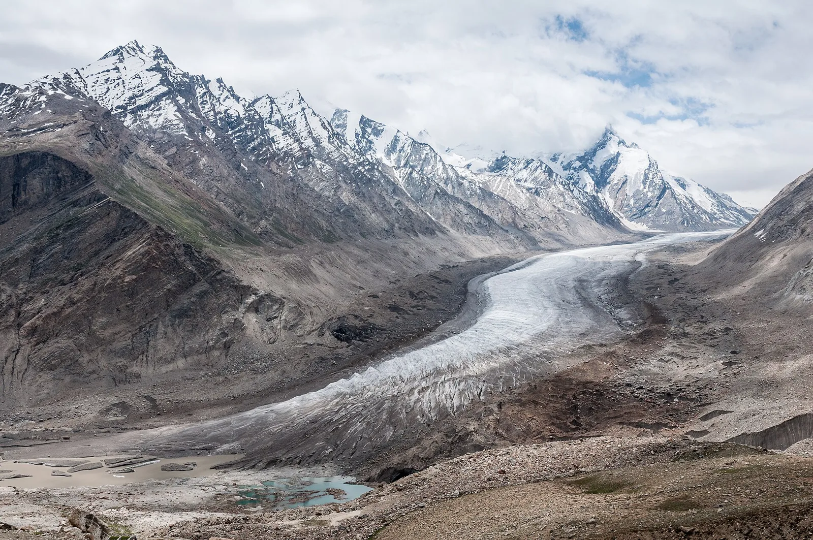
Drang-Drung Glacier
A long glacier in Ladakh’s Zanskar Range, Drang-Drung attracts travellers on the Kargil–Zanskar route who come to see its extensive ice and snow and the peak rising above it.
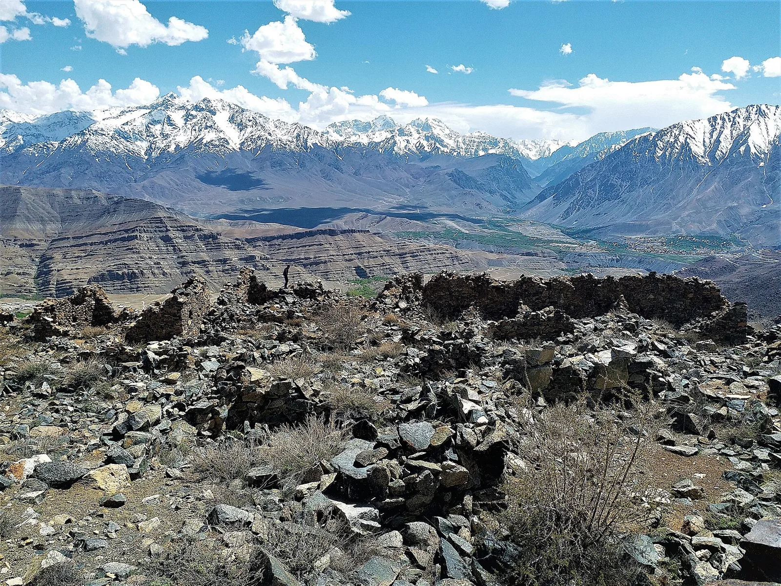
Kargil
Kargil is a city in Ladakh and the union territory’s joint capital, as well as the administrative centre of its district. Travellers pass through it on journeys between Srinagar and Leh.
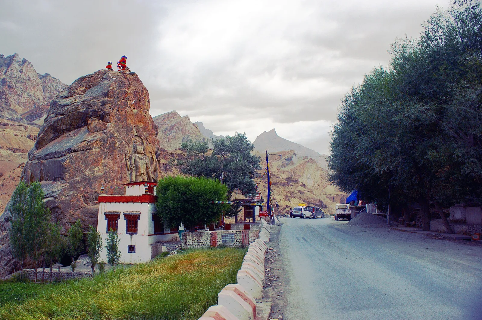
Mulbekh Monastery
In Ladakh’s Kargil district, Mulbekh Monastery is a Buddhist complex known for its Maitreya Buddha image, Kharosti edicts and two historic gompas representing different lineages.
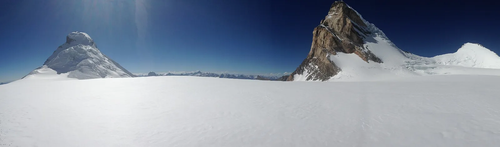
Nun Kun
Nun Kun is a Himalayan mountain group in Ladakh, known for the high summits of Nun and Kun and their snowy divide. Visitors are drawn to its distinctive cluster of peaks.
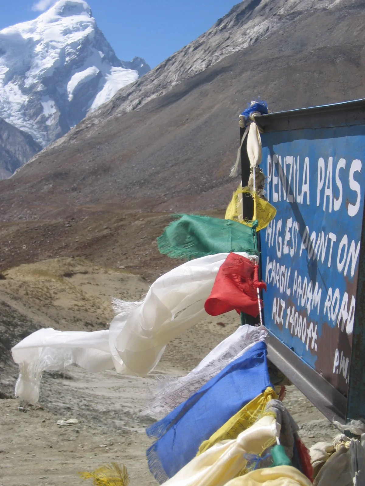
Penzi La
Penzi La is a mountain pass in Kargil district, within Ladakh. Travellers visit it as a crossing point on their journeys.
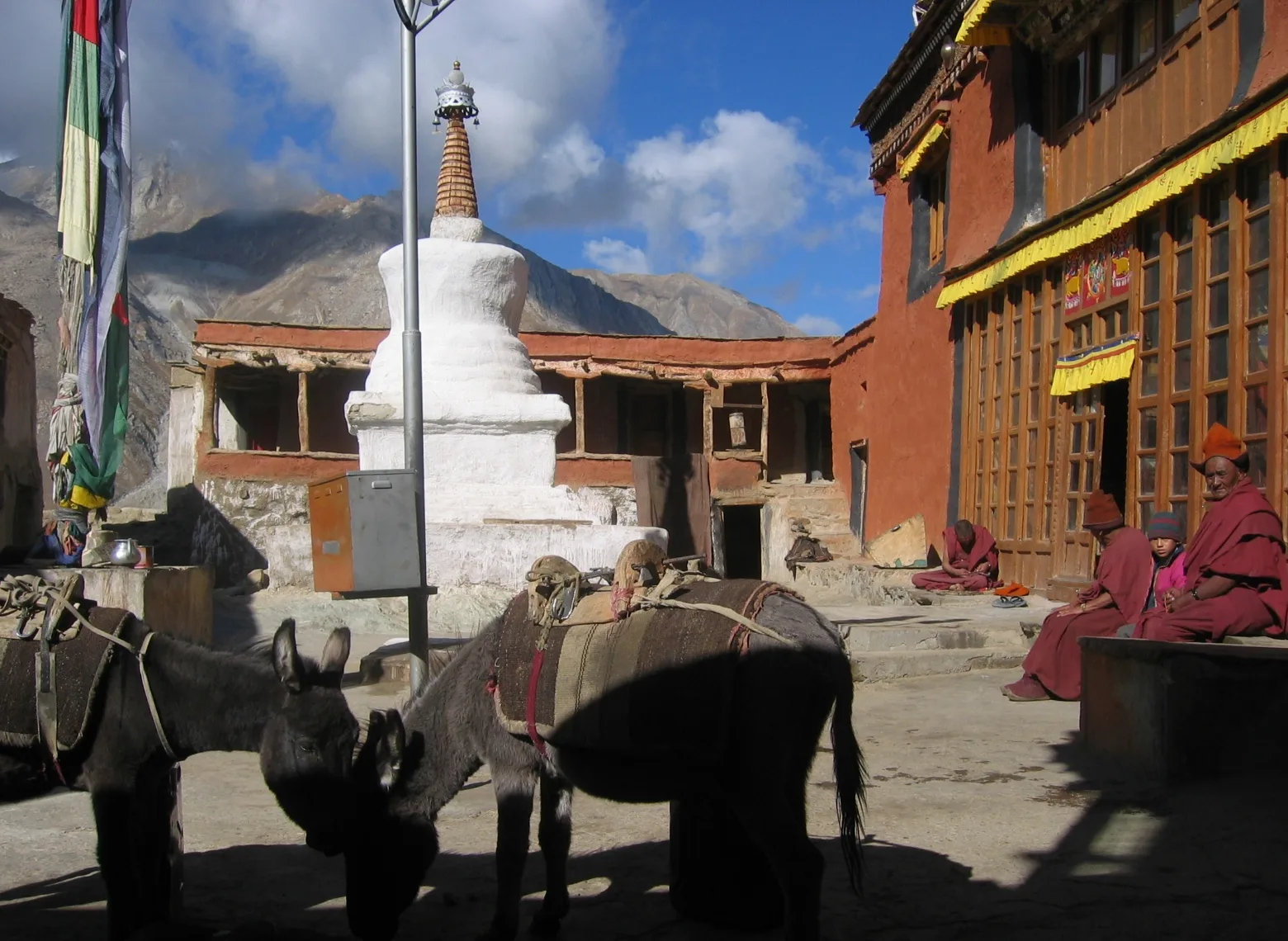
Rangdum Monastery
Rangdum Monastery is a Gelugpa Tibetan Buddhist institution on a steep hill in Ladakh’s Suru Valley. Visitors come to see the monastery and its high-altitude setting.
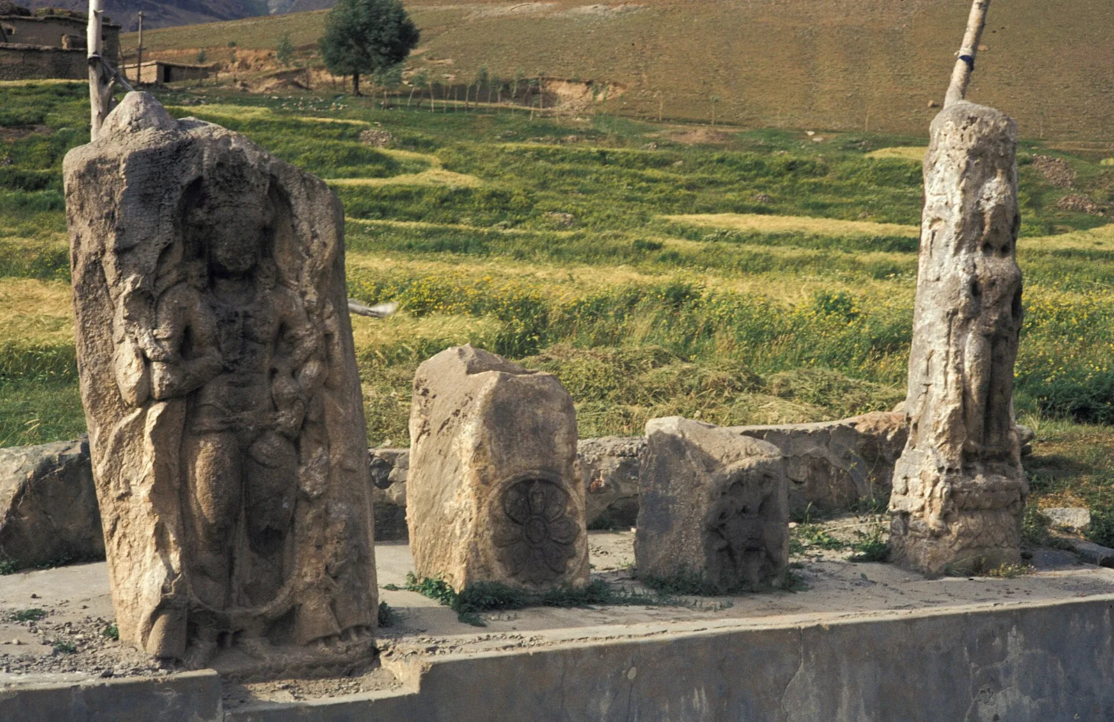
Zoji La
Zoji La is a Himalayan mountain pass spanning Ganderbal in Jammu and Kashmir and Kargil in Ladakh. Travellers cross it on the route between Srinagar and Leh.
Food in Kargil draws on Ladakhi, Balti and Kashmiri traditions, with availability varying between town eateries and remote villages. Across Ladakh, familiar dishes include thukpa noodle soup, skyu made with pieces of wheat dough, steamed momos and tingmo bread. Roasted barley flour, known as tsampa, and butter tea are important regional staples. Kargil is associated with apricot growing; dried apricots and apricot jam are worth seeking out. Balti and Kashmiri dishes also feature in Kargil and Drass. Small eateries may prepare only a few dishes each day, so ask what is freshly cooked rather than expecting an extensive menu.
Kargil shares in the wider Himalayan traditions of wool spinning, hand knitting and weaving, with warm textiles suited to the mountain climate. Across Ladakh, woven woollen cloth, rugs and carpets serve both domestic and decorative purposes; availability and provenance vary between sellers. Buddhist monasteries preserve another strand of regional artistry through murals, painted religious images and carved or decorated ritual objects. Mulbekh’s rock-cut Maitreya is a notable example of monumental sacred art. When buying textiles or souvenirs, ask where they were made rather than assuming everything sold locally was produced in Kargil.
Islamic observances are central to community life in much of Kargil. Eid celebrations follow the lunar calendar, while Muharram is marked with particular importance by many Shia Muslims. Buddhist communities in the district observe Losar, generally in winter, and hold monastery festivals according to lunar calendars; dates vary by monastery and year. These occasions are primarily community and religious events rather than guaranteed tourist spectacles. Family visits and local gatherings can make accommodation busier around major celebrations, so travellers should check local calendars and reserve ahead when visiting during a festival period.
Kargil’s terrain ranges from steep, largely bare mountain slopes to settled valleys and high passes. The Suru River and its tributaries support villages, fields and orchards, while the Nun Kun massif and the glaciers beyond Penzi La define the higher country. Tree cover is limited compared with wetter Himalayan regions, though cultivated and planted patches appear near settlements. Roads follow narrow valleys and cross exposed mountain terrain, so journeys can be slow and vulnerable to snow, rockfall, weather and traffic controls. The landscape is both a scenic draw and a practical constraint on movement.
Summer is the most accessible season, with milder conditions in the valleys and the best chance of open high-pass roads. Late spring and autumn can bring changeable weather and cold nights, while winter is severe and many high routes may close or become difficult to travel. Kargil lies in a rain-shadow region, but weather on the Kashmir approach and at high elevations can differ, and monsoon-season rain may affect western routes. For most sightseeing, June to September is the usual period to consider, subject to current road conditions. Pack warm layers, a windproof outer layer, sun protection and sturdy footwear; carry extra insulation for evenings and high-altitude stops.
Kargil is reached mainly by road on the Srinagar–Kargil–Leh highway, with the Kashmir approach crossing Zoji La. Leh’s Kushok Bakula Rimpochee Airport and Srinagar Airport are practical gateways for scheduled flights, followed by a road journey. Do not assume regular civilian flights to Kargil Airport are available. There is no direct railway connection to Kargil. Snow, weather and traffic controls can interrupt mountain routes, particularly around high passes. Taxis, shared vehicles and available bus services connect settlements; a hired vehicle offers flexibility for the Suru Valley, Rangdum and the Pensi La route. Check current services locally.
Kargil town is the main starting point for road journeys through the district. The Srinagar–Kargil–Leh highway connects it with the Kashmir side and Leh, while roads from town lead into the Suru Valley and towards Rangdum and Penzi La when conditions allow. Taxis and hired vehicles are useful for reaching dispersed sights; shared vehicles and bus services may operate between settlements, but availability can vary by season. Local transport within Kargil town may include taxis and shared vehicles. Confirm current services locally, especially before travelling to remote valleys or high passes.
2 days: Kargil – Mulbekh Monastery – Kargil; sleep both nights in Kargil. 3 days: Kargil – Zoji La – Kargil – Mulbekh Monastery – Kargil; sleep each night in Kargil, subject to road access at Zoji La. 4 days: Kargil – Nun Kun – Penzi La – Drang-Drung Glacier – Rangdum Monastery – Kargil; sleep night 1 in Kargil, night 2 near Rangdum if lodging is available, and night 3 in Kargil.
Kargil town is the most practical base for the highway, Mulbekh Monastery and shorter excursions; it has the district’s broadest choice of hotels and guesthouses, with some homestays. For the Penzi La and Drang-Drung Glacier route, an overnight near Rangdum can reduce backtracking, but accommodation is limited and seasonal, so confirm arrangements before setting out. Basic guesthouses, homestays or other local lodging may be available in smaller settlements. Government accommodation or community lodging can be limited and should not be assumed to be open.
Allow time to acclimatise before strenuous activity at altitude, and seek medical advice if you have relevant health concerns. Roads are narrow and exposed in places; snow, rockfall, poor visibility and traffic controls can delay travel or close passes, so check conditions locally and avoid rushing. Medical facilities and mobile connectivity are more limited outside Kargil town. Use treated or reliably safe drinking water, and carry essential medicines. Wildlife encounters are uncommon on usual road itineraries, but keep a respectful distance from animals and do not feed them. Do not assume a permit is required for these listed stops; confirm current access and permit rules through official sources, particularly for restricted border areas.
- Sankooabout 27 km
- Drassabout 50 km
- Kishtwar · Jammu and Kashmirabout 65 km
- Shamabout 71 km
- Anantnag · Jammu and Kashmirabout 91 km
- Zanskarabout 97 km
- Pulwama · Jammu and Kashmirabout 116 km
- Ganderbal · Jammu and Kashmirabout 118 km
Straight-line distance between the centres of each district's destinations; road distance is longer.
Q: How many days should I spend in Kargil district? A: Allow at least two days for Kargil town and a nearby excursion; three or four days give more time for the Suru Valley, Rangdum and the high-pass route, if roads are open. Q: When is the best time to visit? A: Summer, usually June to September, is generally the most practical season, though pass access depends on current conditions. Q: Where is the best base for exploring? A: Kargil town is the most convenient base for services and shorter trips. Stay near Rangdum only if you have confirmed seasonal lodging. Q: How do I get to Kargil? A: Travel by road on the Srinagar–Kargil–Leh highway. Leh and Srinagar airports are practical flight gateways, followed by a road journey; there is no direct railway connection. Q: Is Kargil suitable for families or elderly travellers? A: It can suit travellers who are comfortable with long, sometimes rough road journeys and altitude. Plan a gradual pace, check medical needs in advance and avoid remote excursions if road or health conditions are uncertain.
This page draws on our 7 destination guides for Kargil and is updated as our team checks it.
Be the first to share photos, stories, advice or a helpful contact for Kargil.
Loading…