
District · Uttarakhand
Champawat
Champawat offers a quieter way to explore the eastern Kumaon Himalaya, where the Sharda valley rises towards wooded hills and small mountain towns.
Champawat district lies in the eastern Kumaon Himalaya, rising from the warmer Sharda river valley near the Nepal border to forested ridges and hill towns such as Champawat and Lohaghat. The Sharda, also known as the Kali along parts of the border, shapes the district’s southern landscape and historic connections. Champawat was an important centre of the Chand rulers of Kumaon, and its temples and old settlements reflect that past. Baleshwar Temple is among its notable heritage sites; Purnagiri is an important pilgrimage destination, while Mayavati is associated with the Advaita Ashrama. The district’s character is quieter and more rural than that of Uttarakhand’s major hill resorts, with religious sites, wooded slopes and winding mountain roads.
Champawat offers a quieter way to explore the eastern Kumaon Himalaya, where the Sharda valley rises towards wooded hills and small mountain towns. It is best known for its Chand-era heritage, including Baleshwar Temple in Champawat, and for Purnagiri, a major pilgrimage site near Tanakpur. Lohaghat and the Advaita Ashrama at Mayavati add town and spiritual-history visits amid forested surroundings. The district’s position near the Nepal border and the Sharda, also called the Kali along parts of the frontier, gives it a distinct regional setting. Travellers come for religious sites, Kumaoni history and rural hill scenery rather than resort-style attractions.
The Champawat region formed part of the wider Kumaon cultural and political landscape. Before the rise of the Chand rulers, the Katyuris held power across parts of the central Himalaya; after their decline, the Chand dynasty established a kingdom in Kumaon. Champawat is remembered as an early centre of Chand rule, and the town’s Baleshwar Temple complex reflects the region’s medieval religious and architectural history. The Chand kingdom later shifted its political centre westward, but Champawat remained an important local settlement. In the late eighteenth century, Gorkha forces took control of Kumaon. British rule followed the Anglo-Nepalese War, and the area became part of the Kumaon administrative region under British India. After independence, it remained within Uttar Pradesh until the creation of Uttarakhand in 2000. Champawat district was formed in 1997 from territory previously administered as part of Pithoragarh district. Mayavati’s Advaita Ashrama, founded in 1899, represents a later chapter in the region’s religious history and is associated with Swami Vivekananda’s circle.
5 destination guides · 4 on the map
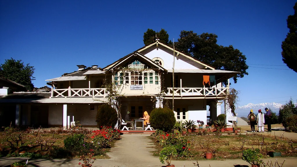
Advaita Ashrama, Mayavati
Advaita Ashrama in Mayavati is a Ramakrishna Math institution centred on Advaita Vedanta. Visitors may learn about its spiritual practice, explore its publications and learn of its charitable work.
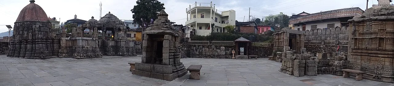
Baleshwar Temple
Baleshwar Temple is a historic Shiva shrine in Champawat, Uttarakhand. Visitors can see its stone carving and learn about its links to the Chand rulers.
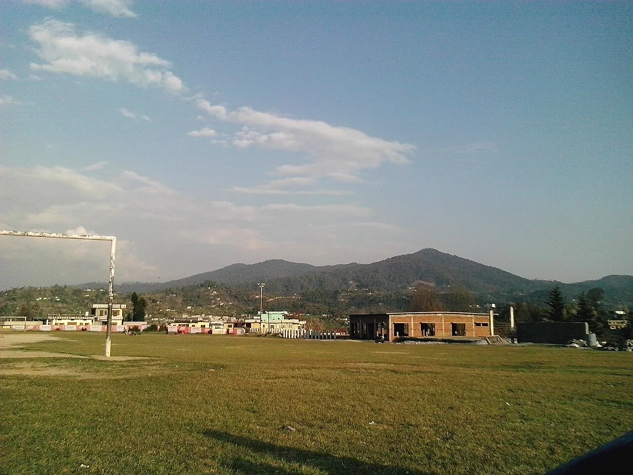
Champawat
Champawat is a town and Nagar Palika Parishad in Uttarakhand, India, and the administrative centre of its district. Visitors may be interested in its former role as the capital of the Kumaon Kingdom.
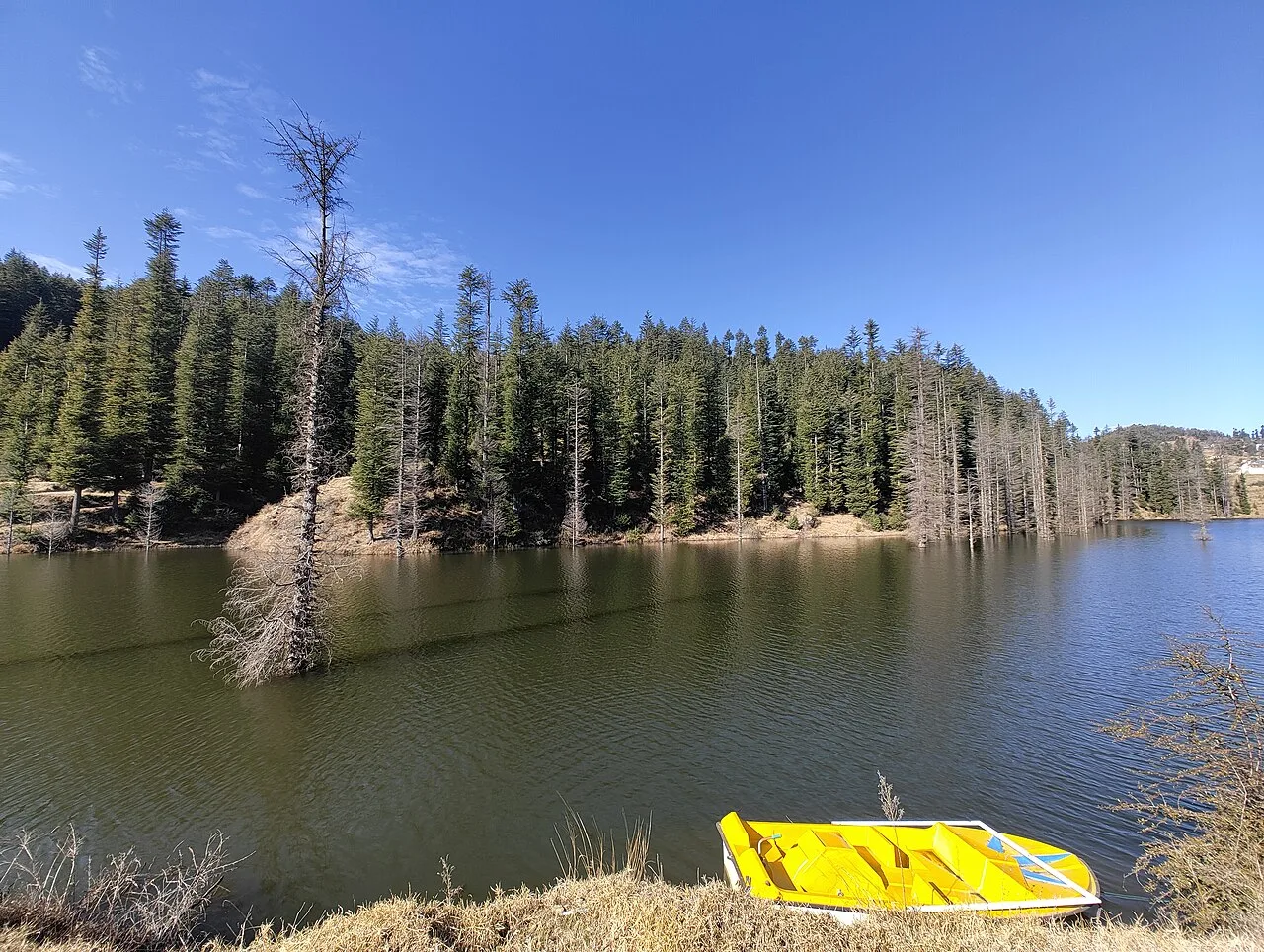
Lohaghat
Lohaghat is a town and nagar palika in Uttarakhand’s Champawat district. Its cultural events, including Holi Rang Mahotsav, Devidhar Mela and an old Ramleela tradition, draw interest.
Purnagiri
Purnagiri is a sacred place in Uttarakhand’s Champawat district, recognised as a temple site. People visit for its religious significance.
The district shares the food traditions of Kumaon and the wider Uttarakhand hills. Everyday meals may include mandua (finger-millet) rotis, bhatt ki churkani, aloo ke gutke, and lentil preparations such as chainsoo or phaanu. Kafuli, a greens-based curry, and jhangora kheer are also found in the regional repertoire. In spring, buransh (rhododendron) squash is a seasonal drink in parts of the hills. Small eateries may prepare a limited menu based on what is fresh that day; near pilgrimage sites, vegetarian food is common, and some kitchens avoid onion and garlic. Sweets such as bal mithai and singori are associated more broadly with Kumaon, especially Almora.
Craft traditions in Champawat sit within the wider cultural world of Kumaon, and their visibility varies from place to place. Aipan, a ritual art made with rice paste on red-ochre backgrounds, is used across the region to decorate thresholds and household or ceremonial spaces. Ringal, a local hill bamboo, is traditionally woven into practical items such as baskets and containers; wool weaving and other household textile work are also part of Kumaoni life. These are regional traditions rather than crafts exclusive to Champawat, and visitors may find them through local makers or markets rather than dedicated craft centres.
Religious observances shape much of the district’s festival calendar. Navratri, especially the spring season, draws pilgrims to Purnagiri, and the temple area can become crowded, with demand for basic accommodation rising. Local fairs and seasonal gatherings are held in Kumaoni towns and villages; their dates and scale vary by place. Harela, celebrated in the broader Kumaon region during the monsoon season, marks the agricultural cycle and is observed in local communities. During major pilgrimage periods and public holidays, road traffic and lodging pressure may increase, so arranging a stay in advance is sensible.
Elsewhere in Uttarakhand
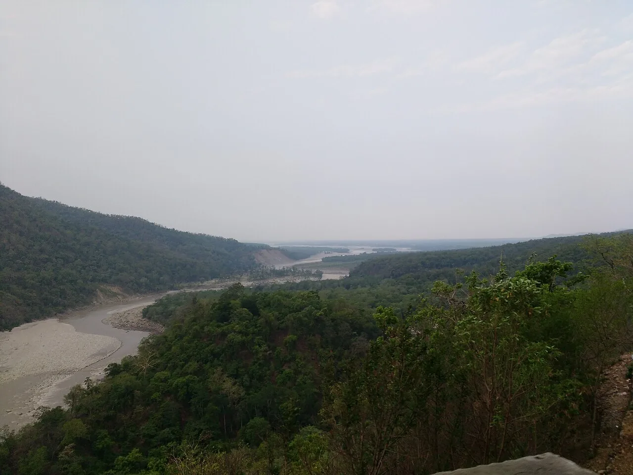
The district climbs from the Sharda valley and the Nepal-facing frontier into forested ridges and hill settlements, including Champawat and Lohaghat. The Sharda, known as the Kali along parts of the border, is a defining river of the southern landscape. Pine and other wooded slopes, cultivated patches and steep valleys shape the scenery. Roads follow the terrain rather than straight routes, with winding climbs and descents between settlements. Journeys can therefore take longer than map distances suggest, and weather or road conditions may affect access to smaller places.
Spring and autumn generally bring comfortable conditions for walking and road travel, making these good seasons to visit. Summer is often milder in the higher towns than in the Sharda valley, though lower areas can feel warm. The monsoon, usually from early summer into the later rainy season, brings green landscapes but can also cause slippery roads, poor visibility and travel delays. Winters are cold in the hills, particularly at night, and higher or exposed areas may feel chilly. Pack layers, a rain jacket during the wet season, sturdy footwear and warm clothing for winter evenings. Check local road conditions before setting out.
Tanakpur is the principal nearby railway station and a common rail gateway for road journeys into the district. From Tanakpur, roads climb through the Sharda valley towards Champawat and continue to Lohaghat and other hill settlements; buses and shared jeeps operate on major routes, while taxis can help reach places beyond regular services. The closest airport by map location is Pithoragarh’s Naini Saini Airport, but flights are limited and may not be operating when you travel. Pantnagar Airport is another regional option, with a longer onward road journey. Mountain roads are winding, so allow extra time and check current services locally.
Roads connect Tanakpur with Champawat and continue towards Lohaghat and other settlements. Local buses and shared jeeps serve major routes, but services may be less frequent for smaller destinations. Taxis are useful for linking places such as Champawat, Baleshwar Temple, Lohaghat and Mayavati, or for reaching sites beyond regular public transport. Autos may be available for short town journeys, but availability varies. There are no useful boat links for sightseeing between the listed destinations. Mountain roads are winding, so allow flexibility and confirm current transport locally, especially during monsoon weather.
2 days: Champawat → Baleshwar Temple (sleep in Champawat); Lohaghat → Advaita Ashrama, Mayavati (sleep in Lohaghat). 3 days: Purnagiri (sleep in Tanakpur); Champawat → Baleshwar Temple (sleep in Champawat); Lohaghat → Advaita Ashrama, Mayavati (sleep in Lohaghat). 4 days: Purnagiri (sleep in Tanakpur); Champawat → Baleshwar Temple (sleep in Champawat); Lohaghat → Advaita Ashrama, Mayavati (sleep in Lohaghat); Lohaghat (sleep in Lohaghat).
Champawat is a practical base for Baleshwar Temple and nearby heritage visits, while Lohaghat suits trips to Mayavati and the surrounding hills. Tanakpur is useful for a Purnagiri visit and for arriving from the plains. Accommodation ranges from small hotels and guesthouses to homestays; government lodges and dharamshalas may be available in some places, particularly near pilgrimage centres. Choices can be limited outside the main towns, so book ahead during Navratri, public holidays and other busy periods. Confirm facilities and seasonal availability directly before travel.
Expect steep, winding roads and allow extra time, especially in monsoon weather, when landslides, slippery surfaces or poor visibility can disrupt journeys. Check local road advice before travelling and avoid rushing after dark. Forested areas are wildlife habitat; keep a respectful distance from animals and follow local guidance. Use treated or reliably safe drinking water. Mobile connectivity can be uneven outside towns, so share plans and carry essential supplies. Pilgrimage crowds may make paths and roads busier at Purnagiri. No special permit requirement is established for the listed destinations, but confirm any current access rules with official local authorities before travel.
- Almoraabout 53 km
- Nainitalabout 57 km
- Bageshwarabout 70 km
- Pilibhit · Uttar Pradeshabout 71 km
- Udham Singh Nagarabout 80 km
- Pithoragarhabout 90 km
- Lakhimpur Kheri · Uttar Pradeshabout 110 km
- Rampur · Uttar Pradeshabout 120 km
Straight-line distance between the centres of each district's destinations; road distance is longer.
Q: How many days should I spend in Champawat district? A: Two or three days suit the main town, temple and hill visits; allow longer if including Purnagiri and a slower journey. Q: When is the best time to visit? A: Spring and autumn are generally pleasant for travel. Monsoon journeys can be affected by rain, while winter evenings are cold. Q: What is the best base for exploring? A: Champawat works for Baleshwar Temple, Lohaghat for Mayavati, and Tanakpur for Purnagiri. Q: How do I get to the district? A: Tanakpur is the principal nearby railway gateway; continue by road. Pithoragarh and Pantnagar airports are regional options, but onward travel is by road. Q: Is Champawat suitable for families or elderly travellers? A: Yes, with suitable pacing and transport planning. Uneven paths, steep roads and limited services in some areas may require extra care.
This page draws on our 5 destination guides for Champawat and is updated as our team checks it.
Be the first to share photos, stories, advice or a helpful contact for Champawat.
Loading…