Ghumoopedia — Explore, Discover, Experience
Sign in
Mainpat, near Dharamjaigarh

City guide · Chhattisgarh

Dharamjaigarh

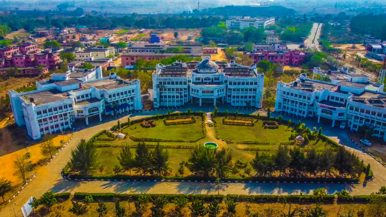
Dharamjaigarh is a town and sub-divisional headquarters in northern Raigarh district, serving as an administrative and commercial centre for nearby villages. Its position on the Raigarh–Ambikapur highway connects it with towns across northern Chhattisgarh, while its rural hinterland depends on small-scale farming, especially paddy cultivation.

Famous for

  • Regional administrative hub
  • Paddy-growing countryside
  • Sal forest surroundings
  • Tribal communities
  • Raigarh princely heritage

Why Dharamjaigarh matters

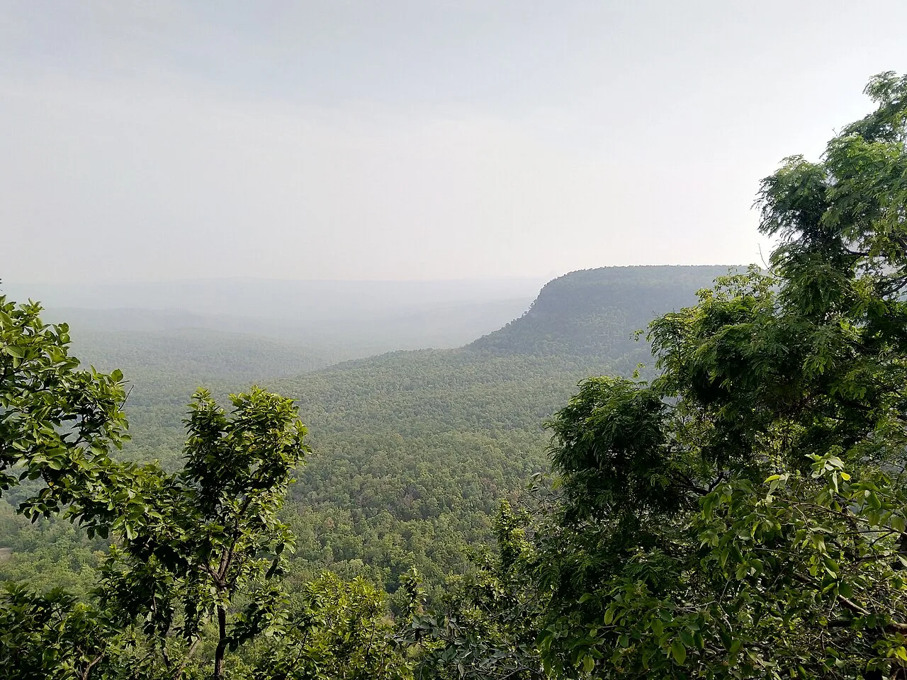
Dharamjaigarh is a town and sub-divisional headquarters in northern Raigarh district, serving as an administrative and commercial centre for nearby villages. Its position on the Raigarh–Ambikapur highway connects it with towns across northern Chhattisgarh, while its rural hinterland depends on small-scale farming, especially paddy cultivation. The area also lies amid sal forests and the wooded hills of the Eastern Chhattisgarh region, close to the borders of Jashpur and Korba districts.

Visitors are more likely to come for local connections, work or a stop along the highway than for a large, established tourist circuit. The surrounding countryside and the cultural life of its tribal communities give the area much of its character. Dharamjaigarh is also associated with the former princely state of Raigarh. Today, its practical importance lies in providing services and a marketplace for surrounding settlements. Hindi and Chhattisgarhi are widely used, with Odia, Bengali and English also heard.
Famous for: crafts, trade & products

Dharamjaigarh is not widely identified with a particular textile, handicraft, GI-tagged product or large manufacturing industry. Its commercial role is primarily local: the town serves residents of surrounding villages, who come for everyday shopping, services and administrative business. The central market area is the most practical place to look for general provisions and locally traded farm produce; availability changes with the season and market day.

Paddy is an important crop in the surrounding agricultural landscape, while nearby forests are a defining feature of the region. These are better understood as parts of the local economy and environment than as a guaranteed range of visitor-oriented products. For locally made goods or seasonal produce, ask shopkeepers in the town centre or check with residents about current market activity. Dharamjaigarh’s strongest distinction is its role as a service and trading hub for nearby communities, rather than a destination for a specific branded product.

History

Dharamjaigarh’s history is linked to the former princely state of Raigarh, within whose historical sphere the town and surrounding area developed. The available historical picture is local in scale: the settlement served a largely rural region, with agriculture, forest landscapes and village networks shaping life around it. There is no need to assign a specific founding date or ruler to explain its present character.

During the period of princely rule, Raigarh was the regional political centre; Dharamjaigarh’s importance was more closely tied to its position among settlements in the northern part of the territory. The town’s later role grew through administration, road connections and services for surrounding villages. In modern Chhattisgarh it functions as a sub-divisional and taluk headquarters, as well as a nagar panchayat. Its location on the Raigarh–Ambikapur highway has reinforced its practical importance as a local centre, connecting nearby rural communities with district-level services and commerce.

Food, festivals & culture

Rice is central to everyday meals in this agricultural region. Chhattisgarhi home cooking commonly includes rice-based dishes, lentils and seasonal vegetables; familiar regional preparations such as chila or fara may be found, though menus vary between households and eateries.

Hindi and Chhattisgarhi are widely spoken, alongside some Odia, Bengali and English. Festivals celebrated across the wider region include Hareli and Pola, associated with the farming calendar, as well as Teeja and major Hindu festivals such as Diwali and Holi; observances differ between communities and villages. Tribal communities contribute to the area’s cultural life, including local traditions of music, dance and seasonal gatherings, but performances are not necessarily scheduled for visitors. Neighbourhood temples and shrines serve as places of worship; ask residents for directions and observe local customs when visiting.

Visiting the city

The cooler, drier months from about October to February are generally the most comfortable for travel. Raipur is the nearest airport, while Raigarh is the nearest railway station. Dharamjaigarh lies on the Raigarh–Ambikapur highway, around 77 km north-west of Raigarh. Bus connections link the town with Raigarh and other regional centres; within town, local transport and walking are practical for short trips. Confirm current connections locally before setting out.

Begin around the town centre and market to see its everyday role as a service hub. The highway corridor is useful for onward travel, while the surrounding rural areas offer a sense of the paddy-growing landscape and nearby forested hills. Seek local advice before visiting countryside or forest areas, and do not assume that remote locations have visitor facilities.

Trips from the city

Nearest places to visit from Dharamjaigarh

Our closest destination guides, by straight-line distance.

Mainpat

43 km away · Surguja district

Mainpat

Mainpat is a small settlement and hill station in northern Chhattisgarh’s Surguja district. Visitors know it for Ulta Pani, also called Bisar Paani, where water appears to run uphill.

Ramgarh

57 km away · Balrampur district

Ramgarh

Ramgarh is a village in Balrampur district, Chhattisgarh, close to the Ramgarh hills. Visitors come to see the well-known Jogimara and Sitabenga caves there.

Chaiturgarh

97 km away · Korba district

Chaiturgarh

Chaiturgarh, also called Lafagarh, is a historic hill fort in Korba district, Chhattisgarh. Visitors come for its pilgrimage associations, historic remains and setting within a biosphere reserve.

107 km away · Raigarh district

Gomardha Wildlife Sanctuary

Gomardha Wildlife Sanctuary is a wildlife-protection area in Chhattisgarh, associated with Raigarh and Sarangarh-Bilaigarh districts. Visitors come to encounter it as a place set aside for wildlife.

Ratanpur

109 km away · Bilaspur district

Ratanpur

Ratanpur is a town and nagar palika in Chhattisgarh’s Bilaspur district. Travellers encounter it on National Highway 130, about 25 kilometres from Bilaspur on the way towards Ambikapur.

Malhar

115 km away · Bilaspur district

Malhar

Malhar, in Chhattisgarh’s Bilaspur district, draws visitors interested in archaeology and its remains of an old fort, restored Shiva temples, and Hindu, Jain and Buddhist temples.

Tala

137 km away · Bilaspur district

Tala

Tala is a village in Chhattisgarh’s Bilaspur district. Visitors are drawn to the Devrani and Jethani temples and its distinctive stone statue of Rudra Shiva.

141 km away · Mahasamund district

Barnawapara Wildlife Sanctuary

Barnawapara Wildlife Sanctuary, in Chhattisgarh’s Mahasamund district, is a protected area established in 1976 under the Wildlife Protection Act. Visitors come to experience a wildlife sanctuary.

Map

Dharamjaigarh on the map

  1. 1Mainpat
  2. 2Ramgarh
  3. 3Chaiturgarh
  4. 4Gomardha Wildlife Sanctuary
  5. 5Ratanpur
  6. 6Malhar
  7. 7Tala
  8. 8Barnawapara Wildlife Sanctuary

Chhattisgarh

Other cities to explore