

District · Chhattisgarh
Bastar
Bastar, in southern Chhattisgarh, is a useful base for exploring a region of forest, river valleys, waterfalls and caves.
Bastar district in southern Chhattisgarh brings together forested country, river valleys, waterfalls and limestone caves, with Jagdalpur as its main urban base. Chitrakote Falls spreads across the Indravati River, while Teerathgarh Falls, Kanger Valley National Park and Kotumsar Cave reveal different aspects of the landscape. Seasonal Mendri Ghumar adds to the district’s waterfall excursions, and Dalpat Sagar offers a lakeside contrast. Bastar Palace recalls the former princely state whose name survives across a wider region than today’s district. Adivasi communities and their diverse cultural traditions are central to Bastar’s character. Travel here benefits from unhurried planning, respect for local customs and attention to seasonal access.
Bastar, in southern Chhattisgarh, is a useful base for exploring a region of forest, river valleys, waterfalls and caves. Jagdalpur anchors visits to Chitrakote Falls on the Indravati River, Teerathgarh Falls and Kanger Valley National Park, where Kotumsar Cave offers a very different landscape. Seasonal waterfalls such as Mendri Ghumar and Tamda Ghumar add to the region’s excursions. In Jagdalpur, Bastar Palace and Dalpat Sagar provide a contrast to trips beyond town. Bastar is also known for the diverse Adivasi communities and cultural traditions that shape the wider region; respectful, unhurried travel helps visitors engage with it thoughtfully.
The history of Bastar is closely associated with the former princely state of Bastar, whose territory was larger than today’s district. Local dynastic accounts connect the kingdom with Annam Deo, traditionally described as a member of the Kakatiya line who established rule in the region. Jagdalpur became an important centre, and Bastar Palace recalls the later royal administration. The kingdom’s rulers operated amid changing regional powers and, in the colonial period, the state came under British paramountcy while retaining its princely status. After Indian independence, Bastar State joined the Indian Union in 1948 and was incorporated into Madhya Pradesh when that state was formed in 1956. The large Bastar district was later reorganised; the present district took shape when the wider district was divided in 1998, including the creation of Dantewada and Kanker districts. Chhattisgarh became a separate state in 2000. Adivasi communities have long histories and distinct social and cultural traditions; these should not be reduced to the history of princely rule alone.
8 destination guides · 5 on the map
Bastar Palace
Bastar Palace is a palace or haveli in Bastar district, Chhattisgarh. Visitors may come to see it as a named example of this type of place.
Chitrakote Falls
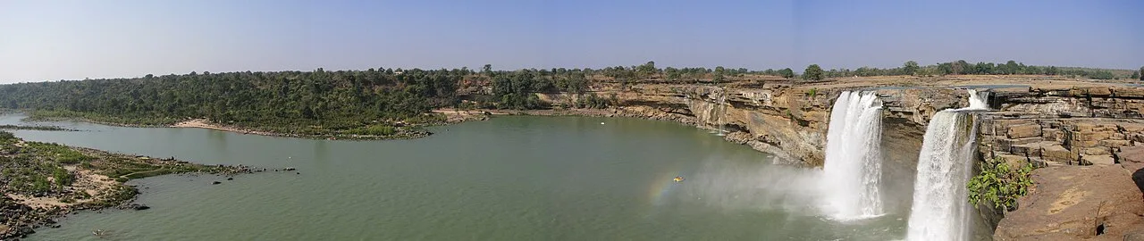
Chitrakote Falls is a waterfall on the Indravati River in Chhattisgarh, drawing visitors to see its broad monsoon flow and distinctive horseshoe form.
Dalpat Sagar
Dalpat Sagar is a lake in Bastar district, Chhattisgarh. Visitors can come to see the lake itself, though no particular activities or other attractions are specified.
Kanger Valley National Park
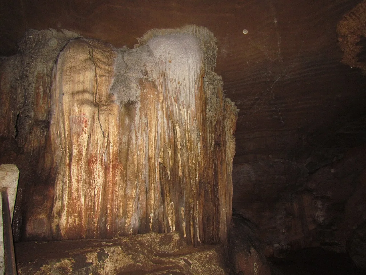
In Bastar, Chhattisgarh, Kanger Valley is a protected natural area visited for its wildlife, waterfalls and limestone caves, set within a landscape of varied landforms.
Kotumsar Cave
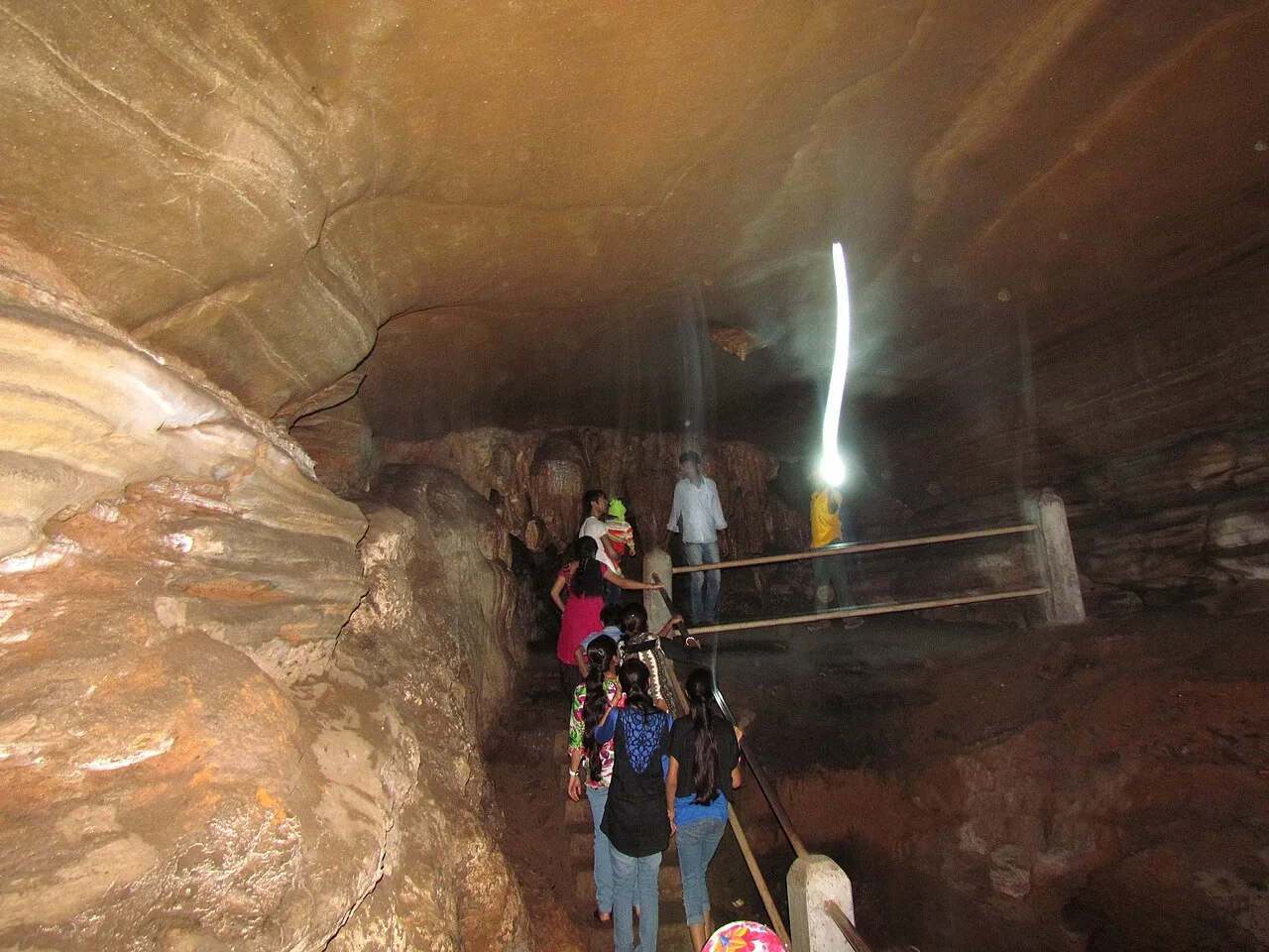
In Bastar district near Jagdalpur, Chhattisgarh, Kotumsar Cave is a limestone cave in the Kanger belt. It draws visitors interested in ecotourism and the cave’s natural setting.
Mendri Ghumar
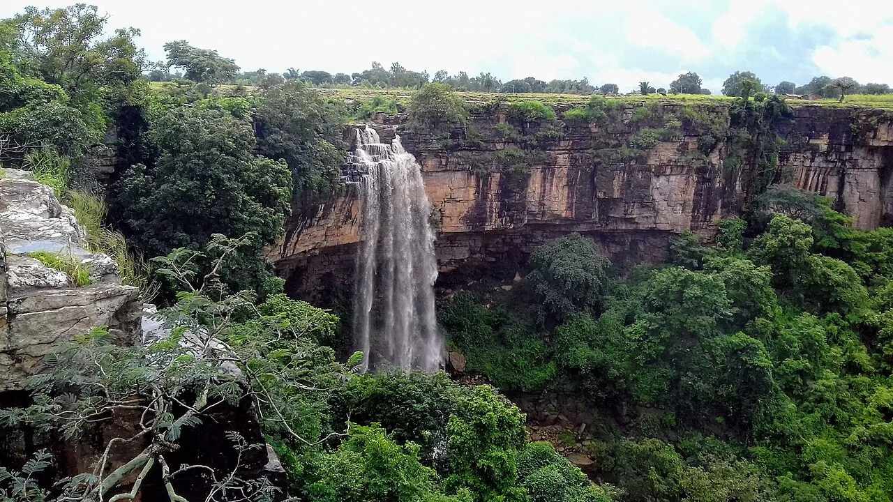
Mendri Ghumar is a seasonal waterfall in Bastar district, Chhattisgarh, about 44 kilometres west of Jagdalpur. Visitors come to see the falls, which are near Chitrakote and Tamda Ghumar.
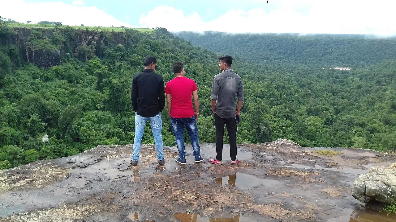
Tamda Ghumar Waterfall
Tamda Ghumar is a waterfall in Bastar district, Chhattisgarh, and visitors come to see the waterfall as a natural feature of the area.
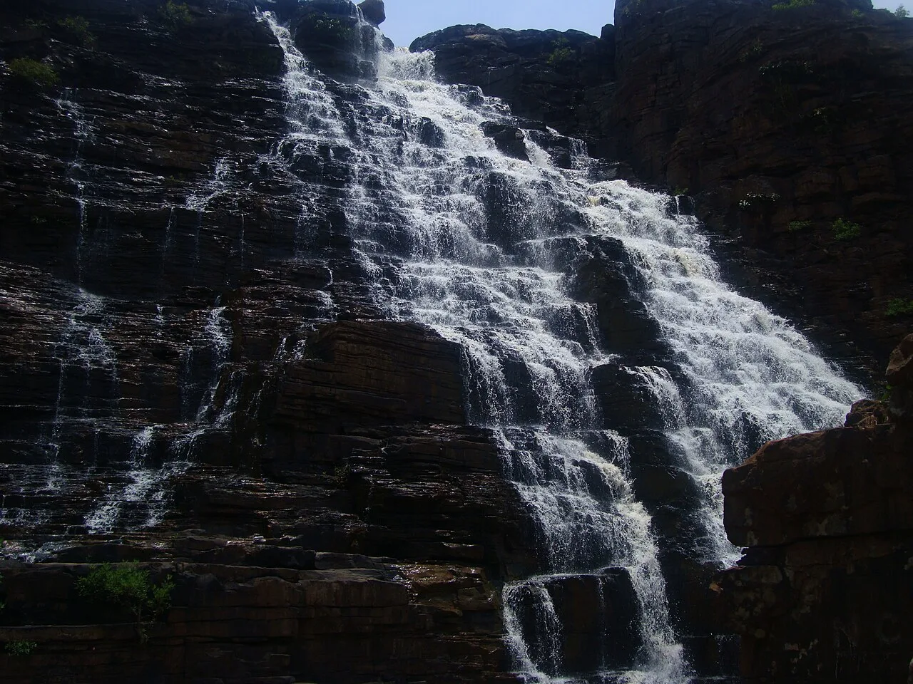
Teerathgarh Falls
Teerathgarh Falls is a waterfall in Bastar district, Chhattisgarh, about 35 kilometres from Jagdalpur. Visitors come to see water descend beside a hillside shaped by natural rock.
Rice anchors much of the food of Bastar and the wider Chhattisgarh region. Look for fara, steamed rice dumplings, and chila, a rice-and-lentil pancake, alongside dishes such as muthiya, aamat and bafauri. Thethari and khurmi are regional savoury and sweet snacks. Pej, a grain-based preparation, features in local food traditions, while mahua is used in foods and drinks in parts of the wider Bastar region. Chaprah, or red ant chutney, is particularly associated with Bastar but is not served everywhere. Ask small eateries what is freshly prepared, and carry drinking water and snacks for remote outings.
The wider Bastar region is known for dhokra metal casting, wrought-iron work and wood carving. Dhokra artisans use the lost-wax process to make figures and decorative objects, often drawing on animals, community life and ritual imagery. Wrought-iron pieces include lamps, animal forms and other sculptural designs, while carved wood appears in both practical and ceremonial objects. Bamboo work is also part of the region’s craft traditions. In Jagdalpur and surrounding craft outlets, ask about the maker and place of production rather than assuming every item was made within the present district.
Bastar Dussehra, centred on Jagdalpur, is a distinctive regional celebration held over an extended season around the monsoon and autumn; its observances differ from the usual emphasis on Rama’s victory. Goncha is another locally known festival, generally associated with the monsoon season. Madai fairs take place in different communities across the wider Bastar region, often during the post-harvest and cooler months, with local schedules varying. These events can bring visitors and substantial local crowds, particularly to Jagdalpur during Bastar Dussehra. Reserve accommodation ahead during major celebrations and ask locally about road access and event arrangements.
In this district
Bastar’s interior is a mix of forested plateaus, low hills, rocky ravines and river valleys. The Indravati River shapes the western excursions, including Chitrakote Falls, while the Kanger valley’s forest and limestone formations include Kotumsar Cave and Teerathgarh Falls. Waterfalls and cave approaches are reached by road from Jagdalpur, but the final stretches can be uneven or slow. Forest cover and seasonal streams make routes feel remote, and rain can alter access. Towns and attractions are spread out, so allow time for road journeys rather than planning a tightly packed sightseeing schedule.
Summer is generally hot, and excursions are more comfortable when planned for the cooler parts of the day, with drinking water and sun protection. The monsoon brings heavy spells of rain, greener scenery and stronger waterfalls, but roads can become muddy or difficult and some approaches may be affected. Winter is usually the most comfortable season for longer road trips and outdoor visits, though mornings and evenings can feel cool. The months after the monsoon and through winter are often a practical time to visit; waterfall conditions vary with recent rain. Pack light layers, sturdy shoes with grip, rain protection in wet months and sun protection in warmer weather.
Jagdalpur is the main base for exploring Bastar district. Maa Danteshwari Airport at Jagdalpur provides air access, while Raipur’s Swami Vivekananda Airport is a larger gateway for onward road travel. Jagdalpur railway station serves the town; Raipur Junction is another useful rail gateway. Road connections link Jagdalpur with Raipur through Kondagaon and with neighbouring parts of the region. Buses serve major routes, while hired cars, taxis and locally available shared vehicles can help with excursions. Interior roads and waterfall approaches may be slow, especially during rain. Confirm return transport before leaving town and check current services locally.
Jagdalpur is the main hub for road travel to the district’s sights. Buses connect Jagdalpur with larger towns and regional routes, but services may not suit visits to several attractions in one day. Autos are useful within Jagdalpur; for outlying waterfalls, the national park and cave areas, visitors commonly arrange a taxi, hired car or locally available shared vehicle. Interior roads can be slow, especially in rain, and transport back from remote stops may be limited. Agree on a return plan with the driver before setting out and check road conditions locally. Do not assume a boat service is available at river or lake sites.
Jagdalpur is the most practical base for all the listed destinations, with hotels and some simpler guesthouse-style options. It also offers the broadest choice of services for arranging road excursions. Smaller settlements may have basic homestays or limited local accommodation, but availability and facilities can vary; confirm before relying on an overnight stay outside town. Government lodges may be available in the wider region, subject to current operation and booking arrangements. Dharamshalas can provide simple accommodation in some places, though they may not suit every traveller or accept all visitors.
Wear shoes with good grip around waterfalls, wet rock and cave approaches; stay behind barriers and away from strong currents, especially during and after rain. Follow local guidance on wildlife and do not enter forest areas or caves without authorised access and suitable assistance. Carry safe drinking water and basic medicines; mobile coverage can be patchy outside Jagdalpur. Road surfaces and access can change in the monsoon, so avoid rushing and confirm return transport. Conditions and security guidance in remote parts of the wider region can change; check current official and local advice, and avoid unfamiliar routes after dark. Follow Kanger Valley National Park rules and confirm any required permissions with the relevant authorities.
- Dantewadaabout 55 km
- Koraput · Odishaabout 76 km
- Alluri Sitharama Raju · Andhra Pradeshabout 136 km
- Bhadradri Kothagudem · Telanganaabout 164 km
- Mulugu · Telanganaabout 201 km
- Visakhapatnam · Andhra Pradeshabout 204 km
Straight-line distance between the centres of each district's destinations; road distance is longer.
Q: How many days should I spend in Bastar? A: Two days can cover a short selection of sights, while three or four days allow more time for the park, cave and waterfall excursions. Q: When is the best time to visit? A: The post-monsoon months and winter are generally comfortable for road travel; waterfall conditions depend on recent rain. Q: What is the best base for exploring the district? A: Jagdalpur is the most practical base, with road connections and the widest range of accommodation and transport options. Q: How do I get to Bastar? A: Reach Jagdalpur by air or rail where services are available, or travel by road from Raipur; check current connections before setting out. Q: Is Bastar suitable for families or elderly travellers? A: Jagdalpur and selected road-accessible sights can work for many visitors, but uneven paths, cave access and long drives may be challenging. Choose stops to suit mobility and check access conditions locally.
This page draws on our 8 destination guides for Bastar and is updated as our team checks it.
Be the first to share photos, stories, advice or a helpful contact for Bastar.
Loading…