
District · Andhra Pradesh
YSR
YSR district, also known as Kadapa district, offers a view of inland Rayalaseema through its rocky terrain, dry plains and Penna river valley.
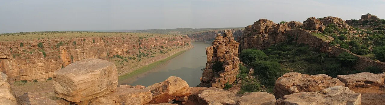
YSR district, also known as Kadapa district, lies in Andhra Pradesh’s inland Rayalaseema region. Its landscape combines rocky hills, dry plains and the Penna river valley, with Gandikota providing its most dramatic meeting of water, cliffs and fortifications. The village and historic fort stand above a deep river gorge near Jammalamadugu. Sidhout Fort adds another fortified landmark to the district’s heritage, while Ameen Peer Dargah in Kadapa city reflects its living Sufi traditions. Together, these places introduce a district shaped by defensive settlements, river corridors and religious life. Kadapa is a practical urban base, but the surrounding countryside is central to understanding the district’s rugged character.
YSR district, also known as Kadapa district, offers a view of inland Rayalaseema through its rocky terrain, dry plains and Penna river valley. It is best known for Gandikota, where a historic fort stands above a deep river gorge, and for Sidhout Fort, another reminder of the region’s fortified past. In Kadapa city, Ameen Peer Dargah reflects the district’s living Sufi traditions. These sights make the district a rewarding stop for travellers interested in landscapes, heritage and religious life beyond Andhra Pradesh’s coastal destinations. Kadapa city is a useful base, while journeys into the countryside reveal the area’s distinctive rugged character.
The Kadapa region has been shaped by successive powers of the Deccan and southern India. It was associated at different times with the Mauryas, Satavahanas, Pallavas, Cholas and Kakatiyas, followed by the Vijayanagara kingdom. Forts such as Gandikota and Sidhout reflect the strategic importance of routes and river crossings in this inland frontier. After Vijayanagara power declined, the area passed through changing Deccan sultanate and Mughal-era administrations; local chiefs and the Kadapa Nawabs also held influence. The East India Company established control in the region in the early nineteenth century, and Cuddapah became a district under British administration. After independence, it formed part of Andhra State and then Andhra Pradesh. The district was renamed YSR district in 2010 in honour of former chief minister Y. S. Rajasekhara Reddy. In 2022, Andhra Pradesh reorganised its districts, changing YSR district’s administrative boundaries while retaining Kadapa as its principal urban centre.
3 destination guides · 2 on the map
Ameen Peer Dargah
Ameen Peer Dargah is a Sufi shrine in Kadapa, Andhra Pradesh, within YSR district. People visit it as a place of religious devotion.
Gandikota Gorge and Fort
Gandikota is a village and historic fort beside the Penna in Andhra Pradesh. Visitors come to see the gorge and fort, shaped by successive ruling powers.
Sidhout Fort
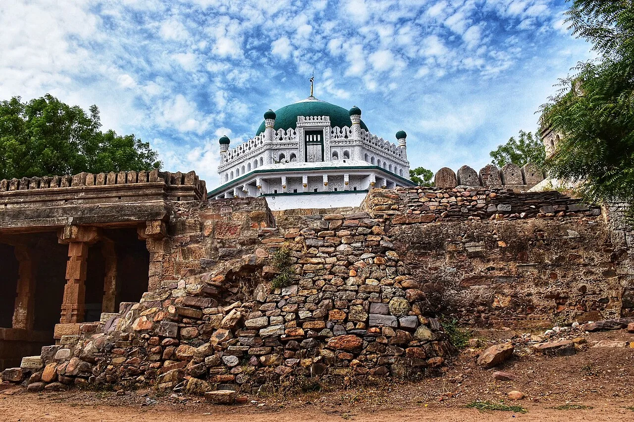
Sidhout Fort is a fort in YSR district, Andhra Pradesh, and appears in the state’s fort listings. Visitors interested in forts may visit to see this site in the district.
Food here belongs to the wider Rayalaseema and Andhra culinary traditions. Ragi sangati, a substantial preparation of finger millet and rice, is a regional staple, often paired with vegetable gravies or meat curries. Andhra meals commonly bring rice, dal, vegetables, pickles and curd together; gongura and avakaya contribute sour, spicy flavours. Pesarattu, sometimes served with upma, and pulihora are other familiar Andhra choices rather than district-specific specialities. Small eateries may offer only a limited daily menu, so ask what has been freshly prepared. Request milder seasoning if needed, and finish with curd rice.
For craft context, look to the wider Andhra Pradesh region rather than assuming every item sold in Kadapa is locally made. The state has established cotton handloom traditions and kalamkari, a textile art using painted or block-printed designs. Srikalahasti is associated with hand-painted kalamkari, while Machilipatnam is known for its block-printed tradition; both centres lie outside YSR district. When browsing textiles or handicrafts, ask where an item was produced and whether it is handwoven, hand-painted or machine-made. These distinctions are more useful than broad souvenir labels.
Sankranti, usually celebrated in January, Ugadi in spring and Dasara in autumn are observed across the district, with family gatherings and activity around temples. Ramadan and Eid are important in Kadapa’s Muslim communities. The annual Urs at Ameen Peer Dargah draws devotees from the district and beyond; visitor numbers can rise around the observance, so arranging a room ahead is sensible. Temple festivals and local fairs also take place at different times of year. Their dates vary, and accommodation pressure is generally most noticeable near the specific shrine or town hosting an event.
The district lies in inland Rayalaseema, with dry plains, rocky outcrops and hill ranges, rather than a coastline. The Penna river and its valley shape parts of the terrain, most dramatically at Gandikota, where the river cuts a deep gorge below the fort. Scrub and forested stretches occur in the uplands, while settlements and cultivated land are scattered across the drier countryside. These contrasts make road travel the practical way to connect sights; journeys beyond Kadapa city can involve open, exposed roads and limited services between towns.
YSR district has hot summers, a monsoon season and milder, comparatively comfortable winters. Summer heat can make exposed walks around forts and rocky viewpoints tiring, so plan outdoor visits for cooler parts of the day and carry water. Monsoon rain can make rural roads and uneven paths slippery, and conditions may change quickly. The cooler months, broadly from November to February, are usually the most comfortable for sightseeing. Pack light clothing, sun protection and sturdy footwear; bring a light layer for winter evenings and rain protection during the monsoon. Check local conditions before travelling to gorge viewpoints.
Kadapa city is the district’s main arrival base, with Kadapa Airport and Kadapa railway station providing air and rail access. Confirm available flights before planning around the airport. Road connections and APSRTC buses link Kadapa with other Andhra Pradesh towns and destinations within the district. Gandikota is approached via Jammalamadugu, while Sidhout requires a separate road journey from Kadapa. Autos are useful for city trips, and hired cars can simplify visits to scattered heritage sites. Bus coverage and last-mile connections may vary, so check current services locally.
Kadapa city is the main transport hub, with road links to towns and settlements across the district. APSRTC buses serve many routes, but connections to individual heritage sites and the frequency of services can vary. Gandikota is approached via Jammalamadugu, while Sidhout calls for a separate road journey from Kadapa. Autos are useful for getting around the city; hired cars or taxis offer more flexibility for combining rural sights. Shared vehicles may be available on some local routes, but should not be relied on for a tight itinerary. There are no routine sightseeing boat services to plan around at the gorge.
2 days: Ameen Peer Dargah → Sidhout Fort → Gandikota Gorge and Fort. Night 1: Kadapa. 3 days: Ameen Peer Dargah → Sidhout Fort → Gandikota Gorge and Fort. Night 1: Kadapa; Night 2: Jammalamadugu.
Kadapa is the most practical base for Ameen Peer Dargah and for arranging a road visit to Sidhout Fort. It has the district’s broadest choice of ordinary hotels and guest accommodation. For Gandikota, staying in or near Jammalamadugu can reduce backtracking, though the choice of rooms may be more limited than in the city. Basic lodgings or homestays may be found around smaller settlements, but availability and facilities vary. Check current options before setting out; government lodges or dharamshalas should not be assumed to be available at every stop.
Gandikota’s gorge edges and fort paths can be uneven and exposed; keep back from unguarded drops, supervise children and take care in strong sun or after rain. Carry drinking water and sun protection, as facilities can be sparse outside towns. Use a suitable vehicle and check local road conditions before rural journeys, especially during the monsoon. Mobile connectivity may be patchy away from Kadapa and larger settlements, so share plans and avoid relying on a signal for navigation. Watch for animals on rural roads, particularly after dark. No special visitor permit is generally associated with the listed sights, but confirm any current access rules with local authorities before travel.
- Nandyalabout 85 km
- Sri Sathya Saiabout 97 km
- Anantapurabout 102 km
- Chittoorabout 111 km
- Kurnoolabout 132 km
- Tirupatiabout 137 km
- Jogulamba Gadwal · Telanganaabout 144 km
- Chikkaballapur · Karnatakaabout 168 km
Straight-line distance between the centres of each district's destinations; road distance is longer.
Q: How many days should I spend in YSR district? A: Two days can cover the main listed sights at a brisk pace; three days allow more time for road travel and an overnight near Gandikota. Q: When is the best time to visit? A: November to February is generally more comfortable for outdoor sightseeing. Summer is hot, while monsoon conditions can affect rural roads and paths. Q: What is the best base for exploring? A: Kadapa city is the most practical all-round base. Jammalamadugu is useful for visiting Gandikota Gorge and Fort. Q: How do I get to the district? A: Reach Kadapa by rail or road, or check whether flights to Kadapa Airport are operating for your travel dates. Buses and hired vehicles connect onward to district sights. Q: Is the district suitable for families or elderly travellers? A: Kadapa city and the dargah are accessible choices for many visitors, but forts and gorge viewpoints may involve uneven ground, exposure and walking. Assess mobility needs and supervise children near edges.
This page draws on our 3 destination guides for YSR and is updated as our team checks it.
Be the first to share photos, stories, advice or a helpful contact for YSR.
Loading…