
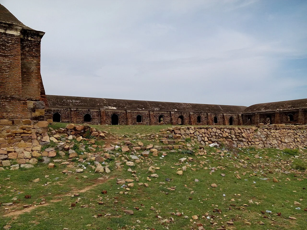
District · Andhra Pradesh
Anantapur
Anantapur lies in the dry interior of Rayalaseema, in western Andhra Pradesh near the Karnataka border.
Anantapur lies in the dry, inland Rayalaseema region of Andhra Pradesh, where broad plains, rocky outcrops and scrubby hills shape the landscape. Rainfall is limited and drought is a recurring challenge, giving agriculture and daily life a close relationship with water. The area has long been a crossroads between the Deccan and the southern peninsula, and its forts and temples reflect successive regional powers and trading routes. Gooty Fort, rising above the town on a rocky hill, is a notable reminder of this layered past. The wider historic Anantapur region also includes places such as Penukonda and Lepakshi, though administrative boundaries have changed. Today the district combines busy market towns, farming communities and a strong Rayalaseema identity.
Anantapur lies in the dry interior of Rayalaseema, in western Andhra Pradesh near the Karnataka border. It suits travellers interested in the region’s rugged plateau scenery, historic forts and the layered history of the Vijayanagara era. Gooty Fort and Penukonda Fort are among the district’s listed heritage stops; Penukonda is especially associated with Vijayanagara rule. Lepakshi Veerabhadra Temple is a nearby excursion, but Lepakshi is in present-day Sri Sathya Sai district, not Anantapur district. The district can be explored as part of a wider Rayalaseema journey, with road and rail links connecting its towns to regional centres.
The Anantapur region has passed through the hands of several southern Indian powers. Medieval political influence included the Chalukyas and Hoysalas, followed by the Vijayanagara Empire, whose rulers and local governors left a strong mark on the region’s forts and religious architecture. After the Battle of Talikota in 1565, Penukonda served as an important seat of the surviving Vijayanagara court under the Aravidu dynasty. Gooty Fort also changed hands among regional powers over time. In the colonial period, the area formed part of the Ceded Districts, territories transferred by the Nizam of Hyderabad to the East India Company in 1800. Anantapur district was constituted in 1882 from territory that had been part of Bellary district under British administration. It remained within the Madras Presidency before becoming part of Andhra State and later Andhra Pradesh. In 2022, Andhra Pradesh reorganised its districts: the present Anantapur district is smaller than the former district, and Lepakshi now lies in neighbouring Sri Sathya Sai district.
3 destination guides · 2 on the map
Gooty Fort
Gooty Fort is a ruined hill fort in Gooty, Andhra Pradesh, also known as Ravadurg and Gutti Kota. Visitors come to see the remains and its hilltop location.
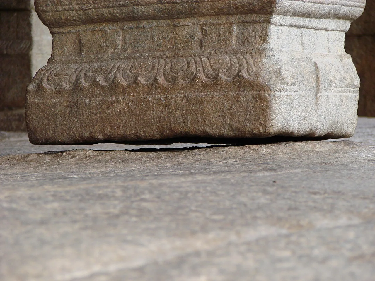
Lepakshi Veerabhadra Temple
Lepakshi Veerabhadra Temple is a temple in the Andhra Pradesh village of Lepakshi. Visitors go to the village to see the Veerabhadra Temple.
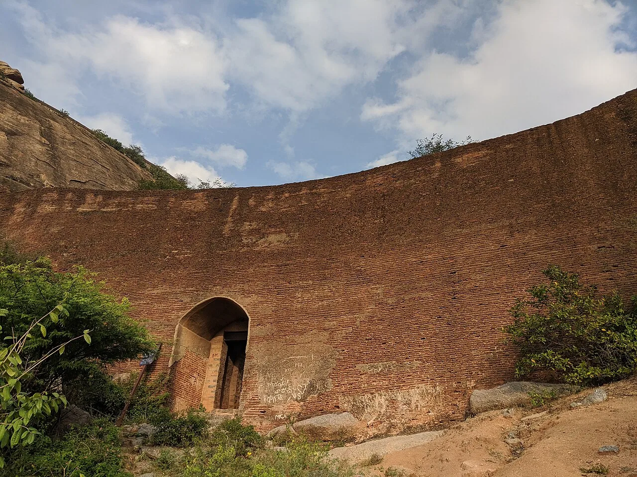
Penukonda Fort
Penukonda Fort is a fort in Anantapur district, Andhra Pradesh. Visitors come to see the site identified by this name and its place within the district.
The district’s food belongs to the wider Rayalaseema tradition: hearty, often spicy meals built around rice, lentils and seasonal vegetables. Ragi sangati, a firm millet staple, is commonly paired with pappu or a rich curry, while pulihora and Andhra-style pickles such as avakaya add tang and heat. Gongura is another familiar regional favourite. Small eateries may prepare a limited menu based on what is fresh that day. Spice levels can be intense, so ask for a milder serving if needed; curd rice makes a cooling finish. Coastal seafood specialties are less characteristic of this inland district.
Craft traditions in and around Anantapur reflect the wider Rayalaseema region. Handloom weaving is part of the area’s textile heritage, while nearby Dharmavaram is particularly well known for silk sarees; it is best treated as a regional tradition rather than a craft confined to Anantapur district. Andhra Pradesh is also known for leather shadow puppetry, an old performance-and-craft tradition, though it is not specific to this district. Visitors may find locally made textiles and household crafts in town markets, but availability varies. Ask sellers about the makers and the place of origin when buying.
Ugadi, Sankranti, Dasara and Deepavali are observed across the district, with family visits and local events especially noticeable around the harvest season and major festival periods. Temple celebrations and village fairs also take place in the wider Rayalaseema region; their scale and timing vary by locality. These occasions can make local roads and central areas busier, and accommodation may be harder to find in towns hosting larger events. Travellers planning around a particular fair should check locally for current dates and arrangements.
Anantapur is an inland, largely semi-arid plateau of open agricultural land, rocky ground and low, rugged hills. The Pennar and seasonal rivers and streams shape parts of the region, while scrub and dry woodland occur in less cultivated areas. There is no coastline. Rocky hill settings give forts such as Gooty and Penukonda steep, uneven approaches, so visits often involve walking and climbing rather than simply viewing from a roadside. Towns and heritage sites are spread across the district, making road travel an important part of an itinerary.
The district has a generally hot, dry climate. Summers, roughly from March into June, can be demanding for outdoor sightseeing, especially on exposed fort paths. The monsoon season usually falls across the middle and later part of the year; rainfall can make tracks slippery, though conditions vary from year to year. Winter, broadly from November to February, is usually more comfortable for exploring. October to February is often the most practical visiting period. Carry sun protection, a hat, light breathable clothing and enough drinking water; during the cooler months, a light layer can be useful for mornings and evenings.
Anantapur railway station is a useful rail gateway, with Guntakal Junction serving as another important connection in the region. Bengaluru is a major practical airport gateway; check which airport and onward route best suit your itinerary, as nearby air services may be limited. National and state highways connect Anantapur with Bengaluru, Hyderabad and other Rayalaseema towns. APSRTC buses serve district towns, while local buses, shared autos and hired vehicles can help with shorter journeys to forts and villages. Some heritage sites lie outside the main towns, so arrange onward transport in advance. Check current services locally before travelling.
Anantapur town, Gooty and Penukonda are connected by regional roads, and public buses link many larger towns and settlements. Rail services serve parts of the district, but visitors should check current routes for their chosen starting point. Within towns, autos are useful for short journeys; taxis or a hired vehicle offer more flexibility between forts and less frequent bus stops. Shared vehicles may operate on some local routes but availability can vary. Lepakshi is outside the present district, in Sri Sathya Sai district, and requires a separate road leg. Allow flexibility for rural road conditions and onward connections.
2 days: Gooty Fort, then Penukonda Fort; sleep in Gooty after day 1. 3 days: Penukonda Fort, then Lepakshi Veerabhadra Temple, then Gooty Fort; sleep in Penukonda after day 1 and Hindupur after day 2. Lepakshi is in neighbouring Sri Sathya Sai district. 4 days: Gooty Fort, then Penukonda Fort, then Lepakshi Veerabhadra Temple; sleep in Gooty, Anantapur and Hindupur on successive nights. Lepakshi is an excursion outside the present district.
Anantapur town is the most practical base for travellers wanting a wider choice of accommodation and access to regional transport. Gooty and Penukonda can suit shorter fort-focused visits, though lodging choices may be more limited than in the district headquarters. For a Lepakshi excursion, consider staying in or near Hindupur, in neighbouring Sri Sathya Sai district. Options across the area generally include hotels and modest guesthouses; homestays, government lodges or dharamshalas may be available in some places, but should be checked in advance.
Fort approaches can be steep, rocky and uneven; wear firm footwear, avoid climbing beyond safe paths and take care in heat or after rain. Carry drinking water, sun protection and any personal medicines, and use reliable drinking water sources. Wildlife encounters are not a usual feature of town visits, but avoid disturbing animals or entering scrub after dark. Road surfaces and mobile connectivity can be variable outside towns, so plan onward transport before setting out. Crowds may increase during festivals. No special permit is generally associated with these listed visits; confirm any current access rules with official local authorities before travel.
- Sri Sathya Saiabout 39 km
- YSRabout 102 km
- Tumakuru · Karnatakaabout 114 km
- Chikkaballapur · Karnatakaabout 120 km
- Chittoorabout 122 km
- Chitradurga · Karnatakaabout 135 km
- Nandyalabout 141 km
- Kurnoolabout 153 km
Straight-line distance between the centres of each district's destinations; road distance is longer.
Q: How many days should I spend in Anantapur district? A: Two days can cover a fort-focused visit; allow three or four days for a slower route and the Lepakshi excursion in neighbouring Sri Sathya Sai district. Q: When is the best time to visit? A: October to February is generally more comfortable for outdoor sightseeing than the hot summer months. Q: What is the best base for exploring? A: Anantapur town is a practical base with broader transport and accommodation options; Gooty or Penukonda may suit a shorter local stay. Q: How do I get to the district? A: Anantapur is connected to regional centres by road and rail. Check current services for your route, then use buses, autos or a hired vehicle for local travel. Q: Is the area suitable for families or elderly travellers? A: Town visits can suit families, but fort paths are steep and uneven. Elderly visitors or anyone with limited mobility may prefer to skip the climbs or arrange assistance where available.
This page draws on our 3 destination guides for Anantapur and is updated as our team checks it.
Be the first to share photos, stories, advice or a helpful contact for Anantapur.
Loading…