Ghumoopedia — Explore, Discover, Experience
Sign in
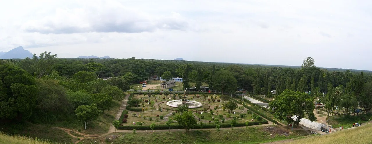
Aliyar Dam and Reservoir, near Udumalaipettai

City guide · Tamil Nadu

Udumalaipettai

Udumalaipettai, often called Udumalai, is a town in Tiruppur district and the administrative centre of its taluk. Set amid the agricultural plains of western Tamil Nadu, it is framed on three sides by the Western Ghats.

Famous for

  • Western Ghats foothills
  • Coconut and agriculture trade
  • Amaravathi reservoir trips
  • Thirumoorthy Hills excursions
  • Kongu region gateway

Why Udumalaipettai matters

Udumalaipettai, often called Udumalai, is a town in Tiruppur district and the administrative centre of its taluk. Set amid the agricultural plains of western Tamil Nadu, it is framed on three sides by the Western Ghats. Its location on routes linking Coimbatore, Palani and the hill country makes it a useful regional hub as well as a stop for travellers exploring the surrounding landscape.

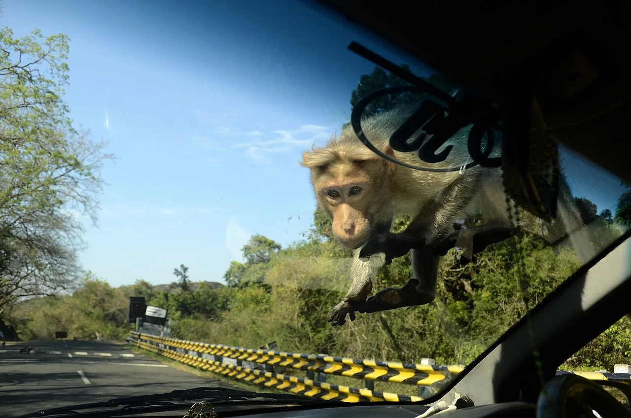
The town’s appeal lies in this mix of everyday commerce and nearby outdoor destinations. The foothills, reservoirs and rural scenery around it invite day trips, particularly to Thirumoorthy Hills and the Amaravathi area, where visitors can enjoy the landscape and, at Amaravathi, visit the crocodile farm. Udumalaipettai is also associated with farming and the trade of local produce, including coconuts. It has the services and transport links of a working district town, while remaining close to quieter countryside. Visitors often use it as a base for exploring western Tiruppur district rather than as a large standalone sightseeing destination.
Famous for: crafts, trade & products

Udumalaipettai’s best-known trade is tied to the surrounding farms. Coconuts and other agricultural produce move through local wholesale markets and shops, alongside crops grown in the region’s varied soils. The town and its hinterland also have connections to cotton processing and textile-related work, as well as food and oil mills. These are practical regional industries rather than a distinctive visitor-facing craft tradition.

For a sense of local commerce, explore the central market streets and produce-trading areas, where shops serve both residents and nearby villages. You may find coconuts and seasonal farm goods, but availability varies with harvests. The surrounding countryside is also notable for wind-energy installations, a feature of the wider region rather than a souvenir product. Udumalaipettai is not especially known for a particular GI-tagged textile, handicraft or specialty saree, so visitors looking for those should not expect a dedicated craft quarter. Its identity is more closely connected to agriculture, small-scale industry and its role as a service centre for western Tiruppur district.

History

Udumalaipettai grew as a market and administrative town in the Kongu region, an area whose history was shaped by successive South Indian powers, including the Cheras, Cholas, Pandyas and later Vijayanagara and Nayak rulers. The town’s development was also influenced by its position between the western plains and the routes towards the Palani hills. As in much of the region, British rule brought changes to administration and transport, though the town is not chiefly known for a surviving colonial-era monument.

Municipal government was established in 1918, reflecting Udumalaipettai’s growing role as a local centre. Its municipality was upgraded in stages in the decades that followed. Agriculture, trade and small industries supported its modern growth, while its roads and rail connection strengthened links with nearby towns. Udumalaipettai belonged to Coimbatore district until 2008, when it became part of the newly formed Tiruppur district. The district transfer was opposed by some local residents, illustrating the town’s longstanding ties to the Coimbatore region.

Food, festivals & culture

Everyday food reflects the Kongu region’s Tamil cooking, with rice, lentils, millets, coconut and locally grown vegetables appearing in home-style meals. Tiffin such as idli, dosa and vadai is common, while meals and snacks vary from one household and eatery to another. There is no single sweet or dish that defines the town; visitors can look for traditional sweets and savouries in local bakeries and sweet shops.

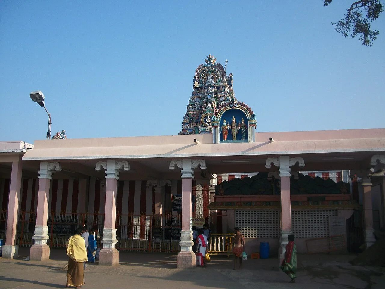
Tamil is the main language, and the local speech has a Kongu Tamil character. Pongal, celebrated in January, is especially significant in this farming area, with harvest-related observances and family gatherings. Deepavali and Tamil New Year are also widely marked. Temples hold annual festivals, often featuring processions, music and community events; the Mariamman temple is among the town’s places of worship. Religious life includes temples as well as churches and mosques. Folk performance and devotional music are most visible during festivals, while classical and popular Tamil music are part of everyday cultural life.

Visiting the city

The cooler months from roughly October to February are generally the most comfortable for exploring; summers can be hot, and monsoon showers may affect outdoor plans. Coimbatore International Airport is the nearest major airport, about 72 km away. Udumalaipettai railway station serves the town, with onward connections available through the regional rail network.

Auto-rickshaws and local buses are useful for getting around town; a hired vehicle is convenient for countryside excursions. Explore the central market and temple areas for a feel of daily life, then plan separate trips towards Thirumoorthy Hills or the Amaravathi reservoir and crocodile farm. Check local conditions before setting out to hill or water-side areas, especially during heavy rain.

Trips from the city

Nearest places to visit from Udumalaipettai

Our closest destination guides, by straight-line distance.

Aliyar Dam and Reservoir

33 km away · Coimbatore district

Aliyar Dam and Reservoir

Aliyar Dam and Reservoir is a water-storage site in Tamil Nadu’s Anaimalai Hills. Visitors come for boating, mountain views and facilities including a park, aquarium and play area.

Monkey Falls

34 km away · Coimbatore district

Monkey Falls

Monkey Falls is a natural waterfall in the Anaimalai Hills of Coimbatore district, near the route between Pollachi and Valparai. Visitors come to see the falls.

Palani Murugan Temple

34 km away · Dindigul district

Palani Murugan Temple

Palani Murugan Temple is a Murugan shrine on a hill at Palani in Tamil Nadu. Pilgrims come to worship, observe temple festivals and take part in customs including tonsuring and carrying kavadi.

Valparai

43 km away · Coimbatore district

Valparai

Valparai is a hill town in Tamil Nadu’s Coimbatore district, set among tea estates and forest in the Anaimalai Hills and reached by a winding road from the foothills.

Bryant Park

47 km away · Dindigul district

Bryant Park

Bryant Park is beside Kodaikanal Lake in Tamil Nadu. Visitors to the area come for boating on the lake and its summer boat pageants and flower shows.

Eachanari Vinayagar Temple

47 km away · Coimbatore district

Eachanari Vinayagar Temple

Located in Eachanari near Coimbatore, this Tamil Nadu temple honours Vinayagar. Visitors come to worship the Hindu deity at a shrine around 12 km from Coimbatore city.

Kodaikanal Lake

47 km away · Dindigul district

Kodaikanal Lake

Set within Kodaikanal in Tamil Nadu’s Dindigul district, this artificial lake is a central feature of the hill town. Visitors come for boating and seasonal events beside the water.

Berijam Lake

48 km away · Dindigul district

Berijam Lake

Berijam Lake is a reservoir in the upper Palani hills near Kodaikanal, Tamil Nadu. Visitors come to see the lake and its setting at the former Fort Hamilton site.

Map

Udumalaipettai on the map

  1. 1Aliyar Dam and Reservoir
  2. 2Monkey Falls
  3. 3Palani Murugan Temple
  4. 4Valparai
  5. 5Bryant Park
  6. 6Eachanari Vinayagar Temple
  7. 7Kodaikanal Lake
  8. 8Berijam Lake

Tamil Nadu

Other cities to explore