
District · Jammu and Kashmir
Udhampur
Udhampur offers a varied introduction to Jammu’s mountain country, linking the region’s road and rail corridors with forested hills, pilgrimage sites and historic settlements.
Udhampur district stretches from the Jammu plains’ foothills into the forested hills and highland meadows of the Shivalik and Pir Panjal ranges. Its landscape includes river valleys, pine-covered slopes and popular hill destinations such as Patnitop, alongside towns, villages and historic religious sites. The district is part of the Jammu Division and has long been shaped by its position on routes connecting Jammu with the Kashmir Valley. Krimchi’s group of ancient temples reflects the area’s religious and architectural heritage, while Udhampur town serves as an important regional centre. The district’s character combines Dogra traditions, mountain scenery and pilgrimage and leisure travel.
Udhampur offers a varied introduction to Jammu’s mountain country, linking the region’s road and rail corridors with forested hills, pilgrimage sites and historic settlements. The district is best known to many visitors as the home of Patnitop, a hill destination, and Krimchi’s group of ancient temples. Udhampur town is an important regional centre, while nearby routes lead towards higher meadows and other parts of the Jammu Division. Travellers can combine mountain scenery with Dogra cultural heritage and religious travel, using the district as a stop on journeys between Jammu and the Kashmir Valley.
The Udhampur region formed part of the territories associated with the Dogra rulers of Jammu, whose influence grew across the surrounding hill states over several centuries. Krimchi’s temples, commonly dated to around the eighth or ninth century, testify to an older history of Hindu worship and temple building in the area. The region’s position between Jammu and the Kashmir Valley also made its routes important for travel and administration. In 1846, the Treaty of Amritsar established the princely state of Jammu and Kashmir under Dogra rule, within the broader setting of British India; Udhampur remained part of that princely state until its end in 1947. After independence and the political changes that followed, the area became part of Jammu and Kashmir’s Indian-administered administration. District boundaries have changed over time: Reasi and Ramban became separate districts in 2007, leaving the present Udhampur district smaller than the former administrative unit. Udhampur town continues to serve as a regional administrative and transport centre.
3 destination guides
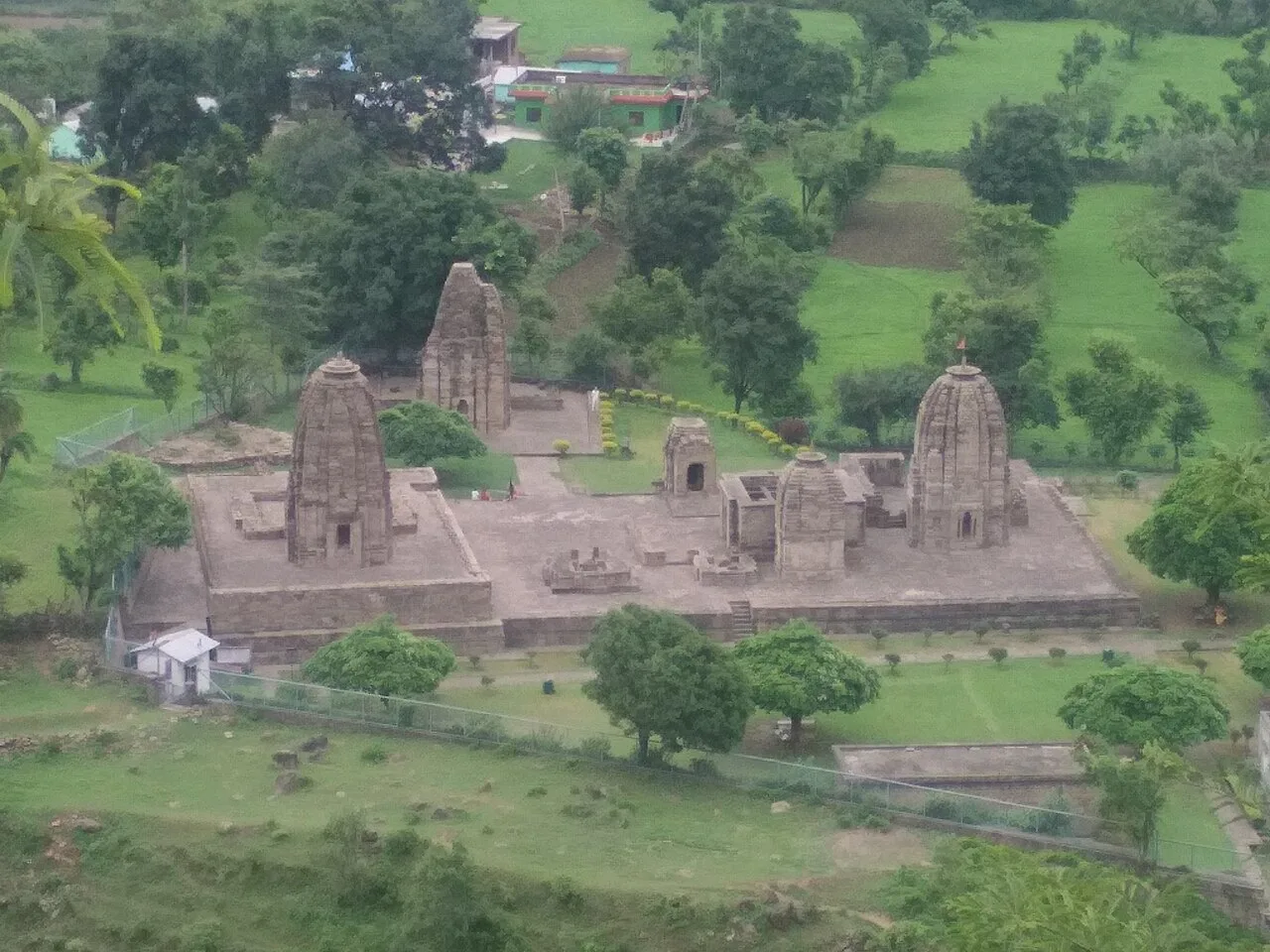
Krimchi temples
Krimchi Temples is a cluster of seven ancient Hindu shrines in Udhampur district, Jammu and Kashmir. Visitors come to see the group, locally called the Pandava Temples.
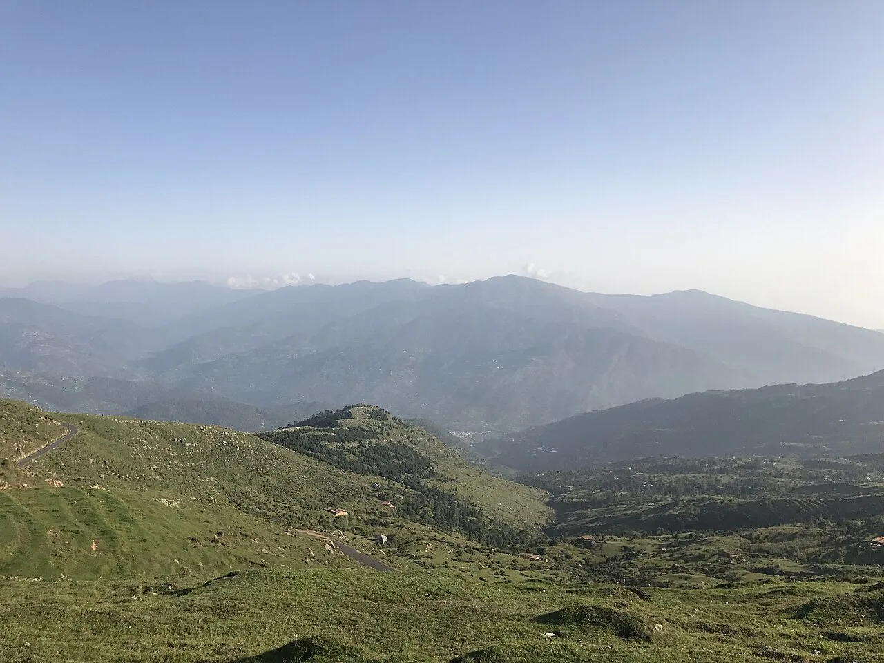
Patnitop
Patnitop is a hill station in Jammu and Kashmir’s Udhampur district, within the lower Himalayas. Its elevated setting near the Jammu–Srinagar highway and the Chenab River draws visitors.
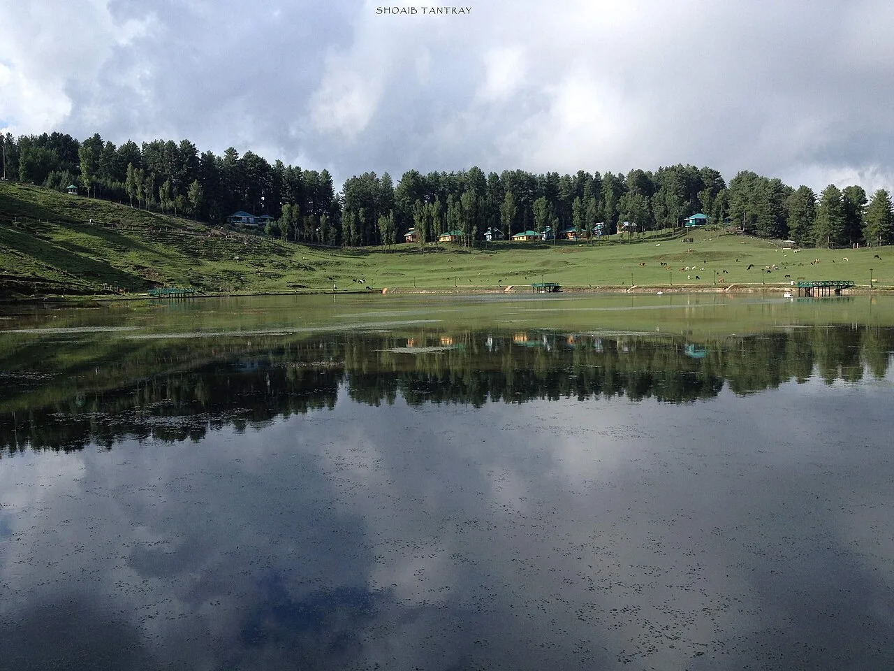
Sanasar
Sanasar is a destination associated with the villages of Sana and Sar in Jammu and Kashmir. Visitors come for adventure and sports, as well as views of mountain ranges such as the Brammah Massif.
Food in Udhampur reflects the wider Dogra and Jammu-region table. Rajma-chawal is a familiar meal, while kalari, a locally associated ripened cheese of the Jammu region, is often cooked or served with bread. Dogra dishes such as ambal, a sweet-and-sour preparation, and auria are also found in the region. Menus vary by place and season; some eateries offer simple vegetarian meals, while others serve meat dishes. Across Jammu and Kashmir, visitors may also encounter dishes such as dum aloo, nadru and haak, as well as kahwa and salty noon chai. Ask what is freshly prepared, especially at small roadside stops.
Craft traditions vary across Jammu and Kashmir, and not every regional craft is made in Udhampur district. The wider Jammu region is associated with handloom weaving, woollen textiles and practical household work in wood and cane. Across the Union Territory, visitors may also see Kashmir-region crafts such as papier-mâché, carpet weaving, crewel embroidery and walnut-wood carving; these are regional traditions rather than crafts to assume are locally produced in Udhampur. Local markets and craft outlets can offer a useful introduction, but the maker and place of origin are worth checking when buying.
Religious festivals and seasonal fairs reflect the district’s Dogra Hindu traditions and its wider Jammu setting. Navratri, Shivratri, Lohri and Baisakhi are observed, while temple gatherings and local fairs bring pilgrims and residents together at different times of year. Some nearby pilgrimage events follow the Hindu lunar calendar, so their dates shift annually. Crowds are usually more noticeable around major religious occasions and during summer travel periods; popular hill destinations can be busier, and rooms may be harder to find. Check local announcements when planning a visit around a festival.
Elsewhere in Jammu and Kashmir
- Shri Amarnath YatraDates to be announced · Seasonal
- Kheer Bhawani Mela (Zyeth Atham)Dates to be announced · Seasonal
- Herath (Kashmiri Shivaratri)Dates to be announced · Seasonal
- Navreh (Kashmiri New Year)Dates to be announced · Seasonal
- Eid & the Shrine Festivals of KashmirDates to be announced · Seasonal
- Bahu MelaDates to be announced · Seasonal
- Jhiri Mela23 Nov 2026 – 3 Dec 2026 · Confirmed
- Lohri & Baisakhi in JammuDates to be announced · Seasonal
- Tulip Festival, SrinagarDates to be announced · Seasonal
The district rises from lower foothills into the Shivalik and Pir Panjal mountain country. Its terrain includes wooded slopes, pine forests, narrow valleys and open upland areas; the Tawi and its tributaries are part of the wider regional drainage. Roads climb and curve through the hills, so journeys between towns and attractions can take longer than the map suggests. Patnitop is among the best-known hill destinations. Sanasar, often visited on the same regional trip, lies in neighbouring Ramban district rather than Udhampur.
Conditions vary with elevation. Summers are generally warm in lower areas, while hill destinations offer cooler conditions; the monsoon, usually from July into September, can bring rain, slippery roads and occasional travel disruption. Autumn is often a comfortable time for road trips, and spring brings milder weather. Winters can be cold in the hills, with snow possible at higher elevations and on some routes. Spring and autumn are useful seasons for combining town visits with outdoor stops, though conditions can change quickly in the mountains. Pack layers, a waterproof outer layer and sturdy footwear, and check forecasts and road advisories before travelling.
Udhampur Railway Station is the district’s principal rail stop, while Jammu Airport is the nearest major airport for most visitors. Jammu Tawi is another important rail gateway. National Highway 44 links the district with Jammu to the south and the Kashmir Valley to the north; the Chenani-Nashri Tunnel forms part of this route. Mountain roads to hill destinations and villages can be winding, so allow flexibility when travelling between sites. Buses and shared or private taxis connect major towns, while taxis are often more practical for scattered attractions. Check current services locally before setting out.
National Highway 44 links Udhampur with Jammu to the south and the Kashmir Valley to the north; the Chenani-Nashri Tunnel is part of this route. Roads branch towards Patnitop and nearby settlements, while Krimchi is reached by local roads from the Udhampur area. Local buses and shared vehicles serve major towns and some hill routes, but service to smaller sites may be limited. Auto-rickshaws are useful for local journeys in town, while taxis offer more flexibility for scattered attractions. Sanasar is in neighbouring Ramban district and requires a regional road trip. Confirm current road and transport conditions locally.
2 days: Krimchi temples, then Patnitop; sleep night 1 in Udhampur and night 2 in Patnitop. 3 days: Patnitop, then Sanasar; sleep night 1 in Patnitop and night 2 in Sanasar. Sanasar is in neighbouring Ramban district. 4 days: Krimchi temples, Patnitop, then Sanasar; sleep night 1 in Udhampur, night 2 in Patnitop and night 3 in Sanasar. Sanasar is in neighbouring Ramban district.
Udhampur town is a practical base for Krimchi temples and onward rail or road travel, with hotels and other basic visitor accommodation. Patnitop suits travellers focusing on the hills and has hotels, guesthouses and some homestays; availability can tighten during holidays and peak seasons. For a route extending to Sanasar, consider an overnight stay there if suitable accommodation is available, or use a nearby town as a base. Government guesthouses or lodges and dharamshalas may be available in the wider region, but facilities and access vary, so confirm arrangements before setting out.
Mountain roads can be narrow, winding and affected by rain, snow, landslides or traffic; check local advisories and avoid rushing between stops. Carry water and drink treated or sealed water, especially on longer drives. Use care on forest paths, watch for wildlife and do not approach or feed animals. Crowds increase at pilgrimage sites and during holidays. Mobile connectivity can be patchy outside towns, so save key information offline and tell someone your route. No routine Inner Line Permit is generally associated with these listed destinations, but check current official advisories for any area-specific restrictions before travel.
- Reasiabout 33 km
- Dodaabout 44 km
- Sambaabout 45 km
- Jammuabout 54 km
- Kulgamabout 76 km
- Kathuaabout 84 km
- Anantnagabout 88 km
- Kishtwarabout 89 km
Straight-line distance between the centres of each district's destinations; road distance is longer.
Q: How many days should I spend in Udhampur district? A: Two days can cover Krimchi temples and Patnitop at a relaxed pace. Allow three or four days if adding Sanasar as a regional extension in neighbouring Ramban district. Q: When is the best time to visit? A: Spring and autumn are generally comfortable for sightseeing. Summer suits hill stays, while winter visitors should check snow and road conditions. Q: What is the best base for visiting the district? A: Udhampur town is convenient for Krimchi temples and transport connections; Patnitop is a useful base for a hill-focused visit. Q: How do I get to Udhampur? A: Udhampur Railway Station serves the district, and Jammu Airport and Jammu Tawi are important gateways. National Highway 44 connects the area by road. Q: Is Udhampur suitable for families or elderly travellers? A: Yes, with suitable planning. Choose accessible accommodation, allow extra time for winding roads and consider mobility needs at hill sites and temple steps.
This page draws on our 3 destination guides for Udhampur and is updated as our team checks it.
Be the first to share photos, stories, advice or a helpful contact for Udhampur.
Loading…