
District · Rajasthan
Chittorgarh
Chittorgarh district lies in southern Rajasthan, within the historic Mewar region.
Chittorgarh district lies in Rajasthan’s Mewar region, where dry plains, cultivated fields and rocky rises create a landscape shaped by both farming and fortifications. Its best-known landmark is Chittor Fort, a vast hilltop complex whose gateways, palaces, temples and Vijaya Stambha tell of the power and changing fortunes of Mewar’s rulers. The fort is associated with repeated sieges and enduring stories of resistance, and is part of the UNESCO-listed Hill Forts of Rajasthan. Beyond the historic stronghold, the district is a working part of modern Rajasthan, with towns, villages and agricultural areas. Its character brings together a celebrated Rajput past and the everyday life of the Mewar countryside.
Chittorgarh district lies in southern Rajasthan, within the historic Mewar region. Travellers come chiefly for Chittor Fort, a vast hilltop fort complex associated with Mewar’s rulers and several celebrated sieges, and for the Vijaya Stambha, its intricately carved victory tower. The district offers a glimpse of Rajasthan’s Rajput history alongside the everyday life of a regional town and its surrounding countryside. Chittorgarh is also a useful stop on journeys linking Udaipur, Bhilwara and Kota.
Chittorgarh’s history is closely tied to Mewar, a Rajput kingdom whose rulers made Chittor an important seat of power. The fort changed hands during successive conflicts. It was captured by Alauddin Khalji in 1303, taken by Gujarat’s Sultan Bahadur Shah in 1535, and besieged by the Mughal emperor Akbar in 1567–68. The Sisodia rulers of Mewar later established their principal capital at Udaipur, though Chittor remained a powerful symbol of the kingdom’s history. The fort’s palaces, temples and monuments reflect the long period of Rajput rule and the political and religious life of the region. In the colonial era, Mewar was a princely state under British paramountcy rather than a directly administered British province. After Indian independence, Mewar joined the process of integrating princely states into Rajasthan. Chittorgarh district took shape through these post-independence administrative changes, with boundaries and arrangements adjusted over time.
3 destination guides
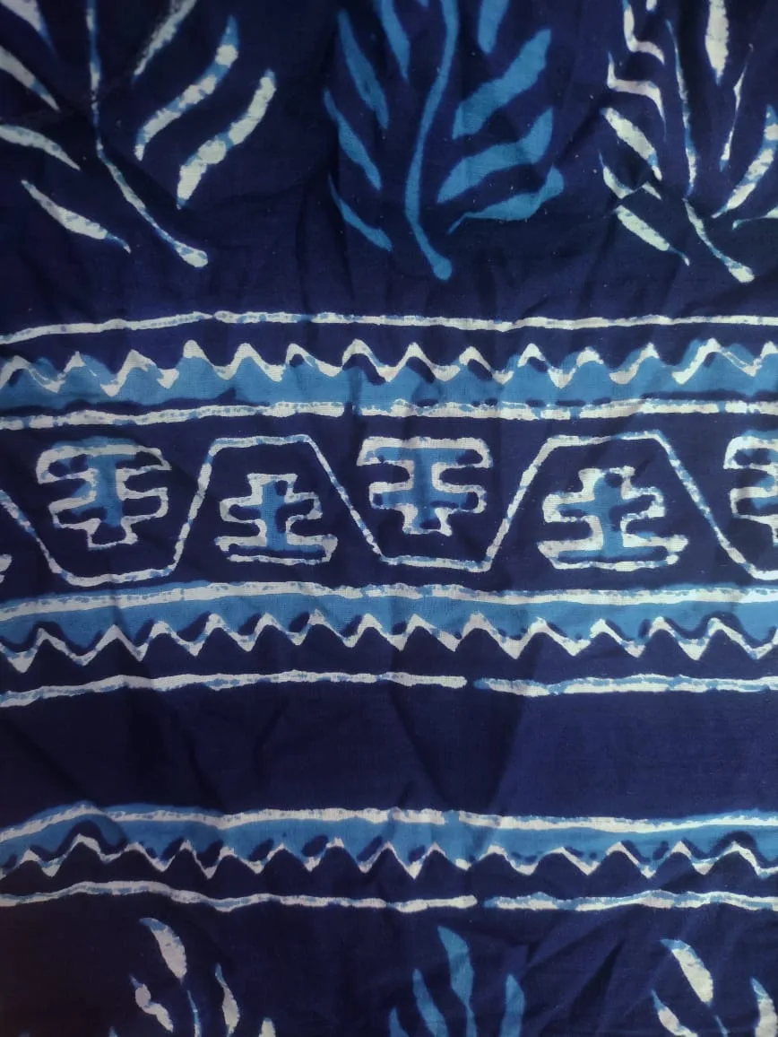
Akola (Dabu Print Village)
Akola, also called Chhipo ka Akola, is a village in Rajasthan’s Chittorgarh district. Visitors are drawn by its Dabu print, known across India.
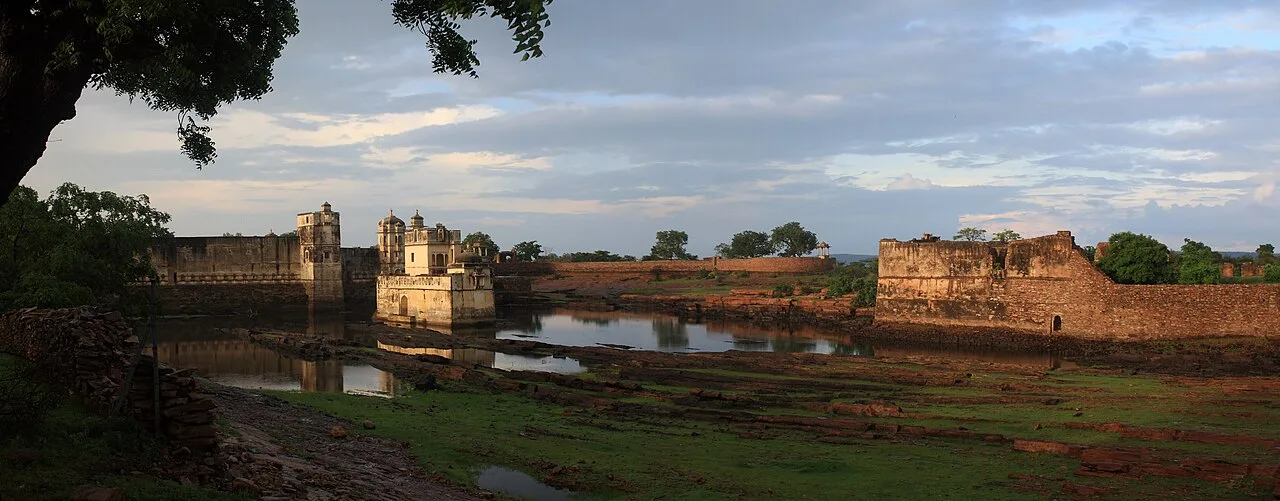
Chittor Fort
Chittor Fort, also called Chittod Fort, is among India’s largest forts and the former capital of Mewar. Visitors explore its historic palaces, temples, water bodies, memorials and towers.
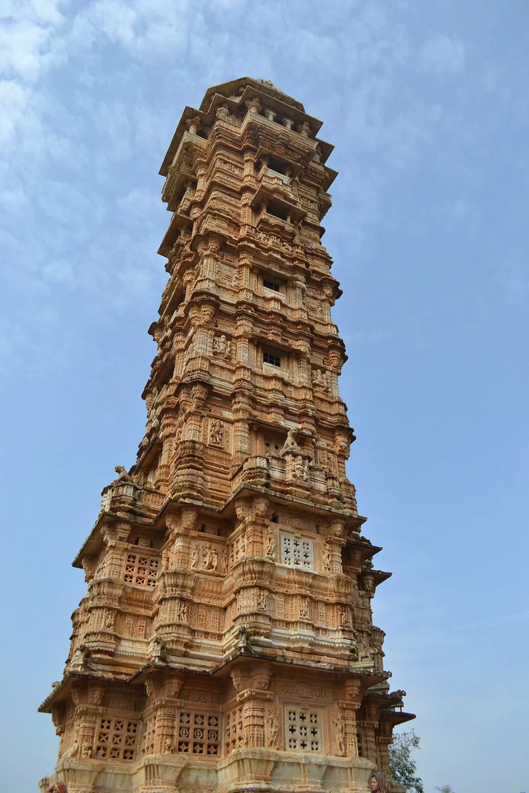
Vijaya Stambha
Vijaya Stambha is a victory tower in Chittor Fort, Chittorgarh district, Rajasthan. Visitors come to see its Rajput architecture and its association with Rana Kumbha’s 1448 triumph.
The district’s food reflects the wider Mewar and Rajasthan region. Common dishes include dal baati churma, gatte ki sabzi and ker sangri; laal maas is a well-known non-vegetarian option. Pyaaz kachori and mirchi vada make popular snacks, while ghewar and mawa kachori are among the sweets found in the region. Chaach, or spiced buttermilk, is a refreshing accompaniment. Menus vary between eateries, and smaller places may prepare only a limited selection each day, so it is worth asking what is fresh. Vegetarian travellers generally have plenty of choices. Carry water and snacks when visiting more remote sites, where food outlets may be scarce.
Chittorgarh is better known for its historic architecture than for one widely recognised district-specific craft. The fort’s stone gateways, temples and carved architectural details are a prominent expression of the region’s building heritage. In the wider Mewar area, miniature painting has a long courtly tradition, while bandhani tie-dye and hand-block-printed textiles are among the broader crafts of Rajasthan. These traditions are regional rather than exclusive to Chittorgarh; what is available in local markets can vary, so ask sellers about an item’s place of origin and how it was made.
Gangaur, Teej, Holi and Diwali are observed in Chittorgarh and the wider Mewar region, with local customs and community gatherings. The Jauhar Mela at Chittor Fort is held around late winter or early spring and commemorates the fort’s history; it can draw visitors and increase demand for rooms in town. Festival periods may bring busier roads, crowded public areas and reduced accommodation choice, especially around the fort. Travellers planning a visit during a local celebration should check current event information and arrange a place to stay ahead of time.
Elsewhere in Rajasthan
The district lies in the Mewar plateau country of southeastern Rajasthan, with rocky uplands, low hills, cultivated plains and scattered scrub or dry woodland. Chittor Fort occupies a prominent hill above the surrounding town. Rivers and seasonal streams cross parts of the district, while reservoirs and other water bodies are present in the wider countryside. The terrain makes road travel between towns practical, but exploring the fort involves slopes, uneven surfaces and substantial walking. Rural routes may pass through open, sparsely settled areas, so visitors should plan water and transport rather than assume services are close by.
Chittorgarh has hot summers, a monsoon season and generally milder, drier winters. Summer heat can make extended outdoor visits, particularly on the exposed fort, tiring; monsoon showers can make steps and stone paths slippery. Winter is usually the most comfortable season for sightseeing. October to March is generally a suitable period to visit, while conditions can vary from year to year. Carry sun protection and water in warmer months, and bring a light layer for cooler winter evenings. During the monsoon, pack rain protection and footwear with a good grip. Check local forecasts before setting out.
Chittaurgarh Junction is the district’s principal railway station, and Maharana Pratap Airport near Udaipur is the nearest operating airport. Road connections link Chittorgarh with Udaipur, Bhilwara, Kota and towns in neighbouring Madhya Pradesh through national and state highways. Buses and private vehicles are options for reaching the district; within the town, taxis and auto-rickshaws can help with local trips. Chittor Fort is extensive, with sights spread across its hilltop area, so arranging a vehicle can make getting around easier. Road conditions and transport availability may vary by season and location. Check current services locally before travelling.
Chittorgarh town is linked by road with other regional centres, including Udaipur, Bhilwara and Kota, and buses serve intercity routes. Local buses, autos and taxis can help with journeys around town and to the fort entrance; availability may be less predictable outside the urban area. Taxis or arranged private vehicles are useful for combining places across the district. The fort is extensive, and reaching its monuments can require walking on steep or uneven paths even after arriving by vehicle. Confirm onward transport locally, especially for rural stops or late-day returns.
2 days: Chittor Fort → Vijaya Stambha; sleep both nights in Chittorgarh town. 3 days: Chittor Fort → Vijaya Stambha; sleep all nights in Chittorgarh town, allowing an extra day for a slower visit. 4 days: Chittor Fort → Vijaya Stambha; sleep all nights in Chittorgarh town, with unhurried time for the fort and nearby town.
Chittorgarh town is the most practical base for visiting both listed places, with a range of hotels and guesthouses and access to local transport. It suits short visits focused on the fort as well as a slower stay. Depending on availability, travellers may also find homestays, government accommodation or dharamshalas in the district, but options can be more limited outside town. For a visit during a fair or festival, reserve ahead where possible. Check accessibility directly if stairs, lifts or other facilities are important.
The fort has steep sections, uneven stone surfaces and long walking stretches; use sturdy footwear, take breaks and carry drinking water, especially in hot weather. Monsoon rain can make paths slippery, and exposed areas offer limited shade. Keep an eye on belongings in crowded places and do not feed wildlife or stray animals. Road conditions and services may vary beyond town, so confirm return transport before travelling into rural areas. Mobile coverage can be inconsistent in some locations. Standard visits to the listed places do not generally require a special permit; confirm officially if visiting any restricted or separately managed site.
- Bhilwaraabout 58 km
- Rajsamandabout 90 km
- Udaipurabout 103 km
- Bundiabout 117 km
- Paliabout 121 km
- Kotaabout 128 km
- Sabarkantha · Gujaratabout 172 km
Straight-line distance between the centres of each district's destinations; road distance is longer.
Q: How many days should I spend in Chittorgarh district? A: Two days can cover the listed highlights at a steady pace; three days allows more time to explore the fort and town. Q: When is the best time to visit? A: October to March is generally more comfortable for outdoor sightseeing than the hot summer months. Q: Where is the best base for these places? A: Chittorgarh town is the most convenient base for Chittor Fort and the Vijaya Stambha. Q: How can I get to Chittorgarh? A: The town is served by rail and regional roads. Travellers arriving by air commonly use Udaipur as a gateway and continue by road; check current connections before travel. Q: Is Chittorgarh suitable for families or elderly travellers? A: Yes, with planning. The fort’s slopes, stairs and uneven paths may be challenging, so allow extra time and choose accessible sections according to mobility.
This page draws on our 3 destination guides for Chittorgarh and is updated as our team checks it.
Be the first to share photos, stories, advice or a helpful contact for Chittorgarh.
Loading…