
District · West Bengal
South 24 Parganas
South 24 Parganas links Kolkata’s southern fringe with the Ganges delta and the Bay of Bengal.
South 24 Parganas stretches from Kolkata’s southern outskirts into the tidal landscape of the Ganges delta, where rivers, creeks, inhabited islands and mangrove forests meet the Bay of Bengal. Its character changes markedly between busy mainland settlements, the coastal village of Bakkhali and the waterways of the Sundarbans. Sundarbans National Park forms a core part of a tiger reserve and biosphere reserve, while Sagar Island is an important Hindu pilgrimage destination associated with Gangasagar. The district’s history is closely tied to river-borne settlement, cultivation and the reclamation of delta land. Fishing, farming and pilgrimage remain important influences on everyday life, alongside the demands of living with tides, erosion and cyclonic weather.
South 24 Parganas links Kolkata’s southern fringe with the Ganges delta and the Bay of Bengal. It is known for the mangrove waterways of the Sundarbans, the pilgrimage at Gangasagar on Sagar Island, and the coastal village of Bakkhali. The district offers very different journeys: road travel through busy mainland settlements, ferry crossings to islands, and boat trips through tidal creeks. Fishing, farming and pilgrimage shape local life, while tides, erosion and cyclones influence how people travel and work. Visitors come for delta landscapes, wildlife and coastal experiences, but should plan around transfers and weather rather than expect a single, easy-to-cover sightseeing circuit.
The delta’s history has been shaped by shifting rivers, settlement and the gradual cultivation of low-lying land. Communities adapted to tidal conditions through fishing, farming and the construction of embankments. The area was part of the wider Bengal region under successive rulers; its local history is better understood through changing settlement and land use than through a single kingdom associated with the whole present-day district. Under East India Company and later British rule, much of the region was administered within the 24 Parganas. Colonial-era land reclamation and the expansion of cultivation altered parts of the Sundarbans, although forest, waterways and settlement continued to coexist. After independence, the area remained part of the undivided 24 Parganas district of West Bengal. South 24 Parganas was formed as a separate district in 1986 when 24 Parganas was divided into North and South 24 Parganas. Its present character reflects that long interaction between river systems, inhabited land, forest conservation and access to the coast.
3 destination guides
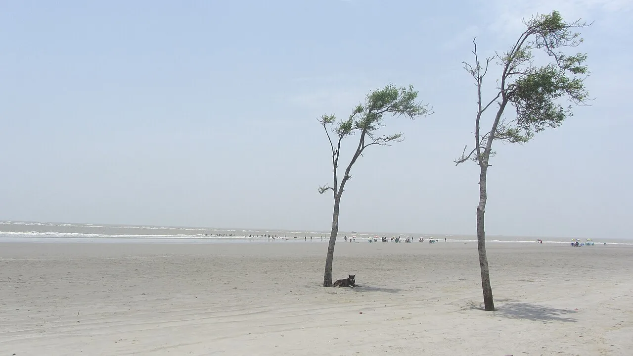
Bakkhali
Bakkhali is a village in West Bengal’s South 24 Parganas district. Visitors interested in the area’s local geography can place it within the Namkhana and Kakdwip administrative areas.
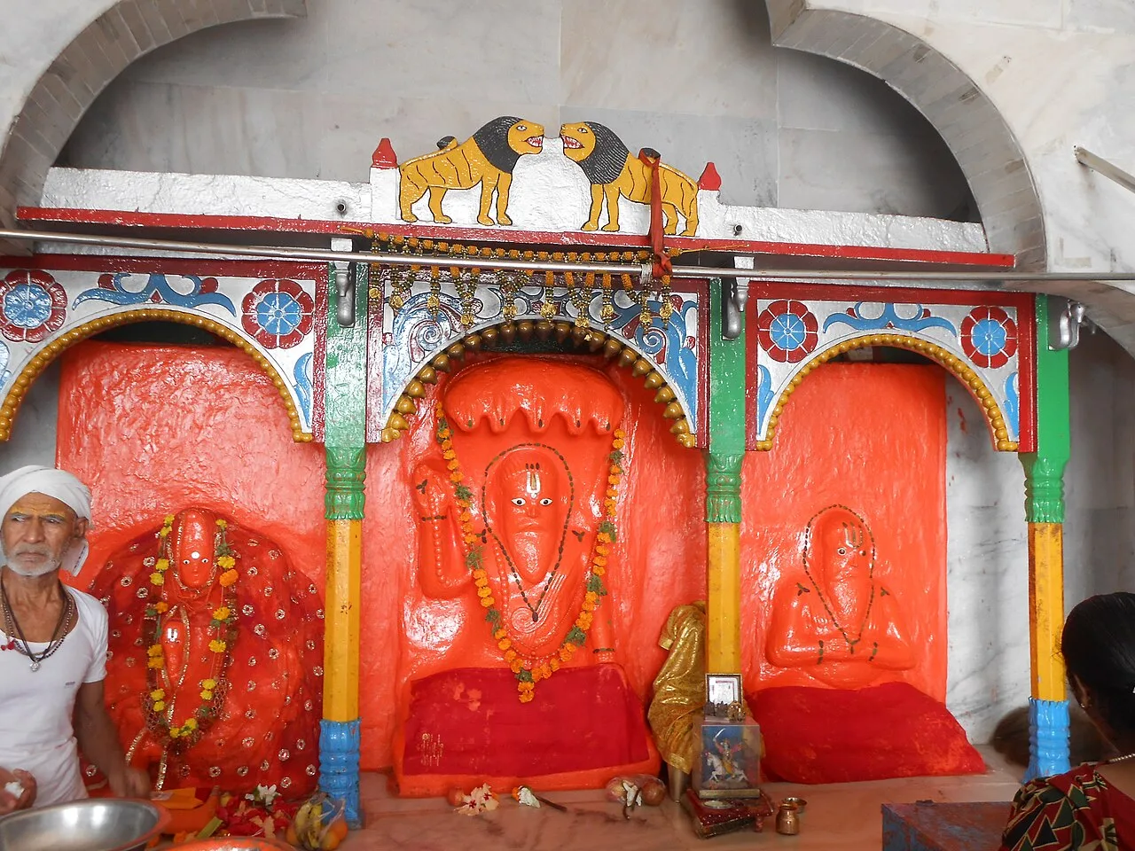
Sagar Island
Sagar Island, in West Bengal’s South 24 Parganas district, is the state’s largest island in the Ganges delta. Hindu pilgrims visit to bathe where the Ganges meets the Bay of Bengal and pray at Kapil Muni Temple.
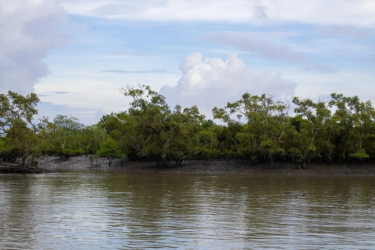
Sundarbans National Park
In West Bengal’s Ganges Delta, Sundarbans National Park protects mangrove habitat and Bengal tigers. Visitors come to explore its distinctive landscape and learn about its rich variety of wildlife.
Food here belongs largely to the wider Bengali tradition, with rice, fish, lentils and seasonal vegetables forming familiar meals. Macher jhol, a light fish curry, suits the district’s riverine and coastal setting; shorshe ilish, hilsa cooked with mustard, is a celebrated regional dish rather than a district speciality. Luchi with alur dom offers a familiar vegetarian option, while mishti doi, rosogolla and sandesh represent Bengal’s sweet-making traditions. Ask small eateries what is fresh and available that day, since menus may be limited. For remote islands or boat excursions, arrange meals ahead rather than assuming restaurants will be available.
Craft traditions associated with the wider Bengal region include kantha embroidery, sholapith decoration and bamboo or cane work. Kantha uses running stitches to embellish cloth, traditionally including layered household textiles, while lightweight sholapith is shaped into ceremonial ornaments and decorative objects. Bamboo work has practical uses in baskets and other everyday items suited to rural life. These are regional traditions, not crafts exclusive to South 24 Parganas. Markets may offer such work, but availability varies; ask where an item was made if you want to support local makers rather than buy a generic souvenir.
Gangasagar Mela, held around Makar Sankranti in January, is the district’s major pilgrimage gathering. Visitors travel to Sagar Island for the ritual bathing and religious observances, bringing heavy crowds and pressure on ferries, roads and accommodation. Durga Puja in autumn and Kali Puja around the same season are widely observed in the region, especially in settled areas. Local fairs and religious events may also take place around the delta. During major gatherings, book transport and accommodation well ahead where possible, and allow extra time for queues, transfers and crowd management.
Elsewhere in West Bengal
The district runs from the settled southern outskirts of Kolkata into a low-lying delta of rivers, creeks, islands and coastal stretches. The Hooghly and other tidal channels shape routes to Sagar Island and the southern coast; the Sundarbans is a vast mangrove landscape cut by waterways. There are no prominent hill routes. Roads serve much of the mainland, but island journeys often depend on ferries, boats and changing tide conditions. Erosion, embankments and seasonal weather can affect access, so a route that looks short on a map may involve several transfers.
South 24 Parganas has a warm, humid climate. Summers are hot and humid, while the monsoon brings heavy rain, swollen waterways and possible travel disruption. Winter is generally more comfortable for outdoor travel and boat journeys. November to February is often the most practical period to visit, particularly for the coast and Sundarbans, though conditions can vary and cyclone risks are not limited to one season. Pack light, breathable clothing, sun protection and insect repellent; carry rain protection during the monsoon and a light layer for breezy ferry or boat rides in winter. Check local weather and transport conditions before setting out.
Kolkata is the main arrival gateway, with Netaji Subhas Chandra Bose International Airport serving air travellers. Sealdah provides suburban rail connections towards the district; Namkhana is a useful railhead for the Bakkhali side, while Canning serves as a gateway towards the Sundarbans. Roads connect mainland towns and coastal departure points, with buses, hired cars and local vehicles covering onward journeys. Sagar Island requires a ferry crossing, and Sundarbans visits generally combine road or rail travel with boats. Allow flexibility for tides, weather and transfers, especially when travelling to islands. Check current services locally.
Roads connect mainland towns and coastal departure points, with local buses, shared vehicles, autos and hired cars serving different stretches. Namkhana is a useful rail-and-road gateway for Bakkhali, while Canning is a common starting point for journeys towards the Sundarbans. Reaching Sagar Island involves a road journey followed by a ferry crossing, then local transport on the island. Sundarbans visits usually combine road or rail travel with boats, often arranged through local operators. Services and connections vary; confirm onward transport locally and leave room for delays caused by tides, weather or queues.
2 days: Bakkhali; sleep both nights in Bakkhali. 3 days: Sagar Island; sleep on Sagar Island each night. 4 days: Sundarbans National Park; arrange an overnight base near the park for each night.
Bakkhali is a practical base for the coast, with hotels and guesthouses in and around the village. On Sagar Island, accommodation is more limited and can fill during Gangasagar Mela; local guesthouses and simple lodgings may be available. For the Sundarbans, use a locally arranged lodge or tour base near the chosen boat departure point; some trips include boat-based accommodation. Options across the district range from basic stays to more established hotels, with availability and facilities varying considerably. Confirm transport connections as well as lodging before travelling to an island.
Tides, strong currents, changing weather and uneven or wet landing points require care, especially on ferries and boats. Use established operators and follow crew instructions; do not approach or feed wildlife in the Sundarbans. Cyclones and monsoon rain can disrupt roads, ferries and boat trips, so check conditions and keep plans flexible. Drink treated or sealed water and take insect protection. Mobile connectivity may be patchy on islands and waterways; tell someone your plans and carry essential medicines. Protected-area visits can have entry rules and permit requirements; confirm current requirements with official authorities or an authorised operator before travel.
- Purba Medinipurabout 67 km
- Kolkataabout 101 km
- Howrahabout 105 km
- North 24 Parganasabout 112 km
- Hooghlyabout 141 km
- Balasore · Odishaabout 146 km
- Jhargramabout 159 km
- Kendrapara · Odishaabout 186 km
Straight-line distance between the centres of each district's destinations; road distance is longer.
Q: How many days should I spend in South 24 Parganas? A: Two days can suit Bakkhali or a focused Sagar Island visit; allow three or more days for a Sundarbans trip, including transfers. Q: When is the best time to visit? A: November to February is generally comfortable, although weather and transport conditions should still be checked. Q: What is the best base for a visit? A: Bakkhali suits the coast, Sagar Island suits Gangasagar, and a locally arranged lodge near a boat departure point suits the Sundarbans. Q: How do I get to the district? A: Travel from Kolkata by road or suburban rail towards a suitable gateway, then use local road transport; island and Sundarbans journeys also require ferries or boats. Q: Is the district suitable for families or elderly travellers? A: Yes, with planning, but ferry steps, long transfers, heat and limited facilities on some islands may be challenging. Choose a manageable route and check access needs in advance.
This page draws on our 3 destination guides for South 24 Parganas and is updated as our team checks it.
Be the first to share photos, stories, advice or a helpful contact for South 24 Parganas.
Loading…